more stats
2,555 ft
Distance
-460 ft
Descent
00:06:04
Avg time
-461 ft
Altitude change
4,297 ft
Altitude min
4,759 ft
Altitude max
4,758 ft
Altitude start
4,297 ft
Altitude end
-18.054%
Grade
-49.056%
Grade max
2.892%
Grade min
34 ft
Distance climb
2,521 ft
Distance down
00:06:04
Avg time

Full Face? Details

  • Activities
    • Mountain Bike
    • E-Bike
    • Hike
    • Trail Running
  • Riding Area
    Elk Basin
    Belfry, Montana
  • Difficulty Rating
  • Local Popularity
    5 in Mountain Biking [+]
    • 5 in E-Biking
    • 5 in Trail Running
    • 5 in Hiking
  • Global Ranking
    #156358 in Mountain Biking [+]
    • #305375 in Trail Running
    • #316300 in Hiking
  • Trail Type
    Singletrack
  • Bike Type
    AM
  • Direction
    Downhill Primary
  • Season
    Do not ride when wet
  • Dogs Allowed
    Yes
  • eBike Allowed
    Yes up to Class 1
  • Land Owner
    BLM

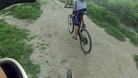
This is a steep, loose trail with a couple of drops in the steep stuff. Once you negotiate the tree, hold on. The name comes from a smart rider commenting, maybe we should wear our full face helmets for this one. The lower half flows well with chances for some decent air.

Trail Supporters
  • BLM
    BLM
    Land Manager
Local Trail Association
Traditionally Indigenous Territory

Recent Activity on Trail

Past Week
  • 0 rides
  •  
6 Months
  • 0 rides
  •  
All
  • 8 rides
  • Last: Jun 13, 2026
c1c2c3c4
January
February
March
April
May
June
July
August
September
October
November
December
update trails status or condition

Full Face? Trail Reports

statusdatedescription
Apr 20, 2020 @ 8:14pm
Apr 20, 2020
more »
Status:
on Apr 20, 2020
Dry
Avg: 4.13 (1 votes)
Your vote: 0

view (38)
close
3D
Trail Conditions
  • Unknown
  • Snow Groomed
  • Snow Packed
  • Snow Covered
  • Snow Cover Partial
  • Freeze/thaw Cycle
  • Icy
  • Prevalent Mud
  • Wet
  • Variable
  • Ideal
  • Dry
  • Very Dry
Trail Flow (Ridden Direction)
Trailforks scans users ridelogs to determine the most popular direction each trail is ridden. A good flowing trail network will have most trails flowing in a single direction according to their intension.
The colour categories are based on what percentage of riders are riding a trail in its intended direction.
  • > 96%
  • > 90%
  • > 80%
  • > 70%
  • > 50%
  • < 50%
  • bi-directional trail
  • no data
Trail Last Ridden
Trailforks scans ridelogs to determine the last time a trail was ridden.
  • < 2 days
  • < 1 week
  • < 2 weeks
  • < 1 month
  • < 6 months
  • > 6 months
Trail Ridden Direction
The intended direction a trail should be ridden.
  • Downhill Only
  • Downhill Primary
  • Both Directions
  • Uphill Primary
  • Uphill Only
  • One Direction
Contribute Details
Colors indicate trail is missing specified detail.
  • Description
  • Photos
  • Description & Photos
  • Videos
Trail Popularity ?
Trailforks scans ridelogs to determine which trails are ridden the most in the last 9 months. Trails are compared with nearby trails in the same city region with a possible 25 colour shades. Think of this as a heatmap, more rides = more kinetic energy = warmer colors.
  • most popular
  • popular
  • less popular
  • not popular
ATV/ORV/OHV Filter
Max Vehicle Width
inches
US Cell Coverage
Legend
cell carrier legend

Radar Time
Activity Recordings
Trailforks uses anonymized public activity data. ?
Activity Recordings
Trailforks uses anonymized public activity data. ?
Personal Heatmap
Activity Types
all / none
Options
2
Date range month
Winter Trails
Warning A routing network for winter maps does not exist. Selecting trails using the winter trails layer has been disabled.
Missing Trails
Most Popular
Least Popular
Trails are colored based on popularity. The more popular a trail is, the more red. Less popular trails trend towards green.
Jump Magnitude Heatmap
Heatmap of where riders jump on trails. Zoom in to see individual jumps, click circles to view jump details.
BC Backroad Status

Service Road Atlas is a free to use, community-driven service for viewing and creating reports on the numerous back-country service roads around B.C. and Alberta.

map legend
Slope Aspect
Direction the slope faces
Flat N NE E SE S SW W NW
Trails Deemphasized
Trails are shown in grey.
disable
Only show trails with no bike usage.
Enable
Suggested Layers
Based on selected activity type

    Save the current map location and zoom level as your default home location whenever this page is loaded.

    Save
        Directions to full-face trailhead (45.048660, -108.928810)

        Photos

        No photos have been added for Full Face? yet, add a photo.

        Videos

        4 more »
        Kali Protectives Introduces the Shiva
        2:40 | 5951 | Apr 6, 2015 , Belfry
        Fun hill
        0:38 | 294 | Apr 24, 2012 , Belfry
        TEST: GoPro full-face helmet setup
        0:49 | 645 | Sep 15, 2009 , Belfry
        Full Face Camera Test
        0:14 | 25 | Jun 16, 2015 , Belfry

        2 Reviews & Comments


        We hope you've been enjoying Trailforks!

        Create a FREE account to view trail comments and much more.

        Nearby Trails

        • By mschrowe & contributors
        • #125543 - 1,221 views

        Frequently Asked Questions About Full Face?

        Where is Full Face? located?
        Full Face? is located in Elk Basin, Belfry, Montana, United States. It is part of the Elk Basin trail network. The trailhead is located at coordinates 45.04866, -108.92881.
        How hard is Full Face??
        Full Face? is rated as Double Black Diamond difficulty. The average grade is 18.054%.
        What is the elevation gain for Full Face??
        The trail has 460 ft of elevation descent. The elevation ranges from 4,297 ft to 4,759 ft.
        Is Full Face? a point to point trail?
        Full Face? is not a point to point trail. The direction is Downhill Primary. The trail type is singletrack.

        Hit the Trail

        Open in App

        Get this trail on your phone instantly.
        open trail in app

        Download Trail

        Save to wishlist, Garmin & download.
        save the trail

        Find Related Routes

        Find routes and users activities that include this trail.
        find routes for this trail

        You must enter a description before submitting.