close
-
Layers w
- Weather Layers
- Pro
- Pro
- Pro
- Pro
- Pro
- Pro
- More Layers
- Pro
- Pro
- Pro
- Pro
-
Upgrade to

3D
Trail Conditions
- Unknown
- Snow Groomed
- Snow Packed
- Snow Covered
- Snow Cover Partial
- Freeze/thaw Cycle
- Icy
- Prevalent Mud
- Wet
- Variable
- Ideal
- Dry
- Very Dry
Trail Flow (Ridden Direction)
Trailforks scans users ridelogs to determine the most popular direction each trail is ridden. A good flowing trail network will have most trails flowing in a single direction according to their intension.
The colour categories are based on what percentage of riders are riding a trail in its intended direction.
The colour categories are based on what percentage of riders are riding a trail in its intended direction.
- > 96%
- > 90%
- > 80%
- > 70%
- > 50%
- < 50%
- bi-directional trail
- no data
Trail Last Ridden
Trailforks scans ridelogs to determine the last time a trail was ridden.
- < 2 days
- < 1 week
- < 2 weeks
- < 1 month
- < 6 months
- > 6 months
Trail Ridden Direction
The intended direction a trail should be ridden.
- Downhill Only
- Downhill Primary
- Both Directions
- Uphill Primary
- Uphill Only
- One Direction
Contribute Details
Colors indicate trail is missing specified detail.
- Description
- Photos
- Description & Photos
- Videos
Trail Popularity ?
Trailforks scans ridelogs to determine which trails are ridden the most in the last 9 months.
Trails are compared with nearby trails in the same city region with a possible 25 colour shades.
Think of this as a heatmap, more rides = more kinetic energy = warmer colors.
- most popular
- popular
- less popular
- not popular
ATV/ORV/OHV Filter
Max Vehicle Width
inches
US Cell Coverage
Legend

Radar Time
Activity Recordings
Trailforks uses anonymized public activity data.
?
Activity Recordings
Trailforks uses anonymized public activity data.
?
Personal Heatmap
▶
Activity Types
all
/
none
▶
Options
2
Date range
month
–
Winter Trails
Warning
A routing network for winter maps does not exist. Selecting trails using the winter trails layer has been disabled.
Missing Trails
Most Popular
Least Popular
Trails are colored based on popularity. The more popular a trail is, the more red. Less popular trails trend towards green.
Jump Magnitude Heatmap
Heatmap of where riders jump on trails. Zoom in to see individual jumps, click circles to view jump details.
BC Backroad Status
![map legend]()
Service Road Atlas is a free to use, community-driven service for viewing and creating reports on the numerous back-country service roads around B.C. and Alberta.

Slope Aspect
Direction the slope faces
Trails Deemphasized
Trails are shown in grey.
Only show trails with no bike usage.
Suggested Layers
Based on selected activity type
Save the current map location and zoom level as your default home location whenever this page is loaded.
Save
No description for Belluno has been added yet!
Login or register to submit one.
This region uses the Uk/Euro style trail grading system.
Activities Click to view
- Mountain Bike
58 trails
- E-Bike
54 trails
- Gravel Bike
0 trails
- Adaptive Bike
0 trails
- Winter Fat Bike
0 trails
- Hike
44 trails
- Trail Running
44 trails
Region Details
- 2
- 2
- 21
- 24
Region Status
Open as of Jul 1, 2026Stats
- Avg Trail Rating
- Trails (view details)
- 58
- Trails Mountain Bike
- 58
- Trails E-Bike
- 54
- Trails Hike
- 44
- Trails Trail Running
- 44
- Total Distance
- 55 miles
- Total Descent
- 41,652 ft
- Total Vertical
- 5,595 ft
- Highest Trailhead
- 6,667 ft
- Reports
- 195
- Photos
- 114
- Ridden Counter
- 818
Sub Regions
-
Cadore
- 2
-
Nevegal
- 1
- 11
- 16
-
Serva / Col de Roanza
- 1
- 1
Popular Belluno Mountain Biking Trails
• 100 ★ 4.5 • 4,239 ft • 98 ft • 65 •
Classic bike park style trail. This is the easiest trail in the bike park, the trail has been built in the summer of 2017, it is two to four meters wide depending on the sections, it has a really low gradient, so this is a good trail...
• 100 ★ 4.0 • 2 miles • 0 ft • 33 •
old downhill world cup track, the world cup circuit has been there several times in the 90s. really tough track, old school dh, kept almost the same as it was back in the day but with some new jumps and berms. the track is so various it...
• 90 ★ 5.0 • 1 mile • 0 ft • 28 •
Molte foglie e sassi smossi, tratti molto veloci, bosco fantastico
• 60 ★ 4.5 • 2 miles • 321 ft • 23 •
entusiasmante single track pratoso di cresta. Appena alcuni passaggi risultano non ciclabili se il tragitto viene affrontato in senso inverso
• 95 ★ 0.0 • 3,171 ft • 8 ft • 23 •
this trail is actually linking 4 different single-track section, each one starting and ending at the gravel raod via col de Gou. Easy and fun
• 5 ★ 4.0 • 2 miles • 34 ft • 22 •
Natural trail re builded in the summer of 2019, the trail was destroyed after a heavy storm that caused big damages at the wood, it has been re builded by dolomiti bike company volounteers for the ''Nevegàl bike fest'' event, it took...
• 75 ★ 4.0 • 1 mile • 12 ft • 17 •
Popular blue difficulty singletrack. This mountain bike primary trail can be used downhill primary. On average it takes 8 minutes to complete this trail.
Photos of Belluno Mountain Bike
Videos of Belluno Mountain Bike
0:27 |
168 |
Feb 3, 2017
3:03 |
275 |
Aug 24, 2016
12:31 |
115 |
Oct 12, 2024 , Belluno
trail: Costa Legner 2.0
5:25 |
477 |
Jan 27, 2020 , Belluno

1158 |
Jan 24, 2017 , Belluno

868 |
Jan 23, 2017 , Belluno
trail: Col fiorito
609 |
Mar 23, 2016 , Belluno
trail: Cargador-Roanza
639 |
Mar 23, 2016 , Belluno
Recent Trail Reports
| status | trail | date | condition | info | user |
|---|---|---|---|---|---|
| Troi del Mut | May 3, 2026 @ 6:04pm (Europe/Rome) May 3, 2026 | Ideal | CristianPof1981 | ||
| Calmada I | May 3, 2026 @ 6:03pm (Europe/Rome) May 3, 2026 | Ideal | CristianPof1981 | ||
| Pian dei Longhi | May 2, 2026 @ 7:52am (Europe/Rome) May 1, 2026 | Unknown | CristianPof1981 | ||
| Budel complet | Dec 18, 2025 @ 4:09pm (Europe/Rome) Dec 18, 2025 | Ideal | Maurodg | ||
| the roanz | Dec 18, 2025 @ 2:22pm (Europe/Rome) Dec 18, 2025 | Ideal | Maurodg | ||
| Costa Legner 2.0 | Nov 9, 2025 @ 6:10pm (Europe/Rome) Nov 9, 2025 | Unknown | Maurodg | ||
| Faverghera flow line - Nevegàl bike park | Sep 21, 2025 @ 9:25am (Europe/Rome) Sep 21, 2025 | Unknown | szantolevi | ||
| World cup downhill track - Nevegàl bike park | Aug 17, 2025 @ 10:56am Aug 17, 2025 | Dry | Feid | ||
| Seggiovia Nevegal - Col dei Pez (I Tronco) | Aug 14, 2025 @ 11:49am Aug 14, 2025 | Unknown | AlfonsoTraverso | ||
| Seggiovia Col dei Pez - Faverghera (II tronco) | Aug 14, 2025 @ 11:49am Aug 14, 2025 | Unknown | AlfonsoTraverso |
Activity Feed
| username | action | type | title | date |
|---|---|---|---|---|
| Melachai | wishlist | region | activity #96938985 | Jun 13, 2026 @ 10:01pm Jun 13, 2026 |
| Lucaip2g8N | wishlist | trail | activity #96856628 and 2 more | Jun 13, 2026 @ 2:40am Jun 13, 2026 |
| maobotter | wishlist | trail | activity #94995276 | May 18, 2026 @ 12:55pm May 18, 2026 |
| CristianPof1981 | add | report | activity #93953625 and 1 more | May 3, 2026 @ 9:03am May 3, 2026 |
| CristianPof1981 | add | report | activity #93833695 | May 1, 2026 @ 10:52pm May 1, 2026 |
Recent Comments
| username | type | title | comment | date |
|---|---|---|---|---|
| report | @szantolevi: if I'm not mistaken there were... | Sep 27, 2025 @ 10:20am Sep 27, 2025 | ||
| report | But do you know why nobody took care of that... | Sep 27, 2025 @ 10:09am Sep 27, 2025 | ||
| report | I asked the staff after i tried to ride the... | Sep 27, 2025 @ 10:07am Sep 27, 2025 | ||
| report | It's not correct to label a trail as closed if... | Sep 27, 2025 @ 9:28am Sep 27, 2025 | ||
| trail | You go through stretches with tall grass to... | Jul 24, 2025 @ 6:19am Jul 24, 2025 |
Local Badges
-

10 Green Trails11 awarded -

10 Blue Trails6 awarded -

Epic Ride Climb 2k296 awarded -

Climbing 10k Badge42 awarded -

Climbing 100k Badge6 awarded -

Epic Ride Descent 2k302 awarded
Local Trail Supporters
- Dolomiti Bike Company
- Marco De Col
![]()
Activity Type Stats
| activitytype | trails | distance | descent | descent distance | total vertical | rating | global rank | state rank | photos | reports | routes | ridelogs |
|---|---|---|---|---|---|---|---|---|---|---|---|---|
| Mountain Bike | 58 | 55 miles | 41,650 ft | 40 miles | 5,597 ft | #2,760 | #132 | 114 | 195 | 4,734 | ||
| E-Bike | 54 | 13 miles | 9,416 ft | 9 miles | 5,000 ft | #3,790 | #361 | 155 | 664 | |||
| Hike | 44 | 44 miles | 32,320 ft | 30 miles | 5,410 ft | #4,413 | #182 | 180 | 370 | |||
| Trail Running | 44 | 44 miles | 32,320 ft | 30 miles | 5,410 ft | #3,837 | #163 | 180 | 152 |
Frequently Asked Questions About Belluno
▼
What are the best places to ride in Belluno?
Belluno has 3 areas to explore for mountain biking. The top rated areas are:
▼
What are the highest rated mountain biking trails in Belluno?
The highest rated mountain biking trails in Belluno are:
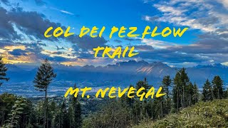
- Col dei Pez flow trail - Nevegàl bike park (4.2/5)
- Teleferica trail (4.1/5)
- Troi dele cave (4.1/5)
- Calmada I (4.1/5)
- 922 (4.1/5)
▼
What is the best time of the year to ride in Belluno?
Based on ride log data, the most popular months to ride in Belluno are:
- August (9 activities)
- May (8 activities)
- June (4 activities)
▼
Where can I park to ride in Belluno?
Activities
Trails
Points of Interest
- By paolo-santesso & contributors
- Admins: micheletraversi
- #11587 - 5,092 views
- belluno activity log | embed map of Belluno mountain bike trails | belluno mountain biking points of interest
Downloading of trail gps tracks in kml & gpx formats is enabled for Belluno.
You must login to download files.