close
-
Layers w
- Weather Layers
- Pro
- Pro
- Pro
- Pro
- Pro
- Pro
- More Layers
- Pro
- Pro
- Pro
- Pro
-
Upgrade to

3D
Trail Conditions
- Unknown
- Snow Groomed
- Snow Packed
- Snow Covered
- Snow Cover Partial
- Freeze/thaw Cycle
- Icy
- Prevalent Mud
- Wet
- Variable
- Ideal
- Dry
- Very Dry
Trail Flow (Ridden Direction)
Trailforks scans users ridelogs to determine the most popular direction each trail is ridden. A good flowing trail network will have most trails flowing in a single direction according to their intension.
The colour categories are based on what percentage of riders are riding a trail in its intended direction.
The colour categories are based on what percentage of riders are riding a trail in its intended direction.
- > 96%
- > 90%
- > 80%
- > 70%
- > 50%
- < 50%
- bi-directional trail
- no data
Trail Last Ridden
Trailforks scans ridelogs to determine the last time a trail was ridden.
- < 2 days
- < 1 week
- < 2 weeks
- < 1 month
- < 6 months
- > 6 months
Trail Ridden Direction
The intended direction a trail should be ridden.
- Downhill Only
- Downhill Primary
- Both Directions
- Uphill Primary
- Uphill Only
- One Direction
Contribute Details
Colors indicate trail is missing specified detail.
- Description
- Photos
- Description & Photos
- Videos
Trail Popularity ?
Trailforks scans ridelogs to determine which trails are ridden the most in the last 9 months.
Trails are compared with nearby trails in the same city region with a possible 25 colour shades.
Think of this as a heatmap, more rides = more kinetic energy = warmer colors.
- most popular
- popular
- less popular
- not popular
ATV/ORV/OHV Filter
Max Vehicle Width
inches
US Cell Coverage
Legend

Radar Time
Activity Recordings
Trailforks uses anonymized public activity data.
?
Activity Recordings
Trailforks uses anonymized public activity data.
?
Personal Heatmap
▶
Activity Types
all
/
none
▶
Options
2
Date range
month
–
Winter Trails
Warning
A routing network for winter maps does not exist. Selecting trails using the winter trails layer has been disabled.
Missing Trails
Most Popular
Least Popular
Trails are colored based on popularity. The more popular a trail is, the more red. Less popular trails trend towards green.
Jump Magnitude Heatmap
Heatmap of where riders jump on trails. Zoom in to see individual jumps, click circles to view jump details.
BC Backroad Status
![map legend]()
Service Road Atlas is a free to use, community-driven service for viewing and creating reports on the numerous back-country service roads around B.C. and Alberta.

Slope Aspect
Direction the slope faces
Trails Deemphasized
Trails are shown in grey.
Only show trails with no bike usage.
Suggested Layers
Based on selected activity type
Save the current map location and zoom level as your default home location whenever this page is loaded.
Save
No description for Bothell has been added yet!
Login or register to submit one.
Activities Click to view
- Mountain Bike
47 trails
- E-Bike
15 trails
- Gravel Bike
0 trails
- Adaptive Bike
0 trails
- Winter Fat Bike
0 trails
- Hike
47 trails
- Trail Running
47 trails
Region Details
- 11
- 1
- 9
- 16
- 1
Region Status
Open as of Jun 5, 2026Stats
- Avg Trail Rating
- Trails (view details)
- 38
- Trails Mountain Bike
- 47
- Trails E-Bike
- 15
- Trails Hike
- 47
- Trails Trail Running
- 47
- Total Distance
- 24 miles
- Total Descent
- 2,777 ft
- Total Vertical
- 512 ft
- Highest Trailhead
- 531 ft
- Reports
- 117
- Photos
- 31
- Ridden Counter
- 5,269
Sub Regions
-
Blyth Park
- 5
- 2
- 1
-
Shelton View Forest
- 11
Popular Bothell Mountain Biking Trails
• 85 ★ 4.0 • 4,357 ft • 412 ft • 124 •
Trail can be ridden both directions. Tight switchbacks add to the technicality. Watch out for hikers and trail runners.
• 55 ★ 3.0 • 4,760 ft • 98 ft • 59 •
Moderately popular blue difficulty primitive. This multi-use trail can be used both directions. On average it takes 10 minutes to complete this trail.
• 40 ★ 0.0 • 1,900 ft • 6 ft • 56 •
Moderately popular white difficulty family friendly paved path. This multi-use trail can be used both directions and has a easy overall physical rating with a 6 ft green climb. Adaptive MTB rating: amtb green. Trail visibility is always easy to follow. On average it takes 18 minutes to complete this trail.
• 85 ★ 3.6 • 1,306 ft • 0 ft • 48 •
Unsanctioned MTB specific trail. Only rideable in dry months due to slick clay dirt and steepness of trail
• 60 ★ 0.0 • 1,398 ft • 40 ft • 42 •
Moderately popular green difficulty singletrack. This multi-use trail can be used both directions. On average it takes 3 minutes to complete this trail.
• 70 ★ 0.0 • 640 ft • 125 ft • 37 •
Popular blue difficulty singletrack. This mountain bike primary trail can be used both directions. On average it takes 2 minutes to complete this trail.
• 50 ★ 0.0 • 1,332 ft • 155 ft • 32 •
Moderately popular blue difficulty singletrack. This mountain bike primary trail can be used both directions. On average it takes 4 minutes to complete this trail.
Bothell Mountain Bike Routes
9 miles • 713 ft • 1 • Loop •
From Gateway Park in Woodinville, this route goes through the wine country on Sammamish River Trail. Then...
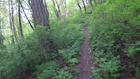
Photos of Bothell Mountain Bike
Videos of Bothell Mountain Bike
trail: Ninth Green at Nine
0:19 |
674 |
May 10, 2021
trail: Ninth Green at Nine
2:49 |
561 |
Jul 30, 2023 , Bothell
Recent Trail Reports
| status | trail | date | condition | info | user |
|---|---|---|---|---|---|
| Tolt Pipeline | Jun 5, 2026 @ 4:17pm (America/Los_Angeles) Jun 5, 2026 | Ideal | realdogdad | ||
| Ninth Green at Nine | May 6, 2026 @ 9:10pm (America/Los_Angeles) May 6, 2026 | Ideal | robertc3 | ||
| East Trail | Mar 20, 2026 @ 12:56pm (America/Los_Angeles) Mar 20, 2026 | Ideal | badfishnomad | ||
| Burke-Gilman to Sammamish River Trail. | Sep 7, 2025 @ 12:37pm Sep 7, 2025 | Ideal | aaronspruit | ||
| Willows Road Trail Connector | May 18, 2025 @ 9:01am May 18, 2025 | Ideal | theprofessionaljerry | ||
| Blyth Switchbacks | Apr 18, 2025 @ 9:49am Apr 18, 2025 | Ideal | robertc3 | ||
| Burke-gilman trail east end | Nov 10, 2024 @ 1:41pm Nov 10, 2024 | Variable | theprofessionaljerry | ||
| Beyond Blyth Park | Oct 3, 2024 @ 1:10pm Oct 3, 2024 | Ideal | robertc3 | ||
| Path | Jul 13, 2024 @ 6:28am Jul 13, 2024 | Dry | GarrickSol | ||
| NE 162nd Trail | Jul 13, 2024 @ 6:28am Jul 13, 2024 | Dry | GarrickSol |
Activity Feed
| username | action | type | title | date |
|---|---|---|---|---|
| Joannax2OVCa | ridden | trail | activity #96724326 | Jun 11, 2026 @ 1:57am 12 hours |
| realdogdad | comment | trail | activity #96328060 | Jun 5, 2026 @ 4:18pm Jun 5, 2026 |
| realdogdad | add | report | activity #96327958 | Jun 5, 2026 @ 4:17pm Jun 5, 2026 |
| xGeuZk | wishlist | trail | activity #94475907 | May 10, 2026 @ 8:09pm May 10, 2026 |
| robertc3 | add | report | activity #94197652 | May 6, 2026 @ 9:12pm May 6, 2026 |
Recent Comments
| username | type | title | comment | date |
|---|---|---|---|---|
| trail | Bit of a burner, but provides roadless access... | Jun 5, 2026 @ 4:18pm Jun 5, 2026 | ||
| report | Thank you! | Nov 10, 2022 @ 4:24pm Nov 10, 2022 | ||
| report | There's a gate in the fence on the east side | Apr 20, 2022 @ 8:37pm Apr 20, 2022 | ||
| trail | The gap jump after the steep chute is gone do... | Aug 25, 2021 @ 1:45pm Aug 25, 2021 | ||
| trail | There's access near the intersection of... | Aug 10, 2021 @ 1:57pm Aug 10, 2021 |
Local Badges
-

Epic Ride Climb 2k6 awarded -

Climbing 10k Badge41 awarded -

Climbing 100k Badge0 awarded -

Epic Ride Descent 2k6 awarded -

Descent 10k Badge40 awarded -

Descent 100k Badge0 awarded
Activity Type Stats
| activitytype | trails | distance | descent | descent distance | total vertical | rating | global rank | state rank | photos | reports | routes | ridelogs |
|---|---|---|---|---|---|---|---|---|---|---|---|---|
| Mountain Bike | 47 | 24 miles | 2,779 ft | 9 miles | 512 ft | #4,264 | #1,437 | 31 | 117 | 1 | 12,794 | |
| E-Bike | 15 | 10 miles | 643 ft | 3 miles | 397 ft | #6,431 | #1,950 | 88 | 511 | |||
| Hike | 47 | 24 miles | 2,779 ft | 9 miles | 512 ft | #6,486 | #2,287 | 103 | 882 | |||
| Trail Running | 47 | 24 miles | 2,779 ft | 9 miles | 512 ft | #5,418 | #1,706 | 103 | 1,962 |
Frequently Asked Questions About Bothell
▼
What are the best places to ride in Bothell?
Bothell has 3 areas to explore for mountain biking. The top rated areas are:
▼
What are the highest rated mountain biking trails in Bothell?
The highest rated mountain biking trails in Bothell are:
- Timber Creek Loop (4.3/5)
- SayYes2GreenSpace (4.2/5)
- Blyth Switchbacks (4/5)
- Beyond Blyth Park (3.8/5)
- Mola (3.8/5)
▼
What is the best time of the year to ride in Bothell?
Based on ride log data, the most popular months to ride in Bothell are:
- July (52 activities)
- August (32 activities)
- June (26 activities)
▼
Where can I park to ride in Bothell?
Activities
Trails
Points of Interest
- By mtruffat
 & contributors
 - Admins: EMBA-C2S, EMBA-C2S
- #16460 - 7,329 views
- bothell activity log | embed map of Bothell mountain bike trails | bothell mountain biking points of interest
Downloading of trail gps tracks in kml & gpx formats is enabled for Bothell.
You must login to download files.