close
-
Layers w
- Map Content
- More Layers
- Pro
- Pro
- Pro
- Pro
- Pro
- Pro
- Pro
- Pro
-
Upgrade to

3D
Trail Conditions
- Unknown
- Snow Groomed
- Snow Packed
- Snow Covered
- Snow Cover Partial
- Freeze/thaw Cycle
- Icy
- Prevalent Mud
- Wet
- Variable
- Ideal
- Dry
- Very Dry
Trail Flow (Ridden Direction)
Trailforks scans users ridelogs to determine the most popular direction each trail is ridden. A good flowing trail network will have most trails flowing in a single direction according to their intension.
The colour categories are based on what percentage of riders are riding a trail in its intended direction.
The colour categories are based on what percentage of riders are riding a trail in its intended direction.
- > 96%
- > 90%
- > 80%
- > 70%
- > 50%
- < 50%
- bi-directional trail
- no data
Trail Last Ridden
Trailforks scans ridelogs to determine the last time a trail was ridden.
- < 2 days
- < 1 week
- < 2 weeks
- < 1 month
- < 6 months
- > 6 months
Trail Ridden Direction
The intended direction a trail should be ridden.
- Downhill Only
- Downhill Primary
- Both Directions
- Uphill Primary
- Uphill Only
- One Direction
Contribute Details
Colors indicate trail is missing specified detail.
- Description
- Photos
- Description & Photos
- Videos
Trail Popularity ?
Trailforks scans ridelogs to determine which trails are ridden the most in the last 9 months.
Trails are compared with nearby trails in the same city region with a possible 25 colour shades.
Think of this as a heatmap, more rides = more kinetic energy = warmer colors.
- most popular
- popular
- less popular
- not popular
ATV/ORV/OHV Filter
Max Vehicle Width
inches
US Cell Coverage
Legend

Radar Time
x
Activity Recordings
Trailforks users anonymized public ridelogs from the past 6 months.
- mountain biking recent
- mountain biking (>6 month)
- hiking (1 year)
- moto (1 year)
Activity Recordings
Trailforks users anonymized public skilogs from the past 12 months.
- Downhill Ski
- Backcountry Ski
- Nordic Ski
- Snowmobile
Winter Trails
Warning
A routing network for winter maps does not exist. Selecting trails using the winter trails layer has been disabled.
x
Missing Trails
Most Popular
Least Popular
Trails are colored based on popularity. The more popular a trail is, the more red. Less popular trails trend towards green.
Jump Magnitude Heatmap
Heatmap of where riders jump on trails. Zoom in to see individual jumps, click circles to view jump details.
Trails Deemphasized
Trails are shown in grey.
Only show trails with NO bikes.
Save the current map location and zoom level as your default home location whenever this page is loaded.
Save
No description for Boxford State Forest has been added yet!
Login or register to submit one.
 google parking directions
Primary Trail Type: Cross-Country
eBikes Allowed:
No
Land Status: State Forest
Land Manager: Mass DCR
google parking directions Activities Click to view
- Mountain Bike
83 trails
- Horse
5 trails
- Hike
90 trails
- Trail Running
90 trails
- Snowshoe
16 trails
- Nordic Ski
16 trails
Region Details
- 3
- 69
- 8
- 3
Region Status
Caution as of Mar 9, 2024Stats
- Avg Trail Rating
- Trails (view details)
- 90
- Trails Mountain Bike
- 83
- Trails E-Bike
- 3
- Trails Horse
- 5
- Trails Hike
- 90
- Trails Trail Running
- 90
- Trails Snowshoe
- 16
- Trails Nordic Ski
- 16
- Total Distance
- 72 miles
- Total Descent Distance
- 11 miles
- Total Descent
- 2,231 ft
- Total Vertical
- 145 ft
- Highest Trailhead
- 189 ft
- Reports
- 33
- Photos
- 35
- Ridden Counter
- 2,201
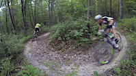
Popular Boxford State Forest Mountain Biking Trails
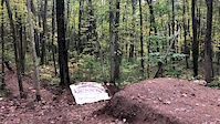
Photos of Boxford State Forest Mountain Bike
trail: Middleton Road
18 |
Apr 9, 2023 @ 10:55am
Apr 9, 2023
trail: Track 018
35 |
Nov 12, 2020 @ 7:04am
Nov 12, 2020
trail: Track 018
41 |
Nov 12, 2020 @ 7:04am
Nov 12, 2020
trail: Track 024
32 |
Nov 10, 2020 @ 12:24pm
Nov 10, 2020
trail: Fuller Trail
31 |
Nov 10, 2020 @ 12:03pm
Nov 10, 2020
trail: Thomas Road
50 |
Nov 10, 2020 @ 11:59am
Nov 10, 2020
trail: Thomas Road
57 |
Nov 10, 2020 @ 11:59am
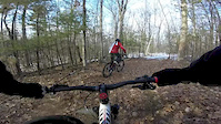
Nov 10, 2020Videos of Boxford State Forest Mountain Bike
trail: 100 (BCT)
0:05 |
150 |
Dec 6, 2019

trail: 111
0:20 |
50 |
Jan 31, 2016
trail: 111
2:57 |
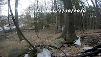
51 |
Jan 30, 2016
trail: 111
0:59 |
16 |
Jan 30, 2016

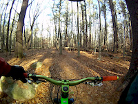
trail: 45
0:39 |
372 |
Nov 27, 2015
trail: 95
2:25 |
78 |
Nov 15, 2015

trail: Burning Bush Road Junction
0:46 |
60 |
Jul 6, 2015
trail: 100 (BCT)
12:41 |
658 |
Sep 5, 2014
Recent Trail Reports
| status | trail | date | condition | info | user |
|---|---|---|---|---|---|
| Track 023b | Mar 9, 2024 @ 7:43am Mar 9, 2024 | Ideal | JoeONeil | ||
| Price Trail 2 | Mar 9, 2024 @ 7:43am Mar 9, 2024 | Ideal | JoeONeil | ||
| Crooked South | Nov 19, 2023 @ 5:31pm Nov 19, 2023 | Variable | Squishlefunke | ||
| Mystery Yellow Train | Oct 3, 2023 @ 1:15am Oct 3, 2023 | Ideal | Zambo69 | ||
| Price Trail | Oct 3, 2023 @ 1:15am Oct 3, 2023 | Ideal | Zambo69 | ||
| Track 024a | Jul 20, 2023 @ 2:31pm Jul 20, 2023 | Wet | ChrisvfGP6M | ||
| Fern Gully (BCT) | Jul 3, 2023 @ 7:25am Jul 3, 2023 | Variable | glenzx | ||
| Track 016 2 | Jul 3, 2023 @ 7:25am Jul 3, 2023 | Variable | glenzx | ||
| Crooked Pond Access Trail | Jul 3, 2023 @ 7:25am Jul 3, 2023 | Variable | glenzx | ||
| Track 010 | Jun 3, 2023 @ 6:03pm Jun 3, 2023 | Wet | the-og-gary-b |
Activity Feed
| username | action | type | title | date |
|---|---|---|---|---|
| rRIOpZ | add | karma | activity #52181485 | May 6, 2024 @ 11:42am May 6, 2024 |
| jpmcgill89 | wishlist | region | activity #51391839 | Apr 19, 2024 @ 7:28am Apr 19, 2024 |
| JoeONeil | add | report | activity #49852946 and 1 more | Mar 9, 2024 @ 4:17pm Mar 9, 2024 |
| jessejviolin | wishlist | region | activity #46890108 | Dec 2, 2023 @ 7:54pm Dec 2, 2023 |
| DTWLynn | add | photo | activity #46664138 | Nov 25, 2023 @ 4:01pm Nov 25, 2023 |
Recent Comments
| username | type | title | comment | date |
|---|---|---|---|---|
| trail | This is a great trail with a couple of... | Aug 14, 2023 @ 3:47pm Aug 14, 2023 | ||
| trail | This trail simply no longer exists. Downed... | Aug 14, 2023 @ 3:44pm Aug 14, 2023 | ||
| trail | Well marked, nice bridge. | Jul 8, 2023 @ 12:13pm Jul 8, 2023 | ||
| trail | Trail is blocked near the end by homeowners | Oct 7, 2022 @ 4:18pm Oct 7, 2022 | ||
| report | Lot's of work done on this section - trees... | Apr 11, 2022 @ 4:13pm Apr 11, 2022 |
Nearby Areas
| name | distance | ||||
|---|---|---|---|---|---|
| Lord Forest | 10 | 1 km | |||
| Lockwood Forest | 9 | 6 | 1.2 km | ||
| Boxford Common | 8 | 2 | 1.5 km | ||
| Windrush Farm | 6 | 2 | 1.6 km | ||
| Lord-Ericson Woods | 5 | 1.8 km |
Local Badges
-

Completionist0 awarded
Activity Type Stats
| activitytype | trails | distance | descent | descent distance | total vertical | rating | global rank | state rank | photos | reports | routes | ridelogs |
|---|---|---|---|---|---|---|---|---|---|---|---|---|
| Mountain Bike | 83 | 70 miles | 2,047 ft | 10 miles | 144 ft | #9,092 | #3,827 | 26 | 31 | 604 | ||
| E-Bike | 3 | 4,255 ft | 36 ft | 1,112 ft | 72 ft | 19 | 9 | |||||
| Horse | 5 | 1 mile | 49 ft | 1,713 ft | 56 ft | #1,725 | 3 | |||||
| Hike | 90 | 72 miles | 2,231 ft | 11 miles | 144 ft | #7,838 | #3,588 | 2 | 33 | 93 | ||
| Trail Running | 90 | 72 miles | 2,231 ft | 11 miles | 144 ft | #7,818 | #3,572 | 33 | 12 | |||
| Snowshoe | 16 | 5 miles | 220 ft | 1 mile | 95 ft | #796 | #466 | 7 | 1 | |||
| Nordic Ski | 16 | 5 miles | 220 ft | 1 mile | 95 ft | #578 | #359 | 1 | 1 |
- By WillieJacobsz
 TRAILFORKS Trailforks Map Team & contributors
 - Admins: SiamDelightRules
- #29166 - 3,936 views
- boxford state forest activity log | embed map of Boxford State Forest mountain bike trails | boxford state forest mountain biking points of interest
Downloading of trail gps tracks in kml & gpx formats is enabled for Boxford State Forest.
You must login to download files.