420 ft
Distance
8 ft
Climb
00:00:25
Avg time
Supporters, Builders, Maintainers & Land Managers of 100 (BCT) Trail

100 (BCT) Details

  • Activities
    • Hike
    • Trail Running
  • Riding Area
    Boxford State Forest
    Boxford, Massachusetts
  • AKA
  • Difficulty Rating
  • Hiking SAC Scale
    T1 Hiking
  • Trail Type
    Singletrack
  • eBike Allowed
  • Global Ranking
    #7733 in Hiking [+]
    • #38314 in Trail Running
  • Local Popularity
    95 in Hiking [+]
    • 100 in Trail Running
  • Land Owner
    Mass DCR

No description for 100 (BCT) trail has been added yet!
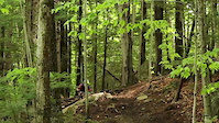
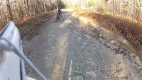
 Submit one here.

100 (BCT) is a 420 ft popular green singletrack trail located near Boxford Massachusetts. This hike primary trail. On average it takes minutes to complete this trail.

Disclaimer

Bikes are not allowed on this section of BCT, which goes through the John C Phillips Wildlife Sanctuary.

Local Trail Association
Traditionally Indigenous Territory
More Stats for 100 (BCT) hike trail trail
  • Altitude change
    8 ft
  • Altitude min
    144 ft
  • Altitude max
    153 ft
  • Altitude start
    145 ft
  • Altitude end
    154 ft
  • Grade
    1.9%
  • Grade max
    -1.7%
  • Grade min
    4.1%
  • Distance climb
    299 ft
  • Distance down
    39 ft
  • Distance flat
    82 ft
  • Avg time
    00:00:25
  • Avg reverse time
    00:01:37
  • view trail stats
Status:
on Aug 12, 2020
Dry
no votes yet
Your vote: 0

view (415)
close
3D
Trail Conditions
  • Unknown
  • Snow Groomed
  • Snow Packed
  • Snow Covered
  • Snow Cover Inadequate
  • Freeze/thaw Cycle
  • Icy
  • Prevalent Mud
  • Wet
  • Variable
  • Ideal
  • Dry
  • Very Dry
Trail Flow (Ridden Direction)
Trailforks scans users ridelogs to determine the most popular direction each trail is ridden. A good flowing trail network will have most trails flowing in a single direction according to their intension.
The colour categories are based on what percentage of riders are riding a trail in its intended direction.
  • > 96%
  • > 90%
  • > 80%
  • > 70%
  • > 50%
  • < 50%
  • bi-directional trail
  • no data
Trail Last Ridden
Trailforks scans ridelogs to determine the last time a trail was ridden.
  • < 2 days
  • < 1 week
  • < 2 weeks
  • < 1 month
  • < 6 months
  • > 6 months
Trail Ridden Direction
The intended direction a trail should be ridden.
  • Downhill Only
  • Downhill Primary
  • Both Directions
  • Uphill Primary
  • Uphill Only
  • One Direction
Contribute Details
Colors indicate trail is missing specified detail.
  • Description
  • Photos
  • Description & Photos
  • Videos
Trail Popularity ?
Trailforks scans ridelogs to determine which trails are ridden the most in the last 9 months. Trails are compared with nearby trails in the same city region with a possible 25 colour shades. Think of this as a heatmap, more rides = more kinetic energy = warmer colors.
  • most popular
  • popular
  • less popular
  • not popular
ATV/ORV/OHV Filter
Max Vehicle Width
inches

Radar Time
x Activity Recordings
Trailforks users anonymized public ridelogs from the past 6 months.
  • mountain biking recent
  • mountain biking (>6 month)
  • hiking (1 year)
  • moto (1 year)
Activity Recordings
Trailforks users anonymized public skilogs from the past 12 months.
  • Downhill Ski
  • Backcountry Ski
  • Nordic Ski
  • Snowmobile
Winter Trails
Warning A routing network for winter maps does not exist. Selecting trails using the winter trails layer has been disabled.
x Missing Trails
Most Popular
Least Popular
Trails are colored based on popularity. The more popular a trail is, the more red. Less popular trails trend towards green.
Jump Magnitude Heatmap
Heatmap of where riders jump on trails. Zoom in to see individual jumps, click circles to view jump details.
Trails Deemphasized
Trails are shown in grey.
disable
Only show trails with NO bikes.
enable

Save the current map location and zoom level as your default home location whenever this page is loaded.

Save
      Directions to 100-bct trailhead (42.635920, -71.000270)
      update trails status or condition

      100 (BCT) Trail Reports

      statusdatedescription
      Aug 12, 2020 @ 3:42am
      Aug 12, 2020
      view all reports »

      Recent Ridelog Activity on Trail

      Past Week
      • 0 rides
      •  
      6 Months
      • 2 rides
      • 5 miles avg distance
      All
      • 23 rides
      •  

      Photos

      no photos have been added for 100 (BCT) yet, add a photo.

      Trail Lists

      Routes with this trail

      titledistance
      Bay Circuit Trail - Official Hiking Route221 miles

      Reviews / Comments

      No reviews yet, be the first to write a review or ask a question.
      Use trail reports to comment on trail conditions.


      We hope you've been enjoying Trailforks!

      Create a FREE account to view trail comments and much more.

      Videos

      more »
      2014 Attitash Mt Bike Park Opening Weekend
      1:03 | 251 | May 29, 2014 , Boxford
      DH sessions at Highland mtb Park
      3:16 | 131 | Mar 9, 2013 , Boxford
      Ayr Academy Coach: Jamie Goldman
      3:25 | 5213 | Feb 15, 2013 , Boxford
      Christian Raeber at Highland Mountain
      4:33 | 1525 | Oct 5, 2012 , Boxford
      • By Endoair & contributors
      • #285670 - 373 views
      • subscribe
      • flag
      • login to download gpx or kml files.