close
-
Layers w
- Weather Layers
- Pro
- Pro
- Pro
- Pro
- Pro
- Pro
- More Layers
- Pro
- Pro
- Pro
- Pro
-
Upgrade to

3D
Trail Conditions
- Unknown
- Snow Groomed
- Snow Packed
- Snow Covered
- Snow Cover Partial
- Freeze/thaw Cycle
- Icy
- Prevalent Mud
- Wet
- Variable
- Ideal
- Dry
- Very Dry
Trail Flow (Ridden Direction)
Trailforks scans users ridelogs to determine the most popular direction each trail is ridden. A good flowing trail network will have most trails flowing in a single direction according to their intension.
The colour categories are based on what percentage of riders are riding a trail in its intended direction.
The colour categories are based on what percentage of riders are riding a trail in its intended direction.
- > 96%
- > 90%
- > 80%
- > 70%
- > 50%
- < 50%
- bi-directional trail
- no data
Trail Last Ridden
Trailforks scans ridelogs to determine the last time a trail was ridden.
- < 2 days
- < 1 week
- < 2 weeks
- < 1 month
- < 6 months
- > 6 months
Trail Ridden Direction
The intended direction a trail should be ridden.
- Downhill Only
- Downhill Primary
- Both Directions
- Uphill Primary
- Uphill Only
- One Direction
Contribute Details
Colors indicate trail is missing specified detail.
- Description
- Photos
- Description & Photos
- Videos
Trail Popularity ?
Trailforks scans ridelogs to determine which trails are ridden the most in the last 9 months.
Trails are compared with nearby trails in the same city region with a possible 25 colour shades.
Think of this as a heatmap, more rides = more kinetic energy = warmer colors.
- most popular
- popular
- less popular
- not popular
ATV/ORV/OHV Filter
Max Vehicle Width
inches
US Cell Coverage
Legend

Radar Time
Activity Recordings
Trailforks uses anonymized public activity data.
?
Activity Recordings
Trailforks uses anonymized public activity data.
?
Personal Heatmap
▶
Activity Types
all
/
none
▶
Options
2
Date range
month
–
Winter Trails
Warning
A routing network for winter maps does not exist. Selecting trails using the winter trails layer has been disabled.
Missing Trails
Most Popular
Least Popular
Trails are colored based on popularity. The more popular a trail is, the more red. Less popular trails trend towards green.
Jump Magnitude Heatmap
Heatmap of where riders jump on trails. Zoom in to see individual jumps, click circles to view jump details.
BC Backroad Status
![map legend]()
Service Road Atlas is a free to use, community-driven service for viewing and creating reports on the numerous back-country service roads around B.C. and Alberta.

Slope Aspect
Direction the slope faces
Trails Deemphasized
Trails are shown in grey.
Only show trails with no bike usage.
Suggested Layers
Based on selected activity type
Save the current map location and zoom level as your default home location whenever this page is loaded.
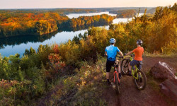
SaveChamplin is a city in Hennepin County, Minnesota, United States. The population was 23,089 at the 2010 census.
Champlin is a northern suburb of Minneapolis.
U.S. Highway 169 and Hennepin County Road 12 (CR 12) are two of the main routes in Champlin.
Champlin is a northern suburb of Minneapolis.
U.S. Highway 169 and Hennepin County Road 12 (CR 12) are two of the main routes in Champlin.
source: Wikipedia
Activities Click to view
- Mountain Bike
24 trails
- E-Bike
14 trails
- Gravel Bike
0 trails
- Adaptive Bike
0 trails
- Winter Fat Bike
0 trails
- Horse
1 trails
- Hike
37 trails
- Trail Running
37 trails
- Dirtbike/Moto
0 trails
- Observed Trials
0 trails
- ATV/ORV/OHV
0 trails
- Snowmobile
1 trails
- Snowshoe
5 trails
- Downhill Ski
0 trails
- Backcountry Ski
0 trails
- Nordic Ski
13 trails
Region Details
- 8
- 3
- 9
- 2
Region Status
Open as of 6 hoursStats
- Avg Trail Rating
- Trails (view details)
- 34
- Trails Mountain Bike
- 25
- Trails E-Bike
- 14
- Trails Horse
- 1
- Trails Hike
- 37
- Trails Trail Running
- 37
- Trails Snowmobile
- 1
- Trails Snowshoe
- 5
- Trails Nordic Ski
- 13
- Total Distance
- 80 miles
- Total Descent
- 2,577 ft
- Total Vertical
- 197 ft
- Highest Trailhead
- 1,037 ft
- Reports
- 376
- Photos
- 26
- Ridden Counter
- 7,436
Articles
The Best Mountain Biking in Minnesota
Aug 22, 2024 from outsideonline.com
World-class riding is the state’s best-kept secret. These are the top trails, according to a local expert.
Sub Regions
-
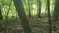
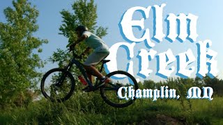
Elm Creek Park
- 3
- 9
- 2
Popular Champlin Mountain Biking Trails
• 100 ★ 3.9 • 6 miles • 325 ft • 1,356 •
This is a very mellow blue (aqua?) trail, relatively smooth, rolling through the woods and meadows, with a number of narrowish sections and a few small bumps/jumps scattered around. The trail sees very heavy use, and is many rider's...
• 90 ★ 3.9 • 3 miles • 145 ft • 1,287 •
Popular blue difficulty singletrack. This mountain bike primary trail can be used downhill primary and has a moderate overall physical rating with a 145 ft blue climb. It features jump. On average it takes 13 minutes to complete this trail.
• 100 ★ 3.7 • 515 ft • 5 ft • 1,188 •
Popular blue difficulty singletrack. This mountain bike primary trail can be used both directions and has a moderate overall physical rating with a 5 ft blue climb. On average it takes minutes to complete this trail.
• 85 ★ 4.8 • 2 miles • 155 ft • 1,186 •
The are a lot fun technical sections along with more flows sections that Elm Creek is known for. This section is rated black diamond but every feature has a bypass option.
• 80 ★ 3.5 • 1,880 ft • 38 ft • 969 •
Popular blue difficulty singletrack. This multi-use trail can be used one direction. On average it takes 1 minutes to complete this trail.
• 75 ★ 3.7 • 915 ft • 29 ft • 848 •
Popular blue difficulty singletrack. This multi-use trail can be used both directions and has a moderate overall physical rating with a 29 ft blue climb. It features jump. On average it takes 2 minutes to complete this trail.
• 65 ★ 3.0 • 292 ft • 14 ft • 608 •
Moderately popular blue difficulty singletrack. This mountain bike primary trail can be used uphill primary and has a moderate overall physical rating with a 14 ft blue climb. On average it takes minutes to complete this trail.
• 70 ★ 3.0 • 3,868 ft • 33 ft • 493 •
Popular green difficulty singletrack. This multi-use trail can be used one direction and has a easy overall physical rating with a 33 ft green climb. On average it takes 4 minutes to complete this trail.
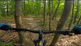
Photos of Champlin Mountain Bike
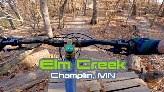
Videos of Champlin Mountain Bike
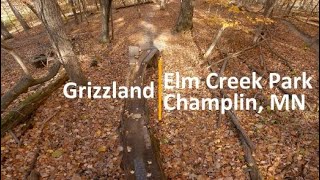
trail: Grizzland
0:18 |
388 |
Apr 22, 2019
trail: Grizz to Parking Lot
20:20 |
171 |
Jun 25, 2024 , Champlin

trail: Parking Lot to Grizz
20:20 |
240 |
Jun 25, 2024 , Champlin
youtuber
![Speed and Jumps...that is why you ride this trail!]()
13:14 |
251 |
Oct 24, 2022
trail: Grizzland
8:32 |
572 |
Jun 2, 2022 , Champlin

trail: Parking Lot to Grizz
20:01 |
320 |
Aug 4, 2021 , Champlin
trail: Charlie's Playground
20:01 |
288 |
Aug 4, 2021 , Champlin

20:01 |
171 |
Aug 4, 2021
Recent Trail Reports
| status | trail | date | condition | info | user |
|---|---|---|---|---|---|
| EC Intermediate | Jun 6, 2026 @ 3:50pm (America/Chicago) 6 hours | Ideal | bpsmpls | ||
| Powerline Lumps 1 | Jun 6, 2026 @ 3:50pm (America/Chicago) 6 hours | Ideal | bpsmpls | ||
| Meadow Bonus Loop | Jun 6, 2026 @ 3:50pm (America/Chicago) 6 hours | Ideal | bpsmpls | ||
| Grizz to Parking Lot | Jun 6, 2026 @ 3:50pm (America/Chicago) 6 hours | Ideal | bpsmpls | ||
| Int Cutoff | Jun 6, 2026 @ 3:50pm (America/Chicago) 6 hours | Ideal | bpsmpls | ||
| Woods Bonus Loop | Jun 6, 2026 @ 3:50pm (America/Chicago) 6 hours | Ideal | bpsmpls | ||
| Charlie's Playground | Jun 6, 2026 @ 3:50pm (America/Chicago) 6 hours | Variable | bpsmpls | ||
| Parking Lot to Grizz | Jun 6, 2026 @ 3:50pm (America/Chicago) 6 hours | Ideal | bpsmpls | ||
| Medicine Lake Regional Trail | Jun 5, 2026 @ 1:05pm (America/Chicago) 1 day | Unknown | nunnu | ||
| Easy Loop 1 | May 12, 2026 @ 11:35am (America/Atikokan) May 12, 2026 | Ideal | DDRIII |
Activity Feed
| username | action | type | title | date |
|---|---|---|---|---|
| bpsmpls | add | report | activity #96416772 | Jun 6, 2026 @ 5:00pm 3 hours |
| bpsmpls | add | report | activity #96416769 and 6 more | Jun 6, 2026 @ 5:00pm 3 hours |
| nunnu | add | report | activity #96309320 | Jun 5, 2026 @ 11:05am 1 day |
| uQ0BC1 | wishlist | region | activity #96295463 | Jun 5, 2026 @ 7:47am 1 day |
| SharkRepellant | wishlist | trail | activity #96189197 | Jun 3, 2026 @ 4:37pm Jun 3, 2026 |
Recent Comments
| username | type | title | comment | date |
|---|---|---|---|---|
| trail | Great for introducing your kid to mountain... | Sep 20, 2024 @ 10:48am Sep 20, 2024 | ||
| trail | A number of trees down (date ridden 7/22/23)... | Jul 23, 2023 @ 6:26am Jul 23, 2023 | ||
| report | Already resolved | Jun 19, 2022 @ 9:31am Jun 19, 2022 | ||
| trail | This is a relatively flat trail with no... | May 31, 2020 @ 8:18am May 31, 2020 | ||
| trail | Grizzland is a blast! Love it. | Aug 6, 2018 @ 4:47pm Aug 6, 2018 |
Local Badges
-

Epic Mountain Bike Climb 2k0 awarded -

Climbing 10k Badge42 awarded -

Mountain Biking 100k Badge1 awarded -

Epic Ride 50k494 awarded -

Epic Ride Descent 2k0 awarded -

Descent 10k Badge21 awarded
Activity Type Stats
| activitytype | trails | distance | descent | descent distance | total vertical | rating | global rank | state rank | photos | reports | routes | ridelogs |
|---|---|---|---|---|---|---|---|---|---|---|---|---|
| Mountain Bike | 24 | 63 miles | 2,031 ft | 20 miles | 197 ft | #1,306 | #497 | 25 | 376 | 22,385 | ||
| E-Bike | 14 | 33 miles | 965 ft | 9 miles | 98 ft | #4,359 | #1,420 | 345 | 374 | |||
| Horse | 1 | 8 miles | 233 ft | 2 miles | 62 ft | #3,047 | #1,726 | 85 | 7 | |||
| Hike | 37 | 80 miles | 2,579 ft | 25 miles | 197 ft | #3,935 | #1,390 | 1 | 376 | 499 | ||
| Trail Running | 37 | 80 miles | 2,579 ft | 25 miles | 197 ft | #3,416 | #1,011 | 376 | 374 | |||
| Snowmobile | 1 | 8 miles | 233 ft | 2 miles | 62 ft | #418 | #228 | |||||
| Snowshoe | 5 | 24 miles | 725 ft | 7 miles | 98 ft | #985 | #485 | 1 | 48 | |||
| Nordic Ski | 13 | 11 miles | 331 ft | 3 miles | 89 ft | #995 | #418 | 1 | 1,455 |
Frequently Asked Questions About Champlin
▼
What are the best places to ride in Champlin?
Champlin has 1 areas to explore for mountain biking. The top rated areas are:
▼
What are the highest rated mountain biking trails in Champlin?
The highest rated mountain biking trails in Champlin are:
- Grizzland (4.5/5)
- Charlie's Playground (4/5)
- Grizz to Parking Lot (3.9/5)
- Parking Lot to Grizz (3.9/5)
- Meadow Bonus Loop (3.9/5)
▼
What is the best time of the year to ride in Champlin?
Based on ride log data, the most popular months to ride in Champlin are:
- August (223 activities)
- July (223 activities)
- September (191 activities)
▼
Where can I park to ride in Champlin?
There are 15 parking locations listed in Champlin. The most popular parking spots are: View all parking and trailhead locations on the map to plan your visit.
Activities
Trails
Points of Interest
- By canadaka
 Trailforks & contributors
 - Admins: apply
- #27678 - 2,531 views
- champlin activity log | embed map of Champlin mountain bike trails | champlin mountain biking points of interest
Downloading of trail gps tracks in kml & gpx formats is enabled for Champlin.
You must login to download files.