close
-
Layers w
- Weather Layers
- Pro
- Pro
- Pro
- Pro
- Pro
- Pro
- More Layers
- Pro
- Pro
- Pro
- Pro
-
Upgrade to

3D
Trail Conditions
- Unknown
- Snow Groomed
- Snow Packed
- Snow Covered
- Snow Cover Partial
- Freeze/thaw Cycle
- Icy
- Prevalent Mud
- Wet
- Variable
- Ideal
- Dry
- Very Dry
Trail Flow (Ridden Direction)
Trailforks scans users ridelogs to determine the most popular direction each trail is ridden. A good flowing trail network will have most trails flowing in a single direction according to their intension.
The colour categories are based on what percentage of riders are riding a trail in its intended direction.
The colour categories are based on what percentage of riders are riding a trail in its intended direction.
- > 96%
- > 90%
- > 80%
- > 70%
- > 50%
- < 50%
- bi-directional trail
- no data
Trail Last Ridden
Trailforks scans ridelogs to determine the last time a trail was ridden.
- < 2 days
- < 1 week
- < 2 weeks
- < 1 month
- < 6 months
- > 6 months
Trail Ridden Direction
The intended direction a trail should be ridden.
- Downhill Only
- Downhill Primary
- Both Directions
- Uphill Primary
- Uphill Only
- One Direction
Contribute Details
Colors indicate trail is missing specified detail.
- Description
- Photos
- Description & Photos
- Videos
Trail Popularity ?
Trailforks scans ridelogs to determine which trails are ridden the most in the last 9 months.
Trails are compared with nearby trails in the same city region with a possible 25 colour shades.
Think of this as a heatmap, more rides = more kinetic energy = warmer colors.
- most popular
- popular
- less popular
- not popular
ATV/ORV/OHV Filter
Max Vehicle Width
inches
US Cell Coverage
Legend

Radar Time
Activity Recordings
Trailforks uses anonymized public activity data.
?
Activity Recordings
Trailforks uses anonymized public activity data.
?
Personal Heatmap
▶
Activity Types
all
/
none
▶
Options
2
Date range
month
–
Winter Trails
Warning
A routing network for winter maps does not exist. Selecting trails using the winter trails layer has been disabled.
Missing Trails
Most Popular
Least Popular
Trails are colored based on popularity. The more popular a trail is, the more red. Less popular trails trend towards green.
Jump Magnitude Heatmap
Heatmap of where riders jump on trails. Zoom in to see individual jumps, click circles to view jump details.
BC Backroad Status
![map legend]()
Service Road Atlas is a free to use, community-driven service for viewing and creating reports on the numerous back-country service roads around B.C. and Alberta.

Slope Aspect
Direction the slope faces
Trails Deemphasized
Trails are shown in grey.
Only show trails with no bike usage.
Suggested Layers
Based on selected activity type
Save the current map location and zoom level as your default home location whenever this page is loaded.
Save
No description for Clitheroe has been added yet!
Login or register to submit one.
This region uses the Uk/Euro style trail grading system.
Activities Click to view
- Mountain Bike
43 trails
- E-Bike
5 trails
- Gravel Bike
0 trails
- Adaptive Bike
0 trails
- Hike
28 trails
- Trail Running
28 trails
Region Details
- 15
- 6
- 15
- 3
- 1
Region Status
Open as of Jun 14, 2026Stats
- Avg Trail Rating
- Trails (view details)
- 40
- Trails Mountain Bike
- 43
- Trails E-Bike
- 5
- Trails Hike
- 28
- Trails Trail Running
- 28
- Total Distance
- 23 miles
- Total Descent
- 3,006 ft
- Total Vertical
- 540 ft
- Highest Trailhead
- 1,155 ft
- Reports
- 723
- Photos
- 128
- Ridden Counter
- 28,847
Sub Regions
-
Gisburn Forest
- 5
- 15
- 3
- 1
Popular Clitheroe Mountain Biking Trails
• 90 ★ 3.4 • 1,857 ft • 20 ft • 1,393 •
Popular red difficulty singletrack. This mountain bike primary trail can be used one direction and has a moderate overall physical rating with a 20 ft blue climb. On average it takes 2 minutes to complete this trail.
• 95 ★ 3.7 • 1,351 ft • 70 ft • 1,390 •
Popular red difficulty singletrack. This mountain bike primary trail can be used uphill only and has a moderate overall physical rating with a 70 ft blue climb. On average it takes 3 minutes to complete this trail.
• 95 ★ 4.0 • 3,829 ft • 52 ft • 1,358 •
A small climb followed by one of the funnest descents "like chasing Ewoks" tight and twisty volunteer handbuilt trail.
• 85 ★ 3.7 • 1,273 ft • 87 ft • 1,343 •
Popular red difficulty singletrack. This mountain bike primary trail can be used uphill only and has a hard overall physical rating with a 87 ft blue climb. On average it takes 3 minutes to complete this trail.
• 75 ★ 4.0 • 2,459 ft • 2 ft • 1,283 •
Popular red difficulty singletrack. This mountain bike primary trail can be used downhill primary. On average it takes 3 minutes to complete this trail.
• 70 ★ 4.5 • 1 mile • 154 ft • 1,269 •
Highly rated popular red difficulty singletrack. This mountain bike primary trail can be used downhill primary. It features berm, rock face and rock garden. On average it takes 19 minutes to complete this trail.
Clitheroe Mountain Bike Routes
★ 3.0 • 12 miles • 1,214 ft • 11 •
Highlights include the volunteer built trail of , gnarly rocks of and the roller coaster ride down Follow...
• 17 miles • 2,150 ft • 20 •
• 13 miles • 1,486 ft • 21 •
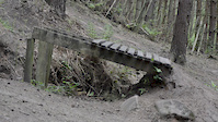
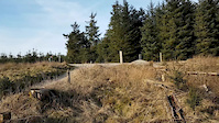
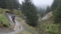
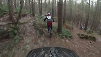
Photos of Clitheroe Mountain Bike
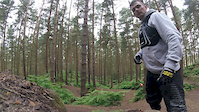
Videos of Clitheroe Mountain Bike

trail: Final Trail / 27 Berms
3:36 |
144 |
Apr 25, 2023

trail: Home Baked
4:14 |
122 |
Apr 25, 2023
trail: Hully Gully
6:37 |
574 |
Apr 25, 2023
trail: Leap of Faith
0:15 |
718 |
May 8, 2017
trail: The Hope Line
0:51 |
434 |
Mar 27, 2017
trail: Home Baked
4:26 |
2405 |
Mar 21, 2017
trail: Leap of Faith
0:43 |
586 |
Dec 18, 2016
trail: Leap of Faith
0:55 |
215 |
Dec 12, 2016
Recent Trail Reports
| status | trail | date | condition | info | user |
|---|---|---|---|---|---|
| Home Baked | Jun 14, 2026 @ 9:56am (Europe/London) Jun 14, 2026 | Variable | Vimto-North | ||
| Rocky Road | Jun 14, 2026 @ 9:56am (Europe/London) Jun 14, 2026 | Variable | Vimto-North | ||
| Circle | Jun 14, 2026 @ 9:56am (Europe/London) Jun 14, 2026 | Variable | Vimto-North | ||
| Over The Hill | Jun 14, 2026 @ 9:56am (Europe/London) Jun 14, 2026 | Variable | Vimto-North | ||
| The Snake | Jun 14, 2026 @ 9:56am (Europe/London) Jun 14, 2026 | Variable | Vimto-North | ||
| Parkwood | May 31, 2026 @ 10:05am (Europe/London) May 31, 2026 | Dry | Vimto-North | ||
| Swoopy | May 31, 2026 @ 10:05am (Europe/London) May 31, 2026 | Dry | Vimto-North | ||
| Bottoms | May 31, 2026 @ 10:05am (Europe/London) May 31, 2026 | Dry | Vimto-North | ||
| Connector | May 31, 2026 @ 10:05am (Europe/London) May 31, 2026 | Dry | Vimto-North | ||
| Hully Gully | May 31, 2026 @ 10:05am (Europe/London) May 31, 2026 | Dry | Vimto-North |
Activity Feed
| username | action | type | title | date |
|---|---|---|---|---|
| Vimto-North | add | report | activity #96960039 and 4 more | Jun 14, 2026 @ 6:00am Jun 14, 2026 |
| Vimto-North | add | report | activity #95942772 and 9 more | May 31, 2026 @ 8:24am May 31, 2026 |
| Nathanowen26 | wishlist | region | activity #95933657 | May 31, 2026 @ 6:32am May 31, 2026 |
| trailforks | add | video | activity #95774079 | May 29, 2026 @ 7:00am May 29, 2026 |
| rwnxUp | wishlist | route | activity #91444281 | Mar 28, 2026 @ 9:10am Mar 28, 2026 |
Recent Comments
| username | type | title | comment | date |
|---|---|---|---|---|
| trail | Really good trail, even on a wet mid November... | Nov 14, 2021 @ 1:52pm Nov 14, 2021 | ||
| trail | Careful some of the drop offs end up In Big... | May 3, 2021 @ 6:53am May 3, 2021 | ||
| trail | Again it’s not a walkers trails | Jun 25, 2020 @ 5:34am Jun 25, 2020 | ||
| trail | It’s not a sodding walking trail | Jun 25, 2020 @ 5:33am Jun 25, 2020 | ||
| trail | Definitely a red route not a pro line expert... | May 9, 2020 @ 10:24am May 9, 2020 |
Local Badges
-

Epic Ride Climb 2k28 awarded -

Climbing 10k Badge32 awarded -

Climbing 100k Badge1 awarded -

Epic Ride Descent 2k28 awarded -

Descent 10k Badge32 awarded -

Descent 100k Badge1 awarded
Activity Type Stats
| activitytype | trails | distance | descent | descent distance | total vertical | rating | global rank | state rank | photos | reports | routes | ridelogs |
|---|---|---|---|---|---|---|---|---|---|---|---|---|
| Mountain Bike | 43 | 23 miles | 3,005 ft | 11 miles | 541 ft | #1,493 | #54 | 128 | 723 | 4 | 8,520 | |
| E-Bike | 5 | 2 miles | 522 ft | 5,210 ft | 269 ft | #4,701 | #192 | 636 | 2 | 1,944 | ||
| Hike | 28 | 18 miles | 1,854 ft | 8 miles | 489 ft | #6,647 | #175 | 681 | 505 | |||
| Trail Running | 28 | 18 miles | 1,854 ft | 8 miles | 489 ft | #6,058 | #162 | 681 | 123 |
Frequently Asked Questions About Clitheroe
▼
What are the best places to ride in Clitheroe?
Clitheroe has 1 areas to explore for mountain biking. The top rated areas are:
▼
What are the highest rated mountain biking trails in Clitheroe?
The highest rated mountain biking trails in Clitheroe are:
- Hully Gully (4.5/5)
- Leap of Faith (4.4/5)
- Whelpstone Crag (4.3/5)
- Long Way Down (4.2/5)
- The Hope Line (4.2/5)
▼
What is the best time of the year to ride in Clitheroe?
Based on ride log data, the most popular months to ride in Clitheroe are:
- August (42 activities)
- June (39 activities)
- September (39 activities)
▼
Where can I park to ride in Clitheroe?
There are 2 parking locations listed in Clitheroe. The most popular parking spots are:
Activities
Trails
Points of Interest
- By brenthillier
 NSMBA TRAILFORKS & contributors
 - Admins: wisey, MathieuC, cemoorelife, PMBA
- #6873 - 7,342 views
- clitheroe activity log | embed map of Clitheroe mountain bike trails | clitheroe mountain biking points of interest
Downloading of trail gps tracks in kml & gpx formats is enabled for Clitheroe.
You must login to download files.