close
-
Layers w
- Weather Layers
- Pro
- Pro
- Pro
- Pro
- Pro
- Pro
- More Layers
- Pro
- Pro
- Pro
- Pro
-
Upgrade to

3D
Trail Conditions
- Unknown
- Snow Groomed
- Snow Packed
- Snow Covered
- Snow Cover Partial
- Freeze/thaw Cycle
- Icy
- Prevalent Mud
- Wet
- Variable
- Ideal
- Dry
- Very Dry
Trail Flow (Ridden Direction)
Trailforks scans users ridelogs to determine the most popular direction each trail is ridden. A good flowing trail network will have most trails flowing in a single direction according to their intension.
The colour categories are based on what percentage of riders are riding a trail in its intended direction.
The colour categories are based on what percentage of riders are riding a trail in its intended direction.
- > 96%
- > 90%
- > 80%
- > 70%
- > 50%
- < 50%
- bi-directional trail
- no data
Trail Last Ridden
Trailforks scans ridelogs to determine the last time a trail was ridden.
- < 2 days
- < 1 week
- < 2 weeks
- < 1 month
- < 6 months
- > 6 months
Trail Ridden Direction
The intended direction a trail should be ridden.
- Downhill Only
- Downhill Primary
- Both Directions
- Uphill Primary
- Uphill Only
- One Direction
Contribute Details
Colors indicate trail is missing specified detail.
- Description
- Photos
- Description & Photos
- Videos
Trail Popularity ?
Trailforks scans ridelogs to determine which trails are ridden the most in the last 9 months.
Trails are compared with nearby trails in the same city region with a possible 25 colour shades.
Think of this as a heatmap, more rides = more kinetic energy = warmer colors.
- most popular
- popular
- less popular
- not popular
ATV/ORV/OHV Filter
Max Vehicle Width
inches
US Cell Coverage
Legend

Radar Time
Activity Recordings
Trailforks uses anonymized public activity data.
?
Activity Recordings
Trailforks uses anonymized public activity data.
?
Personal Heatmap
▶
Activity Types
all
/
none
▶
Options
2
Date range
month
–
Winter Trails
Warning
A routing network for winter maps does not exist. Selecting trails using the winter trails layer has been disabled.
Missing Trails
Most Popular
Least Popular
Trails are colored based on popularity. The more popular a trail is, the more red. Less popular trails trend towards green.
Jump Magnitude Heatmap
Heatmap of where riders jump on trails. Zoom in to see individual jumps, click circles to view jump details.
BC Backroad Status
![map legend]()
Service Road Atlas is a free to use, community-driven service for viewing and creating reports on the numerous back-country service roads around B.C. and Alberta.

Slope Aspect
Direction the slope faces
Trails Deemphasized
Trails are shown in grey.
Only show trails with no bike usage.
Suggested Layers
Based on selected activity type
Save the current map location and zoom level as your default home location whenever this page is loaded.
Save
No description for Colebrook has been added yet!
Login or register to submit one.
Activities Click to view
- Mountain Bike
40 trails
- E-Bike
37 trails
- Hike
39 trails
- Trail Running
38 trails
Region Details
- 21
- 8
- 7
- 3
Region Status
Open as of Jul 3, 2026Stats
- Avg Trail Rating
- Trails (view details)
- 39
- Trails Mountain Bike
- 40
- Trails E-Bike
- 37
- Trails Horse
- 2
- Trails Hike
- 39
- Trails Trail Running
- 38
- Total Distance
- 20 miles
- Total Descent Distance
- 8 miles
- Total Descent
- 3,064 ft
- Total Vertical
- 399 ft
- Highest Trailhead
- 1,593 ft
- Reports
- 690
- Photos
- 95
- Ridden Counter
- 24,253
Sub Regions
-
Norbrook Farm Brewery and Trail Network
- 8
- 6
- 4
Popular Colebrook Mountain Biking Trails
• 100 ★ 5.0 • 2,808 ft • 0 ft • 1,372 •
• 65 ★ 4.3 • 4,334 ft • 14 ft • 1,070 •
- Easiest singletrack climb back to top of trail network
• 70 ★ 4.8 • 3,097 ft • 0 ft • 1,028 •
• 95 ★ 4.8 • 4,846 ft • 218 ft • 1,026 •
Highly rated popular green difficulty family friendly singletrack. This multi-use trail can be used both directions and has a easy overall physical rating with a 218 ft green climb. Trail visibility is always easy to follow. On average it takes 10 minutes to complete this trail.
• 90 ★ 4.8 • 2,602 ft • 41 ft • 1,006 •
Popular green difficulty singletrack. This multi-use trail can be used both directions with a 41 ft green climb. Trail visibility is always easy to follow. On average it takes 5 minutes to complete this trail.
• 70 ★ 4.7 • 942 ft • 36 ft • 881 •
Climb trail to get to top of . Connects with double track at top.
Colebrook Mountain Bike Routes
4 miles • 415 ft • 4 •
Potential race course for Housatonic Mountain Biking League championship. Starts from upper lot, goes to...
★ 3.0 • 7 miles • 1,441 ft • 15 •
Be careful when you're transferring up because stage 3 crosses the transfer, be careful on the climb up to...
★ 4.0 • 5 miles • 658 ft • 8 • Loop • Race •
Norbrook race loop based on the steep endurance website loop
3 miles • 386 ft • 6 • Race •
This is the race route for HMBL. CAT 1-3
1 mile • 100 ft • 1 • Race •
This is the CAT 4 race course for HMBL's championship race.
Photos of Colebrook Mountain Bike
Videos of Colebrook Mountain Bike

trail: Steve Quinn Memorial Trail
0:05 |
99 |
Mar 7, 2021

trail: Dirt Sessions
0:07 |
384 |
Sep 3, 2020

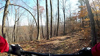
trail: Sherpa
4:39 |
499 |
Nov 15, 2019
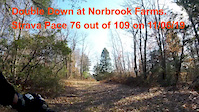
trail: Double Down
3:48 |
332 |
Nov 14, 2019
trail: Old Oak
3:41 |
589 |
Nov 12, 2019
trail: Sherpa
5:33 |
110 |
May 30, 2025 , Colebrook

trail: Dirt Sessions
0:41 |
119 |
May 30, 2025 , Colebrook
trail: Route 66
2:53 |
55 |
May 30, 2025 , Colebrook
Recent Trail Reports
| status | trail | date | condition | info | user |
|---|---|---|---|---|---|
| Warm-Up | Jul 3, 2026 @ 9:35am (America/New_York) Jul 3, 2026 | Ideal | the-grey-fox | ||
| Sherpa | Jul 3, 2026 @ 9:35am (America/New_York) Jul 3, 2026 | Ideal | the-grey-fox | ||
| Lost Camp | Jul 3, 2026 @ 9:35am (America/New_York) Jul 3, 2026 | Ideal | the-grey-fox | ||
| Steve Quinn Memorial Trail | Jul 3, 2026 @ 9:35am (America/New_York) Jul 3, 2026 | Ideal | the-grey-fox | ||
| Dirt Sessions | Jul 3, 2026 @ 9:35am (America/New_York) Jul 3, 2026 | Ideal | the-grey-fox | ||
| South Shore Drive (FS to NA) | May 31, 2026 @ 10:12am (America/New_York) May 31, 2026 | Ideal | Kyl3laplant3 | ||
| Flying Squirrel | May 31, 2026 @ 10:12am (America/New_York) May 31, 2026 | Ideal | Kyl3laplant3 | ||
| Dive Bomb | May 31, 2026 @ 10:12am (America/New_York) May 31, 2026 | Ideal | Kyl3laplant3 | ||
| Trails Access | Oct 16, 2025 @ 6:14pm (America/New_York) Oct 16, 2025 | Unknown | susanpmurphy | ||
| Double Down | Aug 8, 2025 @ 3:55pm Aug 8, 2025 | Ideal | Gnarmania |
Activity Feed
| username | action | type | title | date |
|---|---|---|---|---|
| the-grey-fox | add | report | activity #98336952 and 4 more | Jul 3, 2026 @ 8:12am Jul 3, 2026 |
| rastrickland | wishlist | trail | activity #97257130 and 1 more | Jun 18, 2026 @ 9:20am Jun 18, 2026 |
| rastrickland | wishlist | region | activity #97255686 | Jun 18, 2026 @ 8:55am Jun 18, 2026 |
| Foodee | ridden | trail | activity #97180305 | Jun 17, 2026 @ 6:58am Jun 17, 2026 |
| KelleyDiJRDp | ridden | route | activity #96174149 | Jun 3, 2026 @ 12:30pm Jun 3, 2026 |
Recent Comments
| username | type | title | comment | date |
|---|---|---|---|---|
| trail | This is NOT a green trail. Lots of sketchy... | Apr 26, 2026 @ 4:46pm Apr 26, 2026 | ||
| trail | This is probably my favorite trail at... | Dec 9, 2025 @ 11:28am Dec 9, 2025 | ||
| report | Craftmanship! | Nov 19, 2024 @ 9:27am Nov 19, 2024 | ||
| trail | Crazy horse flies and mosquitoes in summer. ... | Jul 1, 2024 @ 7:17pm Jul 1, 2024 | ||
| trail | This logging trail connects RT. 57 with the... | Dec 5, 2023 @ 6:17am Dec 5, 2023 |
Local Badges
-

Completionist60 awarded -

Epic Mountain Bike Climb 2k8 awarded -

Climbing 10k Badge4 awarded -

Mountain Biking 100k Badge0 awarded -

Epic Ride Descent 2k8 awarded -

Descent 10k Badge4 awarded
Activity Type Stats
| activitytype | trails | distance | descent | descent distance | total vertical | rating | global rank | state rank | photos | reports | routes | ridelogs |
|---|---|---|---|---|---|---|---|---|---|---|---|---|
| Mountain Bike | 40 | 20 miles | 3,064 ft | 8 miles | 400 ft | #1,406 | #534 | 104 | 692 | 5 | 5,677 | |
| E-Bike | 37 | 11 miles | 2,241 ft | 4 miles | 305 ft | #752 | #759 | 648 | 395 | |||
| Horse | 2 | 5 miles | 305 ft | 3 miles | 259 ft | 21 | 3 | |||||
| Hike | 39 | 16 miles | 2,835 ft | 7 miles | 377 ft | #1,246 | #573 | 2 | 687 | 1 | 89 | |
| Trail Running | 38 | 12 miles | 2,694 ft | 6 miles | 305 ft | #7,979 | #2,655 | 687 | 1 | 168 |
Frequently Asked Questions About Colebrook
▼
What are the best places to ride in Colebrook?
Colebrook has 2 areas to explore for mountain biking. The top rated areas are:
▼
What are the highest rated mountain biking trails in Colebrook?
The highest rated mountain biking trails in Colebrook are:
- Dirt Sessions (4.7/5)
- Dive Bomb (4.5/5)
- Old Oak (lower) (4.4/5)
- Long Shot (4.4/5)
- Old Oak (4.4/5)
▼
What is the best time of the year to ride in Colebrook?
Based on ride log data, the most popular months to ride in Colebrook are:
- September (123 activities)
- July (107 activities)
- October (106 activities)
▼
Where can I park to ride in Colebrook?
There are 2 parking locations listed in Colebrook. The most popular parking spots are:
Activities
Trails
- By redogrunner & contributors
- Admins: HCH, NEMBAEXEC
- #31956 - 5,472 views
- colebrook activity log | embed map of Colebrook mountain bike trails | colebrook mountain biking points of interest polygons
Downloading of trail gps tracks in kml & gpx formats is enabled for Colebrook.
You must login to download files.