close
-
Layers w
- Weather Layers
- Pro
- Pro
- Pro
- Pro
- Pro
- Pro
- More Layers
- Pro
- Pro
- Pro
- Pro
-
Upgrade to

3D
Trail Conditions
- Unknown
- Snow Groomed
- Snow Packed
- Snow Covered
- Snow Cover Partial
- Freeze/thaw Cycle
- Icy
- Prevalent Mud
- Wet
- Variable
- Ideal
- Dry
- Very Dry
Trail Flow (Ridden Direction)
Trailforks scans users ridelogs to determine the most popular direction each trail is ridden. A good flowing trail network will have most trails flowing in a single direction according to their intension.
The colour categories are based on what percentage of riders are riding a trail in its intended direction.
The colour categories are based on what percentage of riders are riding a trail in its intended direction.
- > 96%
- > 90%
- > 80%
- > 70%
- > 50%
- < 50%
- bi-directional trail
- no data
Trail Last Ridden
Trailforks scans ridelogs to determine the last time a trail was ridden.
- < 2 days
- < 1 week
- < 2 weeks
- < 1 month
- < 6 months
- > 6 months
Trail Ridden Direction
The intended direction a trail should be ridden.
- Downhill Only
- Downhill Primary
- Both Directions
- Uphill Primary
- Uphill Only
- One Direction
Contribute Details
Colors indicate trail is missing specified detail.
- Description
- Photos
- Description & Photos
- Videos
Trail Popularity ?
Trailforks scans ridelogs to determine which trails are ridden the most in the last 9 months.
Trails are compared with nearby trails in the same city region with a possible 25 colour shades.
Think of this as a heatmap, more rides = more kinetic energy = warmer colors.
- most popular
- popular
- less popular
- not popular
ATV/ORV/OHV Filter
Max Vehicle Width
inches
US Cell Coverage
Legend

Radar Time
Activity Recordings
Trailforks uses anonymized public activity data.
?
Activity Recordings
Trailforks uses anonymized public activity data.
?
Personal Heatmap
▶
Activity Types
all
/
none
▶
Options
2
Date range
month
–
Winter Trails
Warning
A routing network for winter maps does not exist. Selecting trails using the winter trails layer has been disabled.
Missing Trails
Most Popular
Least Popular
Trails are colored based on popularity. The more popular a trail is, the more red. Less popular trails trend towards green.
Jump Magnitude Heatmap
Heatmap of where riders jump on trails. Zoom in to see individual jumps, click circles to view jump details.
BC Backroad Status
![map legend]()
Service Road Atlas is a free to use, community-driven service for viewing and creating reports on the numerous back-country service roads around B.C. and Alberta.

Slope Aspect
Direction the slope faces
Trails Deemphasized
Trails are shown in grey.
Only show trails with no bike usage.
Suggested Layers
Based on selected activity type
Save the current map location and zoom level as your default home location whenever this page is loaded.
SaveThis beautiful loop trail, which parallels Hwy 49 on one side and the American River Canyon on the other, passes through open, rolling hills with several species of oak trees, and wildflowers in spring. It also includes steep canyon descents and climbs as it crosses Knickerbocker and Salt Creeks. Side trails on the canyon side offer panoramic views of the North Fork American River and of the Auburn dam construction site. Trail markers have been posted about every half-mile and at most trail intersections
source: Olmstead Trail Guide
Links
Activities Click to view
- Mountain Bike
28 trails
- E-Bike
5 trails
- Adaptive Bike
0 trails
- Horse
27 trails
- Hike
29 trails
- Trail Running
29 trails
Region Details
- 3
- 21
- 4
Region Status
Caution as of Apr 9, 2026Stats
- Avg Trail Rating
- Trails (view details)
- 29
- Trails Mountain Bike
- 28
- Trails E-Bike
- 5
- Trails Horse
- 27
- Trails Hike
- 29
- Trails Trail Running
- 29
- Total Distance
- 32 miles
- Total Descent
- 4,631 ft
- Total Vertical
- 1,118 ft
- Highest Trailhead
- 1,652 ft
- Reports
- 46
- Photos
- 99
- Ridden Counter
- 2,105
Sub Regions
-
Olmstead Loop
- 21
- 4
Popular Cool Mountain Biking Trails
• 30 ★ 4.0 • 9 miles • 1,043 ft • 129 •
Highly rated less popular blue difficulty mixed. This mountain bike primary trail can be used both directions and has a moderate overall physical rating with a 1,043 ft blue climb. Trail visibility is always easy to follow. On average it takes 1 hour7 minutes to complete this trail.
• 100 ★ 0.0 • 2 miles • 489 ft • 124 •
Popular green difficulty singletrack. This mountain bike primary trail can be used both directions and has a easy overall physical rating with a 489 ft green climb. Trail visibility is always easy to follow. On average it takes 22 minutes to complete this trail.
• 100 ★ 0.0 • 2,550 ft • 36 ft • 98 •
Popular green difficulty doubletrack. This mountain bike primary trail can be used downhill primary and has a easy overall physical rating with a 36 ft green climb. On average it takes 2 minutes to complete this trail.
• 90 ★ 0.0 • 2,572 ft • 173 ft • 63 •
Popular green difficulty singletrack. This mountain bike primary trail can be used both directions and has a easy overall physical rating with a 173 ft green climb. Trail visibility is always easy to follow. On average it takes 6 minutes to complete this trail.
• 80 ★ 0.0 • 3,031 ft • 31 ft • 54 •
Popular green difficulty singletrack. This mountain bike primary trail can be used both directions and has a easy overall physical rating with a 31 ft green climb. Trail visibility is always easy to follow. On average it takes 3 minutes to complete this trail.
• 95 ★ 0.0 • 2,575 ft • 12 ft • 52 •
Popular blue difficulty singletrack. This mountain bike primary trail can be used downhill primary and has a moderate overall physical rating with a 12 ft blue climb. Trail visibility is always easy to follow. On average it takes 2 minutes to complete this trail.
• 50 ★ 0.0 • 2 miles • 11 ft • 44 •
Moderately popular green difficulty singletrack. This mountain bike primary trail can be used both directions and has a easy overall physical rating with a 11 ft green climb. On average it takes 7 minutes to complete this trail.
• 10 ★ 0.0 • 4 miles • 974 ft • 37 •
Less popular blue difficulty mixed. This mountain bike primary trail can be used both directions and has a moderate overall physical rating with a 974 ft blue climb. Trail visibility is always easy to follow. On average it takes 30 minutes to complete this trail.
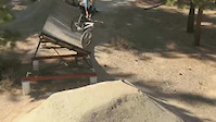
Photos of Cool Mountain Bike
Videos of Cool Mountain Bike
trail: Shoreline
0:33 |
117 |
Apr 23, 2019
trail: Rim Trail
2:37 |
96 |
Mar 29, 2015
youtuber
![Olmstead Loop (Cool, CA) Mountain Biking]()

trail: Salt Creek Loop Trail
16:09 |
1026 |
Jan 10, 2021 , Cool
youtuber
![Olmstead Loop (Cool, CA) Mountain Biking]()
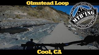
trail: Olmstead Loop Trail
16:09 |
922 |
Jan 10, 2021 , Cool
Recent Trail Reports
| status | trail | date | condition | info | user |
|---|---|---|---|---|---|
| Olmstead Loop Trail | Apr 9, 2026 @ 12:43pm (America/Los_Angeles) Apr 9, 2026 | Variable | emagneson | ||
| Rim Trail | Mar 22, 2026 @ 2:14pm (America/Los_Angeles) Mar 22, 2026 | Dry | jbiendara | ||
| St. Florian Chute | Jan 25, 2026 @ 10:12am (America/Los_Angeles) Jan 25, 2026 | Ideal | BobDobolina | ||
| Cave Valley Trail | Apr 9, 2025 @ 11:52am Apr 9, 2025 | Prevalent Mud | theconductor | ||
| Salt Creek Loop Connector Trail | Apr 9, 2025 @ 11:52am Apr 9, 2025 | Ideal | theconductor | ||
| Cool Runnings | Apr 9, 2025 @ 11:52am Apr 9, 2025 | Ideal | theconductor | ||
| Ranch Road Trail | Apr 9, 2025 @ 11:52am Apr 9, 2025 | Wet | theconductor | ||
| Olmstead Loop - Rim Trail Connector | Mar 10, 2024 @ 10:41am Mar 10, 2024 | Prevalent Mud | fellows1961 | ||
| Olmstead Loop - Knickerbocker Canyon Connector | Nov 26, 2023 @ 10:38am Nov 26, 2023 | Ideal | sandski2 | ||
| Knickerbocker Canyon Trail | Nov 26, 2023 @ 10:38am Nov 26, 2023 | Ideal | sandski2 |
Activity Feed
| username | action | type | title | date |
|---|---|---|---|---|
| JosephXaKtfv | wishlist | trail | activity #95376024 and 1 more | May 23, 2026 @ 8:10pm May 23, 2026 |
| SzpBIlN | ridden | trail | activity #95351929 | May 23, 2026 @ 1:45pm May 23, 2026 |
| c6SNH | ridden | trail | activity #93879963 | May 2, 2026 @ 11:21am May 2, 2026 |
| MaheshnPbWFG | wishlist | trail | activity #93356507 | Apr 25, 2026 @ 8:01am Apr 25, 2026 |
| depaulo | wishlist | trail | activity #92919881 | Apr 18, 2026 @ 10:07pm Apr 18, 2026 |
Recent Comments
| username | type | title | comment | date |
|---|---|---|---|---|
| trail | Agree that the interior trails are generally... | Mar 22, 2026 @ 8:15pm Mar 22, 2026 | ||
| report | I OOM k | Sep 5, 2025 @ 3:31pm Sep 5, 2025 | ||
| trail | Wonderful little set of xc trails ranging from... | Jun 15, 2025 @ 5:10pm Jun 15, 2025 | ||
| trail | Mostly doubletrack, some overgrown... | Jun 23, 2023 @ 8:43pm Jun 23, 2023 | ||
| trail | Terrible ruts described in 2020, below, are... | Jan 24, 2023 @ 8:00pm Jan 24, 2023 |
Local Badges
-

Epic Ride Climb 2k1 awarded -

Climbing 10k Badge7 awarded -

Climbing 100k Badge0 awarded -

Completionist0 awarded -

Epic Ride Descent 2k1 awarded -

Descent 10k Badge7 awarded
Activity Type Stats
| activitytype | trails | distance | descent | descent distance | total vertical | rating | global rank | state rank | photos | reports | routes | ridelogs |
|---|---|---|---|---|---|---|---|---|---|---|---|---|
| Mountain Bike | 28 | 31 miles | 4,373 ft | 14 miles | 1,119 ft | #7,185 | #2,396 | 90 | 45 | 1,207 | ||
| E-Bike | 5 | 8 miles | 1,529 ft | 4 miles | 951 ft | #7,937 | #2,402 | 32 | 99 | |||
| Horse | 27 | 32 miles | 4,610 ft | 15 miles | 1,099 ft | #1,457 | #858 | 19 | 9 | |||
| Hike | 29 | 32 miles | 4,629 ft | 15 miles | 1,119 ft | #6,531 | #2,303 | 6 | 46 | 275 | ||
| Trail Running | 29 | 32 miles | 4,629 ft | 15 miles | 1,119 ft | #5,875 | #1,881 | 2 | 46 | 1 | 184 |
Frequently Asked Questions About Cool
▼
What are the best places to ride in Cool?
Cool has 1 areas to explore for mountain biking. The top rated areas are:
▼
What are the highest rated mountain biking trails in Cool?
The highest rated mountain biking trails in Cool are:
- Olmstead Loop Trail (4.1/5)
- Cool Runnings (3.8/5)
- Old Cave Valley Trail (3.6/5)
- Rim Trail (0/5)
- Salt Creek Loop Connector Trail (0/5)
▼
What is the best time of the year to ride in Cool?
Based on ride log data, the most popular months to ride in Cool are:
- October (35 activities)
- April (21 activities)
- September (18 activities)
▼
Where can I park to ride in Cool?
There are 1 parking locations listed in Cool. The most popular parking spots are:
- By lordmatthias & contributors
- Admins: TheAngryTomato
- #29168 - 3,078 views
- cool activity log | embed map of Cool mountain bike trails | cool mountain biking points of interest
Downloading of trail gps tracks in kml & gpx formats is enabled for Cool.
You must login to download files.