
close
3D
Trail Conditions
- Unknown
- Snow Groomed
- Snow Packed
- Snow Covered
- Snow Cover Partial
- Freeze/thaw Cycle
- Icy
- Prevalent Mud
- Wet
- Variable
- Ideal
- Dry
- Very Dry
Trail Flow (Ridden Direction)
Trailforks scans users activity logs to determine the most popular direction each trail is ridden. A good flowing trail network will have most trails flowing in a single direction according to their intension.
The colour categories are based on what percentage of users are riding a trail in its intended direction.
The colour categories are based on what percentage of users are riding a trail in its intended direction.
- > 96%
- > 90%
- > 80%
- > 70%
- > 50%
- < 50%
- bi-directional trail
- no data
Trail Last Used
Trailforks scans activity logs to determine the last time a trail was ridden.
- < 2 days
- < 1 week
- < 2 weeks
- < 1 month
- < 6 months
- > 6 months
Trail Ridden Direction
The intended direction a trail should be ridden.
- Downhill Only
- Downhill Primary
- Both Directions
- Uphill Primary
- Uphill Only
- One Direction
Contribute Details
Colors indicate trail is missing specified detail.
- Description
- Photos
- Description & Photos
- Videos
Trail Popularity ?
Trailforks scans activity logs to determine which trails are ridden the most in the last 9 months.
Trails are compared with nearby trails in the same city region with a possible 25 colour shades.
Think of this as a heatmap, more activities = more kinetic energy = warmer colors.
- most popular
- popular
- less popular
- not popular
ATV/ORV/OHV Filter
Max Vehicle Width
inches
US Cell Coverage
Legend

Radar Time
Activity Recordings
Trailforks uses anonymized public activity data.
?
Activity Recordings
Trailforks uses anonymized public activity data.
?
Winter Trails
Warning
A routing network for winter maps does not exist. Selecting trails using the winter trails layer has been disabled.
Missing Trails
Most Popular
Least Popular
Trails are colored based on popularity. The more popular a trail is, the more red. Less popular trails trend towards green.
Jump Magnitude Heatmap
Heatmap of where users jump on trails. Zoom in to see individual jumps, click circles to view jump details.
BC Backroad Status
![map legend]()
Service Road Atlas is a free to use, community-driven service for viewing and creating reports on the numerous back-country service roads around B.C. and Alberta.

Slope Aspect
Direction the slope faces
Trails Deemphasized
Trails are shown in grey.
Only show trails with no bike usage.
Suggested Layers
Based on selected activity type
Save the current map location and zoom level as your default home location whenever this page is loaded.
Save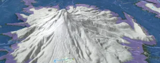
Snow & Rain 3D forecast Pro
See where it will snow, sleet or rain on Côte-de-Beaupré hour by hour, on 3D terrain.
View 3D snow forecast
Côte-de-Beaupré trails and routes are listed on Trailforks with interactive trail maps, difficulty ratings, photos, and user-reported trail conditions. The Trailforks community has mapped hundreds of trails and shared thousands of photos in this region. Supported activity types include E-Biking, Mountain Biking, Hiking, Trail Running, Skiing, Nordic Skiing, Gravel Biking, Backcountry Skiing and Snowshoeing. Trails here are often rooty, tight and twisty and flowy. Scenery includes views and alpine terrain. Common trail features include drops, bridges and berms. Many trails are family friendly. Amenities include huts. Popular destinations include Beaupré, Saint‑Ferréol‑les‑Neiges and Parc du Mont-Sainte-Anne (Sépaq).
This is an auto-generated description of Côte-de-Beaupré.
Login or register to submit a custom description.
Links
Trail info last updated
Region Supporters & Maintainers
![Québec Vélo de Montagne]()
Québec Vélo de MontagneSponsor![]() Sponsor


Activities Click to view
- Mountain Bike
197 trails
- E-Bike
200 trails
- Gravel Bike
53 trails
- Hike
82 trails
- Trail Running
82 trails
- Snowshoe
7 trails
- Downhill Ski
81 trails
- Backcountry Ski
18 trails
- Nordic Ski
63 trails
Region Details
- 18
- 1
- 26
- 66
- 58
- 22
- 6
Stats
- Avg Trail Rating
- Trails (view details)
- 392
- Trails Mountain Bike
- 197
- Trails E-Bike
- 200
- Trails Gravel Bike
- 53
- Trails Adaptive Bike
- 25
- Trails Winter Fat Bike
- 60
- Trails Hike
- 82
- Trails Trail Running
- 82
- Trails Snowshoe
- 7
- Trails Downhill Ski
- 81
- Trails Backcountry Ski
- 18
- Trails Nordic Ski
- 63
- Total Distance
- 370 miles
- Total Descent
- 105,598 ft
- Total Vertical
- 2,717 ft
- Highest Trailhead
- 2,733 ft
- Reports
- 3,035
- Photos
- 1,163
- Completed Counter
- 71,342
Articles
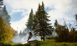
Video; Mont-Sainte-Anne Celebrates 30 Years of Mountain Bike History & Legends
Nov 1, 2025 from pinkbike.com
Legendary races, iconic riders, and unforgettable moments define this Québec mountain’s storied past.
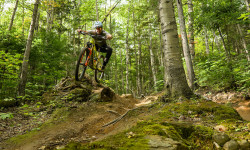
Video: Brice Shirbach Discovers Mont-Sainte-Anne's Finest Trails in 'Underexposed'
Oct 14, 2025 from pinkbike.com
Mont Sainte Anne might have to bid farewell to the World Cup for the time being, but this amazing community isn't going anywhere.

Kenny & Team MS Ride in Pink for Breast Cancer Awareness at Mont-Sainte-Anne
Oct 8, 2025 from pinkbike.com
A new collaborative kit project turns one rider’s personal story into a collective show of support during Pink October.

Details Announced For 2025 Downhill Quebec Cup in Mont Sainte-Anne
May 7, 2025 from pinkbike.com
The race will take place on Labour Day weekend, with the finals on Sunday, August 31st.
Sub Regions
Popular Côte-de-Beaupré Mountain Biking Trails
• 95 ★ 4.4 • 846 ft • 15 ft • 1,392 •
Piste de style «All-Mountain» accessible depuis le sommet de la montagne. Permet de rejoindre le réseau XC à la fin du sentier ou de poursuivre jusqu'à la base par la Grisante
• 100 ★ 4.1 • 2,808 ft • 28 ft • 1,267 •
Highly rated popular blue difficulty singletrack. This mountain bike primary trail can be used both directions and has a easy overall physical rating. Trail visibility is always easy to follow. On average it takes 5 minutes to complete this trail.
• 100 ★ 4.6 • 2,897 ft • 10 ft • 1,222 •
Highly rated popular blue difficulty singletrack. This mountain bike primary trail and has a moderate overall physical rating with a 10 ft blue climb. Trail visibility is always easy to follow. On average it takes 7 minutes to complete this trail.
• 95 ★ 4.2 • 1,847 ft • 8 ft • 1,213 •
Beautifully crafted short flow trail Sentier coulant de toute beauté!
• 95 ★ 4.4 • 1 mile • 0 ft • 1,189 •
Highly rated popular blue difficulty singletrack. This mountain bike primary trail can be used downhill only and has a moderate overall physical rating with a 0 ft blue climb. It features berm and bridge. On average it takes 7 minutes to complete this trail.
• 100 ★ 4.9 • 4,698 ft • 5 ft • 1,179 •
Highly rated popular blue difficulty singletrack. This mountain bike primary trail. Adaptive MTB rating: amtb blue. Trail visibility is always easy to follow. On average it takes 5 minutes to complete this trail.
• 95 ★ 4.0 • 2,123 ft • 21 ft • 1,080 •
Highly rated popular black diamond difficulty singletrack. This mountain bike primary trail can be used both directions and has a moderate overall physical rating with a 21 ft blue climb. Trail visibility is always easy to follow. On average it takes 3 minutes to complete this trail.
• 100 ★ 4.2 • 3 miles • 3 ft • 1,055 •
Fast! Mix of flowy DH trail with old school straight wide DH trail with fast turns and berms ending with a rooty singletrack. Un mix entre un sentier flowy nouveau genre et un sentier de type vieille école, avec ses lignes droites en...
Côte-de-Beaupré Mountain Bike Routes
★ 4.0 • 11 miles • 856 ft • 4 • Loop •
Parcours débutant/intermédiaire empruntant en grande majorité des sentiers singletracks. Possibilité...
★ 3.5 • 25 miles • 2,476 ft • 16 • Point to Point •
Lots of milage and a fair amount of vert on this iconic mountain. Bring your A game.
17 miles • 1,221 ft • 11 • Loop •
That is one of the finest way to ride your average mountain bike accros the legendary MSA trail system....
★ 5.0 • 8 miles • 1,462 ft • 20 • Loop •
Small fun loop with a mix of the new and old trails
6 miles • 277 ft • 4 • Point to Point •
This is a very nice way to experience Mont-Sainte-Anne from the summit! Warm-up in La Grisante before...
Photos of Côte-de-Beaupré Mountain Bike
Videos of Côte-de-Beaupré Mountain Bike
Current Trail Warnings
| status | trail | date | condition | user | info |
|---|---|---|---|---|---|
| Bouttaboutte Parc du Mont-Sainte-Anne (Sépaq) | Oct 20, 2026 @ 12:45pm (America/Moncton) Oct 20, 2026 | Unknown | Dexter1110 | Le bas est fermé avec indications de... |
Recent Trail Reports
Activity Feed
| username | action | type | title | date |
|---|---|---|---|---|
| alinteau | update | trail | activity #107560289 | Nov 10, 2026 @ 2:04pm Nov 10, 2026 |
| markholloway | update | region | activity #107543364 | Nov 10, 2026 @ 8:49am Nov 10, 2026 |
| jpdupuis1101 | ridden | trail | activity #107493045 | Nov 9, 2026 @ 9:13am Nov 9, 2026 |
| Kazman606 | wishlist | trail | activity #107324878 | Nov 6, 2026 @ 9:23pm Nov 6, 2026 |
| Romain-S | update | trail | activity #107235587 | Nov 5, 2026 @ 6:50am Nov 5, 2026 |
Recent Comments
| username | type | title | comment | date |
|---|---|---|---|---|
| trail | Piste de ski , pas de vélo | Sep 11, 2026 @ 4:05pm Sep 11, 2026 | ||
| report | Piste abandonnée, à éviter | Sep 1, 2026 @ 3:35pm Sep 1, 2026 | ||
| trail | Ouiiii! :D \m/ | Aug 31, 2026 @ 4:53pm Aug 31, 2026 | ||
| trail | Sick track :D \m/ | Aug 21, 2026 @ 12:59pm Aug 21, 2026 | ||
| trail | So sick to be back at MSA, at this point... | Aug 21, 2026 @ 11:09am Aug 21, 2026 |
Local Badges
-

Top 10 Trails0 awarded -

Big Ride 30k4,031 awarded -

Epic Ride 50k845 awarded -

10 Expert Trails134 awarded -

Descent 100k Badge36 awarded -

Completionist0 awarded
Bike & Skill Parks
| name | type | city | rating |
|---|---|---|---|
| Mont-Sainte-Anne DH Park | bike park | Beaupré | |
| Mont-Sainte-Anne Pump Track | skill park | Mont Sainte Anne | |
| Pump track de Château-Richer | skill park | Château-Richer | |
| Skills park | skill park | Saint‑Ferréol‑les‑Neiges | |
| Pump Track & Skate Park École Secondaire Mont-Sainte-Anne | skill park | Beaupré |
Upcoming Local Events



Activity Type Stats
| activitytype | trails | distance | descent | descent distance | total vertical | rating | global rank | state rank | photos | reports | routes | activity logs |
|---|---|---|---|---|---|---|---|---|---|---|---|---|
| Mountain Bike | 197 | 137 miles | 36,949 ft | 65 miles | 2,178 ft | 1,143 | 2,885 | 49 | 50,393 | |||
| E-Bike | 200 | 151 miles | 77,585 ft | 95 miles | 2,178 ft | 7 | 2,559 | 6 | 1,858 | |||
| Gravel Bike | 53 | 53 miles | 6,729 ft | 20 miles | 2,575 ft | 402 | 28 | |||||
| Adaptive Bike | 25 | 34 miles | 4,885 ft | 14 miles | 1,594 ft | 484 | 12 | |||||
| Winter Fat Bike | 60 | 26 miles | 3,281 ft | 7 miles | 1,362 ft | 41 | 144 | |||||
| Hike | 82 | 94 miles | 13,028 ft | 33 miles | 2,602 ft | 6 | 2,734 | 1 | 4,514 | |||
| Trail Running | 82 | 94 miles | 13,028 ft | 33 miles | 2,602 ft | 6 | 2,732 | 2 | 4,187 | |||
| Snowshoe | 7 | 5 miles | 459 ft | 1 mile | 1,355 ft | 167 | 286 | |||||
| Downhill Ski | 81 | 50 miles | 51,588 ft | 50 miles | 2,037 ft | 45 | 3,389 | |||||
| Backcountry Ski | 18 | 15 miles | 5,758 ft | 5 miles | 2,028 ft | 37 | 2,480 | |||||
| Nordic Ski | 63 | 127 miles | 10,768 ft | 46 miles | 2,700 ft | 1 | 192 | 10,255 |
Frequently Asked Questions
▼
What are the best places to ride in Côte-de-Beaupré?
Côte-de-Beaupré has 7 areas to explore for mountain biking. The top rated areas are:
▼
What are the highest rated mountain biking trails in Côte-de-Beaupré?
The highest rated mountain biking trails in Côte-de-Beaupré are:
- Cairn #21 (4.7/5)
- La "2" (4.5/5)
- Poutchow (4.4/5)
- 1837 (La Bête) (4.4/5)
- Bouttaboutte (4.4/5)
▼
What is the longest trail in Côte-de-Beaupré?
The longest trail in Côte-de-Beaupré is La Montée Saint-Hilaire at 5.2 miles. View all trails sorted by distance.
▼
What are the best & highest rated hiking trails in Côte-de-Beaupré?
The best hiking trails in Côte-de-Beaupré are: View all hiking trails sorted by popularity score.
▼
What are the best & highest rated trail running trails in Côte-de-Beaupré?
The best trail running trails in Côte-de-Beaupré are: View all trail running trails sorted by popularity score.
▼
How many trails are in Côte-de-Beaupré?
Côte-de-Beaupré has a total of 392 trails. Of those, 197 are designated for mountain biking. Browse top mountain biking trails in Côte-de-Beaupré to find detailed information including difficulty ratings, distances, and trail conditions.
▼
Which trail has the most elevation gain in Côte-de-Beaupré?
The trail with the most elevation gain in Côte-de-Beaupré is Bouttaboutte with 844 ft of elevation gain. View all trails sorted by elevation gain.
▼
Which trail has the most elevation descent in Côte-de-Beaupré?
The trail with the most elevation descent in Côte-de-Beaupré is La Grisante with 1,905 ft of elevation descent. View all trails sorted by elevation descent.
▼
What activities are most popular in Côte-de-Beaupré?
Côte-de-Beaupré supports the following activities: Mountain Biking, E-Biking, Gravel Biking, Hiking, Trail Running, Snowshoeing, Skiing, Backcountry Skiing, Nordic Skiing.
▼
What bike services are there in Côte-de-Beaupré?
The following bike services are available in Côte-de-Beaupré:
- Bike Shop (3)
- Club (1)
- Other (1)
- Trail Builders (1)
- Trail Association (1)
▼
What are the steepest mountain biking trails in Côte-de-Beaupré?
The steepest mountain biking trail in Côte-de-Beaupré is La Keuleuleu with an average grade of 13.7%. View all trails sorted by grade.
▼
Are there any trails with scenic viewpoints in Côte-de-Beaupré?
Yes, there are 1 scenic viewpoints marked along trails in Côte-de-Beaupré. Some popular viewpoints include: Explore more points of interest to find trails with the best views.
▼
What trails have the biggest jumps in Côte-de-Beaupré?
The trails with the biggest jumps in Côte-de-Beaupré are: Browse all mountain bike trails to find trails with jumps and technical features.
▼
Are the trails open in Côte-de-Beaupré?
The overall region status for Côte-de-Beaupré is Clear / Green. Out of 127 trails:
- Clear / Green: 99
- Minor Issue / Yellow: 1
- Significant Issue / Amber: 2
- Closed: 25
▼
Can I ride an ebike in Côte-de-Beaupré?
Yes, Côte-de-Beaupré supports e-bike riding. There are 193 trails in Côte-de-Beaupré that allow e-bikes. Check the e-bike trails listing for specific trail access details and any local regulations.
▼
What are the most popular mountain biking routes in Côte-de-Beaupré?
The most popular mountain biking routes in Côte-de-Beaupré are: View all mountain biking routes in Côte-de-Beaupré.
▼
What is the highest summit in Côte-de-Beaupré?
The highest summit in Côte-de-Beaupré is Montagne Brûlée at 3,560 ft elevation.
▼
What are the most popular Strava Segments in Côte-de-Beaupré?
The most popular Strava segments in Côte-de-Beaupré are:
- Boutaboute finale DOWN (4,764 athletes)
- Baptême Stage 1 (4,506 athletes)
- Boutaboutte EPI du printemps (4,336 athletes)
▼
What are some popular technical trail features in Côte-de-Beaupré?
There are 31 technical trail features (TTFs) in Côte-de-Beaupré. Some popular features include:
- Step Down/Gap (Gap Jump)
- Bridge/Gap Jump (Gap Jump)
- Bedrock Garden (Rock Garden)
- Step-up (Jump)
- Rock Armoured Corner (Rock Garden)
▼
What trails are closed in Côte-de-Beaupré?
There are currently 25 closed trails in Côte-de-Beaupré. The breakdown of all trail statuses is:
- Clear / Green: 99
- Minor Issue / Yellow: 1
- Significant Issue / Amber: 2
- Closed: 25
▼
Are there local clubs or events in Côte-de-Beaupré?
There are 3 upcoming events in Côte-de-Beaupré. View upcoming events. There are 2 local clubs or associations listed in the Côte-de-Beaupré directory. Browse the local directory for details.
▼
What are the most popular mountain biking trails in Côte-de-Beaupré?
The most popular mountain biking trails in Côte-de-Beaupré are: View all mountain biking trails sorted by popularity.
▼
What are the best beginner ride trails in Côte-de-Beaupré?
The best beginner mountain biking trails in Côte-de-Beaupré are:
- La Grisante (3.9/5)
- 38 - La Véloroute Marie-Hélène Prémont (5/5)
- La Boucle d'Or (3.8/5)
Activities
- Côte-de-Beaupré Mountain Biking Trails
- Côte-de-Beaupré E-Biking Trails
- Côte-de-Beaupré Gravel Biking Trails
- Côte-de-Beaupré Hiking Trails
- Côte-de-Beaupré Trail Running Trails
- Côte-de-Beaupré Snowshoeing Trails
- Côte-de-Beaupré Skiing Trails
- Côte-de-Beaupré Backcountry Skiing Trails
- Côte-de-Beaupré Nordic Skiing Trails
Trails
Points of Interest
- Rock Gap TTF
- Step Down/Gap TTF
- Accueil / Information
- Refuge St-Anselme Cabin
- Refuge du Ruisseau Rouge Cabin
- Refuge Saint-Nicolas Cabin
- Refuge Marie-Josée Cabin
- Pont Georges Bridge
- Rock Drop/Gap TTF
- Rock Drop TTF
- Montagne Brûlée (3,560 ft)
- Mont de la Tour du Nord (3,284 ft)
- Mont Saint-Étienne (3,182 ft)
- By zeGG
 QVDM & contributors
- Admins: VQ, bigjay, StephaneMarceau, Canadmos, QVDM, quebecsingletrack
- #19021 - 3,588 views
- côte-de-beaupré activity log | embed map of Côte-de-Beaupré mountain bike trails | côte-de-beaupré mountain biking points of interest
Downloading of trail gps tracks in kml & gpx formats is enabled for Côte-de-Beaupré.
You must login to download files.
