close
-
Layers w
- Weather Layers
- Pro
- Pro
- Pro
- Pro
- Pro
- Pro
- More Layers
- Pro
- Pro
- Pro
- Pro
-
Upgrade to

3D
Trail Conditions
- Unknown
- Snow Groomed
- Snow Packed
- Snow Covered
- Snow Cover Partial
- Freeze/thaw Cycle
- Icy
- Prevalent Mud
- Wet
- Variable
- Ideal
- Dry
- Very Dry
Trail Flow (Ridden Direction)
Trailforks scans users ridelogs to determine the most popular direction each trail is ridden. A good flowing trail network will have most trails flowing in a single direction according to their intension.
The colour categories are based on what percentage of riders are riding a trail in its intended direction.
The colour categories are based on what percentage of riders are riding a trail in its intended direction.
- > 96%
- > 90%
- > 80%
- > 70%
- > 50%
- < 50%
- bi-directional trail
- no data
Trail Last Ridden
Trailforks scans ridelogs to determine the last time a trail was ridden.
- < 2 days
- < 1 week
- < 2 weeks
- < 1 month
- < 6 months
- > 6 months
Trail Ridden Direction
The intended direction a trail should be ridden.
- Downhill Only
- Downhill Primary
- Both Directions
- Uphill Primary
- Uphill Only
- One Direction
Contribute Details
Colors indicate trail is missing specified detail.
- Description
- Photos
- Description & Photos
- Videos
Trail Popularity ?
Trailforks scans ridelogs to determine which trails are ridden the most in the last 9 months.
Trails are compared with nearby trails in the same city region with a possible 25 colour shades.
Think of this as a heatmap, more rides = more kinetic energy = warmer colors.
- most popular
- popular
- less popular
- not popular
ATV/ORV/OHV Filter
Max Vehicle Width
inches
US Cell Coverage
Legend

Radar Time
Activity Recordings
Trailforks uses anonymized public activity data.
?
Activity Recordings
Trailforks uses anonymized public activity data.
?
Personal Heatmap
▶
Activity Types
all
/
none
▶
Options
2
Date range
month
–
Winter Trails
Warning
A routing network for winter maps does not exist. Selecting trails using the winter trails layer has been disabled.
Missing Trails
Most Popular
Least Popular
Trails are colored based on popularity. The more popular a trail is, the more red. Less popular trails trend towards green.
Jump Magnitude Heatmap
Heatmap of where riders jump on trails. Zoom in to see individual jumps, click circles to view jump details.
BC Backroad Status
![map legend]()
Service Road Atlas is a free to use, community-driven service for viewing and creating reports on the numerous back-country service roads around B.C. and Alberta.

Slope Aspect
Direction the slope faces
Trails Deemphasized
Trails are shown in grey.
Only show trails with no bike usage.
Suggested Layers
Based on selected activity type
Save the current map location and zoom level as your default home location whenever this page is loaded.
Save
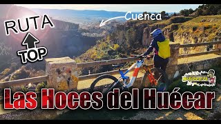
No description for Cuenca has been added yet!
Login or register to submit one.
This region uses the Uk/Euro style trail grading system.
Activities Click to view
- Mountain Bike
836 trails
- E-Bike
833 trails
- Gravel Bike
1 trails
- Adaptive Bike
0 trails
- Horse
13 trails
- Hike
841 trails
- Trail Running
838 trails
- Dirtbike/Moto
4 trails
Region Details
- 555
- 36
- 205
- 38
- 2
Region Status
Open as of Apr 2, 2026Trail Running Stats
- Global Ranking
- #46
- State Ranking
- #19
- Trails (view details)
- 838
- Trails Mountain Bike
- 836
- Trails E-Bike
- 833
- Trails Gravel Bike
- 1
- Trails Horse
- 13
- Trails Hike
- 841
- Trails Trail Running
- 838
- Trails Dirtbike/Moto
- 4
- Trails ATV/ORV/OHV
- 3
- Total Distance
- 784 miles
- Total Descent Distance
- 411 miles
- Total Descent
- 131,181 ft
- Total Vertical
- 2,828 ft
- Reports
- 406
- Ridden Counter
- 131
Sub Regions
-
Antenas
- 1
- 5
- 4
-
Arcas
- 6
- 24
- 1
-
Carrasola
- 3
- 22
- 5
-
El Cerro
- 11
- 7
-
Mira
- 30
- 42
- 8
- 2
-
Serranía Baja-Algarra Alrededores
- 6
- 1
-
Talayuelas
- 1
- 47
- 6
-
Valdeganga de Cuenca
Popular Cuenca Trail Running Trails
• 95 ★ 0.0 • 2,776 ft • 112 ft • 5 •
Popular blue difficulty singletrack. This multi-use trail can be used both directions and has a moderate overall physical rating with a 112 ft blue climb. Trail visibility is always easy to follow.
• 5 ★ 0.0 • 5,217 ft • 122 ft • 3 • • hike
Blue difficulty singletrack. This hike primary trail can be used both directions.
• 95 ★ 0.0 • 2,310 ft • 65 ft • 3 • • hike
Popular red difficulty singletrack. This hike primary trail can be used downhill primary and has a moderate overall physical rating with a 65 ft blue climb. Trail visibility is always easy to follow.
• 5 ★ 0.0 • 1 mile • 73 ft • 2 •
Less popular red difficulty singletrack. This multi-use trail can be used downhill primary and has a moderate overall physical rating with a 73 ft black diamond climb. Trail visibility is always easy to follow. On average it takes 9 minutes to complete this trail.
• 5 ★ 0.0 • 2,890 ft • 487 ft • 2 • • hike
Blue difficulty singletrack. This hike primary trail can be used both directions.
• 90 ★ 0.0 • 2,969 ft • 0 ft • 2 •
Popular blue difficulty singletrack. This multi-use trail can be used downhill primary. On average it takes 3 minutes to complete this trail.
• 5 ★ 0.0 • 3 miles • 494 ft • 2 •
Less popular blue difficulty singletrack. This multi-use trail can be used both directions and has a moderate overall physical rating with a 494 ft blue climb. Trail visibility is always easy to follow.
• 5 ★ 4.0 • 1 mile • 199 ft • 1 •
sendero discurre por la senda de los Miradores Hoce de Cuenca, sin dificultad salvo los peatones y algún tramo de escaleras.
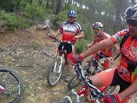
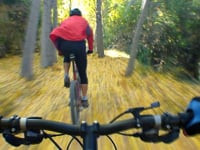
Photos of Cuenca
Videos of Cuenca
46:26 |
69 |
Dec 22, 2024 , Cuenca

trail: La Losa
46:26 |
82 |
Dec 22, 2024 , Cuenca

trail: Los Hocinos
46:26 |
62 |
Dec 22, 2024 , Cuenca
3:14 |
90 |
May 27, 2023
3:58 |
117 |
May 27, 2023
trail: Del B12
3:15 |
91 |
May 27, 2023 , Cuenca
trail: Grederos
3:53 |
95 |
May 27, 2023 , Cuenca
trail: Mira Baja
3:53 |
98 |
May 27, 2023 , Cuenca
Recent Trail Reports
| status | trail | date | condition | info | user |
|---|---|---|---|---|---|
| DH2 Flow | Apr 2, 2026 @ 2:50pm (Europe/Madrid) Apr 2, 2026 | Variable | Damia88 | ||
| Palomero | Apr 2, 2026 @ 2:50pm (Europe/Madrid) Apr 2, 2026 | Dry | Damia88 | ||
| Covachón | Apr 2, 2026 @ 2:50pm (Europe/Madrid) Apr 2, 2026 | Dry | Damia88 | ||
| Merendero | Apr 2, 2026 @ 2:50pm (Europe/Madrid) Apr 2, 2026 | Dry | Damia88 | ||
| Fuente | Apr 2, 2026 @ 2:50pm (Europe/Madrid) Apr 2, 2026 | Dry | Damia88 | ||
| Fuente 2 | Apr 2, 2026 @ 2:50pm (Europe/Madrid) Apr 2, 2026 | Variable | Damia88 | ||
| Mirabueno | Apr 2, 2026 @ 2:50pm (Europe/Madrid) Apr 2, 2026 | Variable | Damia88 | ||
| Vallejo Doctor extra | Apr 4, 2026 @ 9:09am (Europe/Madrid) Apr 4, 2026 | Ideal | montonm TFSPAIN | ||
| Cañasfrias A | Apr 4, 2026 @ 9:09am (Europe/Madrid) Apr 4, 2026 | Ideal | montonm TFSPAIN | ||
| De Cañas Frias Baja | Apr 4, 2026 @ 9:09am (Europe/Madrid) Apr 4, 2026 | Ideal | montonm TFSPAIN |
Activity Feed
| username | action | type | title | date |
|---|---|---|---|---|
| AMG | update | trail | activity #96105749 | Jun 2, 2026 @ 1:14pm Jun 2, 2026 |
| montonm | add | poi | activity #96041597 | Jun 1, 2026 @ 2:39pm Jun 1, 2026 |
| montonm | update | trail | activity #96041273 | Jun 1, 2026 @ 2:32pm Jun 1, 2026 |
| montonm | update | trail | activity #96040402 and 2 more | Jun 1, 2026 @ 2:15pm Jun 1, 2026 |
| montonm | add | trail | activity #96036392 and 8 more | Jun 1, 2026 @ 1:02pm Jun 1, 2026 |
Recent Comments
| username | type | title | comment | date |
|---|---|---|---|---|
| trail | Bonita senda: rápida, limpia, con flow... | Dec 20, 2025 @ 11:38am Dec 20, 2025 | ||
| report | Immpracticable desde la dana 2024 | Aug 9, 2025 @ 4:13am Aug 9, 2025 | ||
| trail | el tramo de mayor pendiente esta algo roto y... | Aug 9, 2025 @ 3:59am Aug 9, 2025 | ||
| trail | Excellent. Flowy with several jumps and features. | Apr 27, 2025 @ 9:18am Apr 27, 2025 | ||
| trail | Top part is definitely black, steep and... | Apr 27, 2025 @ 9:16am Apr 27, 2025 |
Local Badges
-

Epic Trail Running Climb 2k0 awarded -

Climbing 10k Badge1 awarded -

Trail Running 100k Badge0 awarded -

Big Trail Run 30k0 awarded -

Epic Trail Run 50k0 awarded
Activity Type Stats
| activitytype | trails | distance | descent | descent distance | total vertical | rating | global rank | state rank | photos | reports | routes | ridelogs |
|---|---|---|---|---|---|---|---|---|---|---|---|---|
| Mountain Bike | 836 | 782 miles | 130,253 ft | 410 miles | 2,828 ft | #198 | #27 | 87 | 406 | 9 | 3,097 | |
| E-Bike | 833 | 780 miles | 130,108 ft | 410 miles | 2,828 ft | #25 | #22 | 403 | 6 | 347 | ||
| Gravel Bike | 1 | #399 | #79 | 27 | 1 | 10 | ||||||
| Horse | 13 | 23 miles | 3,543 ft | 11 miles | 1,247 ft | #1,358 | #101 | 28 | ||||
| Hike | 841 | 784 miles | 131,181 ft | 411 miles | 2,828 ft | #69 | #22 | 406 | 114 | 236 | ||
| Trail Running | 838 | 784 miles | 131,181 ft | 411 miles | 2,828 ft | #46 | #19 | 406 | 548 | |||
| Dirtbike/Moto | 4 | 5 miles | 259 ft | 2 miles | 338 ft | #739 | #38 | 28 | ||||
| ATV/ORV/OHV | 3 | 5 miles | 259 ft | 2 miles | 338 ft | 28 |
Frequently Asked Questions About Cuenca
▼
What are the best places to run in Cuenca?
Cuenca has 12 areas to explore for trail running. The top rated areas are:
▼
What are the highest rated trail running trails in Cuenca?
The highest rated trail running trails in Cuenca are:
- Pieza de Lazaro 2 (0/5)
- Loma de la Canaleja centro (0/5)
- Entrada a Las Pedrizas (0/5)
- De Cañas Frias Baja (0/5)
- Corral del Espinosa (0/5)
▼
Where can I park to run in Cuenca?
There are 1 parking locations listed in Cuenca.
▼
What is the longest trail in Cuenca?
The longest trail in Cuenca is Crruz Carnicero-Alto Valhondo at 3.2 miles. View all trails sorted by distance.
Activities
Trails
- By sbrarturo & contributors
- Admins: AMG, Kalamarrrrrdo, not-really, montonm
- #8706 - 3,720 views
- cuenca activity log | embed map of Cuenca mountain bike trails | cuenca mountain biking points of interest
Downloading of trail gps tracks in kml & gpx formats is enabled for Cuenca.
You must login to download files.