
close
3D
Trail Conditions
- Unknown
- Snow Groomed
- Snow Packed
- Snow Covered
- Snow Cover Partial
- Freeze/thaw Cycle
- Icy
- Prevalent Mud
- Wet
- Variable
- Ideal
- Dry
- Very Dry
Trail Flow (Ridden Direction)
Trailforks scans users activity logs to determine the most popular direction each trail is ridden. A good flowing trail network will have most trails flowing in a single direction according to their intension.
The colour categories are based on what percentage of users are riding a trail in its intended direction.
The colour categories are based on what percentage of users are riding a trail in its intended direction.
- > 96%
- > 90%
- > 80%
- > 70%
- > 50%
- < 50%
- bi-directional trail
- no data
Trail Last Used
Trailforks scans activity logs to determine the last time a trail was ridden.
- < 2 days
- < 1 week
- < 2 weeks
- < 1 month
- < 6 months
- > 6 months
Trail Ridden Direction
The intended direction a trail should be ridden.
- Downhill Only
- Downhill Primary
- Both Directions
- Uphill Primary
- Uphill Only
- One Direction
Contribute Details
Colors indicate trail is missing specified detail.
- Description
- Photos
- Description & Photos
- Videos
Trail Popularity ?
Trailforks scans activity logs to determine which trails are ridden the most in the last 9 months.
Trails are compared with nearby trails in the same city region with a possible 25 colour shades.
Think of this as a heatmap, more activities = more kinetic energy = warmer colors.
- most popular
- popular
- less popular
- not popular
ATV/ORV/OHV Filter
Max Vehicle Width
inches
US Cell Coverage
Legend

Radar Time
Activity Recordings
Trailforks uses anonymized public activity data.
?
Activity Recordings
Trailforks uses anonymized public activity data.
?
Winter Trails
Warning
A routing network for winter maps does not exist. Selecting trails using the winter trails layer has been disabled.
Missing Trails
Most Popular
Least Popular
Trails are colored based on popularity. The more popular a trail is, the more red. Less popular trails trend towards green.
Jump Magnitude Heatmap
Heatmap of where users jump on trails. Zoom in to see individual jumps, click circles to view jump details.
BC Backroad Status
![map legend]()
Service Road Atlas is a free to use, community-driven service for viewing and creating reports on the numerous back-country service roads around B.C. and Alberta.

Slope Aspect
Direction the slope faces
Trails Deemphasized
Trails are shown in grey.
Only show trails with no bike usage.
Suggested Layers
Based on selected activity type
Save the current map location and zoom level as your default home location whenever this page is loaded.
SaveCuliacán (from Nahuatl: Kolwahkan, meaning "Place of the Colhuas"), officially Culiacán Rosales, is a city in northwestern Mexico. It is the capital and most populous city of the state of Sinaloa and the seat of the municipality of the same name. It was co-founded on September 29, 1531, by the Spanish conquistadors Lázaro de Cebreros and Nuño Beltrán de Guzmán under the name Villa de San Miguel, in reference to its patron saint, Saint Michael the Archangel.
According to the 2020 Population and Housing Census conducted by the National Institute of Statistics and Geography (INEGI), the city of Culiacán has a population of 808,416, making it the 19th most populous city in Mexico, while its metropolitan area ranks as the 17th most populous in Mexico, with 1,003,530 inhabitants.
Culiacán is known for its culture, luxury, and celebrations. Its iconic sites include its historic center, Las Riberas Park, the Culiacán Botanical Garden, the flagpole known as the Dancing Fountains, the Tomateros Stadium, and religious temples such as its cathedral basilica, the sanctuary, and La Lomita. The Tres Ríos district is known for its buildings, plazas, hotels, parks, restaurants, and schools. The city's first layout was designed by architect Luis F. Molina.
The city is located in a valley at the foot of the Sierra Madre Occidental mountain range, at the confluence of the Tamazula and Humaya rivers, which join to form the Culiacán River.
According to the 2020 Population and Housing Census conducted by the National Institute of Statistics and Geography (INEGI), the city of Culiacán has a population of 808,416, making it the 19th most populous city in Mexico, while its metropolitan area ranks as the 17th most populous in Mexico, with 1,003,530 inhabitants.
Culiacán is known for its culture, luxury, and celebrations. Its iconic sites include its historic center, Las Riberas Park, the Culiacán Botanical Garden, the flagpole known as the Dancing Fountains, the Tomateros Stadium, and religious temples such as its cathedral basilica, the sanctuary, and La Lomita. The Tres Ríos district is known for its buildings, plazas, hotels, parks, restaurants, and schools. The city's first layout was designed by architect Luis F. Molina.
The city is located in a valley at the foot of the Sierra Madre Occidental mountain range, at the confluence of the Tamazula and Humaya rivers, which join to form the Culiacán River.
source: Culiacán - Wikipedia
Links
Trail info last updated
Activities Click to view
- Mountain Bike
27 trails
- E-Bike
24 trails
- Gravel Bike
3 trails
- Horse
0 trails
- Hike
14 trails
- Trail Running
15 trails
- Dirtbike/Moto
0 trails
- Observed Trials
0 trails
- ATV/ORV/OHV
0 trails
- Snowmobile
0 trails
Region Details
- 3
- 6
- 7
- 8
- 2
- 1
Region Status
Open as of 24 hoursStats
- Avg Trail Rating
- Trails (view details)
- 27
- Trails Mountain Bike
- 27
- Trails E-Bike
- 24
- Trails Gravel Bike
- 3
- Trails Winter Fat Bike
- 1
- Trails Hike
- 14
- Trails Trail Running
- 15
- Total Distance
- 24 miles
- Total Descent
- 4,100 ft
- Total Vertical
- 811 ft
- Highest Trailhead
- 1,008 ft
- Reports
- 10
- Photos
- 52
- Completed Counter
- 106
Sub Regions
-
Cerritos Trail Network
- 1
-
La Pedrera Trail Network
- 5
- 5
- 8
- 2
- 1
-
La Primavera Trail Network
- 2
Popular Culiacan Mountain Biking Trails
• 45 ★ 0.0 • 2 miles • 60 ft • 9 •
Moderately popular blue difficulty singletrack. This mountain bike primary trail with a 60 ft blue climb. It features bridge and jump. On average it takes 20 minutes to complete this trail.
• 40 ★ 0.0 • 3 miles • 36 ft • 6 •
Moderately popular blue difficulty singletrack. This mountain bike primary trail. On average it takes 21 minutes to complete this trail.
• 55 ★ 0.0 • 4 miles • 107 ft • 6 •
Moderately popular green difficulty singletrack. This mountain bike primary trail can be used both directions and has a easy overall physical rating with a 107 ft green climb. Exposure: Normal Injury Risk. Trail visibility is always easy to follow. On average it takes 29 minutes to complete this trail.
• 85 ★ 5.0 • 3,133 ft • 4 ft • 5 •
Popular double black diamond difficulty singletrack. This mountain bike primary trail can be used downhill only and has a hard overall physical rating with a 4 ft double black diamond climb. It features drop, jump and gap jump. Exposure: High Risk of Serious Injury. Trail visibility is always easy to follow. On average it takes 11 minutes to complete this trail.
Photos of Culiacan Mountain Bike
Videos of Culiacan Mountain Bike
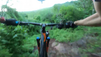


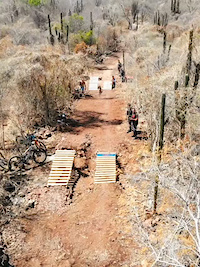
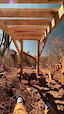


Recent Trail Reports
| status | trail | date | condition | info | user |
|---|---|---|---|---|---|
| Subida Principal | Nov 19, 2026 @ 6:17am (America/Mazatlan) 24 hours | Ideal | felino RGAG | ||
| Bouble Black | Jan 14, 2026 @ 12:33pm (America/Los_Angeles) Jan 14, 2026 | Unknown | felino RGAG | ||
| Jump Line | Nov 11, 2025 @ 6:28am (America/Mazatlan) Nov 11, 2025 | Ideal | trivizw | ||
| Mata Venados Leñador | Nov 11, 2025 @ 6:28am (America/Mazatlan) Nov 11, 2025 | Variable | trivizw | ||
| Coralillo | Nov 11, 2025 @ 6:28am (America/Mazatlan) Nov 11, 2025 | Ideal | trivizw | ||
| Ruta Del Jaguar | Nov 11, 2025 @ 6:28am (America/Mazatlan) Nov 11, 2025 | Dry | trivizw | ||
| Ruta Del Jaguar I | Nov 11, 2025 @ 6:28am (America/Mazatlan) Nov 11, 2025 | Ideal | trivizw | ||
| pista 2 completa | Dec 28, 2021 @ 7:59am Dec 28, 2021 | Ideal | Diff01 |
Activity Feed
| username | action | type | title | date |
|---|---|---|---|---|
| felino | add | report | activity #108054984 | Nov 19, 2026 @ 1:29pm 16 hours |
| OchoaLeonardo | wishlist | trail | activity #108019039 | Nov 18, 2026 @ 6:16pm 1 day |
| markholloway | update | trail | activity #102480062 and 2 more | Aug 27, 2026 @ 4:23pm Aug 27, 2026 |
| felino | add | trail | activity #97674521 | Jun 23, 2026 @ 9:30pm Jun 23, 2026 |
| felino | add | trail | activity #95874522 and 1 more | May 30, 2026 @ 11:51am May 30, 2026 |
Recent Comments
| username | type | title | comment | date |
|---|---|---|---|---|
| trail | Descenso Rápido | Oct 18, 2022 @ 8:47pm Oct 18, 2022 |

Activity Type Stats
| activitytype | trails | distance | descent | descent distance | total vertical | rating | global rank | state rank | photos | reports | routes | activity logs |
|---|---|---|---|---|---|---|---|---|---|---|---|---|
| Mountain Bike | 27 | 24 miles | 4,101 ft | 11 miles | 810 ft | #2,965 | #31 | 47 | 10 | 1 | 4,399 | |
| E-Bike | 24 | 18 miles | 3,822 ft | 10 miles | 810 ft | #3,115 | #50 | 4 | 10 | 1 | 357 | |
| Gravel Bike | 3 | 2 miles | 210 ft | 2 miles | 115 ft | #1,614 | #26 | 1 | 1 | 3 | ||
| Winter Fat Bike | 1 | 1 mile | 118 ft | 4,646 ft | 115 ft | #6,226 | #41 | |||||
| Hike | 14 | 14 miles | 1,657 ft | 6 miles | 692 ft | #5,958 | #60 | 10 | 97 | |||
| Trail Running | 15 | 14 miles | 1,673 ft | 6 miles | 692 ft | #5,334 | #58 | 1 | 10 | 12 |
Frequently Asked Questions
▼
What are the best places to ride in Culiacan?
Culiacan has 3 areas to explore for mountain biking. The top rated areas are:
▼
What are the highest rated mountain biking trails in Culiacan?
The highest rated mountain biking trails in Culiacan are:
- Death Wish (4.1/5)
- Mata Venados Leñador (4.1/5)
- Descenso Rapido (4.1/5)
- Subida Principal (4.1/5)
- Ruta Del Jaguar (4.1/5)
▼
Where can I park to ride in Culiacan?
There are 1 parking locations listed in Culiacan. The most popular parking spots are:
▼
What is the longest trail in Culiacan?
The longest trail in Culiacan is pista 1 completa at 3.7 miles. View all trails sorted by distance.
▼
How many trails are in Culiacan?
Culiacan has a total of 27 trails. Browse top mountain biking trails in Culiacan to find detailed information including difficulty ratings, distances, and trail conditions.
▼
Which trail has the most elevation gain in Culiacan?
The trail with the most elevation gain in Culiacan is Subida Principal with 441 ft of elevation gain. View all trails sorted by elevation gain.
▼
Which trail has the most elevation descent in Culiacan?
The trail with the most elevation descent in Culiacan is Death Wish with 638 ft of elevation descent. View all trails sorted by elevation descent.
▼
What activities are most popular in Culiacan?
Culiacan supports the following activities: Mountain Biking, E-Biking, Gravel Biking, Horseback, Hiking, Trail Running, Dirtbiking, Observed Trials, ATVing/Offroading, Snowmobiling.
▼
What bike services are there in Culiacan?
The following bike services are available in Culiacan:
- Trail Association (1)
- Club (1)
▼
What are the steepest mountain biking trails in Culiacan?
The steepest mountain biking trail in Culiacan is Subida Death Wish - Nirvana with an average grade of 10.4%. View all trails sorted by grade.
▼
Are there any trails with scenic viewpoints in Culiacan?
Yes, there are 1 scenic viewpoints marked along trails in Culiacan. Some popular viewpoints include: Explore more points of interest to find trails with the best views.
▼
Are the trails open in Culiacan?
Out of 6 trails:
- Clear / Green: 4
- Minor Issue / Yellow: 1
- Significant Issue / Amber: 1
▼
Can I ride an ebike in Culiacan?
Yes, Culiacan supports e-bike riding. There are 24 trails in Culiacan that allow e-bikes. Check the e-bike trails listing for specific trail access details and any local regulations.
▼
What is the highest summit in Culiacan?
The highest summit in Culiacan is Cerro Mohinora at 10,804 ft elevation.
▼
What are the most popular Strava Segments in Culiacan?
The most popular Strava segments in Culiacan are:
- zag zag bajadita (475 athletes)
- descenso rapido (467 athletes)
- Coralillo hasta Arrastradero (172 athletes)
▼
Are there local clubs or events in Culiacan?
There are 2 local clubs or associations listed in the Culiacan directory. Browse the local directory for details.
▼
What are the most popular mountain biking trails in Culiacan?
The most popular mountain biking trails in Culiacan are: View all mountain biking trails sorted by popularity.
▼
What are the best beginner ride trails in Culiacan?
The best beginner mountain biking trails in Culiacan are:
- Descenso Rapido (5/5)
- Leñador Kids (0/5)
- Greenday (0/5)
Activities
Trails
- By DQXBikes & contributors
- Admins: RGAG
- #12582 - 3,247 views
- culiacan activity log | embed map of Culiacan mountain bike trails | culiacan mountain biking points of interest
Downloading of trail gps tracks in kml & gpx formats is enabled for Culiacan.
You must login to download files.
