
close
3D
Trail Conditions
- Unknown
- Snow Groomed
- Snow Packed
- Snow Covered
- Snow Cover Partial
- Freeze/thaw Cycle
- Icy
- Prevalent Mud
- Wet
- Variable
- Ideal
- Dry
- Very Dry
Trail Flow (Ridden Direction)
Trailforks scans users activity logs to determine the most popular direction each trail is ridden. A good flowing trail network will have most trails flowing in a single direction according to their intension.
The colour categories are based on what percentage of users are riding a trail in its intended direction.
The colour categories are based on what percentage of users are riding a trail in its intended direction.
- > 96%
- > 90%
- > 80%
- > 70%
- > 50%
- < 50%
- bi-directional trail
- no data
Trail Last Used
Trailforks scans activity logs to determine the last time a trail was ridden.
- < 2 days
- < 1 week
- < 2 weeks
- < 1 month
- < 6 months
- > 6 months
Trail Ridden Direction
The intended direction a trail should be ridden.
- Downhill Only
- Downhill Primary
- Both Directions
- Uphill Primary
- Uphill Only
- One Direction
Contribute Details
Colors indicate trail is missing specified detail.
- Description
- Photos
- Description & Photos
- Videos
Trail Popularity ?
Trailforks scans activity logs to determine which trails are ridden the most in the last 9 months.
Trails are compared with nearby trails in the same city region with a possible 25 colour shades.
Think of this as a heatmap, more activities = more kinetic energy = warmer colors.
- most popular
- popular
- less popular
- not popular
ATV/ORV/OHV Filter
Max Vehicle Width
inches
US Cell Coverage
Legend

Radar Time
Activity Recordings
Trailforks uses anonymized public activity data.
?
Activity Recordings
Trailforks uses anonymized public activity data.
?
Winter Trails
Warning
A routing network for winter maps does not exist. Selecting trails using the winter trails layer has been disabled.
Missing Trails
Most Popular
Least Popular
Trails are colored based on popularity. The more popular a trail is, the more red. Less popular trails trend towards green.
Jump Magnitude Heatmap
Heatmap of where users jump on trails. Zoom in to see individual jumps, click circles to view jump details.
BC Backroad Status
![map legend]()
Service Road Atlas is a free to use, community-driven service for viewing and creating reports on the numerous back-country service roads around B.C. and Alberta.

Slope Aspect
Direction the slope faces
Trails Deemphasized
Trails are shown in grey.
Only show trails with no bike usage.
Suggested Layers
Based on selected activity type
Save the current map location and zoom level as your default home location whenever this page is loaded.
SaveSinaloa, officially the Free and Sovereign State of Sinaloa, is one of the 31 states which, along with Mexico City, comprise the Federal Entities of Mexico. It is divided into 18 municipalities and its capital city is Culiacán Rosales.
It is located in northwest Mexico, and is bordered by the states of Sonora to the north, Chihuahua and Durango to the east (separated from them by the Sierra Madre Occidental) and Nayarit to the south. To the west, Sinaloa faces Baja California Sur across the Gulf of California. The state covers an area of 58,328 square kilometers (22,521 sq mi), and includes the Islands of Palmito Verde, Palmito de la Virgen, Altamura, Santa María, Saliaca, Macapule and San Ignacio. In addition to the capital city, the state's important cities include Mazatlán and Los Mochis.
It is located in northwest Mexico, and is bordered by the states of Sonora to the north, Chihuahua and Durango to the east (separated from them by the Sierra Madre Occidental) and Nayarit to the south. To the west, Sinaloa faces Baja California Sur across the Gulf of California. The state covers an area of 58,328 square kilometers (22,521 sq mi), and includes the Islands of Palmito Verde, Palmito de la Virgen, Altamura, Santa María, Saliaca, Macapule and San Ignacio. In addition to the capital city, the state's important cities include Mazatlán and Los Mochis.
source: Sinaloa - Wikipedia
Links
Trail info last updated
Region Details
- 3
- 1
- 6
- 7
- 8
- 2
- 1
Stats
- Avg Trail Rating
- Trails (view details)
- 28
- Trails Mountain Bike
- 28
- Trails E-Bike
- 24
- Trails Gravel Bike
- 4
- Trails Adaptive Bike
- 1
- Trails Winter Fat Bike
- 1
- Trails Hike
- 15
- Trails Trail Running
- 16
- Total Distance
- 26 miles
- Total Descent
- 4,184 ft
- Total Vertical
- 941 ft
- Highest Trailhead
- 1,008 ft
- Reports
- 10
- Photos
- 52
- Completed Counter
- 111
Sub Regions
- Culiacán (Municipality) (27)
- Los Mochis (1)
Popular Sinaloa (State) Mountain Biking Trails
• 45 ★ 0.0 • 2 miles • 60 ft • 9 •
Moderately popular blue difficulty singletrack. This mountain bike primary trail with a 60 ft blue climb. It features bridge and jump. On average it takes 20 minutes to complete this trail.
• 40 ★ 0.0 • 3 miles • 36 ft • 6 •
Moderately popular blue difficulty singletrack. This mountain bike primary trail. On average it takes 21 minutes to complete this trail.
• 55 ★ 0.0 • 4 miles • 107 ft • 6 •
Moderately popular green difficulty singletrack. This mountain bike primary trail can be used both directions and has a easy overall physical rating with a 107 ft green climb. Exposure: Normal Injury Risk. Trail visibility is always easy to follow. On average it takes 29 minutes to complete this trail.
Sinaloa (State) Mountain Bike Routes
★ 5.0 • 44 miles • 2,097 ft • 0 • Out & Back •
Buena ruta para rodar, bastantes subidas y ni se diga subir a la mina el Magistral en Mocorito Sinaloa
43 miles • 1,268 ft • 0 • Out & Back •
Puerto del Palmar de los Sepúlveda, Sinaloa.
30 miles • 1,345 ft • 0 •
Bonita ruta saliendo de Mocorito atravesando sus poblados hasta llegar al San Benito y regresar por carretera
36 miles • 1,351 ft • 0 •
Bonita ruta Saliendo desde Guamúchil y pasando por Mocorito para llegar a Tecomate y visitar los...
56 miles • 3,156 ft • 0 •
Travesía por los poblados de Mocorito: Zapote, San José de la puerta, Los Sitios, La huerta
18 miles • 933 ft • 0 •
Clásica Mocorito Ruta corta, excelente ruta para conocer la belleza de Mocorito
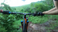
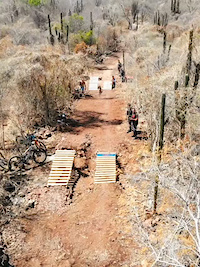
Photos of Sinaloa (State) Mountain Bike
Videos of Sinaloa (State) Mountain Bike




Recent Trail Reports
Activity Feed
| username | action | type | title | date |
|---|---|---|---|---|
| felino | add | report | activity #108054984 | Nov 19, 2026 @ 1:29pm 16 hours |
| OchoaLeonardo | wishlist | trail | activity #108019039 | Nov 18, 2026 @ 6:16pm 1 day |
| markholloway | update | trail | activity #102480062 and 2 more | Aug 27, 2026 @ 4:23pm Aug 27, 2026 |
| felino | add | trail | activity #97674521 | Jun 23, 2026 @ 9:30pm Jun 23, 2026 |
| felino | add | trail | activity #95874522 and 1 more | May 30, 2026 @ 11:51am May 30, 2026 |
Recent Comments
| username | type | title | comment | date |
|---|---|---|---|---|
| trail | Descenso Rápido | Oct 18, 2022 @ 8:47pm Oct 18, 2022 |

Activity Type Stats
| activitytype | trails | distance | descent | descent distance | total vertical | rating | global rank | state rank | photos | reports | routes | activity logs |
|---|---|---|---|---|---|---|---|---|---|---|---|---|
| Mountain Bike | 28 | 26 miles | 4,183 ft | 12 miles | 942 ft | 47 | 10 | 11 | 5,771 | |||
| E-Bike | 24 | 18 miles | 3,822 ft | 10 miles | 810 ft | 4 | 10 | 6 | 360 | |||
| Gravel Bike | 4 | 5 miles | 295 ft | 3 miles | 243 ft | 1 | 2 | 4 | ||||
| Adaptive Bike | 1 | 2 miles | 85 ft | 5,177 ft | 43 ft | |||||||
| Winter Fat Bike | 1 | 1 mile | 118 ft | 4,646 ft | 115 ft | |||||||
| Hike | 15 | 16 miles | 1,742 ft | 7 miles | 820 ft | 10 | 106 | |||||
| Trail Running | 16 | 16 miles | 1,759 ft | 7 miles | 820 ft | 1 | 10 | 83 |
Activities
Trails
- By brenthillier
 NSMBA TRAILFORKS & contributors
- Admins: MAG
- #12690 - 3,278 views
- sinaloa (state) activity log | embed map of Sinaloa (State) mountain bike trails | sinaloa (state) mountain biking points of interest
Downloading of trail gps tracks in kml & gpx formats is enabled for Sinaloa (State).
You must login to download files.
