close
-
Layers w
- Weather Layers
- Pro
- Pro
- Pro
- Pro
- Pro
- Pro
- More Layers
- Pro
- Pro
- Pro
- Pro
-
Upgrade to

3D
Trail Conditions
- Unknown
- Snow Groomed
- Snow Packed
- Snow Covered
- Snow Cover Partial
- Freeze/thaw Cycle
- Icy
- Prevalent Mud
- Wet
- Variable
- Ideal
- Dry
- Very Dry
Trail Flow (Ridden Direction)
Trailforks scans users ridelogs to determine the most popular direction each trail is ridden. A good flowing trail network will have most trails flowing in a single direction according to their intension.
The colour categories are based on what percentage of riders are riding a trail in its intended direction.
The colour categories are based on what percentage of riders are riding a trail in its intended direction.
- > 96%
- > 90%
- > 80%
- > 70%
- > 50%
- < 50%
- bi-directional trail
- no data
Trail Last Ridden
Trailforks scans ridelogs to determine the last time a trail was ridden.
- < 2 days
- < 1 week
- < 2 weeks
- < 1 month
- < 6 months
- > 6 months
Trail Ridden Direction
The intended direction a trail should be ridden.
- Downhill Only
- Downhill Primary
- Both Directions
- Uphill Primary
- Uphill Only
- One Direction
Contribute Details
Colors indicate trail is missing specified detail.
- Description
- Photos
- Description & Photos
- Videos
Trail Popularity ?
Trailforks scans ridelogs to determine which trails are ridden the most in the last 9 months.
Trails are compared with nearby trails in the same city region with a possible 25 colour shades.
Think of this as a heatmap, more rides = more kinetic energy = warmer colors.
- most popular
- popular
- less popular
- not popular
ATV/ORV/OHV Filter
Max Vehicle Width
inches
US Cell Coverage
Legend

Radar Time
Activity Recordings
Trailforks uses anonymized public activity data.
?
Activity Recordings
Trailforks uses anonymized public activity data.
?
Personal Heatmap
▶
Activity Types
all
/
none
▶
Options
2
Date range
month
–
Winter Trails
Warning
A routing network for winter maps does not exist. Selecting trails using the winter trails layer has been disabled.
Missing Trails
Most Popular
Least Popular
Trails are colored based on popularity. The more popular a trail is, the more red. Less popular trails trend towards green.
Jump Magnitude Heatmap
Heatmap of where riders jump on trails. Zoom in to see individual jumps, click circles to view jump details.
BC Backroad Status
![map legend]()
Service Road Atlas is a free to use, community-driven service for viewing and creating reports on the numerous back-country service roads around B.C. and Alberta.

Slope Aspect
Direction the slope faces
Trails Deemphasized
Trails are shown in grey.
Only show trails with no bike usage.
Suggested Layers
Based on selected activity type
Save the current map location and zoom level as your default home location whenever this page is loaded.
Save
No description for Echuca has been added yet!
Login or register to submit one.
Activities Click to view
- Mountain Bike
7 trails
- E-Bike
4 trails
- Hike
5 trails
- Trail Running
5 trails
Region Details
- 4
- 2
- 1
Region Status
Open as of Nov 27, 2024Stats
- Avg Trail Rating
- Trails (view details)
- 7
- Trails Mountain Bike
- 7
- Trails E-Bike
- 4
- Trails Hike
- 5
- Trails Trail Running
- 5
- Total Distance
- 11 miles
- Total Descent
- 425 ft
- Total Vertical
- 48 ft
- Highest Trailhead
- 367 ft
- Reports
- 32
- Photos
- 12
- Ridden Counter
- 591
Sub Regions
-
Banyule Park
- 2
- 2
Popular Echuca Mountain Biking Trails
• 100 ★ 4.5 • 1 mile • 33 ft • 57 •
Popular green difficulty singletrack. This mountain bike primary trail can be used one direction and has a easy overall physical rating. On average it takes 9 minutes to complete this trail.
• 50 ★ 4.5 • 2 miles • 26 ft • 40 •
Moderately popular green difficulty family friendly singletrack. This mountain bike primary trail. On average it takes 8 minutes to complete this trail.
• 25 ★ 4.5 • 4,463 ft • 31 ft • 38 •
Less popular blue difficulty family friendly singletrack. This mountain bike primary trail can be used one direction and has a moderate overall physical rating with a 31 ft blue climb. It features drop, jump and gap jump. On average it takes 4 minutes to complete this trail.
Videos of Echuca Mountain Bike
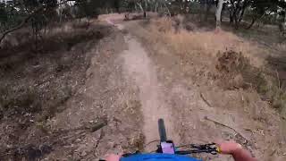
trail: HEY SKIP
7:20 |
225 |
Dec 20, 2023 , Echuca
Recent Trail Reports
| status | trail | date | condition | info | user |
|---|---|---|---|---|---|
| East Beast Trail | Nov 27, 2024 @ 4:02pm Nov 27, 2024 | Ideal | cazzhendrix | ||
| HEY SKIP | Nov 27, 2024 @ 4:02pm Nov 27, 2024 | Ideal | cazzhendrix | ||
| Jenkins Challenge | Nov 27, 2024 @ 4:02pm Nov 27, 2024 | Ideal | cazzhendrix | ||
| Shinbone Alley | Nov 27, 2024 @ 4:02pm Nov 27, 2024 | Ideal | cazzhendrix |
Activity Feed
| username | action | type | title | date |
|---|---|---|---|---|
| askcdjhas | wishlist | trail | activity #92784307 | Apr 17, 2026 @ 6:49am Apr 17, 2026 |
| cazzhendrix | add | report | activity #62381379 and 3 more | Nov 27, 2024 @ 4:04pm Nov 27, 2024 |
| Dooma | ridden | route | activity #50908520 | Apr 7, 2024 @ 2:23pm Apr 7, 2024 |
| TomY7yrsr | comment | trail | activity #50592523 | Mar 29, 2024 @ 3:05pm Mar 29, 2024 |
| WalterCycle | wishlist | trail | activity #49029000 | Feb 10, 2024 @ 4:55am Feb 10, 2024 |
Recent Comments
| username | type | title | comment | date |
|---|---|---|---|---|
| trail | Big to the legend who have this trail a... | Sep 20, 2023 @ 12:56am Sep 20, 2023 | ||
| trail | Nice xc trail, needs some whipper snipper love... | Sep 20, 2023 @ 12:55am Sep 20, 2023 | ||
| trail | Inaccessible from just after the bridge... | Sep 19, 2023 @ 2:02am Sep 19, 2023 | ||
| trail | Green trail not blue. Beware of campers and dogs | Aug 17, 2019 @ 6:24am Aug 17, 2019 |
Activity Type Stats
| activitytype | trails | distance | descent | descent distance | total vertical | rating | global rank | state rank | photos | reports | routes | ridelogs |
|---|---|---|---|---|---|---|---|---|---|---|---|---|
| Mountain Bike | 7 | 11 miles | 423 ft | 4 miles | 49 ft | #5,433 | #199 | 12 | 32 | 1 | 2,840 | |
| E-Bike | 4 | 6 miles | 203 ft | 2 miles | 46 ft | #4,536 | #206 | 28 | 1 | 68 | ||
| Hike | 5 | 7 miles | 269 ft | 2 miles | 46 ft | #7,260 | #220 | 29 | 207 | |||
| Trail Running | 5 | 7 miles | 269 ft | 2 miles | 46 ft | #6,697 | #210 | 29 | 4 |
Frequently Asked Questions About Echuca
▼
What are the best places to ride in Echuca?
Echuca has 2 areas to explore for mountain biking. The top rated areas are:
▼
What are the highest rated mountain biking trails in Echuca?
The highest rated mountain biking trails in Echuca are:
- HEY SKIP (4.1/5)
- Shinbone Alley (4.1/5)
- Jenkins Challenge (4.1/5)
- East Beast Trail (3.7/5)
▼
What is the best time of the year to ride in Echuca?
Based on ride log data, the most popular months to ride in Echuca are:
- April (14 activities)
- October (13 activities)
- December (13 activities)
▼
Where can I park to ride in Echuca?
Check the Echuca trail map for trailhead and parking information. Community members regularly update access and parking details for trails in the area.
- By Addzz
 TRAILFORKS NEMTB & contributors
 - Admins: Victoria
- #14411 - 8,939 views
- echuca activity log | embed map of Echuca mountain bike trails | echuca mountain biking points of interest
Downloading of trail gps tracks in kml & gpx formats is enabled for Echuca.
You must login to download files.