
close
3D
Trail Conditions
- Unknown
- Snow Groomed
- Snow Packed
- Snow Covered
- Snow Cover Partial
- Freeze/thaw Cycle
- Icy
- Prevalent Mud
- Wet
- Variable
- Ideal
- Dry
- Very Dry
Trail Flow (Ridden Direction)
Trailforks scans users activity logs to determine the most popular direction each trail is ridden. A good flowing trail network will have most trails flowing in a single direction according to their intension.
The colour categories are based on what percentage of users are riding a trail in its intended direction.
The colour categories are based on what percentage of users are riding a trail in its intended direction.
- > 96%
- > 90%
- > 80%
- > 70%
- > 50%
- < 50%
- bi-directional trail
- no data
Trail Last Used
Trailforks scans activity logs to determine the last time a trail was ridden.
- < 2 days
- < 1 week
- < 2 weeks
- < 1 month
- < 6 months
- > 6 months
Trail Ridden Direction
The intended direction a trail should be ridden.
- Downhill Only
- Downhill Primary
- Both Directions
- Uphill Primary
- Uphill Only
- One Direction
Contribute Details
Colors indicate trail is missing specified detail.
- Description
- Photos
- Description & Photos
- Videos
Trail Popularity ?
Trailforks scans activity logs to determine which trails are ridden the most in the last 9 months.
Trails are compared with nearby trails in the same city region with a possible 25 colour shades.
Think of this as a heatmap, more activities = more kinetic energy = warmer colors.
- most popular
- popular
- less popular
- not popular
ATV/ORV/OHV Filter
Max Vehicle Width
inches
US Cell Coverage
Legend

Radar Time
Activity Recordings
Trailforks uses anonymized public activity data.
?
Activity Recordings
Trailforks uses anonymized public activity data.
?
Winter Trails
Warning
A routing network for winter maps does not exist. Selecting trails using the winter trails layer has been disabled.
Missing Trails
Most Popular
Least Popular
Trails are colored based on popularity. The more popular a trail is, the more red. Less popular trails trend towards green.
Jump Magnitude Heatmap
Heatmap of where users jump on trails. Zoom in to see individual jumps, click circles to view jump details.
BC Backroad Status
![map legend]()
Service Road Atlas is a free to use, community-driven service for viewing and creating reports on the numerous back-country service roads around B.C. and Alberta.

Slope Aspect
Direction the slope faces
Trails Deemphasized
Trails are shown in grey.
Only show trails with no bike usage.
Suggested Layers
Based on selected activity type
Save the current map location and zoom level as your default home location whenever this page is loaded.
SaveEncinitas trails and routes are listed on Trailforks with interactive trail maps, difficulty ratings, photos, and user-reported trail conditions. The Trailforks community has mapped hundreds of trails and shared hundreds of photos in this region. Supported activity types include Hiking, Trail Running, Mountain Biking, Gravel Biking, Adaptive Biking, E-Biking, Winter Fat Biking and Horseback. Trails here are often faint trail, rocky and tight and twisty. Scenery includes creeks, canyons and views. Common trail features include jumps, berms and rock gardens. Many trails are family friendly. Popular destinations include Rancho La Costa Preserve, San Elijo Lagoon Ecological Preserve and Encinitas Ranch Pathways and Trails.
This is an auto-generated description of Encinitas.
Login or register to submit a custom description.
Trail info last updated
Activities Click to view
- Mountain Bike
74 trails
- E-Bike
25 trails
- Gravel Bike
59 trails
- Adaptive Bike
36 trails
- Winter Fat Bike
20 trails
- Horse
8 trails
- Hike
103 trails
- Trail Running
103 trails
Region Details
- 27
- 13
- 18
- 12
- 3
- 1
Region Status
Open as of Nov 17, 2026Local Trail Association

Stats
- Avg Trail Rating
- Trails (view details)
- 105
- Trails Mountain Bike
- 74
- Trails E-Bike
- 25
- Trails Gravel Bike
- 59
- Trails Adaptive Bike
- 36
- Trails Winter Fat Bike
- 20
- Trails Horse
- 8
- Trails Hike
- 103
- Trails Trail Running
- 103
- Total Distance
- 52 miles
- Total Descent
- 7,831 ft
- Total Vertical
- 1,041 ft
- Highest Trailhead
- 1,047 ft
- Reports
- 568
- Photos
- 703
- Completed Counter
- 9,452
Sub Regions
-
Encinitas Ranch Pathways and Trails
- 10
- 2
- 4
-
Rancho La Costa Preserve
- 3
- 11
- 8
- 3
- 1
-
Yellow Truck
- 1
Popular Encinitas Mountain Biking Trails
• 100 ★ 3.9 • 2 miles • 13 ft • 1,002 •
nice little trail with lots of switchbacks, as the name implies. Lots of people ride up it, although it's a good ride down as well.
• 100 ★ 4.4 • 2 miles • 0 ft • 991 •
Fun downhill with some fast sections. Climb Switchbacks and descend Horned Lizard for a solid loop.
• 95 ★ 2.8 • 1,378 ft • 97 ft • 793 •
Short trail that descends into a small open space with a loop, then climbs up to switchbacks.
• 95 ★ 3.8 • 2 miles • 92 ft • 730 •
Really fun trail wth rocky sections and mellow berms. Best from the top all the way to Copper creek.
• 90 ★ 4.4 • 3,419 ft • 0 ft • 691 •
Super rocky with drops, table tops, and gap jumps. Super sketchy near the top, where it's more rocky.
• 90 ★ 3.4 • 3,763 ft • 56 ft • 682 •
Fun singletrack that parallels Copper Creek for a bit. Includes views of a small waterfall and remains of an old copper mine (see if you can spot when you ride along old mine tailings). Includes a very steep and rocky section near the...
• 90 ★ 2.0 • 2,221 ft • 71 ft • 482 •
An alternate start/end for Switchbacks from Sito Salvia.
Encinitas Mountain Bike Routes
★ 4.3 • 7 miles • 1,148 ft • 4 • Loop •
Though Rancho La Costa is a small area, and this route is relatively short, as the song goes, every inch...
★ 5.0 • 11 miles • 2,102 ft • 11 •
This route ascends the water tower access road at Rancho la Costa Preserve to ride Horned Lizard, then...
★ 5.0 • 20 miles • 3,672 ft • 39 •
20 miles and tons of climbing to hit the fun downhills in Rancho La Costa. This route has you do Horned...
3 miles • 466 ft • 2 • Loop •
A good route to if you want to do laps on the Switchback downhill trail. Pop this in to your computer to...
8 miles • 1,069 ft • 3 •
Starting from the on-street parking area on Camino Junipero, Switchbacks winds its way on multiple...
7 miles • 1,121 ft • 3 •
The paved section will end at the water tank where you can choose your own adventure. To the right, you...
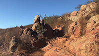
Photos of Encinitas Mountain Bike
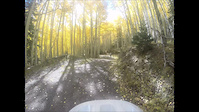
Videos of Encinitas Mountain Bike






Recent Trail Reports
| status | trail | date | condition | info | user |
|---|---|---|---|---|---|
| Switchbacks | Nov 17, 2026 @ 4:28pm (America/Los_Angeles) Nov 17, 2026 | Variable | RickL6Xi1X | ||
| Whip Tail | Nov 10, 2026 @ 8:27am (America/Los_Angeles) Nov 10, 2026 | Ideal | lilmsmayshine | ||
| Copper Creek Raceway East | Oct 18, 2026 @ 10:58am (America/Tijuana) Oct 18, 2026 | Very Dry | bwilley21 | ||
| N. Copper Creek | Oct 18, 2026 @ 10:58am (America/Tijuana) Oct 18, 2026 | Very Dry | bwilley21 | ||
| S. Copper Creek Connector | Oct 18, 2026 @ 10:58am (America/Tijuana) Oct 18, 2026 | Dry | bwilley21 | ||
| Firestation Loop | Jun 29, 2026 @ 10:08am (America/Los_Angeles) Jun 29, 2026 | Variable | bwilley21 | ||
| Copper Creek Raceway Connector | Jun 13, 2026 @ 8:10am (America/Los_Angeles) Jun 13, 2026 | Ideal | mountainmak | ||
| Copper Creek Landfill | Jun 13, 2026 @ 8:10am (America/Los_Angeles) Jun 13, 2026 | Very Dry | mountainmak | ||
| Copper Creek to Water Tower Connector | Jun 13, 2026 @ 8:10am (America/Los_Angeles) Jun 13, 2026 | Very Dry | mountainmak | ||
| Horned Lizard | Feb 15, 2026 @ 2:19pm (America/Los_Angeles) Feb 15, 2026 | Very Dry | sips |
Activity Feed
| username | action | type | title | date |
|---|---|---|---|---|
| RickL6Xi1X | add | report | activity #107963493 | Nov 17, 2026 @ 4:28pm Nov 17, 2026 |
| lilmsmayshine | add | report | activity #107657509 | Nov 12, 2026 @ 8:07am Nov 12, 2026 |
| EthanwG0mJC | add | photo | activity #107520426 | Nov 9, 2026 @ 6:45pm Nov 9, 2026 |
| RickL6Xi1X | add | report | activity #107097239 | Nov 2, 2026 @ 4:10pm Nov 2, 2026 |
| Gdischippies | wishlist | trail | activity #107019882 | Nov 1, 2026 @ 10:18am Nov 1, 2026 |
Recent Comments
| username | type | title | comment | date |
|---|---|---|---|---|
| trail | Trail is overgrown, had to ride through lots... | Oct 3, 2026 @ 12:29pm Oct 3, 2026 | ||
| trail | is this gnar mart | Sep 5, 2026 @ 5:53pm Sep 5, 2026 | ||
| trail | Very challenging/fun going up Switchbacks. Ran... | Jul 30, 2026 @ 11:40am Jul 30, 2026 | ||
| trail | Destroys kind of weird to be honest I did just... | Aug 16, 2025 @ 2:36pm Aug 16, 2025 | ||
| trail | The first time I had a cat that I didn’t... | Aug 16, 2025 @ 2:35pm Aug 16, 2025 |
Local Badges
-

Rancho La Costa Preserve Top 10 Trails18 awarded -

Rancho La Costa Preserve Completionist4 awarded -

Epic Ride Climb 2k210 awarded -

Climbing 10k Badge127 awarded -

Climbing 100k Badge10 awarded -

Epic Ride Descent 2k210 awarded
Activity Type Stats
| activitytype | trails | distance | descent | descent distance | total vertical | rating | global rank | state rank | photos | reports | routes | activity logs |
|---|---|---|---|---|---|---|---|---|---|---|---|---|
| Mountain Bike | 74 | 41 miles | 6,227 ft | 17 miles | 1,033 ft | #1,739 | #81 | 686 | 565 | 13 | 34,843 | |
| E-Bike | 25 | 16 miles | 1,949 ft | 7 miles | 925 ft | #5,318 | #175 | 464 | 4 | 2,717 | ||
| Gravel Bike | 59 | 30 miles | 3,402 ft | 11 miles | 1,037 ft | #1,840 | #75 | 176 | 2 | 218 | ||
| Adaptive Bike | 36 | 20 miles | 2,274 ft | 7 miles | 1,030 ft | #2,900 | #93 | 213 | 2 | |||
| Winter Fat Bike | 20 | 13 miles | 1,427 ft | 5 miles | 594 ft | #2,439 | #53 | 39 | 1 | |||
| Horse | 8 | 4 miles | 299 ft | 1 mile | 459 ft | #3,080 | #214 | 188 | ||||
| Hike | 103 | 52 miles | 7,536 ft | 22 miles | 1,040 ft | #1,813 | #105 | 17 | 565 | 1 | 4,216 | |
| Trail Running | 103 | 52 miles | 7,536 ft | 22 miles | 1,040 ft | #3,000 | #114 | 565 | 1 | 4,660 |
Frequently Asked Questions
▼
What are the best places to ride in Encinitas?
Encinitas has 5 areas to explore for mountain biking. The top rated areas are:
▼
What are the highest rated mountain biking trails in Encinitas?
The highest rated mountain biking trails in Encinitas are:
- Horned Lizard (4.3/5)
- Drop Down (NASCAR) (4.2/5)
- Grizzly (4.1/5)
- S. Copper Creek Connector (4/5)
- Bobcat Trail (4/5)
▼
What is the best time of the year to ride in Encinitas?
Based on activity log data, the most popular months to ride in Encinitas are:
- October (242 activities)
- September (236 activities)
- November (231 activities)
▼
Where can I park to ride in Encinitas?
There are 11 parking locations listed in Encinitas. The most popular parking spots are: View all parking and trailhead locations on the map to plan your visit.
▼
What is the longest trail in Encinitas?
The longest trail in Encinitas is Encinitas Ranch Trail at 2.1 miles. View all trails sorted by distance.
▼
What are the best & highest rated hiking trails in Encinitas?
The best hiking trails in Encinitas are:
- Anne's Canyon Loop Trail
- Gemma Parks Loop
- Nature Center Connector
- Solana Hills Trail
- Rios Avenue Trail
▼
What are the best & highest rated trail running trails in Encinitas?
The best trail running trails in Encinitas are: View all trail running trails sorted by popularity score.
▼
How many trails are in Encinitas?
Encinitas has a total of 105 trails. Of those, 74 are designated for mountain biking. Browse top mountain biking trails in Encinitas to find detailed information including difficulty ratings, distances, and trail conditions.
▼
Which trail has the most elevation gain in Encinitas?
The trail with the most elevation gain in Encinitas is Mule Deer with 428 ft of elevation gain. View all trails sorted by elevation gain.
▼
Which trail has the most elevation descent in Encinitas?
The trail with the most elevation descent in Encinitas is Switchbacks with 539 ft of elevation descent. View all trails sorted by elevation descent.
▼
What activities are most popular in Encinitas?
Encinitas supports the following activities: Mountain Biking, E-Biking, Gravel Biking, Adaptive Biking, Winter Fat Biking, Horseback, Hiking, Trail Running.
▼
What are the steepest mountain biking trails in Encinitas?
The steepest mountain biking trail in Encinitas is Mule Deer with an average grade of 16.2%. View all trails sorted by grade.
▼
Are there any trails with scenic viewpoints in Encinitas?
Yes, there are 6 scenic viewpoints marked along trails in Encinitas. Some popular viewpoints include: Explore more points of interest to find trails with the best views.
▼
Are the trails open in Encinitas?
The overall region status for Encinitas is Clear / Green. Out of 53 trails:
- Clear / Green: 44
- Minor Issue / Yellow: 5
- Significant Issue / Amber: 2
- Closed: 2
▼
What are the trail conditions in Encinitas?
Based on trail reports from the past week in Encinitas:
- Variable: 1 trail
▼
Can I ride an ebike in Encinitas?
Yes, Encinitas supports e-bike riding. There are 23 trails in Encinitas that allow e-bikes. Check the e-bike trails listing for specific trail access details and any local regulations.
▼
What are the most popular mountain biking routes in Encinitas?
The most popular mountain biking routes in Encinitas are:
- Every Inch is Packed with Dynamite
- Rancho La Costa Tour / Fire Road Climbing
- Rancho La Costa All Mountain Loops
▼
What type of bike is most common in Encinitas?
Based on activity log data, the most common bike types used in Encinitas are:
- AM (149 activities)
- XC (1 activities)
- Trials (1 activities)
▼
What are the top sights to see in Encinitas?
There are 4 notable sights in Encinitas. Some of the top sights include: Explore all points of interest in Encinitas.
▼
What are the most popular Strava Segments in Encinitas?
The most popular Strava segments in Encinitas are:
- RIDE Cyclery - Rail It! (Guard Rail) (56,615 athletes)
- Cardiff Rail Trail 2 Reverse (11,151 athletes)
- Golf Course Climb (8,404 athletes)
▼
What are some popular technical trail features in Encinitas?
There are 10 technical trail features (TTFs) in Encinitas. Some popular features include: View all technical trail features in Encinitas.
▼
What trails are closed in Encinitas?
There are currently 2 closed trails in Encinitas. The breakdown of all trail statuses is:
- Clear / Green: 44
- Minor Issue / Yellow: 5
- Significant Issue / Amber: 2
- Closed: 2
▼
Are there accessible or adaptive trails in Encinitas?
Yes, there are 37 accessible/adaptive trails in Encinitas. View all adaptive trails in Encinitas for specific accessibility information.
▼
What are the most popular mountain biking trails in Encinitas?
The most popular mountain biking trails in Encinitas are: View all mountain biking trails sorted by popularity.
▼
What are the best beginner ride trails in Encinitas?
The best beginner mountain biking trails in Encinitas are:
- Bobcat Trail (4/5)
- Indian Head Trail (2/5)
- Meadows (3.5/5)
Activities
Trails
- By ericfoltz
 TRAILFORKS & contributors
- Admins: SDMBA
- #12992 - 8,359 views
- encinitas activity log | embed map of Encinitas mountain bike trails | encinitas mountain biking points of interest
Downloading of trail gps tracks in kml & gpx formats is enabled for Encinitas.
You must login to download files.
