close
-
Layers w
- Weather Layers
- Pro
- Pro
- Pro
- Pro
- Pro
- Pro
- More Layers
- Pro
- Pro
- Pro
- Pro
-
Upgrade to

3D
Trail Conditions
- Unknown
- Snow Groomed
- Snow Packed
- Snow Covered
- Snow Cover Partial
- Freeze/thaw Cycle
- Icy
- Prevalent Mud
- Wet
- Variable
- Ideal
- Dry
- Very Dry
Trail Flow (Ridden Direction)
Trailforks scans users ridelogs to determine the most popular direction each trail is ridden. A good flowing trail network will have most trails flowing in a single direction according to their intension.
The colour categories are based on what percentage of riders are riding a trail in its intended direction.
The colour categories are based on what percentage of riders are riding a trail in its intended direction.
- > 96%
- > 90%
- > 80%
- > 70%
- > 50%
- < 50%
- bi-directional trail
- no data
Trail Last Ridden
Trailforks scans ridelogs to determine the last time a trail was ridden.
- < 2 days
- < 1 week
- < 2 weeks
- < 1 month
- < 6 months
- > 6 months
Trail Ridden Direction
The intended direction a trail should be ridden.
- Downhill Only
- Downhill Primary
- Both Directions
- Uphill Primary
- Uphill Only
- One Direction
Contribute Details
Colors indicate trail is missing specified detail.
- Description
- Photos
- Description & Photos
- Videos
Trail Popularity ?
Trailforks scans ridelogs to determine which trails are ridden the most in the last 9 months.
Trails are compared with nearby trails in the same city region with a possible 25 colour shades.
Think of this as a heatmap, more rides = more kinetic energy = warmer colors.
- most popular
- popular
- less popular
- not popular
ATV/ORV/OHV Filter
Max Vehicle Width
inches
US Cell Coverage
Legend

Radar Time
Activity Recordings
Trailforks uses anonymized public activity data.
?
Activity Recordings
Trailforks uses anonymized public activity data.
?
Personal Heatmap
▶
Activity Types
all
/
none
▶
Options
2
Date range
month
–
Winter Trails
Warning
A routing network for winter maps does not exist. Selecting trails using the winter trails layer has been disabled.
Missing Trails
Most Popular
Least Popular
Trails are colored based on popularity. The more popular a trail is, the more red. Less popular trails trend towards green.
Jump Magnitude Heatmap
Heatmap of where riders jump on trails. Zoom in to see individual jumps, click circles to view jump details.
BC Backroad Status
![map legend]()
Service Road Atlas is a free to use, community-driven service for viewing and creating reports on the numerous back-country service roads around B.C. and Alberta.

Slope Aspect
Direction the slope faces
Trails Deemphasized
Trails are shown in grey.
Only show trails with no bike usage.
Suggested Layers
Based on selected activity type
Save the current map location and zoom level as your default home location whenever this page is loaded.
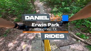
SaveErwin Park Hike & Bike Trails
The Erwin Park Trail system is a premier cross-country (XC) mountain bike and hiking network located across a 220-acre municipal park and adjoining property in McKinney, Texas. Built and maintained entirely by volunteers from the Dallas Off-Road Bicycle Association (DORBA), the main park property is owned and operated by the City of McKinney. All City of McKinney Park rules and regulations are strictly applicable across all trail segments.
Trail Mileage & Property Layout
The trail network is divided into two distinct land management zones:
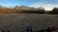
The Main Park Loops: Approximately 10 miles of permanent natural-surface singletrack twisting through the core 220 acres of scenic rolling hills, deep woods, and fragile blackland prairie ecosystems.
The Extension Zone: An additional 2 miles of cross-country trails located on an adjacent 70-acre section of property. Note: Access to this 2-mile section is temporary and dependent on ongoing land-use agreements.
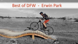
The terrain offers a fast, flowing experience with a balanced mix of tight, twisty wooded singletrack and wide-open field segments. The layout features plentiful punchy climbs to test your lungs, rewarded by fast, fun downhills. While there are technical trail features (TTFs) scattered throughout, almost all of them include clear, built-in ride-arounds. The park also features a progressive, machine-groomed Skills Area equipped with progressive jumps, drops, berms, and a pump track.
Traffic Flow & Trail Etiquette
To minimize head-on conflicts on the singletrack, Erwin Park utilizes a split directional traffic pattern based on user type. Official signs are posted at major trailheads indicating these directions:
Cyclists (All Bikes): Travel Clockwise on the trail system.
Hikers & Trail Runners: Travel Counter-Clockwise on the trail system.
Pedestrian Yield Policy: Because mountain bikes carry significant speed on the singletrack, over features, and around blind corners, foot traffic must be prepared to yield the right-of-way to oncoming bikes for safety.
Bike Feature Policy: All trail features are strictly available for mountain bike use only. Foot traffic must not approach any trail features from a backwards/reverse direction.
No Wheeled Devices: Please do not bring baby strollers, wagons, or other wheeled devices on the trails. They create a severe hazard and block mountain bike traffic on narrow singletrack.
No Rogue Trails or Trail Blocking: Never stop, sit, or stand in a blind landing zone, berm, trail corridor, or intersection. If you need to stop for a rest or mechanical check, pull completely off the trail surface. Do not cut shortcuts or cheater lines. Off-trail traffic destroys fragile native flora and triggers severe erosion. Stay on the marked trail.
Road Crossings & Vehicle Interaction
Uncontrolled Crossings: There are multiple road crossings within the park loops. While these crossings are marked and highly visible to vehicle traffic, there are no official pedestrian crosswalks.
Exercise Extreme Caution: Both cyclists and pedestrians must exercise extreme caution at all road intersections and be prepared to yield the right-of-way to larger motorized vehicles.
Off-Road Restrictions: Motor vehicles must park and drive on paved surfaces only. Driving or parking on the grass is strictly prohibited.
Photography: Photography and filming within the park must not impede or block trail corridors. Production vehicles are completely restricted from driving off-road.
Critical Park Rules & Safety Policies
These regulations are strictly enforced by the City of McKinney and the trail stewards to preserve the landscape and ensure visitor safety:
Strict E-Bike Limitations: Only Class 1 pedal-assist e-bikes with a top speed cap of 20 mph are allowed on the trails and Skills Area. Any electric vehicle operating without functioning pedals, or equipped with unapproved off-road moto-style tires, will be confiscated at the owner's expense.
Absolutely No E-Motos: Dirt bikes, gas-powered vehicles, and electric motorbikes (including Sur-Ron, Talaria, Segway, and similar style e-moto bikes) are strictly prohibited. These high-speed vehicles pose a major danger to trail users and are never allowed on the skills course or hike and bike trails.
RC Vehicles & Drones: Remote-controlled (RC) cars and trucks are completely banned from the trails, fields, and skills area. (Note: Dedicated RC aviation and drone filming is welcomed exclusively at the south field airfield managed by the Sky High RC Club).
Skills Area Gravity Rules: The Skills Area features unidirectional, gravity-primary lines. No uphill or backwards traffic is permitted under any circumstances. Absolutely no foot traffic is allowed on the jump lines or pump track. If you are sessioning a feature, walk your bike back up completely outside the active trail corridor.
No Foraging or Wood Gathering: Collecting or foraging firewood from the park is strictly prohibited. Do not cut or trim any tree limbs or branches, whether they are dead or alive. Open firepits are prohibited; fires are only allowed inside city-installed metal fire rings at designated campsites.
No Smoking Policy: Smoking is strictly prohibited on the trail system and throughout the park landscape. Smoking is allowed only within designated camping or active recreation parking areas.
Wildlife Protection: Erwin Park is a natural habitat. Do not kill, injure, trap, or disrupt any wildlife—this includes all snake species. Give them space and leave them alone.
Pet Ordinance: Dogs must remain restrained by a handheld leash no longer than 6 feet at all times. Owners are legally responsible for picking up and properly disposing of all dog waste.
Prohibited Items: No alcohol or illegal drugs are allowed in the park (Zero Tolerance policy). No firearms or any devices that release a projectile are permitted.
Leave No Trace: Erwin Park is a pack-it-in, pack-it-out facility. Littering on the trails or dumping trash is strictly prohibited. Please utilize trailhead trash receptacles or pack your waste out to keep our singletrack pristine.
Reservations, Amenities, & Park Regulations
Park Hours: Open daily from 8:00 AM to 10:00 PM. Front gates lock promptly at 10:00 PM. Authorized overnight campers are exempt from the exit curfew.
Mandatory Reservations: All campsites, pavilions, and organized group events at the park require advanced reservations. Bookings must be handled directly through the official City of McKinney Parks and Recreation online portal or by calling the community center at 972-547-2690 (located on the northbound service road of Central/US-75, north of Eldorado Parkway). RV camping is strictly prohibited.
On-Site Facilities: Paved parking lots, rentable pavilions, and picnic areas. Restrooms are available on-site but are closed during the winter freeze months (November to March). Two Dero Bike Repair Stations are located at the trailheads for quick adjustments. Gas and food amenities are located within 2 miles of the park entrance.
Pond Regulations: Swimming, wading, and the use of personal watercraft (kayaks, canoes, paddleboards, or remote-controlled boats) are strictly prohibited in the Erwin Park pond. Fishing is permitted but strictly governed by Texas Parks & Wildlife Department (TPWD) regulations. Anglers aged 18 and older must possess a valid Texas fishing license.
Safety Disclaimer & Nearest Emergency Care
Ride, Run, and Hike at your own risk. Helmets are highly recommended—and strongly urged—to be worn at all times while on a bicycle.
In the event of an emergency on the trail, the nearest medical facilities are:
Baylor Scott & White Medical Center - McKinney: Located at the northwest corner of US-75 and University Dr (U.S. 380).
Medical City McKinney: Located off Medical Center Drive, just east of US-75.
Weather, Soil Preservation, & Trail Closures
Erwin Park is built on notorious North Texas black clay soil. When wet, it becomes dangerously slick and highly vulnerable to deep tire ruts and shoe footprint damage. Traveling on wet clay causes advanced erosion that dramatically increases the volunteer workload required to sustain a usable trail system.
IF THE TRAIL IS WET, TURN BACK: Trail conditions on the ground at any given time supercede the arrival of volunteers to physically update signs on property or flip the trail status online. If you are leaving tracks or mud is sticking to your tires/shoes, the trail is closed. Turn back immediately.
Always check the current Region Status right here on Trailforks or via the official DORBA app before heading out. A dedicated Gravel Route map is available on Trailforks for when the dirt singletrack is rained out.
Volunteer Work Days & Community Support
DORBA trails operate under formal agreements with municipal landowners that grant public access to build and maintain singletrack. This work is executed entirely by unpaid volunteers through hard work and sweat equity.
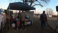
Monthly Public Work Days: Volunteering for trail maintenance is open to the general public on the second Saturday of every month.
Get Involved: Follow Erwin Park MTB on social media for location meetups, event details, and weather updates. All tools and training are provided on-site.
Authorized Maintenance Only: All trail building, trimming, and modification must be explicitly authorized by the Trail Steward. Unauthorized digging is illegal.
Contact & Leadership Roster
Trail Steward: Shawn Feiock (IMBA Trained / Certified)
Assistant Trail Steward: Charlton Mooney
Former Trail Steward: Rich Szecsy, Bill Skalenda
Email Contact: [email protected]
Local Trail Association: Dallas Off-Road Bicycle Association (DORBA) | dorba.org
The Erwin Park Trail system is a premier cross-country (XC) mountain bike and hiking network located across a 220-acre municipal park and adjoining property in McKinney, Texas. Built and maintained entirely by volunteers from the Dallas Off-Road Bicycle Association (DORBA), the main park property is owned and operated by the City of McKinney. All City of McKinney Park rules and regulations are strictly applicable across all trail segments.
Trail Mileage & Property Layout
The trail network is divided into two distinct land management zones:
The Main Park Loops: Approximately 10 miles of permanent natural-surface singletrack twisting through the core 220 acres of scenic rolling hills, deep woods, and fragile blackland prairie ecosystems.
The Extension Zone: An additional 2 miles of cross-country trails located on an adjacent 70-acre section of property. Note: Access to this 2-mile section is temporary and dependent on ongoing land-use agreements.
The terrain offers a fast, flowing experience with a balanced mix of tight, twisty wooded singletrack and wide-open field segments. The layout features plentiful punchy climbs to test your lungs, rewarded by fast, fun downhills. While there are technical trail features (TTFs) scattered throughout, almost all of them include clear, built-in ride-arounds. The park also features a progressive, machine-groomed Skills Area equipped with progressive jumps, drops, berms, and a pump track.
Traffic Flow & Trail Etiquette
To minimize head-on conflicts on the singletrack, Erwin Park utilizes a split directional traffic pattern based on user type. Official signs are posted at major trailheads indicating these directions:
Cyclists (All Bikes): Travel Clockwise on the trail system.
Hikers & Trail Runners: Travel Counter-Clockwise on the trail system.
Pedestrian Yield Policy: Because mountain bikes carry significant speed on the singletrack, over features, and around blind corners, foot traffic must be prepared to yield the right-of-way to oncoming bikes for safety.
Bike Feature Policy: All trail features are strictly available for mountain bike use only. Foot traffic must not approach any trail features from a backwards/reverse direction.
No Wheeled Devices: Please do not bring baby strollers, wagons, or other wheeled devices on the trails. They create a severe hazard and block mountain bike traffic on narrow singletrack.
No Rogue Trails or Trail Blocking: Never stop, sit, or stand in a blind landing zone, berm, trail corridor, or intersection. If you need to stop for a rest or mechanical check, pull completely off the trail surface. Do not cut shortcuts or cheater lines. Off-trail traffic destroys fragile native flora and triggers severe erosion. Stay on the marked trail.
Road Crossings & Vehicle Interaction
Uncontrolled Crossings: There are multiple road crossings within the park loops. While these crossings are marked and highly visible to vehicle traffic, there are no official pedestrian crosswalks.
Exercise Extreme Caution: Both cyclists and pedestrians must exercise extreme caution at all road intersections and be prepared to yield the right-of-way to larger motorized vehicles.
Off-Road Restrictions: Motor vehicles must park and drive on paved surfaces only. Driving or parking on the grass is strictly prohibited.
Photography: Photography and filming within the park must not impede or block trail corridors. Production vehicles are completely restricted from driving off-road.
Critical Park Rules & Safety Policies
These regulations are strictly enforced by the City of McKinney and the trail stewards to preserve the landscape and ensure visitor safety:
Strict E-Bike Limitations: Only Class 1 pedal-assist e-bikes with a top speed cap of 20 mph are allowed on the trails and Skills Area. Any electric vehicle operating without functioning pedals, or equipped with unapproved off-road moto-style tires, will be confiscated at the owner's expense.
Absolutely No E-Motos: Dirt bikes, gas-powered vehicles, and electric motorbikes (including Sur-Ron, Talaria, Segway, and similar style e-moto bikes) are strictly prohibited. These high-speed vehicles pose a major danger to trail users and are never allowed on the skills course or hike and bike trails.
RC Vehicles & Drones: Remote-controlled (RC) cars and trucks are completely banned from the trails, fields, and skills area. (Note: Dedicated RC aviation and drone filming is welcomed exclusively at the south field airfield managed by the Sky High RC Club).
Skills Area Gravity Rules: The Skills Area features unidirectional, gravity-primary lines. No uphill or backwards traffic is permitted under any circumstances. Absolutely no foot traffic is allowed on the jump lines or pump track. If you are sessioning a feature, walk your bike back up completely outside the active trail corridor.
No Foraging or Wood Gathering: Collecting or foraging firewood from the park is strictly prohibited. Do not cut or trim any tree limbs or branches, whether they are dead or alive. Open firepits are prohibited; fires are only allowed inside city-installed metal fire rings at designated campsites.
No Smoking Policy: Smoking is strictly prohibited on the trail system and throughout the park landscape. Smoking is allowed only within designated camping or active recreation parking areas.
Wildlife Protection: Erwin Park is a natural habitat. Do not kill, injure, trap, or disrupt any wildlife—this includes all snake species. Give them space and leave them alone.
Pet Ordinance: Dogs must remain restrained by a handheld leash no longer than 6 feet at all times. Owners are legally responsible for picking up and properly disposing of all dog waste.
Prohibited Items: No alcohol or illegal drugs are allowed in the park (Zero Tolerance policy). No firearms or any devices that release a projectile are permitted.
Leave No Trace: Erwin Park is a pack-it-in, pack-it-out facility. Littering on the trails or dumping trash is strictly prohibited. Please utilize trailhead trash receptacles or pack your waste out to keep our singletrack pristine.
Reservations, Amenities, & Park Regulations
Park Hours: Open daily from 8:00 AM to 10:00 PM. Front gates lock promptly at 10:00 PM. Authorized overnight campers are exempt from the exit curfew.
Mandatory Reservations: All campsites, pavilions, and organized group events at the park require advanced reservations. Bookings must be handled directly through the official City of McKinney Parks and Recreation online portal or by calling the community center at 972-547-2690 (located on the northbound service road of Central/US-75, north of Eldorado Parkway). RV camping is strictly prohibited.
On-Site Facilities: Paved parking lots, rentable pavilions, and picnic areas. Restrooms are available on-site but are closed during the winter freeze months (November to March). Two Dero Bike Repair Stations are located at the trailheads for quick adjustments. Gas and food amenities are located within 2 miles of the park entrance.
Pond Regulations: Swimming, wading, and the use of personal watercraft (kayaks, canoes, paddleboards, or remote-controlled boats) are strictly prohibited in the Erwin Park pond. Fishing is permitted but strictly governed by Texas Parks & Wildlife Department (TPWD) regulations. Anglers aged 18 and older must possess a valid Texas fishing license.
Safety Disclaimer & Nearest Emergency Care
Ride, Run, and Hike at your own risk. Helmets are highly recommended—and strongly urged—to be worn at all times while on a bicycle.
In the event of an emergency on the trail, the nearest medical facilities are:
Baylor Scott & White Medical Center - McKinney: Located at the northwest corner of US-75 and University Dr (U.S. 380).
Medical City McKinney: Located off Medical Center Drive, just east of US-75.
Weather, Soil Preservation, & Trail Closures
Erwin Park is built on notorious North Texas black clay soil. When wet, it becomes dangerously slick and highly vulnerable to deep tire ruts and shoe footprint damage. Traveling on wet clay causes advanced erosion that dramatically increases the volunteer workload required to sustain a usable trail system.
IF THE TRAIL IS WET, TURN BACK: Trail conditions on the ground at any given time supercede the arrival of volunteers to physically update signs on property or flip the trail status online. If you are leaving tracks or mud is sticking to your tires/shoes, the trail is closed. Turn back immediately.
Always check the current Region Status right here on Trailforks or via the official DORBA app before heading out. A dedicated Gravel Route map is available on Trailforks for when the dirt singletrack is rained out.
Volunteer Work Days & Community Support
DORBA trails operate under formal agreements with municipal landowners that grant public access to build and maintain singletrack. This work is executed entirely by unpaid volunteers through hard work and sweat equity.
Monthly Public Work Days: Volunteering for trail maintenance is open to the general public on the second Saturday of every month.
Get Involved: Follow Erwin Park MTB on social media for location meetups, event details, and weather updates. All tools and training are provided on-site.
Authorized Maintenance Only: All trail building, trimming, and modification must be explicitly authorized by the Trail Steward. Unauthorized digging is illegal.
Contact & Leadership Roster
Trail Steward: Shawn Feiock (IMBA Trained / Certified)
Assistant Trail Steward: Charlton Mooney
Former Trail Steward: Rich Szecsy, Bill Skalenda
Email Contact: [email protected]
Local Trail Association: Dallas Off-Road Bicycle Association (DORBA) | dorba.org
Primary Trail Type: Cross-Country
eBikes Allowed:
Yes
Land Status: Municipal Park
Land Manager: City of McKinney
 google parking directions
Links
Activities Click to view
- Mountain Bike
2 trails
- E-Bike
3 trails
- Hike
2 trails
- Trail Running
2 trails
Region Details
- 1
Region Status
Open as of Jun 25, 2026Stats
- Avg Trail Rating
- Trails (view details)
- 1
- Trails Mountain Bike
- 3
- Trails E-Bike
- 3
- Trails Hike
- 2
- Trails Trail Running
- 2
- Total Distance
- 8 miles
- Total Descent Distance
- 3 miles
- Total Descent
- 520 ft
- Total Vertical
- 117 ft
- Highest Trailhead
- 705 ft
- Reports
- 536
- Photos
- 97
- Ridden Counter
- 1,475
Popular Erwin Park Mountain Biking Trails
• 80 ★ 4.2 • 9 miles • 591 ft • 698 •
The trail is maintained by the Dallas Off Road Bicycle Association (dorba.org) is a city of McKinney public park. The trail is just around 8.1 miles. The trail is a mix of tight and twisty in the woods to some fast open field sections....
• 90 ★ 4.7 • 2 miles • 34 ft • 269 •
Popular green difficulty singletrack. This mountain bike primary trail can be used one direction with a 34 ft green climb. Trail visibility is always easy to follow.
• 95 ★ 0.0 • 492 ft • 3 ft • 148 •
Drop is not mandatory, bypass if not experienced, bikes only no foot traffic this loop, no motorized vehicles
Erwin Park Mountain Bike Routes
★ 3.0 • 6 miles • 41 ft • 0 •
Gravel Route for when Erwin gets rained out and we cant use the trail due to our awesome Texas weather.
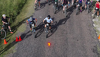
3 miles • 163 ft • 0 • Loop • Race •
The DFW Series Race Loop is used during weeknight mountain bike races and takes place on a closed course....
• 18 miles • 982 ft • 4 •
• 2 miles • 164 ft • 1 •
• 1 mile • 113 ft • 2 •
• 12 miles • 888 ft • 9 •
Videos of Erwin Park Mountain Bike
trail: Erwin Park
0:25 |
292 |
Jun 20, 2022

trail: Erwin Park
0:00 |
103 |
May 11, 2022
trail: Erwin Park
0:51 |
79 |
Apr 29, 2022
trail: Erwin Park
0:11 |
594 |
Feb 19, 2021

trail: Erwin Park
12:44 |
438 |
Dec 15, 2015
11:19 |
3 |
Jul 8, 2026
40:05 |
17 |
Jun 2, 2026
trail: Erwin Park
12:43 |
127 |
Jan 19, 2026 , McKinney
Recent Trail Reports
| status | trail | date | condition | info | user |
|---|---|---|---|---|---|
| Erwin Park Skills Area | Jun 25, 2026 @ 8:59pm (America/Chicago) Jun 25, 2026 | Ideal | scfeiock Trail Steward | ||
| Cutlass Supreme XC Loop | Jun 25, 2026 @ 8:53pm (America/Chicago) Jun 25, 2026 | Ideal | scfeiock Trail Steward | ||
| Beavers Bend Drop Loop | Jun 25, 2026 @ 8:53pm (America/Chicago) Jun 25, 2026 | Ideal | scfeiock Trail Steward |
Activity Feed
| username | action | type | title | date |
|---|---|---|---|---|
| ScottZkVYFp | add | karma | activity #99002411 | Jul 12, 2026 @ 3:21am 12 hours |
| troyadavis44 | ridden | trail | activity #98862330 | Jul 10, 2026 @ 9:17am 2 days |
| mtb-monk | add | video | activity #98718397 | Jul 8, 2026 @ 9:00am Jul 8, 2026 |
| scfeiock | add | report | activity #97809012 and 4 more | Jun 25, 2026 @ 6:53pm Jun 25, 2026 |
| porkchopfilms | wishlist | trail | activity #97670167 | Jun 23, 2026 @ 7:40pm Jun 23, 2026 |
Recent Comments
| username | type | title | comment | date |
|---|---|---|---|---|
| trail | Drop area off the ramp needs light... | Jan 13, 2026 @ 8:30pm Jan 13, 2026 | ||
| report | Cut and pasted from the FB chat cause im lazy:... | Nov 24, 2024 @ 7:05pm Nov 24, 2024 | ||
| report | The trail is okay. I rode a few times in the... | Nov 24, 2024 @ 5:35pm Nov 24, 2024 | ||
| report | Any idea when the trail will be dry enough?... | Nov 24, 2024 @ 8:58am Nov 24, 2024 | ||
| trail | Registration is now open for the 2022 DFW... | May 5, 2022 @ 7:32am May 5, 2022 |
Nearby Areas
| name | distance | ||||
|---|---|---|---|---|---|
| Erwin Park Skill Park | 1 | 0.1 km | |||
| Gray Branch Park | 6 | 3.5 km | |||
| Frisco Northwest Community Park | 2 | 1 | 12.8 km | ||
| Sister Grove Park | 4 | 13.1 km | |||
| Oak Point Park And Nature Preserve | 1 | 13.9 km |
Local Products
Activity Type Stats
| activitytype | trails | distance | descent | descent distance | total vertical | rating | global rank | state rank | photos | reports | routes | ridelogs |
|---|---|---|---|---|---|---|---|---|---|---|---|---|
| Mountain Bike | 2 | 8 miles | 518 ft | 3 miles | 118 ft | #3,479 | #1,218 | 102 | 666 | 2 | 10,867 | |
| E-Bike | 3 | 8 miles | 518 ft | 3 miles | 118 ft | #3,807 | #1,088 | 661 | 1 | 553 | ||
| Hike | 2 | 8 miles | 518 ft | 3 miles | 118 ft | #8,854 | #3,341 | 664 | 98 | |||
| Trail Running | 2 | 8 miles | 518 ft | 3 miles | 118 ft | #7,971 | #2,727 | 664 | 120 |
- By brenthillier
 NSMBA TRAILFORKS & contributors
 - Admins: Trail Steward, DORBA MAIN
- #3726 - 166,885 views
- erwin park activity log | embed map of Erwin Park mountain bike trails | erwin park mountain biking points of interest
Downloading of trail gps tracks in kml & gpx formats is enabled for Erwin Park.
You must login to download files.