close
-
Layers w
- Weather Layers
- Pro
- Pro
- Pro
- Pro
- Pro
- Pro
- More Layers
- Pro
- Pro
- Pro
- Pro
-
Upgrade to

3D
Trail Conditions
- Unknown
- Snow Groomed
- Snow Packed
- Snow Covered
- Snow Cover Partial
- Freeze/thaw Cycle
- Icy
- Prevalent Mud
- Wet
- Variable
- Ideal
- Dry
- Very Dry
Trail Flow (Ridden Direction)
Trailforks scans users ridelogs to determine the most popular direction each trail is ridden. A good flowing trail network will have most trails flowing in a single direction according to their intension.
The colour categories are based on what percentage of riders are riding a trail in its intended direction.
The colour categories are based on what percentage of riders are riding a trail in its intended direction.
- > 96%
- > 90%
- > 80%
- > 70%
- > 50%
- < 50%
- bi-directional trail
- no data
Trail Last Ridden
Trailforks scans ridelogs to determine the last time a trail was ridden.
- < 2 days
- < 1 week
- < 2 weeks
- < 1 month
- < 6 months
- > 6 months
Trail Ridden Direction
The intended direction a trail should be ridden.
- Downhill Only
- Downhill Primary
- Both Directions
- Uphill Primary
- Uphill Only
- One Direction
Contribute Details
Colors indicate trail is missing specified detail.
- Description
- Photos
- Description & Photos
- Videos
Trail Popularity ?
Trailforks scans ridelogs to determine which trails are ridden the most in the last 9 months.
Trails are compared with nearby trails in the same city region with a possible 25 colour shades.
Think of this as a heatmap, more rides = more kinetic energy = warmer colors.
- most popular
- popular
- less popular
- not popular
ATV/ORV/OHV Filter
Max Vehicle Width
inches
US Cell Coverage
Legend

Radar Time
Activity Recordings
Trailforks uses anonymized public activity data.
?
Activity Recordings
Trailforks uses anonymized public activity data.
?
Personal Heatmap
▶
Activity Types
all
/
none
▶
Options
2
Date range
month
–
Winter Trails
Warning
A routing network for winter maps does not exist. Selecting trails using the winter trails layer has been disabled.
Missing Trails
Most Popular
Least Popular
Trails are colored based on popularity. The more popular a trail is, the more red. Less popular trails trend towards green.
Jump Magnitude Heatmap
Heatmap of where riders jump on trails. Zoom in to see individual jumps, click circles to view jump details.
BC Backroad Status
![map legend]()
Service Road Atlas is a free to use, community-driven service for viewing and creating reports on the numerous back-country service roads around B.C. and Alberta.

Slope Aspect
Direction the slope faces
Trails Deemphasized
Trails are shown in grey.
Only show trails with no bike usage.
Suggested Layers
Based on selected activity type
Save the current map location and zoom level as your default home location whenever this page is loaded.
Save
No description for Fairfield has been added yet!
Login or register to submit one.
Activities Click to view
- Mountain Bike
9 trails
- Gravel Bike
0 trails
- Adaptive Bike
0 trails
- Hike
23 trails
- Trail Running
23 trails
Region Details
- 3
- 1
- 1
- 3
- 1
Region Status
Open as of Jan 10, 2026Stats
- Avg Trail Rating
- Trails (view details)
- 23
- Trails Mountain Bike
- 9
- Trails Hike
- 23
- Trails Trail Running
- 23
- Total Distance
- 24 miles
- Total Descent Distance
- 7 miles
- Total Descent
- 1,305 ft
- Total Vertical
- 340 ft
- Highest Trailhead
- 896 ft
- Reports
- 99
- Photos
- 15
- Ridden Counter
- 673
Sub Regions
-
William Harbin Park
- 1
- 1
- 3
- 1
Popular Fairfield Mountain Biking Trails
• 100 ★ 2.0 • 614 ft • 11 ft • 133 •
• 80 ★ 4.6 • 4 miles • 632 ft • 108 •
Short, fun, winding, descents followed by punchy climbs. This trail has several man made bridges and obstacles. This is the most difficult trail at the park, and plays host to the annual Mountain Bike Challenge
• 90 ★ 3.8 • 2,126 ft • 117 ft • 94 •
Lots of elevation change and lots of tight turns through the trees.
• 50 ★ 5.0 • 1,227 ft • 36 ft • 82 •
Moderately popular black diamond difficulty singletrack. This multi-use trail can be used both directions. On average it takes 2 minutes to complete this trail.
• 70 ★ 4.0 • 4,557 ft • 188 ft • 61 •
Lots of elevation change and lots of tight turns through the trees.
• 60 ★ 3.0 • 3,537 ft • 58 ft • 33 •
Has some elevation change and also has several man made bridges to get riders across creeks. It is the easiest of the three trails and is a great trail to hone in our mountain biking skills
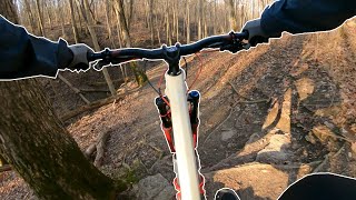
Photos of Fairfield Mountain Bike
Videos of Fairfield Mountain Bike
7:40 |
109 |
Sep 25, 2024
Recent Trail Reports
| status | trail | date | condition | info | user |
|---|---|---|---|---|---|
| Green Trail (West) | Sep 23, 2025 @ 3:31pm (America/Indiana/Vevay) Sep 23, 2025 | Ideal | Abaldhoff | ||
| Green to Orange Connector | Sep 23, 2025 @ 3:31pm (America/Indiana/Vevay) Sep 23, 2025 | Very Dry | Abaldhoff | ||
| Green Trail (East) | Sep 23, 2025 @ 3:31pm (America/Indiana/Vevay) Sep 23, 2025 | Ideal | Abaldhoff | ||
| Orange Trail | Sep 23, 2025 @ 3:22pm (America/Indiana/Vevay) Sep 23, 2025 | Ideal | AndyBaldhoff | ||
| Blue Trail | Jun 2, 2025 @ 6:42pm Jun 2, 2025 | Ideal | tf2013 | ||
| Harbin Park Path | Jun 2, 2025 @ 6:42pm Jun 2, 2025 | Ideal | tf2013 | ||
| Orange Option | Oct 10, 2022 @ 3:30pm Oct 10, 2022 | Ideal | cincicycles | ||
| Great Miami River (Hamilton) | Feb 5, 2022 @ 12:51pm Feb 5, 2022 | Snow Covered | Mellowcat |
Activity Feed
| username | action | type | title | date |
|---|---|---|---|---|
| dddiana | update | trail | activity #88847903 | Feb 13, 2026 @ 1:29pm Feb 13, 2026 |
| hykerwilson | wishlist | region | activity #85847479 | Dec 21, 2025 @ 8:59am Dec 21, 2025 |
| HoneysuckleHero | add | photo | activity #85011737 and 1 more | Dec 1, 2025 @ 6:28am Dec 1, 2025 |
| indanarider | ridden | trail | activity #82267052 and 5 more | Oct 13, 2025 @ 5:48am Oct 13, 2025 |
| AndyBaldhoff | wishlist | region | activity #81836371 | Oct 6, 2025 @ 12:10pm Oct 6, 2025 |
Recent Comments
| username | type | title | comment | date |
|---|---|---|---|---|
| report | Trails had trees fallen across trails in... | Dec 7, 2024 @ 10:12am Dec 7, 2024 | ||
| trail | Agree with this assessment - technically, not... | Mar 31, 2023 @ 9:17am Mar 31, 2023 | ||
| trail | I would say "punchy" climbs as people like to... | Aug 12, 2020 @ 11:41am Aug 12, 2020 | ||
| trail | Black diamond? Really? Lol. Maybe relative to... | Jul 13, 2020 @ 6:13pm Jul 13, 2020 | ||
| trail | Nice short trail. A few parts of the trail was... | Jun 18, 2020 @ 1:30pm Jun 18, 2020 |
Local Badges
-

Epic Ride Descent 2k0 awarded -

Descent 10k Badge0 awarded -

Descent 100k Badge0 awarded
Activity Type Stats
| activitytype | trails | distance | descent | descent distance | total vertical | rating | global rank | state rank | photos | reports | routes | ridelogs |
|---|---|---|---|---|---|---|---|---|---|---|---|---|
| Mountain Bike | 9 | 17 miles | 883 ft | 5 miles | 341 ft | #6,174 | #2,091 | 15 | 98 | 1,791 | ||
| Hike | 23 | 24 miles | 1,306 ft | 7 miles | 341 ft | #6,966 | #2,472 | 98 | 74 | |||
| Trail Running | 23 | 24 miles | 1,306 ft | 7 miles | 341 ft | #7,502 | #2,487 | 98 | 42 |
Frequently Asked Questions About Fairfield
▼
What are the best places to ride in Fairfield?
Fairfield has 3 areas to explore for mountain biking. The top rated areas are:
▼
What are the highest rated mountain biking trails in Fairfield?
The highest rated mountain biking trails in Fairfield are:
- Orange Trail (4.3/5)
- Orange Option (4.1/5)
- Green Trail (East) (4/5)
- Green Trail (West) (3.9/5)
- Green to Orange Connector (3.7/5)
▼
What is the best time of the year to ride in Fairfield?
Based on ride log data, the most popular months to ride in Fairfield are:
- September (25 activities)
- October (21 activities)
- July (19 activities)
▼
Where can I park to ride in Fairfield?
There are 7 parking locations listed in Fairfield. The most popular parking spots are: View all parking and trailhead locations on the map to plan your visit.
Trails
Points of Interest
- By antikid
 & contributors
 - Admins: CORA
- #5371 - 3,031 views
- fairfield activity log | embed map of Fairfield mountain bike trails | fairfield mountain biking points of interest
Downloading of trail gps tracks in kml & gpx formats is enabled for Fairfield.
You must login to download files.