close
-
Layers w
- Weather Layers
- Pro
- Pro
- Pro
- Pro
- Pro
- Pro
- More Layers
- Pro
- Pro
- Pro
- Pro
-
Upgrade to

3D
Trail Conditions
- Unknown
- Snow Groomed
- Snow Packed
- Snow Covered
- Snow Cover Partial
- Freeze/thaw Cycle
- Icy
- Prevalent Mud
- Wet
- Variable
- Ideal
- Dry
- Very Dry
Trail Flow (Ridden Direction)
Trailforks scans users ridelogs to determine the most popular direction each trail is ridden. A good flowing trail network will have most trails flowing in a single direction according to their intension.
The colour categories are based on what percentage of riders are riding a trail in its intended direction.
The colour categories are based on what percentage of riders are riding a trail in its intended direction.
- > 96%
- > 90%
- > 80%
- > 70%
- > 50%
- < 50%
- bi-directional trail
- no data
Trail Last Ridden
Trailforks scans ridelogs to determine the last time a trail was ridden.
- < 2 days
- < 1 week
- < 2 weeks
- < 1 month
- < 6 months
- > 6 months
Trail Ridden Direction
The intended direction a trail should be ridden.
- Downhill Only
- Downhill Primary
- Both Directions
- Uphill Primary
- Uphill Only
- One Direction
Contribute Details
Colors indicate trail is missing specified detail.
- Description
- Photos
- Description & Photos
- Videos
Trail Popularity ?
Trailforks scans ridelogs to determine which trails are ridden the most in the last 9 months.
Trails are compared with nearby trails in the same city region with a possible 25 colour shades.
Think of this as a heatmap, more rides = more kinetic energy = warmer colors.
- most popular
- popular
- less popular
- not popular
ATV/ORV/OHV Filter
Max Vehicle Width
inches
US Cell Coverage
Legend

Radar Time
Activity Recordings
Trailforks uses anonymized public activity data.
?
Activity Recordings
Trailforks uses anonymized public activity data.
?
Personal Heatmap
▶
Activity Types
all
/
none
▶
Options
2
Date range
month
–
Winter Trails
Warning
A routing network for winter maps does not exist. Selecting trails using the winter trails layer has been disabled.
Missing Trails
Most Popular
Least Popular
Trails are colored based on popularity. The more popular a trail is, the more red. Less popular trails trend towards green.
Jump Magnitude Heatmap
Heatmap of where riders jump on trails. Zoom in to see individual jumps, click circles to view jump details.
BC Backroad Status
![map legend]()
Service Road Atlas is a free to use, community-driven service for viewing and creating reports on the numerous back-country service roads around B.C. and Alberta.

Slope Aspect
Direction the slope faces
Trails Deemphasized
Trails are shown in grey.
Only show trails with no bike usage.
Suggested Layers
Based on selected activity type
Save the current map location and zoom level as your default home location whenever this page is loaded.
SaveOhio trails are mostly based out of state parks, but there are a couple of county/municipal trail systems of note, another couple of private trail systems (Vultures Knob, Mohican Wilderness) and the trails in the Wayne National Forest. Some downhill style riding is available at Mohican Wilderness as well as freeride/enduro trails at Horn's HIll, Vulture's Knob, and the Wilds. The rest is mostly cross country.
Region Details
- 1,184
- 46
- 629
- 487
- 86
- 12
- 1
Stats
- Avg Trail Rating
- Trails (view details)
- 4,852
- Trails Mountain Bike
- 2,446
- Trails E-Bike
- 1,188
- Trails Gravel Bike
- 1,770
- Trails Adaptive Bike
- 127
- Trails Winter Fat Bike
- 92
- Trails Horse
- 619
- Trails Hike
- 4,589
- Trails Trail Running
- 4,578
- Trails Dirtbike/Moto
- 73
- Trails Observed Trials
- 10
- Trails ATV/ORV/OHV
- 73
- Trails Snowmobile
- 12
- Trails Snowshoe
- 195
- Trails Downhill Ski
- 61
- Trails Backcountry Ski
- 19
- Trails Nordic Ski
- 204
- Total Distance
- 5,125 miles
- Total Descent
- 345,492 ft
- Total Vertical
- 967 ft
- Highest Trailhead
- 1,438 ft
- Reports
- 15,035
- Photos
- 3,132
- Ridden Counter
- 111,552
Articles

Video: Taj Mehilich & The Fairdale Crew Ride Ray's Indoor Bike Park
Feb 16, 2025 from pinkbike.com
This just in, Pinkbike's resident Doodle Master Taj is still a steezy dude.

Entry to These 20 National Parks Won’t Cost You a Dime
Jan 21, 2025 from outsideonline.com
Most national parks have an entry fee, but not these. And they're all awesome places to visit.
Traveling on a Budget? These 10 U.S. National Parks Are the Most Affordable to Visit.
Jun 16, 2024 from outsideonline.com
Our parks expert has put together long weekend trips for as little as $204, with details on free entrance fees and campsites, and active...
Popular Trail Networks
view all areas »Sub Regions
- Central Ohio (327)
- Champaign County (2)
- Clark County (3)
- Delaware County (34)
- Fairfield County (27)
- Franklin County (146)
- Franklin County (18)
- Knox County (1)
- Licking County (89)
- Logan County (0)
- Madison County (2)
- Marion County (8)
- Pickaway County (3)
- Northeast Ohio (644)
- Ashland County (24)
- Ashtabula County (1)
- Carroll County (31)
- Columbiana County (50)
- Coshocton County (11)
- Cuyahoga County (92)
- Geauga County (5)
- Harrison County (33)
- Holmes County (1)
- Jefferson County (0)
- Lake County (141)
- Lorain County (24)
- Mahoning County (33)
- Medina County (37)
- Portage County (19)
- Richland County (0)
- Stark County (20)
- Summit County (81)
- Trumbell County (2)
- Tuscarawas County (49)
- Wayne County (4)
- Northwest Ohio (284)
- Allen County (12)
- Auglaize County (8)
- Crawford County (2)
- Defiance County (16)
- Erie County (12)
- Fulton County (0)
- Hancock County (8)
- Henry County (20)
- Lucas County (137)
- Mercer County (10)
- Paulding County (15)
- Putnam County (11)
- Sandusky County (3)
- Shelby County (14)
- Williams County (12)
- Wood County (4)
- Southeast Ohio (735)
- Athens County (89)
- Belmont County (0)
- Gallia County (32)
- Guernsey County (26)
- Hocking County (62)
- Jackson County (0)
- Lawrence County (3)
- Meigs County (0)
- Monroe County (3)
- Morgan County (49)
- Muskingum County (67)
- Noble County (41)
- Pike County (23)
- Ross County (141)
- Scioto County (23)
- Vinton County (48)
- Washington County (124)
- Wayne National Forest - Ironton Unit (26)
- Southwest Ohio (471)
- Adams County (34)
- Brown County (35)
- Butler County (12)
- Clark County (1)
- Clermont County (57)
- Drake County (1)
- Fayette County (6)
- Greene County (39)
- Hamilton County (77)
- Highland County (12)
- Miami County (44)
- Montgomery County (56)
- Preble County (25)
- Warren County (71)
Popular Ohio Mountain Biking Trails
• 95 ★ 4.1 • 11 miles • 1,532 ft • 541 •
Highly rated popular blue difficulty singletrack. This multi-use trail can be used one direction. On average it takes 1 hour39 minutes to complete this trail.
• 100 ★ 4.6 • 2 miles • 193 ft • 524 •
A 2.3 mile trail for intermediate level bikers.
• 100 ★ 4.8 • 11 miles • 1,490 ft • 409 •
Highly rated popular blue difficulty singletrack. This multi-use trail can be used one direction and has a moderate overall physical rating with a 1,490 ft blue climb. On average it takes 1 hour29 minutes to complete this trail.
• 100 ★ 4.3 • 6 miles • 428 ft • 430 •
Alum Creek (P2) has quickly become the most heavily ridden trail in Central Ohio. was originally designed for more advanced riders and features some relatively narrow bridges ("skinnies"). As a newer trail than P1, it tends to flow a...
• 90 ★ 0.0 • 4,413 ft • 100 ft • 400 •
The final stretch of the main Mohican MTB Trail. The also connects into this portion of the trail.
• 90 ★ 4.4 • 6 miles • 378 ft • 391 •
Note: Phase 1 is directional by day of week. The trail is ridden clockwise on Tuesdays, Thursdays and Sundays and counterclockwise on Mondays, Wednesdays, Fridays and Saturdays. There is signage at the trail heads indicating which...
• 95 ★ 4.7 • 2 miles • 146 ft • 364 •
is an intermediate natural surface trail with tightly-banked switchbacks punctuated with pleasant scenic views of wetlands and surrounding hillsides. From , you’ll start your descent to West Bailey Run, traveling through a recently...
Ohio Mountain Bike Routes
Phase 2 Featured
6 miles • 289 ft • 1 • Loop •
Alum Creek Phase 2 (P2) has quickly become the most heavily ridden trail in Central Ohio. Phase 2 was...
Phase 1 Featured
6 miles • 258 ft • 1 • Loop •
Note: Phase 1 is directional by day of week. The trail is ridden clockwise on Tuesdays, Thursdays and...
The Whole Alumchilada Featured
26 miles • 1,095 ft • 19 • Loop •
An epic, 26 mile loop around the entire Alum Creek Trail System starting from the Phase 1 .
2 miles • 39 ft • 12 • Loop •
Perfect route for a beginner looking to get in some extra mileage. The Coaster Loop is ridden clockwise....
COMBO: Recommended Main MTB Loop Featured
6 miles • 1,052 ft • 14 • Loop •
★ 5.0 • 5 miles • 653 ft • 5 • Point to Point •
Start up , take a right to climb the switchbacks, land up on the hill (and take a break at the bench on +...
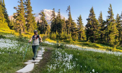
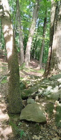
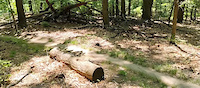
Photos of Ohio Mountain Bike
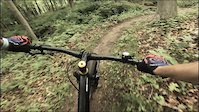
Videos of Ohio Mountain Bike

trail: Chernobyl
0:13 |
|
Nov 19, 2024

trail: Hamilton Loop
0:09 |
61 |
Jul 8, 2023
trail: Touch Stone North
0:06 |
54 |
Jun 21, 2023
trail: Wight Oaks Loop - South
0:05 |
40 |
Jun 21, 2023
trail: Touch Stone South
0:09 |
103 |
Jun 15, 2023

trail: Dead Wreckoning
0:11 |
|
Nov 20, 2022

trail: Ohio & Erie Canal Towpath
0:05 |
69 |
Sep 18, 2022
trail: Snake Hollow Trail
0:08 |
522 |
Jan 7, 2022
National Scenic Trails & Official Routes
-
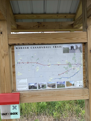
Wabash Cannonball Trail
- Mountain Bike
- E-Bike
- Hike
- Trail Running
- Snowmobile
- Nordic Ski
Activity Feed
| username | action | type | title | date |
|---|---|---|---|---|
| aamcgee | wishlist | region | activity #98251541 | Jul 2, 2026 @ 12:41am 3 hours |
| Trosslivs2ride | add | report | activity #98241538 and 10 more | Jul 1, 2026 @ 7:03pm 8 hours |
| jbunting88 | add | report | activity #98238154 and 1 more | Jul 1, 2026 @ 5:51pm 10 hours |
| ConradG1 | add | report | activity #98210277 and 3 more | Jul 1, 2026 @ 10:23am 17 hours |
| benbrewster-athensbicycleclub | add | trail | activity #98196352 | Jul 1, 2026 @ 6:46am 21 hours |
Recent Comments
| username | type | title | comment | date |
|---|---|---|---|---|
| trail | And yet, almost all lips are in great shape.... | Jun 28, 2026 @ 11:39am Jun 28, 2026 | ||
| trail | Seemed in great shape with recent work done.... | Jun 28, 2026 @ 11:37am Jun 28, 2026 | ||
| trail | These trails are so overgrown and unmaintained... | Jun 28, 2026 @ 10:40am Jun 28, 2026 | ||
| report | Thank you | Jun 23, 2026 @ 7:43pm Jun 23, 2026 | ||
| report | It was reported. They showed up to track him... | Jun 23, 2026 @ 7:25pm Jun 23, 2026 |
Local Badges
-

10 Green Trails85 awarded -

Top 10 Trails2 awarded -

Climbing 10k Badge4 awarded -

Epic Ride Climb 2k0 awarded -
Climbing 10k Badge9 awarded -

Climbing 100k Badge0 awarded
Bike & Skill Parks
| name | type | city | rating |
|---|---|---|---|
| Mad River Mountain | bike park | Zanesfield | |
| Ray's Indoor Bike Park - Cleveland | skill park | Cleveland | |
| Amherst Meadowlarks Motorcycle Track | skill park | Amherst | |
| Mike's Indoor Bike Park | skill park | Dayton | |
| Cliff's Bike Park | skill park | Cleveland |
Upcoming Local Events
Activity Type Stats
| activitytype | trails | distance | descent | descent distance | total vertical | rating | global rank | state rank | photos | reports | routes | ridelogs |
|---|---|---|---|---|---|---|---|---|---|---|---|---|
| Mountain Bike | 2,446 | 3,155 miles | 168,330 ft | 1,059 miles | 892 ft | #38 | 2,911 | 14,943 | 80 | 180,979 | ||
| E-Bike | 1,188 | 1,480 miles | 84,649 ft | 507 miles | 846 ft | #29 | 7 | 8,895 | 25 | 7,100 | ||
| Gravel Bike | 1,770 | 2,343 miles | 80,351 ft | 751 miles | 876 ft | #12 | 952 | 5 | 1,399 | |||
| Adaptive Bike | 127 | 245 miles | 7,136 ft | 76 miles | 719 ft | #36 | 686 | 25 | ||||
| Winter Fat Bike | 92 | 103 miles | 4,898 ft | 36 miles | 722 ft | #40 | 702 | 9 | 12 | |||
| Horse | 619 | 835 miles | 73,573 ft | 321 miles | 873 ft | #22 | 1 | 1,846 | 1 | 140 | ||
| Hike | 4,589 | 4,989 miles | 326,844 ft | 1,722 miles | 912 ft | #26 | 159 | 13,804 | 26 | 18,135 | ||
| Trail Running | 4,578 | 4,979 miles | 325,741 ft | 1,718 miles | 892 ft | #25 | 8 | 13,801 | 28 | 11,025 | ||
| Dirtbike/Moto | 73 | 143 miles | 14,813 ft | 60 miles | 489 ft | #32 | 3 | 1,500 | 85 | |||
| Observed Trials | 10 | 8 miles | 269 ft | 2 miles | 279 ft | #30 | 3 | 23 | 35 | |||
| ATV/ORV/OHV | 73 | 143 miles | 14,990 ft | 60 miles | 489 ft | #35 | 1,557 | 39 | ||||
| Snowmobile | 12 | 13 miles | 584 ft | 4 miles | 696 ft | #33 | 154 | 5 | ||||
| Snowshoe | 195 | 149 miles | 13,258 ft | 66 miles | 636 ft | #36 | 110 | 1 | 46 | |||
| Downhill Ski | 61 | 11 miles | 3,543 ft | 6 miles | 771 ft | #29 | 2 | 989 | ||||
| Backcountry Ski | 19 | 11 miles | 1,129 ft | 5 miles | 364 ft | #32 | 94 | 1 | 50 | |||
| Nordic Ski | 204 | 170 miles | 12,349 ft | 68 miles | 784 ft | #29 | 1 | 107 | 329 |
Activities
- Ohio Mountain Biking Trails
- Ohio E-Biking Trails
- Ohio Gravel Biking Trails
- Ohio Adaptive Biking Trails
- Ohio Winter Fat Biking Trails
- Ohio Horseback Trails
- Ohio Hiking Trails
- Ohio Trail Running Trails
- Ohio Dirtbiking Trails
- Ohio Observed Trials Trails
- Ohio ATVing/Offroading Trails
- Ohio Snowmobiling Trails
- Ohio Snowshoeing Trails
- Ohio Skiing Trails
- Ohio Backcountry Skiing Trails
- Ohio Nordic Skiing Trails
Trails
- By canadaka
 Trailforks & contributors
 - Admins: Map Team, IMBA, TransRockies, chuktA, msmcfate, WillieJacobsz, PlumbBobM, ReckitRolley, colinreuter, Chris-Campbell
- #3164 - 45,575 views
- ohio activity log | embed map of Ohio mountain bike trails | ohio mountain biking points of interest
Downloading of trail gps tracks in kml & gpx formats is enabled for Ohio.
You must login to download files.