
close
3D
Trail Conditions
- Unknown
- Snow Groomed
- Snow Packed
- Snow Covered
- Snow Cover Partial
- Freeze/thaw Cycle
- Icy
- Prevalent Mud
- Wet
- Variable
- Ideal
- Dry
- Very Dry
Trail Flow (Ridden Direction)
Trailforks scans users activity logs to determine the most popular direction each trail is ridden. A good flowing trail network will have most trails flowing in a single direction according to their intension.
The colour categories are based on what percentage of users are riding a trail in its intended direction.
The colour categories are based on what percentage of users are riding a trail in its intended direction.
- > 96%
- > 90%
- > 80%
- > 70%
- > 50%
- < 50%
- bi-directional trail
- no data
Trail Last Used
Trailforks scans activity logs to determine the last time a trail was ridden.
- < 2 days
- < 1 week
- < 2 weeks
- < 1 month
- < 6 months
- > 6 months
Trail Ridden Direction
The intended direction a trail should be ridden.
- Downhill Only
- Downhill Primary
- Both Directions
- Uphill Primary
- Uphill Only
- One Direction
Contribute Details
Colors indicate trail is missing specified detail.
- Description
- Photos
- Description & Photos
- Videos
Trail Popularity ?
Trailforks scans activity logs to determine which trails are ridden the most in the last 9 months.
Trails are compared with nearby trails in the same city region with a possible 25 colour shades.
Think of this as a heatmap, more activities = more kinetic energy = warmer colors.
- most popular
- popular
- less popular
- not popular
ATV/ORV/OHV Filter
Max Vehicle Width
inches
US Cell Coverage
Legend

Radar Time
Activity Recordings
Trailforks uses anonymized public activity data.
?
Activity Recordings
Trailforks uses anonymized public activity data.
?
Winter Trails
Warning
A routing network for winter maps does not exist. Selecting trails using the winter trails layer has been disabled.
Missing Trails
Most Popular
Least Popular
Trails are colored based on popularity. The more popular a trail is, the more red. Less popular trails trend towards green.
Jump Magnitude Heatmap
Heatmap of where users jump on trails. Zoom in to see individual jumps, click circles to view jump details.
BC Backroad Status
![map legend]()
Service Road Atlas is a free to use, community-driven service for viewing and creating reports on the numerous back-country service roads around B.C. and Alberta.

Slope Aspect
Direction the slope faces
Trails Deemphasized
Trails are shown in grey.
Only show trails with no bike usage.
Suggested Layers
Based on selected activity type
Save the current map location and zoom level as your default home location whenever this page is loaded.
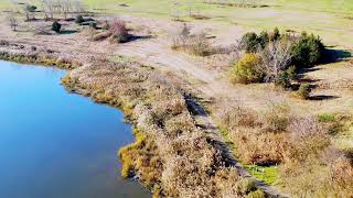
SaveAt 2,200 acres, Freshkills Park is almost three times the size of Central Park and the largest park to be developed in New York City in over 100 years. It also has a significant history as the site of the Fresh Kills Landfill, which was the largest landfill in the world before closing in 2001. Since then, the landscape has been engineered with layers of soil and infrastructure, and the area has become a place for wildlife, recreation, science, education, and art. The interior of the park is currently only accessible during scheduled park programs which provide early access for learning and exploration opportunities. As the park build out continues, please visit the New Springville Greenway, the Owl Hollow Soccer Fields and Schmul Park and stay tuned for news about upcoming openings.
Primary Trail Type: Cross-Country
Land Status: City Managed
Land Manager: New York City Parks Department
 google parking directions plan a road trip here
Disclaimer:
Accessible during special events or with the permission of the Freshkills Alliance.
Use trails at your own risk. Hidden hazards may exist.
Use trails at your own risk. Hidden hazards may exist.
Links
Trail info last updated
Activities Click to view
- Mountain Bike
24 trails
- Horse
4 trails
- Hike
24 trails
- Trail Running
24 trails
- Snowshoe
23 trails
- Nordic Ski
22 trails
Region Details
- 2
- 7
- 15
Region Status
Open as of Feb 12, 2026
Stats
- Avg Trail Rating
- Trails (view details)
- 24
- Trails Mountain Bike
- 24
- Trails E-Bike
- 3
- Trails Gravel Bike
- 23
- Trails Adaptive Bike
- 16
- Trails Winter Fat Bike
- 17
- Trails Horse
- 4
- Trails Hike
- 24
- Trails Trail Running
- 24
- Trails Snowshoe
- 23
- Trails Nordic Ski
- 22
- Total Distance
- 22 miles
- Total Descent Distance
- 6 miles
- Total Descent
- 219 ft
- Total Vertical
- 43 ft
- Highest Trailhead
- 43 ft
- Reports
- 46
- Photos
- 16
- Completed Counter
- 346
Popular Freshkills Mountain Biking Trails
• 85 ★ 0.0 • 4,465 ft • 0 ft • 35 •
Popular green difficulty family friendly dirt/gravel road. This multi-use trail can be used both directions and has a easy overall physical rating with a 0 ft green climb. Adaptive MTB rating: amtb green. Trail visibility is always easy to follow. On average it takes 5 minutes to complete this trail.
• 85 ★ 0.0 • 2,536 ft • 27 ft • 34 •
Popular green difficulty family friendly dirt/gravel road. This multi-use trail can be used both directions and has a moderate overall physical rating with a 27 ft blue climb. Adaptive MTB rating: amtb green. Trail visibility is always easy to follow. On average it takes 2 minutes to complete this trail.
• 75 ★ 0.0 • 4,573 ft • 3 ft • 29 •
Popular blue difficulty family friendly dirt/gravel road. This multi-use trail can be used both directions and has a moderate overall physical rating with a 3 ft blue climb. Adaptive MTB rating: amtb green. Trail visibility is always easy to follow. On average it takes 5 minutes to complete this trail.
• 80 ★ 0.0 • 3,346 ft • 14 ft • 27 •
Popular blue difficulty family friendly doubletrack. This multi-use trail can be used both directions and has a easy overall physical rating with a 14 ft green climb. Adaptive MTB rating: amtb green. Trail visibility is always easy to follow. On average it takes 3 minutes to complete this trail.
• 65 ★ 0.0 • 2,936 ft • 0 ft • 26 •
Moderately popular green difficulty paved path. This multi-use trail can be used both directions and has a easy overall physical rating with a 0 ft green climb. Trail visibility is always easy to follow. On average it takes 17 minutes to complete this trail.
• 85 ★ 4.0 • 1,873 ft • 0 ft • 25 •
Popular blue difficulty family friendly doubletrack. This multi-use trail can be used both directions and has a moderate overall physical rating with a 0 ft green climb. Trail visibility is always easy to follow. On average it takes 1 minutes to complete this trail.
• 55 ★ 0.0 • 1,509 ft • 0 ft • 21 •
Moderately popular blue difficulty family friendly doubletrack. This multi-use trail can be used both directions and has a moderate overall physical rating with a 0 ft blue climb. Trail visibility is always easy to follow. On average it takes 1 minutes to complete this trail.
• 65 ★ 0.0 • 2,431 ft • 7 ft • 17 •
Moderately popular blue difficulty family friendly dirt/gravel road. This multi-use trail can be used both directions and has a moderate overall physical rating with a 7 ft blue climb. Adaptive MTB rating: amtb green. Trail visibility is always easy to follow. On average it takes 3 minutes to complete this trail.
Freshkills Mountain Bike Routes
13 miles • 198 ft • 3 • Loop • Race •
A mix of loose and packed Gravel, Pavement and litlle sections of single track scattered throught out the...
6 miles • 119 ft • 5 • Loop • Race •
THE SHAOLIIN SHOW DOWN is several events on one great day. The first event is a 5 mile trail run. the run...
7 miles • 115 ft • 2 • Loop • Race •
The Shaollin 7 mile mountain bike course. 1 LAP beginner 2 Lap Intermediate 3 Lap Advanced
★ 5.0 • 9 miles • 137 ft • 4 • Race •
Final Approved map for November 19th Great Gobbler
13 miles • 241 ft • 4 • Loop • Race •
This is the Proposed Course for the 1st NYC Gravel Grinder, to be held at Freshkills Landfill on September...
4 miles • 87 ft • 4 • Loop • Race •
4 miles of fun and views, that is if you take the time to look around. Being that this is 1 of the NYC...
Photos of Freshkills Mountain Bike
Videos of Freshkills Mountain Bike
Recent Trail Reports
| status | trail | date | condition | info | user |
|---|---|---|---|---|---|
| Rush the Fence | Jun 21, 2024 @ 7:01pm Jun 21, 2024 | Ideal | mlebow68 NYCMTB | ||
| Half Circle | Jun 21, 2024 @ 7:01pm Jun 21, 2024 | Ideal | mlebow68 NYCMTB | ||
| Freshkills WS1 | Jun 21, 2024 @ 7:01pm Jun 21, 2024 | Ideal | mlebow68 NYCMTB | ||
| Freshkills Outer Loop | Jun 21, 2024 @ 7:01pm Jun 21, 2024 | Ideal | mlebow68 NYCMTB | ||
| Freshkills Opt1 | Jun 21, 2024 @ 7:01pm Jun 21, 2024 | Ideal | mlebow68 NYCMTB | ||
| Freshkills | Jun 21, 2024 @ 7:01pm Jun 21, 2024 | Ideal | mlebow68 NYCMTB | ||
| Freshkills | Oct 29, 2023 @ 4:08am Oct 29, 2023 | Ideal | mlebow68 NYCMTB | ||
| Freshkills LO3 | Jul 23, 2023 @ 6:48am Jul 23, 2023 | Ideal | mlebow68 NYCMTB | ||
| Freshkills LO1 | Jul 23, 2023 @ 6:48am Jul 23, 2023 | Ideal | mlebow68 NYCMTB | ||
| Bike Path 1 | May 29, 2023 @ 12:55am May 29, 2023 | Ideal | mlebow68 NYCMTB |
Activity Feed
| username | action | type | title | date |
|---|---|---|---|---|
| rocbike | wishlist | region | activity #100027992 | Jul 25, 2026 @ 10:21pm Jul 25, 2026 |
| chuckesunshine | wishlist | route | activity #92653914 | Apr 15, 2026 @ 5:36am Apr 15, 2026 |
| mlebow68 | add | route | activity #92631287 and 1 more | Apr 14, 2026 @ 5:18pm Apr 14, 2026 |
| mlebow68 | add | route | activity #88639676 | Feb 9, 2026 @ 12:24pm Feb 9, 2026 |
| EagleDon | rsvp | event | activity #84316727 | Nov 17, 2025 @ 2:55pm Nov 17, 2025 |
Nearby Areas
| name | distance | ||||
|---|---|---|---|---|---|
| Brookfield Park | 2 | 1.5 km | |||
| Arden Woods | 4 | 1.5 km | |||
| Staten Island Greenbelt | 11 | 33 | 2.7 km | ||
| Bloomingdale Park | 1 | 5 | 3.6 km | ||
| Clay Pit Pond | 4 | 3.7 km |
Local Badges
-

Completionist0 awarded
Activity Type Stats
| activitytype | trails | distance | descent | descent distance | total vertical | rating | global rank | state rank | photos | reports | routes | activity logs |
|---|---|---|---|---|---|---|---|---|---|---|---|---|
| Mountain Bike | 24 | 22 miles | 220 ft | 6 miles | 43 ft | #10,700 | #179 | 10 | 46 | 9 | 189 | |
| E-Bike | 3 | 3 miles | 20 ft | 4,170 ft | 20 ft | 46 | 4 | 6 | ||||
| Gravel Bike | 23 | 21 miles | 213 ft | 5 miles | 43 ft | 6 | 9 | 7 | ||||
| Adaptive Bike | 16 | 16 miles | 177 ft | 4 miles | 43 ft | 37 | 2 | |||||
| Winter Fat Bike | 17 | 17 miles | 184 ft | 5 miles | 43 ft | 2 | ||||||
| Horse | 4 | 2 miles | 20 ft | 2,753 ft | 30 ft | #4,003 | #55 | 19 | ||||
| Hike | 24 | 22 miles | 220 ft | 6 miles | 43 ft | #9,494 | #124 | 46 | 1 | 3 | ||
| Trail Running | 24 | 22 miles | 220 ft | 6 miles | 43 ft | #8,698 | #98 | 46 | 5 | 1 | ||
| Snowshoe | 23 | 21 miles | 220 ft | 6 miles | 43 ft | #853 | #29 | 1 | ||||
| Nordic Ski | 22 | 19 miles | 197 ft | 5 miles | 43 ft | #1,097 | #35 | 1 |
Frequently Asked Questions
▼
What are the highest rated mountain biking trails in Freshkills?
The highest rated mountain biking trails in Freshkills are:
- Woodland (4/5)
- Woodland (4/5)
- Freshkills (0/5)
- Freshkills WS1 (0/5)
- Half Circle (0/5)
▼
Where can I park to ride in Freshkills?
There are 1 parking locations listed in Freshkills. The most popular parking spots are:
▼
What is the longest trail in Freshkills?
The longest trail in Freshkills is Loop Rd at 3.5 miles. View all trails sorted by distance.
▼
What are the best & highest rated hiking trails in Freshkills?
The best hiking trails in Freshkills are: View all hiking trails sorted by popularity score.
▼
What are the best & highest rated trail running trails in Freshkills?
The best trail running trails in Freshkills are: View all trail running trails sorted by popularity score.
▼
How many trails are in Freshkills?
Freshkills has a total of 24 trails. Browse top mountain biking trails in Freshkills to find detailed information including difficulty ratings, distances, and trail conditions.
▼
Which trail has the most elevation gain in Freshkills?
The trail with the most elevation gain in Freshkills is Freshkills Outer Loop with 66 ft of elevation gain. View all trails sorted by elevation gain.
▼
Which trail has the most elevation descent in Freshkills?
The trail with the most elevation descent in Freshkills is Freshkills Outer Loop with 55 ft of elevation descent. View all trails sorted by elevation descent.
▼
What activities are most popular in Freshkills?
Freshkills supports the following activities: Mountain Biking, Horseback, Hiking, Trail Running, Snowshoeing, Nordic Skiing.
▼
What are the steepest mountain biking trails in Freshkills?
The steepest mountain biking trail in Freshkills is Freshkills with an average grade of 0.8%. View all trails sorted by grade.
▼
Are the trails open in Freshkills?
The overall region status for Freshkills is Clear / Green. Out of 18 trails:
- Clear / Green: 18
▼
Can I ride an ebike in Freshkills?
There are 3 trails in Freshkills that allow e-bikes. Check the e-bike trails listing for specific trail access details and any local regulations.
▼
What are the most popular mountain biking routes in Freshkills?
The most popular mountain biking routes in Freshkills are: View all mountain biking routes in Freshkills.
▼
What are the most popular Strava Segments in Freshkills?
The most popular Strava segments in Freshkills are:
- New Springville Greenway, Richmond Hill Road to Yukon Avenue. (1,833 athletes)
- New Springfield Greenway Short Sprint (1,749 athletes)
- Too Fresh (1,159 athletes)
▼
What are the most popular mountain biking trails in Freshkills?
The most popular mountain biking trails in Freshkills are: View all mountain biking trails sorted by popularity.
▼
What are the best beginner ride trails in Freshkills?
The best beginner mountain biking trails in Freshkills are:
- Freshkills (0/5)
- Freshkills WS1 (0/5)
- Freshkills (0/5)
Activities
- By mlebow68
 NYCMTB & contributors
- Admins: apply
- #54607 - 2,853 views
- freshkills activity log | embed map of Freshkills mountain bike trails | freshkills mountain biking points of interest
Downloading of trail gps tracks in kml & gpx formats is enabled for Freshkills.
You must login to download files.
