
close
3D
Trail Conditions
- Unknown
- Snow Groomed
- Snow Packed
- Snow Covered
- Snow Cover Partial
- Freeze/thaw Cycle
- Icy
- Prevalent Mud
- Wet
- Variable
- Ideal
- Dry
- Very Dry
Trail Flow (Ridden Direction)
Trailforks scans users activity logs to determine the most popular direction each trail is ridden. A good flowing trail network will have most trails flowing in a single direction according to their intension.
The colour categories are based on what percentage of users are riding a trail in its intended direction.
The colour categories are based on what percentage of users are riding a trail in its intended direction.
- > 96%
- > 90%
- > 80%
- > 70%
- > 50%
- < 50%
- bi-directional trail
- no data
Trail Last Used
Trailforks scans activity logs to determine the last time a trail was ridden.
- < 2 days
- < 1 week
- < 2 weeks
- < 1 month
- < 6 months
- > 6 months
Trail Ridden Direction
The intended direction a trail should be ridden.
- Downhill Only
- Downhill Primary
- Both Directions
- Uphill Primary
- Uphill Only
- One Direction
Contribute Details
Colors indicate trail is missing specified detail.
- Description
- Photos
- Description & Photos
- Videos
Trail Popularity ?
Trailforks scans activity logs to determine which trails are ridden the most in the last 9 months.
Trails are compared with nearby trails in the same city region with a possible 25 colour shades.
Think of this as a heatmap, more activities = more kinetic energy = warmer colors.
- most popular
- popular
- less popular
- not popular
ATV/ORV/OHV Filter
Max Vehicle Width
inches
US Cell Coverage
Legend

Radar Time
Activity Recordings
Trailforks uses anonymized public activity data.
?
Activity Recordings
Trailforks uses anonymized public activity data.
?
Winter Trails
Warning
A routing network for winter maps does not exist. Selecting trails using the winter trails layer has been disabled.
Missing Trails
Most Popular
Least Popular
Trails are colored based on popularity. The more popular a trail is, the more red. Less popular trails trend towards green.
Jump Magnitude Heatmap
Heatmap of where users jump on trails. Zoom in to see individual jumps, click circles to view jump details.
BC Backroad Status
![map legend]()
Service Road Atlas is a free to use, community-driven service for viewing and creating reports on the numerous back-country service roads around B.C. and Alberta.

Slope Aspect
Direction the slope faces
Trails Deemphasized
Trails are shown in grey.
Only show trails with no bike usage.
Suggested Layers
Based on selected activity type
Save the current map location and zoom level as your default home location whenever this page is loaded.
SaveNorsk (English below):
Geilo – flytstier for hele familien
Syklingen på Geilo starter på 800 meters høyde, omgitt av fjell og vidder. Her finner du tilrettelagte stier og moderne anlegg som passer for alle – enten du er helt fersk, sykler med barn eller ønsker mer fart og spenning.
Start gjerne i Vestlia Sykkelpark, perfekt for oppvarming og lek. Deretter kan du ta stolheisen opp og avslutte dagen med heisbaserte flytstier – eller utfordre deg selv på spektakulære høyfjellsstier for mer erfarne syklister.
Adkomst:
Geilo ligger sentralt langs Bergensbanen og Rv7, med god tilgjengelighet med både bil og tog.
English:
Geilo – flow trails for the whole family
Mountain biking at Geilo starts at 800 meters above sea level, surrounded by beautiful alpine scenery. The area offers a wide range of trails and facilities for all ages and skill levels – whether you’re new to biking, riding with kids, or seeking more advanced adventures.
Begin your ride in the Vestlia Bike Park, a great place to warm up and play. Then take the lift up for smooth flow trails – or head into the high mountains for challenging and scenic singletrack.
Access:
Geilo is easily accessible by both car (via Rv7) and train (Bergensbanen).
Geilo – flytstier for hele familien
Syklingen på Geilo starter på 800 meters høyde, omgitt av fjell og vidder. Her finner du tilrettelagte stier og moderne anlegg som passer for alle – enten du er helt fersk, sykler med barn eller ønsker mer fart og spenning.
Start gjerne i Vestlia Sykkelpark, perfekt for oppvarming og lek. Deretter kan du ta stolheisen opp og avslutte dagen med heisbaserte flytstier – eller utfordre deg selv på spektakulære høyfjellsstier for mer erfarne syklister.
Adkomst:
Geilo ligger sentralt langs Bergensbanen og Rv7, med god tilgjengelighet med både bil og tog.
English:
Geilo – flow trails for the whole family
Mountain biking at Geilo starts at 800 meters above sea level, surrounded by beautiful alpine scenery. The area offers a wide range of trails and facilities for all ages and skill levels – whether you’re new to biking, riding with kids, or seeking more advanced adventures.
Begin your ride in the Vestlia Bike Park, a great place to warm up and play. Then take the lift up for smooth flow trails – or head into the high mountains for challenging and scenic singletrack.
Access:
Geilo is easily accessible by both car (via Rv7) and train (Bergensbanen).
This region uses the Uk/Euro style trail grading system.
Trail info last updated
Activities Click to view
- Mountain Bike
35 trails
- Hike
20 trails
- Trail Running
20 trails
- Nordic Ski
25 trails
Region Details
- 11
- 8
- 9
- 5
- 1
Region Status
Open as of Aug 1, 2026Stats
- Avg Trail Rating
- Trails (view details)
- 51
- Trails Mountain Bike
- 35
- Trails E-Bike
- 26
- Trails Gravel Bike
- 19
- Trails Adaptive Bike
- 8
- Trails Winter Fat Bike
- 15
- Trails Hike
- 20
- Trails Trail Running
- 20
- Trails Backcountry Ski
- 3
- Trails Nordic Ski
- 25
- Total Distance
- 106 miles
- Total Descent
- 16,947 ft
- Total Vertical
- 1,889 ft
- Highest Trailhead
- 4,353 ft
- Reports
- 101
- Photos
- 71
- Completed Counter
- 1,550
Sub Regions
-
Geilo Bike Park
- 3
- 3
- 3
-
Geilohøgda / sentrum
- 2
- 2
-
Rallarvegen
-
Vestlia Bike Park
- 3
- 4
- 2
Popular Geilo Mountain Biking Trails
• 85 ★ 4.5 • 2,182 ft • 0 ft • 91 •
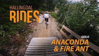
Norsk (English below): Anakonda – en leken flytsti med litt mer trøkk! Heisbasert: Ja Anakonda er en maskinbygd flytsti som starter rett frem når du går av heisen i Geilo Bike Park. Stien ble opprinnelig bygget i 2011 og oppgradert...
• 100 ★ 2.4 • 2 miles • 63 ft • 85 •
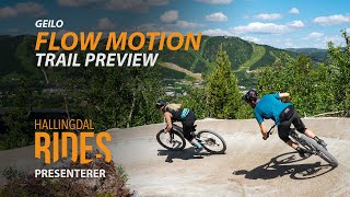
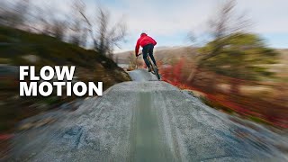
Norsk (English below): Flow Motion – 4 km med sykkelglede for hele familien! Heisbasert: Ja Flow Motion er en av Norges mest spektakulære flytstier. Den starter fra Bjødnahovda, på toppen av sommerheisen i Geilo Bike Park, og...
• 75 ★ 4.2 • 3,586 ft • 54 ft • 84 •
Norsk (English below): Gold Digger – en klassiker i Geilo Bike Park! Heisbasert: Ja Gold Digger er en maskinbygd flytsti som starter til venstre når du kommer opp med heisen i Geilo Bike Park. Stien byr på en spennende blanding av...
• 95 ★ 3.0 • 2,864 ft • 0 ft • 62 •
Norsk (English below): Beskrivelse: Fire Ant er en av de røde løypene i Geilo Bike Park, og byr på en mer teknisk utfordring enn den blå stien Flow Motion. Her får erfarne syklister mulighet til å teste ferdighetene sine på mer...
• 75 ★ 0.0 • 902 ft • 0 ft • 54 •
Norsk (English below): Beskrivelse: En bred og lettsyklet tursti som fungerer som hovedforbindelse mellom Vestlia Resort og både Ustedalsfjorden rundt (flerbrukssti) og Skurfen-stien. Stien går i begge retninger og er godt egnet for...
• 70 ★ 0.0 • 2,434 ft • 3 ft • 50 •
Norsk (English below): Fossekallen – en leken ferdighetssti for alle Avslutt rundturen rundt Ustedalsfjorden med et morsomt innslag i den håndbygde ferdighetsstien Fossekallen. Stien er laget med fokus på bærekraft, og er bygget...
• 75 ★ 4.5 • 2,142 ft • 13 ft • 50 •
Norsk (English below): Røyskatten – en leken runde for hele familien Røyskatten starter rett ved pumptracken i Vestlia Sykkelpark, og tar deg med på en kort og morsom runde gjennom skogen før du avslutter tilbake der du startet....
Geilo Mountain Bike Routes
50 miles • 5,203 ft • 3 • Point to Point •
Norsk (English below): Rallarvegen – en klassiker blant norske sykkelruter Med sin status som Norges...
• 13 miles • 2,803 ft • 17 •
• 3 miles • 114 ft • 1 •
• 29 miles • 9,796 ft • 54 •
Photos of Geilo Mountain Bike
Videos of Geilo Mountain Bike

Recent Trail Reports
| status | trail | date | condition | info | user |
|---|---|---|---|---|---|
| Skurfen | Aug 1, 2026 @ 2:54pm (Europe/Oslo) Aug 1, 2026 | Ideal | Maettu18 | ||
| Hakkespetten | Aug 1, 2026 @ 2:54pm (Europe/Oslo) Aug 1, 2026 | Ideal | Maettu18 | ||
| Moltekroken | Aug 1, 2026 @ 2:54pm (Europe/Oslo) Aug 1, 2026 | Ideal | Maettu18 | ||
| Skrukketrolllet | Aug 1, 2026 @ 2:54pm (Europe/Oslo) Aug 1, 2026 | Ideal | Maettu18 | ||
| Revesvingen | Aug 1, 2026 @ 2:54pm (Europe/Oslo) Aug 1, 2026 | Ideal | Maettu18 | ||
| Fossekallen | Aug 1, 2026 @ 2:54pm (Europe/Oslo) Aug 1, 2026 | Ideal | Maettu18 | ||
| Røyskatten | Aug 1, 2026 @ 2:54pm (Europe/Oslo) Aug 1, 2026 | Ideal | Maettu18 | ||
| Fire Ant | Aug 1, 2026 @ 2:54pm (Europe/Oslo) Aug 1, 2026 | Ideal | Maettu18 | ||
| Anaconda | Aug 1, 2026 @ 2:54pm (Europe/Oslo) Aug 1, 2026 | Ideal | Maettu18 | ||
| Flow Motion | Aug 1, 2026 @ 2:54pm (Europe/Oslo) Aug 1, 2026 | Ideal | Maettu18 |
Activity Feed
| username | action | type | title | date |
|---|---|---|---|---|
| Cykeljohan | add | trail | activity #105329950 and 1 more | Oct 6, 2026 @ 5:21am 2 hours |
| EgilZUvuAG | vote | trail | activity #105091885 | Oct 3, 2026 @ 3:46am Oct 3, 2026 |
| JoakimMLundberg | wishlist | trail | activity #103903093 and 2 more | Sep 16, 2026 @ 2:39am Sep 16, 2026 |
| JanWLJBhM | wishlist | region | activity #103004699 | Sep 3, 2026 @ 10:39pm Sep 3, 2026 |
| iPhilGood23 | wishlist | trail | activity #101456931 | Aug 14, 2026 @ 8:05am Aug 14, 2026 |
Recent Comments
| username | type | title | comment | date |
|---|---|---|---|---|
| trail | Perfect conditions ???????? :) | Aug 1, 2019 @ 12:19pm Aug 1, 2019 | ||
| trail | A great trail, loads of fast berms, a good... | Aug 30, 2018 @ 9:22am Aug 30, 2018 | ||
| trail | You can rent a bicycle at the Finse train... | May 24, 2018 @ 7:21pm May 24, 2018 |
Local Badges
-

Epic Ride Climb 2k136 awarded -

Climbing 10k Badge18 awarded -

Climbing 100k Badge0 awarded -

Epic Ride Descent 2k171 awarded -

Descent 10k Badge19 awarded -

Descent 100k Badge0 awarded
Bike & Skill Parks
| name | type | city | rating |
|---|---|---|---|
| Geilo Bike Park | bike park | Geilo | |
| Vestlia Sykkelpark | skill park | Geilo | |
| Geilo Pump Track | skill park | Geilo | |
| Pump track & Dirt jumps | skill park | Geilo |

Activity Type Stats
| activitytype | trails | distance | descent | descent distance | total vertical | rating | global rank | state rank | photos | reports | routes | activity logs |
|---|---|---|---|---|---|---|---|---|---|---|---|---|
| Mountain Bike | 35 | 70 miles | 13,346 ft | 32 miles | 1,890 ft | #1,490 | #18 | 71 | 100 | 1 | 1,616 | |
| E-Bike | 26 | 65 miles | 12,375 ft | 30 miles | 1,860 ft | #743 | #16 | 75 | 1 | 250 | ||
| Gravel Bike | 19 | 63 miles | 10,627 ft | 28 miles | 1,890 ft | #3,829 | #6 | 10 | 1 | 24 | ||
| Adaptive Bike | 8 | 31 miles | 3,799 ft | 13 miles | 1,860 ft | #3,838 | #13 | 9 | ||||
| Winter Fat Bike | 15 | 8 miles | 2,349 ft | 4 miles | 955 ft | #3,829 | #16 | 16 | ||||
| Hike | 20 | 65 miles | 11,240 ft | 29 miles | 1,890 ft | #1,329 | #16 | 88 | 702 | |||
| Trail Running | 20 | 65 miles | 11,240 ft | 29 miles | 1,890 ft | #971 | #14 | 88 | 83 | |||
| Backcountry Ski | 3 | 4 miles | 663 ft | 4 miles | 919 ft | 1 | 223 | |||||
| Nordic Ski | 25 | 45 miles | 3,694 ft | 16 miles | 1,824 ft | #71 | #7 | 1 | 1,142 |
Frequently Asked Questions
▼
What are the best places to ride in Geilo?
Geilo has 5 areas to explore for mountain biking. The top rated areas are:
▼
What are the highest rated mountain biking trails in Geilo?
The highest rated mountain biking trails in Geilo are:
- Anaconda (4.2/5)
- Revesvingen (4.1/5)
- Gold Digger (4.1/5)
- Skurfen (4/5)
- Røyskatten (4/5)
▼
What is the best time of the year to ride in Geilo?
Based on activity log data, the most popular months to ride in Geilo are:
- July (43 activities)
- August (35 activities)
- September (16 activities)
▼
Where can I park to ride in Geilo?
There are 2 parking locations listed in Geilo. The most popular parking spots are:
▼
What is the longest trail in Geilo?
The longest trail in Geilo is Rundt Ustedalsfjorden at 5.8 miles. View all trails sorted by distance.
▼
What are the best & highest rated hiking trails in Geilo?
The best hiking trails in Geilo are: View all hiking trails sorted by popularity score.
▼
What are the best & highest rated trail running trails in Geilo?
The best trail running trails in Geilo are: View all trail running trails sorted by popularity score.
▼
How many trails are in Geilo?
Geilo has a total of 49 trails. Of those, 33 are designated for mountain biking. Browse top mountain biking trails in Geilo to find detailed information including difficulty ratings, distances, and trail conditions.
▼
Which trail has the most elevation gain in Geilo?
The trail with the most elevation gain in Geilo is Rundt Ustedalsfjorden with 307 ft of elevation gain. View all trails sorted by elevation gain.
▼
Which trail has the most elevation descent in Geilo?
The trail with the most elevation descent in Geilo is Flow Motion with 899 ft of elevation descent. View all trails sorted by elevation descent.
▼
What activities are most popular in Geilo?
Geilo supports the following activities: Mountain Biking, Hiking, Trail Running, Nordic Skiing.
▼
What bike services are there in Geilo?
The following bike services are available in Geilo:
- Trail Builders (1)
▼
What are the steepest mountain biking trails in Geilo?
The steepest mountain biking trail in Geilo is Moltekroken with an average grade of 0.9%. View all trails sorted by grade.
▼
Are the trails open in Geilo?
The overall region status for Geilo is Clear / Green. Out of 20 trails:
- Clear / Green: 20
▼
Can I ride an ebike in Geilo?
There are 25 trails in Geilo that allow e-bikes. Check the e-bike trails listing for specific trail access details and any local regulations.
▼
What are the most popular mountain biking routes in Geilo?
The most popular mountain biking routes in Geilo are: View all mountain biking routes in Geilo.
▼
What type of bike is most common in Geilo?
Based on activity log data, the most common bike types used in Geilo are:
- RD (3 activities)
- AM (1 activities)
▼
What is the highest summit in Geilo?
The highest summit in Geilo is Folarskardnuten at 6,296 ft elevation.
▼
What are the most popular Strava Segments in Geilo?
The most popular Strava segments in Geilo are:
- Reinungabakken opp (11,116 athletes)
- Myrdal Descent (11,081 athletes)
- Fv300 800 Climb (11,036 athletes)
▼
What are the most popular mountain biking trails in Geilo?
The most popular mountain biking trails in Geilo are: View all mountain biking trails sorted by popularity.
▼
What are the best beginner ride trails in Geilo?
The best beginner mountain biking trails in Geilo are:
- Harestien (0/5)
- Fossekallen (0/5)
- Rundt Ustedalsfjorden (0/5)
Activities
Trails
Points of Interest
- By brenthillier
 NSMBA TRAILFORKS & contributors
 - Admins: apply
- #7691 - 9,317 views
- geilo activity log | embed map of Geilo mountain bike trails | geilo mountain biking points of interest
Downloading of trail gps tracks in kml & gpx formats is enabled for Geilo.
You must login to download files.
