
close
3D
Trail Conditions
- Unknown
- Snow Groomed
- Snow Packed
- Snow Covered
- Snow Cover Partial
- Freeze/thaw Cycle
- Icy
- Prevalent Mud
- Wet
- Variable
- Ideal
- Dry
- Very Dry
Trail Flow (Ridden Direction)
Trailforks scans users activity logs to determine the most popular direction each trail is ridden. A good flowing trail network will have most trails flowing in a single direction according to their intension.
The colour categories are based on what percentage of users are riding a trail in its intended direction.
The colour categories are based on what percentage of users are riding a trail in its intended direction.
- > 96%
- > 90%
- > 80%
- > 70%
- > 50%
- < 50%
- bi-directional trail
- no data
Trail Last Used
Trailforks scans activity logs to determine the last time a trail was ridden.
- < 2 days
- < 1 week
- < 2 weeks
- < 1 month
- < 6 months
- > 6 months
Trail Ridden Direction
The intended direction a trail should be ridden.
- Downhill Only
- Downhill Primary
- Both Directions
- Uphill Primary
- Uphill Only
- One Direction
Contribute Details
Colors indicate trail is missing specified detail.
- Description
- Photos
- Description & Photos
- Videos
Trail Popularity ?
Trailforks scans activity logs to determine which trails are ridden the most in the last 9 months.
Trails are compared with nearby trails in the same city region with a possible 25 colour shades.
Think of this as a heatmap, more activities = more kinetic energy = warmer colors.
- most popular
- popular
- less popular
- not popular
ATV/ORV/OHV Filter
Max Vehicle Width
inches
US Cell Coverage
Legend

Radar Time
Activity Recordings
Trailforks uses anonymized public activity data.
?
Activity Recordings
Trailforks uses anonymized public activity data.
?
Winter Trails
Warning
A routing network for winter maps does not exist. Selecting trails using the winter trails layer has been disabled.
Missing Trails
Most Popular
Least Popular
Trails are colored based on popularity. The more popular a trail is, the more red. Less popular trails trend towards green.
Jump Magnitude Heatmap
Heatmap of where users jump on trails. Zoom in to see individual jumps, click circles to view jump details.
BC Backroad Status
![map legend]()
Service Road Atlas is a free to use, community-driven service for viewing and creating reports on the numerous back-country service roads around B.C. and Alberta.

Slope Aspect
Direction the slope faces
Trails Deemphasized
Trails are shown in grey.
Only show trails with no bike usage.
Suggested Layers
Based on selected activity type
Save the current map location and zoom level as your default home location whenever this page is loaded.
SaveA true hidden gem. Ghost lake is full of rowdy rock tech and old school flow. If you like figuring out your way thru rough rooty and rock problems this is the trail system for you. There are a couple of descents on Ghost Hollow Loop II, Root-A-Begga, Ferguson Trail that bring you to the Northshore with large moss-covered slabs.
Primary Trail Type: Cross-Country
 google parking directions plan a road trip here
Trail info last updated
Activities Click to view
- Mountain Bike
14 trails
- Hike
14 trails
- Trail Running
14 trails
Region Details
- 3
- 2
- 4
- 5
Region Status
Caution as of Aug 9, 2026Stats
- Avg Trail Rating
- Trails (view details)
- 14
- Trails Mountain Bike
- 14
- Trails Gravel Bike
- 4
- Trails Adaptive Bike
- 4
- Trails Winter Fat Bike
- 13
- Trails Hike
- 14
- Trails Trail Running
- 14
- Total Distance
- 15 miles
- Total Descent
- 1,223 ft
- Total Vertical
- 144 ft
- Highest Trailhead
- 1,453 ft
- Reports
- 45
- Photos
- 54
- Completed Counter
- 669
Popular Ghost Lake Mountain Biking Trails
• 85 ★ 3.5 • 1 mile • 30 ft • 66 •
A unique Mavis lakeshore romp with plenty to offer intermediate riders. Lakeside single track gives way to old doubletrack.
• 100 ★ 4.0 • 1 mile • 86 ft • 63 •
Beginning at the end of Ferguson Trail, this reversible loop offers some scenic and elevated lakeshore terrain and fast flowy downhill on the inside.
• 90 ★ 4.8 • 2 miles • 223 ft • 61 •
Developed over the summer of 2012 with the help of the Ontario Junior Rangers, The Hill Billy Trail utilizes similar terrain to nearby Rollercoaster.
• 40 ★ 4.4 • 1 mile • 52 ft • 58 •
A popular trail to hone basic mountain bike skills, without straying too far from the car. The Boneyard winds through mature jack pine forests on flatter terrain that is suitable for all skill levels. Pairs nicely with Starlight
• 60 ★ 4.3 • 1 mile • 192 ft • 52 •
This is gnome country. Navigate the elevated ridge separating Ghost and Mavis Lakes. Strenuous and technical, ride within your ability you are a long way out.
• 70 ★ 4.2 • 1 mile • 161 ft • 50 •
The crown jewel of the Ghost/Mavis Trail System, The Ferguson Trail is Canadian Shield riding at its best. Technically demanding great fun in unique terrain. A must do in any season!
• 50 ★ 4.8 • 4,061 ft • 88 ft • 45 •
Built in the reforested area, Rollercoaster takes advantage of some of the area's highest terrain. A moderately strenuous climb rewards intermediate bikers with a great view and a plunging, twisting descent through banked corners to the...
Photos of Ghost Lake Mountain Bike
Videos of Ghost Lake Mountain Bike
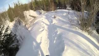
mtb
990 |
Mar 6, 2016
Recent Trail Reports
| status | trail | date | condition | info | user |
|---|---|---|---|---|---|
| Ferguson Backside | Aug 9, 2026 @ 3:42pm (America/Winnipeg) Aug 9, 2026 | Ideal | trailrunnerx | ||
| Access Rd | Aug 9, 2026 @ 3:42pm (America/Winnipeg) Aug 9, 2026 | Ideal | trailrunnerx | ||
| Ghost Hollow Loop 1 | Aug 9, 2026 @ 3:42pm (America/Winnipeg) Aug 9, 2026 | Ideal | trailrunnerx | ||
| Ferguson Trail | Aug 9, 2026 @ 3:42pm (America/Winnipeg) Aug 9, 2026 | Ideal | trailrunnerx | ||
| Ghost Hollow Loop 2 | Jul 31, 2026 @ 12:56pm (America/Winnipeg) Jul 31, 2026 | Variable | MarkWhiteside | ||
| Root-A-Bega | Aug 25, 2025 @ 8:45am Aug 25, 2025 | Ideal | Mattb3jsTy | ||
| Squirrel Nuts | Aug 25, 2025 @ 8:45am Aug 25, 2025 | Ideal | Mattb3jsTy | ||
| Starlight | Aug 6, 2024 @ 2:29pm Aug 6, 2024 | Unknown | reynardmauricio | ||
| Rollercoaster | Aug 6, 2024 @ 2:28pm Aug 6, 2024 | Ideal | reynardmauricio | ||
| The Boneyard | Aug 4, 2024 @ 9:46am Aug 4, 2024 | Ideal | bike4adventure |
Activity Feed
| username | action | type | title | date |
|---|---|---|---|---|
| alexstubbs | add | photo | activity #106340780 | Oct 21, 2026 @ 1:53pm Oct 21, 2026 |
| Lornop | add | photo | activity #103643950 | Sep 12, 2026 @ 12:04pm Sep 12, 2026 |
| Lornop | vote | trail | activity #103643728 | Sep 12, 2026 @ 12:01pm Sep 12, 2026 |
| trailrunnerx | add | report | activity #101130222 and 3 more | Aug 9, 2026 @ 6:47pm Aug 9, 2026 |
| MarkWhiteside | add | report | activity #100442126 | Jul 31, 2026 @ 3:27pm Jul 31, 2026 |
Recent Comments
| username | type | title | comment | date |
|---|---|---|---|---|
| report | I though this trail was closed for mining?? | Aug 25, 2025 @ 8:24pm Aug 25, 2025 | ||
| trail | Nice ride, tight and technical but not overly.... | Aug 28, 2021 @ 3:47pm Aug 28, 2021 | ||
| trail | Great ride with various terrain and a... | Aug 28, 2021 @ 3:43pm Aug 28, 2021 | ||
| trail | The baby heads can get you! Thought I could... | Aug 6, 2017 @ 2:04pm Aug 6, 2017 | ||
| trail | I really liked the flow here. Pick up the... | Aug 6, 2017 @ 2:02pm Aug 6, 2017 |
Nearby Areas
| name | distance | ||||
|---|---|---|---|---|---|
| Aaron Provincial Park | 4.3 km | ||||
| Dryden Ski Club | 7.1 km |
Activity Type Stats
| activitytype | trails | distance | descent | descent distance | total vertical | rating | global rank | state rank | photos | reports | routes | activity logs |
|---|---|---|---|---|---|---|---|---|---|---|---|---|
| Mountain Bike | 14 | 15 miles | 1,224 ft | 5 miles | 144 ft | #6,861 | #134 | 47 | 45 | 466 | ||
| Gravel Bike | 4 | 3 miles | 89 ft | 5,262 ft | 138 ft | #2,713 | #62 | 2 | ||||
| Adaptive Bike | 4 | 3 miles | 89 ft | 5,262 ft | 138 ft | #2,721 | #62 | 2 | ||||
| Winter Fat Bike | 13 | 15 miles | 1,214 ft | 5 miles | 144 ft | #2,713 | #62 | 40 | ||||
| Hike | 14 | 15 miles | 1,224 ft | 5 miles | 144 ft | #11,177 | #236 | 7 | 45 | 18 | ||
| Trail Running | 14 | 15 miles | 1,224 ft | 5 miles | 144 ft | #10,284 | #184 | 45 | 6 |
Frequently Asked Questions
▼
What are the highest rated mountain biking trails in Ghost Lake?
The highest rated mountain biking trails in Ghost Lake are:
- Rollercoaster (4.4/5)
- Hill Billy Trail (4.2/5)
- Ferguson Backside (4.2/5)
- The Boneyard (4.2/5)
- Ghost Hollow Loop 2 (4.1/5)
▼
Where can I park to ride in Ghost Lake?
There are 1 parking locations listed in Ghost Lake. The most popular parking spots are:
▼
What is the longest trail in Ghost Lake?
The longest trail in Ghost Lake is Hill Billy Trail at 2.4 miles. View all trails sorted by distance.
▼
How many trails are in Ghost Lake?
Ghost Lake has a total of 14 trails. Browse top mountain biking trails in Ghost Lake to find detailed information including difficulty ratings, distances, and trail conditions.
▼
Which trail has the most elevation gain in Ghost Lake?
The trail with the most elevation gain in Ghost Lake is Root-A-Bega with 223 ft of elevation gain. View all trails sorted by elevation gain.
▼
Which trail has the most elevation descent in Ghost Lake?
The trail with the most elevation descent in Ghost Lake is Root-A-Bega with 215 ft of elevation descent. View all trails sorted by elevation descent.
▼
What activities are most popular in Ghost Lake?
Ghost Lake supports the following activities: Mountain Biking, Hiking, Trail Running.
▼
What are the steepest mountain biking trails in Ghost Lake?
The steepest mountain biking trail in Ghost Lake is Ferguson Backside with an average grade of 1.7%. View all trails sorted by grade.
▼
Are the trails open in Ghost Lake?
The overall region status for Ghost Lake is Minor Issue / Yellow. Out of 11 trails:
- Clear / Green: 7
- Minor Issue / Yellow: 3
- Significant Issue / Amber: 1
▼
What are the most popular Strava Segments in Ghost Lake?
The most popular Strava segments in Ghost Lake are:
- Hillbilly FWD (100 athletes)
- Half of Coaster (Turnoff from Hillbilly) (89 athletes)
- Squirrel Nuts 2 the car (77 athletes)
▼
What are the most popular mountain biking trails in Ghost Lake?
The most popular mountain biking trails in Ghost Lake are: View all mountain biking trails sorted by popularity.
▼
What are the best beginner ride trails in Ghost Lake?
The best beginner mountain biking trails in Ghost Lake are:
- The Boneyard (4.4/5)
- Old Doubletrack (4/5)
- By markholloway
 Trailforks Map Team & contributors
- Admins: Kenora
- #10743 - 8,863 views
- ghost lake activity log | embed map of Ghost Lake mountain bike trails | ghost lake mountain biking points of interest
Downloading of trail gps tracks in kml & gpx formats is enabled for Ghost Lake.
You must login to download files.
