close
-
Layers w
- Weather Layers
- Pro
- Pro
- Pro
- Pro
- Pro
- Pro
- More Layers
- Pro
- Pro
- Pro
- Pro
-
Upgrade to

3D
Trail Conditions
- Unknown
- Snow Groomed
- Snow Packed
- Snow Covered
- Snow Cover Partial
- Freeze/thaw Cycle
- Icy
- Prevalent Mud
- Wet
- Variable
- Ideal
- Dry
- Very Dry
Trail Flow (Ridden Direction)
Trailforks scans users ridelogs to determine the most popular direction each trail is ridden. A good flowing trail network will have most trails flowing in a single direction according to their intension.
The colour categories are based on what percentage of riders are riding a trail in its intended direction.
The colour categories are based on what percentage of riders are riding a trail in its intended direction.
- > 96%
- > 90%
- > 80%
- > 70%
- > 50%
- < 50%
- bi-directional trail
- no data
Trail Last Ridden
Trailforks scans ridelogs to determine the last time a trail was ridden.
- < 2 days
- < 1 week
- < 2 weeks
- < 1 month
- < 6 months
- > 6 months
Trail Ridden Direction
The intended direction a trail should be ridden.
- Downhill Only
- Downhill Primary
- Both Directions
- Uphill Primary
- Uphill Only
- One Direction
Contribute Details
Colors indicate trail is missing specified detail.
- Description
- Photos
- Description & Photos
- Videos
Trail Popularity ?
Trailforks scans ridelogs to determine which trails are ridden the most in the last 9 months.
Trails are compared with nearby trails in the same city region with a possible 25 colour shades.
Think of this as a heatmap, more rides = more kinetic energy = warmer colors.
- most popular
- popular
- less popular
- not popular
ATV/ORV/OHV Filter
Max Vehicle Width
inches
US Cell Coverage
Legend

Radar Time
Activity Recordings
Trailforks uses anonymized public activity data.
?
Activity Recordings
Trailforks uses anonymized public activity data.
?
Personal Heatmap
▶
Activity Types
all
/
none
▶
Options
2
Date range
month
–
Winter Trails
Warning
A routing network for winter maps does not exist. Selecting trails using the winter trails layer has been disabled.
Missing Trails
Most Popular
Least Popular
Trails are colored based on popularity. The more popular a trail is, the more red. Less popular trails trend towards green.
Jump Magnitude Heatmap
Heatmap of where riders jump on trails. Zoom in to see individual jumps, click circles to view jump details.
BC Backroad Status
![map legend]()
Service Road Atlas is a free to use, community-driven service for viewing and creating reports on the numerous back-country service roads around B.C. and Alberta.

Slope Aspect
Direction the slope faces
Trails Deemphasized
Trails are shown in grey.
Only show trails with no bike usage.
Suggested Layers
Based on selected activity type
Save the current map location and zoom level as your default home location whenever this page is loaded.
Save
No description for Goodyear has been added yet!
Login or register to submit one.
Activities Click to view
- Mountain Bike
152 trails
- E-Bike
61 trails
- Gravel Bike
0 trails
- Adaptive Bike
0 trails
- Winter Fat Bike
0 trails
- Hike
153 trails
- Trail Running
153 trails
- ATV/ORV/OHV
6 trails
Region Details
- 15
- 3
- 37
- 64
- 23
- 4
Region Status
Open as of May 23, 2026Local Trail Association
Stats
- Avg Trail Rating
- Trails (view details)
- 150
- Trails Mountain Bike
- 153
- Trails E-Bike
- 61
- Trails Horse
- 3
- Trails Hike
- 153
- Trails Trail Running
- 153
- Trails ATV/ORV/OHV
- 6
- Total Distance
- 168 miles
- Total Descent
- 17,893 ft
- Total Vertical
- 3,166 ft
- Highest Trailhead
- 4,018 ft
- Reports
- 1,616
- Photos
- 835
- Ridden Counter
- 38,719
Sub Regions
-
Estrella Mountain Regional Park
- 4
- 15
- 1
-
Fantasy Island North Singletrack
- 5
- 25
- 6
- 2
-
Lucero
- 2
- 12
- 2
- 3
- 1
-
Pirate Trails
- 4
- 16
- 10
- 1
Popular Goodyear Mountain Biking Trails
• 90 ★ 4.8 • 1,460 ft • 4 ft • 1,101 •
A short, but fast and fun downhill with several bridges, banked, sculpted turns, and easy jumps. Several places allow rider to take a larger jump or bypass if your a beginner.
• 90 ★ 3.6 • 2,492 ft • 102 ft • 943 •
Joey's Jaunt is mostly used to ride to the top of Kimurel's Hurl and Harv's Howl, which are downhill only and have berms, bridges, and small jumps. While a bit more moderate than , Joey's Jaunt is faster and better quality. This is the...
• 90 ★ 3.3 • 2,822 ft • 6 ft • 817 •
Popular blue difficulty singletrack. This mountain bike primary trail can be used both directions and has a moderate overall physical rating with a 6 ft green climb. On average it takes 4 minutes to complete this trail.
• 90 ★ 3.9 • 3,148 ft • 92 ft • 764 •
Popular blue difficulty singletrack. This mountain bike primary trail can be used both directions. On average it takes 7 minutes to complete this trail.
• 100 ★ 3.7 • 1,401 ft • 5 ft • 720 •
Popular blue difficulty singletrack. This mountain bike primary trail can be used both directions. On average it takes 1 minutes to complete this trail.
• 70 ★ 3.9 • 2,783 ft • 31 ft • 713 •
Popular blue difficulty singletrack. This mountain bike primary trail can be used downhill primary. On average it takes 7 minutes to complete this trail.
• 75 ★ 4.2 • 1 mile • 103 ft • 658 •
A pleasant, but slightly longer way to reach the other rides in the park. Starts by the area and ends at the trail crossing or start for Kimurel's Hurl and others.
• 100 ★ 4.0 • 2,608 ft • 80 ft • 614 •
Highly rated popular blue difficulty singletrack. This mountain bike primary trail can be used both directions and has a moderate overall physical rating with a 80 ft blue climb. On average it takes 4 minutes to complete this trail.
Goodyear Mountain Bike Routes
★ 5.0 • 3 miles • 274 ft • 1 • Loop •
This is a great little XC loop with a little bit of everything. It starts out very chill and green,...
★ 4.2 • 5 miles • 500 ft • 10 • Loop •
Draw a scorpion on your ride! This loop has a nice mix of climbing (some a bit technical) and downhill.
★ 2.0 • 8 miles • 765 ft • 16 • Loop •
This is a great loop at FINS that hits all the best trails. If you want to make it harder or do a longer...
15 miles • 1,448 ft • 2 • Loop •
This blue route loop is a fun one. You get a lot of tricky climbs, fast flats and some fun downhill...
16 miles • 1,387 ft • 5 • Loop •
This blue route loop is a fun one. You get a lot of tricky climbs, fast flats and some fun downhill...
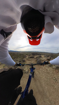
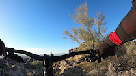
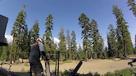
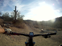
Photos of Goodyear Mountain Bike
Videos of Goodyear Mountain Bike

trail: Northstar
2:15 |
22 |
Feb 7, 2024

trail: Northstar
2:15 |
3 |
Feb 7, 2024
trail: Northstar
2:15 |
4 |
Feb 7, 2024
trail: Blackjack
4:56 |
|
Mar 12, 2023

trail: Blackjack
8:36 |
186 |
Apr 23, 2021

trail: Desert Rose
6:00 |
54 |
Feb 11, 2021
trail: Northstar
10:00 |
159 |
Aug 27, 2017
trail: Saddle
3:01 |
60 |
Jun 6, 2016
Recent Trail Reports
| status | trail | date | condition | info | user |
|---|---|---|---|---|---|
| Coyote | Jun 12, 2026 @ 2:18pm (America/Phoenix) Jun 12, 2026 | Dry | TerryZechman | ||
| Pedersen | May 11, 2026 @ 11:00am (America/Phoenix) May 11, 2026 | Very Dry | TerryZechman | ||
| Quail | May 9, 2026 @ 6:53am (America/Phoenix) May 9, 2026 | Dry | rhartman67 | ||
| Rainbow Valley | May 9, 2026 @ 6:53am (America/Phoenix) May 9, 2026 | Dry | rhartman67 | ||
| Coldwater | May 9, 2026 @ 6:53am (America/Phoenix) May 9, 2026 | Very Dry | rhartman67 | ||
| Butterfield | May 9, 2026 @ 6:53am (America/Phoenix) May 9, 2026 | Dry | rhartman67 | ||
| Flycatcher | May 9, 2026 @ 6:53am (America/Phoenix) May 9, 2026 | Dry | rhartman67 | ||
| Butterfield | May 9, 2026 @ 6:53am (America/Phoenix) May 9, 2026 | Dry | rhartman67 | ||
| Rainbow-Coldwater-Butterfield Connector | May 9, 2026 @ 6:53am (America/Phoenix) May 9, 2026 | Prevalent Mud | rhartman67 | ||
| Desert Rose | Apr 21, 2026 @ 9:17am (America/Phoenix) Apr 21, 2026 | Dry | jhobson |
Activity Feed
| username | action | type | title | date |
|---|---|---|---|---|
| SprungShoulders | wishlist | badge | activity #97523629 | Jun 21, 2026 @ 3:02pm 1 day |
| TerryZechman | add | report | activity #96827672 | Jun 12, 2026 @ 2:19pm Jun 12, 2026 |
| SBtk6J | wishlist | region | activity #96526321 | Jun 8, 2026 @ 1:34am Jun 8, 2026 |
| SBtk6J | wishlist | region | activity #96526320 | Jun 8, 2026 @ 1:33am Jun 8, 2026 |
| SBtk6J | wishlist | region | activity #96526319 | Jun 8, 2026 @ 1:33am Jun 8, 2026 |
Recent Comments
| username | type | title | comment | date |
|---|---|---|---|---|
| trail | Legendary trail but avoid when wet, the wood... | Apr 30, 2026 @ 12:55pm Apr 30, 2026 | ||
| trail | This is the best entry level trail in the... | Jan 7, 2026 @ 9:39pm Jan 7, 2026 | ||
| trail | Not a Blue. Unchallenging Green trail on... | Dec 28, 2025 @ 5:28pm Dec 28, 2025 | ||
| trail | After the fall rains, this trail is worse than... | Dec 28, 2025 @ 3:35pm Dec 28, 2025 | ||
| trail | Skip it. | Dec 28, 2025 @ 3:29pm Dec 28, 2025 |
Local Badges
-

Completionist7 awarded -

Big Ride 30k4,176 awarded -

Epic Ride 50k1,712 awarded -

Top 10 Trails10 awarded -
Completionist0 awarded -
Completionist0 awarded
Bike & Skill Parks
| name | type | city | rating |
|---|---|---|---|
| Estrella Foothills Bike Park | skill park | Goodyear | |
| AZ Protrac | skill park | Goodyear |
Activity Type Stats
| activitytype | trails | distance | descent | descent distance | total vertical | rating | global rank | state rank | photos | reports | routes | ridelogs |
|---|---|---|---|---|---|---|---|---|---|---|---|---|
| Mountain Bike | 152 | 165 miles | 15,243 ft | 62 miles | 771 ft | #378 | #137 | 806 | 1,619 | 19 | 38,744 | |
| E-Bike | 61 | 78 miles | 6,020 ft | 31 miles | 591 ft | #2,069 | #930 | 1 | 1,435 | 2 | 1,025 | |
| Horse | 3 | 7 miles | 318 ft | 2 miles | 495 ft | 288 | 4 | |||||
| Hike | 153 | 164 miles | 17,644 ft | 64 miles | 3,166 ft | #412 | #191 | 30 | 1,574 | 1 | 2,986 | |
| Trail Running | 153 | 164 miles | 17,644 ft | 64 miles | 3,166 ft | #834 | #315 | 9 | 1,572 | 2 | 1,560 | |
| ATV/ORV/OHV | 6 | #830 | #373 | 283 | 4 |
Frequently Asked Questions About Goodyear
▼
What are the best places to ride in Goodyear?
Goodyear has 4 areas to explore for mountain biking. The top rated areas are:
▼
What are the highest rated mountain biking trails in Goodyear?
The highest rated mountain biking trails in Goodyear are:
- Kimurel`s Hurl (4.6/5)
- Blackjack (4.4/5)
- Northstar (4.3/5)
- Copper State Cross Cut (4.2/5)
- Queen Anne's Revenge (4.2/5)
▼
What is the best time of the year to ride in Goodyear?
Based on ride log data, the most popular months to ride in Goodyear are:
- March (396 activities)
- February (385 activities)
- April (368 activities)
▼
Where can I park to ride in Goodyear?
There are 13 parking locations listed in Goodyear. The most popular parking spots are: View all parking and trailhead locations on the map to plan your visit.
Activities
Trails
- By schillingsworth
 TRAILFORKS HTA & contributors
 - Admins: AZT, chainslapAZ, schillingsworth, jeffgicklhorn, jpmcghee, msmcfate, cemoorelife, Schwinnshralper26, WVTA, EMRHOA
- #6209 - 11,613 views
- goodyear activity log | embed map of Goodyear mountain bike trails | goodyear mountain biking points of interest
Downloading of trail gps tracks in kml & gpx formats is enabled for Goodyear.
You must login to download files.