close
-
Layers w
- Weather Layers
- Pro
- Pro
- Pro
- Pro
- Pro
- Pro
- More Layers
- Pro
- Pro
- Pro
- Pro
-
Upgrade to

3D
Trail Conditions
- Unknown
- Snow Groomed
- Snow Packed
- Snow Covered
- Snow Cover Partial
- Freeze/thaw Cycle
- Icy
- Prevalent Mud
- Wet
- Variable
- Ideal
- Dry
- Very Dry
Trail Flow (Ridden Direction)
Trailforks scans users ridelogs to determine the most popular direction each trail is ridden. A good flowing trail network will have most trails flowing in a single direction according to their intension.
The colour categories are based on what percentage of riders are riding a trail in its intended direction.
The colour categories are based on what percentage of riders are riding a trail in its intended direction.
- > 96%
- > 90%
- > 80%
- > 70%
- > 50%
- < 50%
- bi-directional trail
- no data
Trail Last Ridden
Trailforks scans ridelogs to determine the last time a trail was ridden.
- < 2 days
- < 1 week
- < 2 weeks
- < 1 month
- < 6 months
- > 6 months
Trail Ridden Direction
The intended direction a trail should be ridden.
- Downhill Only
- Downhill Primary
- Both Directions
- Uphill Primary
- Uphill Only
- One Direction
Contribute Details
Colors indicate trail is missing specified detail.
- Description
- Photos
- Description & Photos
- Videos
Trail Popularity ?
Trailforks scans ridelogs to determine which trails are ridden the most in the last 9 months.
Trails are compared with nearby trails in the same city region with a possible 25 colour shades.
Think of this as a heatmap, more rides = more kinetic energy = warmer colors.
- most popular
- popular
- less popular
- not popular
ATV/ORV/OHV Filter
Max Vehicle Width
inches
US Cell Coverage
Legend

Radar Time
Activity Recordings
Trailforks uses anonymized public activity data.
?
Activity Recordings
Trailforks uses anonymized public activity data.
?
Personal Heatmap
▶
Activity Types
all
/
none
▶
Options
2
Date range
month
–
Winter Trails
Warning
A routing network for winter maps does not exist. Selecting trails using the winter trails layer has been disabled.
Missing Trails
Most Popular
Least Popular
Trails are colored based on popularity. The more popular a trail is, the more red. Less popular trails trend towards green.
Jump Magnitude Heatmap
Heatmap of where riders jump on trails. Zoom in to see individual jumps, click circles to view jump details.
BC Backroad Status
![map legend]()
Service Road Atlas is a free to use, community-driven service for viewing and creating reports on the numerous back-country service roads around B.C. and Alberta.

Slope Aspect
Direction the slope faces
Trails Deemphasized
Trails are shown in grey.
Only show trails with no bike usage.
Suggested Layers
Based on selected activity type
Save the current map location and zoom level as your default home location whenever this page is loaded.
Save
No description for Hailey has been added yet!
Login or register to submit one.
Links
Activities Click to view
- Mountain Bike
93 trails
- E-Bike
61 trails
- Gravel Bike
9 trails
- Adaptive Bike
1 trails
- Winter Fat Bike
0 trails
- Horse
70 trails
- Hike
87 trails
- Trail Running
87 trails
- Dirtbike/Moto
52 trails
- Observed Trials
4 trails
- ATV/ORV/OHV
15 trails
- Downhill Ski
9 trails
- Backcountry Ski
7 trails
- Nordic Ski
10 trails
Region Details
- 22
- 18
- 30
- 19
- 3
Region Status
Caution as of 18 hoursStats
- Avg Trail Rating
- Trails (view details)
- 117
- Trails Mountain Bike
- 93
- Trails E-Bike
- 61
- Trails Gravel Bike
- 9
- Trails Adaptive Bike
- 1
- Trails Horse
- 70
- Trails Hike
- 87
- Trails Trail Running
- 87
- Trails Dirtbike/Moto
- 52
- Trails Observed Trials
- 4
- Trails ATV/ORV/OHV
- 15
- Trails Snowmobile
- 1
- Trails Snowshoe
- 3
- Trails Downhill Ski
- 9
- Trails Backcountry Ski
- 7
- Trails Nordic Ski
- 10
- Total Distance
- 354 miles
- Total Descent
- 55,618 ft
- Total Vertical
- 4,851 ft
- Highest Trailhead
- 9,690 ft
- Reports
- 970
- Photos
- 346
- Ridden Counter
- 8,764
Sub Regions
-
Croy Creek
- 2
- 8
-
Deer Creek
- 2
- 6
- 1
-
Gray's Peak
- 4
-
Greenhorn
- 4
- 5
-
Little Wood
- 7
-
Old Cutters
- 1
-
Patterson Peak
-
Quigley Canyon
- 2
- 6
- 2
-
Rock Creek
- 2
-
Willow Creek
- 1
- 1
- 3
Popular Hailey Mountain Biking Trails
• 90 ★ 3.8 • 4 miles • 369 ft • 688 •
Popular blue difficulty singletrack. This multi-use trail can be used both directions. On average it takes 21 minutes to complete this trail.
• 95 ★ 3.0 • 5,217 ft • 217 ft • 398 •
Popular blue difficulty singletrack. This multi-use trail can be used both directions and has a moderate overall physical rating with a 217 ft blue climb. On average it takes 11 minutes to complete this trail.
• 90 ★ 5.0 • 6 miles • 1,747 ft • 397 •
The trail climbs steadily through rolling terrain along the north side of the Deer Creek divide. It is a great hike or ride in either direction with excellent views of the Pioneer Mountains. Give some extra time to dry in the springtime...
• 90 ★ 3.5 • 3 miles • 619 ft • 384 •
Popular blue difficulty singletrack. This multi-use trail can be used both directions. On average it takes 32 minutes to complete this trail.
• 80 ★ 4.3 • 6 miles • 776 ft • 349 •
A beautiful roll through the hillside. Plenty of buttery smooth single track with some dips, dives and tight switchbacks to keep you on the gas and having fun.
• 95 ★ 3.0 • 3,960 ft • 194 ft • 349 •
Popular blue difficulty singletrack. This mountain bike primary trail can be used both directions and has a moderate overall physical rating with a 194 ft blue climb. On average it takes 8 minutes to complete this trail.
Hailey Mountain Bike Routes
★ 4.5 • 21 miles • 4,350 ft • 4 • Loop •
Good linkup with good descents that you have to earn
★ 4.0 • 24 miles • 4,827 ft • 4 • Loop •
Linkup of 2 classic loops. A stepping stone to the Triple Sacrifice
★ 5.0 • 3 miles • 531 ft • 6 •
Smaller loop than Bullion. Good climb and flowy downhill
10 miles • 1,613 ft • 4 • Loop •
Fun Route Close to Hailey! Good amount of up hill to make the killer down hill sections feel like you...
★ 2.0 • 16 miles • 3,091 ft • 3 • Loop •
This route extends the milage and climbing of the shorter and common 'Greenhorn - Imperial loop' utilizing...
5 miles • 679 ft • 3 •
Planning on hitting the big 10 miler Nicks Cagey Magic and get the top and think "I just can't make it any...
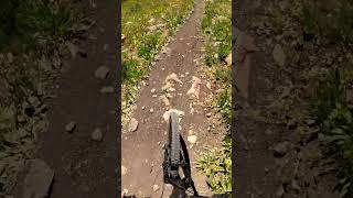
Photos of Hailey Mountain Bike
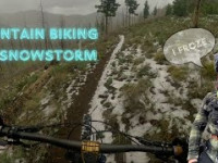
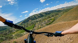
Videos of Hailey Mountain Bike

0:59 |
104 |
Sep 2, 2021

trail: Greenhorn
4:36 |
340 |
Aug 5, 2015
trail: Porcupine
0:00 |
1649 |
Oct 22, 2014
trail: Imperial Gulch
0:37 |
87 |
Jul 23, 2025 , Hailey
trail: Mahoney
44 |
Jun 21, 2025 , Hailey

trail: Imperial Gulch
77 |
Jun 21, 2025 , Hailey
youtuber
![New Hailey, ID Trails! / Hang Loose, Golden...]()
trail: Hang Tight/Hang Loose
13:16 |
118 |
May 8, 2025 , Hailey
youtuber
![Loose Rocks are DANGEROUS!]()
trail: Howard's Trail
16:16 |
105 |
Jun 27, 2024 , Hailey
Current Trail Warnings
| status | trail | date | condition | user | info |
|---|---|---|---|---|---|
| Timber Draw | May 30, 2026 @ 11:13pm (America/Boise) May 30, 2026 | Snow Covered | tripledivide | Trail Running Several large snow coverage sections near... |
Recent Trail Reports
| status | trail | date | condition | info | user |
|---|---|---|---|---|---|
| Mahoney | Jun 22, 2026 @ 3:59pm (America/Boise) 18 hours | Dry | carrotroot | ||
| Lodgepole | Jun 22, 2026 @ 3:51pm (America/Boise) 18 hours | Dry | carrotroot | ||
| Greenhorn | Jun 19, 2026 @ 7:32pm (America/Boise) Jun 19, 2026 | Very Dry | ccmski | ||
| Nadya's Trail | Jun 11, 2026 @ 2:58pm (America/Boise) Jun 11, 2026 | Dry | Ckastner6 | ||
| Mahoney-Lodgepole Connector | Jun 12, 2026 @ 5:17pm (America/Boise) Jun 12, 2026 | Ideal | blainestrat | ||
| North Fork of Deer Creek | Jun 7, 2026 @ 8:17am (America/Boise) Jun 7, 2026 | Ideal | blainestrat | ||
| Middle Fork - South Fork | Jun 7, 2026 @ 8:10am (America/Boise) Jun 7, 2026 | Ideal | blainestrat | ||
| Federal Gulch | May 30, 2026 @ 10:53pm (America/Boise) May 30, 2026 | Wet | tripledivide | ||
| Porcupine | May 30, 2026 @ 10:40pm (America/Boise) May 30, 2026 | Wet | tripledivide | ||
| Fisher Canyon | May 30, 2026 @ 8:43pm (America/Boise) May 30, 2026 | Ideal | clarkcmac |
Activity Feed
| username | action | type | title | date |
|---|---|---|---|---|
| Randomhero83 | ridden | trail | activity #97598733 | Jun 22, 2026 @ 7:02pm 14 hours |
| ccmski | comment | report | activity #97589809 | Jun 22, 2026 @ 4:00pm 17 hours |
| ccmski | like | report | activity #97588551 and 1 more | Jun 22, 2026 @ 3:34pm 17 hours |
| carrotroot | add | photo | activity #97587713 and 1 more | Jun 22, 2026 @ 3:15pm 17 hours |
| carrotroot | add | report | activity #97586845 and 1 more | Jun 22, 2026 @ 2:58pm 18 hours |
Recent Comments
| username | type | title | comment | date |
|---|---|---|---|---|
| report | 😁 | Jun 22, 2026 @ 4:00pm 17 hours | ||
| report | I was just about to report this myself :) | Jun 20, 2026 @ 7:41am Jun 20, 2026 | ||
| report | Picture didn’t upload but location of tree... | Jun 19, 2026 @ 8:06pm Jun 19, 2026 | ||
| trail | Challenging ridgeline trail with numerous... | Jun 7, 2026 @ 7:14am Jun 7, 2026 | ||
| trail | Chunky but manageable to intersection with... | Jun 4, 2026 @ 4:14pm Jun 4, 2026 |
Local Badges
-

10 Blue Trails170 awarded -

Epic Ride Climb 2k17 awarded -

Climbing 10k Badge79 awarded -

Climbing 100k Badge4 awarded -

Epic Ride Descent 2k18 awarded -

Descent 10k Badge78 awarded
Bike & Skill Parks
| name | type | city | rating |
|---|---|---|---|
| BCRD Pump Track | skill park | Hailey |
Activity Type Stats
| activitytype | trails | distance | descent | descent distance | total vertical | rating | global rank | state rank | photos | reports | routes | ridelogs |
|---|---|---|---|---|---|---|---|---|---|---|---|---|
| Mountain Bike | 93 | 332 miles | 50,217 ft | 131 miles | 4,852 ft | #706 | #271 | 271 | 929 | 8 | 13,232 | |
| E-Bike | 61 | 232 miles | 30,787 ft | 86 miles | 3,671 ft | #579 | #732 | 5 | 766 | 3 | 1,236 | |
| Gravel Bike | 9 | 42 miles | 4,934 ft | 16 miles | 4,026 ft | #314 | #926 | 101 | 72 | |||
| Adaptive Bike | 1 | #549 | #1,849 | 9 | ||||||||
| Horse | 70 | 289 miles | 45,502 ft | 115 miles | 4,724 ft | #77 | #355 | 628 | 4 | |||
| Hike | 87 | 330 miles | 49,442 ft | 130 miles | 4,852 ft | #432 | #199 | 24 | 913 | 1 | 2,290 | |
| Trail Running | 87 | 330 miles | 49,442 ft | 130 miles | 4,852 ft | #322 | #126 | 45 | 913 | 3 | 800 | |
| Dirtbike/Moto | 52 | 213 miles | 30,013 ft | 81 miles | 3,599 ft | #100 | #62 | 4 | 414 | 3 | 144 | |
| Observed Trials | 4 | 32 miles | 4,304 ft | 10 miles | 3,327 ft | #139 | #24 | 59 | 17 | |||
| ATV/ORV/OHV | 15 | 80 miles | 8,281 ft | 27 miles | 3,599 ft | #389 | #118 | 169 | 3 | |||
| Snowmobile | 1 | 4 miles | 394 ft | 2 miles | 354 ft | 10 | 1 | |||||
| Snowshoe | 3 | 10 miles | 535 ft | 4 miles | 2,936 ft | 10 | 15 | |||||
| Downhill Ski | 9 | 2 miles | 1,257 ft | 2 miles | 374 ft | #652 | #306 | 24 | 33 | |||
| Backcountry Ski | 7 | 15 miles | 928 ft | 5 miles | 2,936 ft | #486 | #123 | 23 | 112 | |||
| Nordic Ski | 10 | 8 miles | 476 ft | 3 miles | 210 ft | #865 | #345 | 25 | 531 |
Frequently Asked Questions About Hailey
▼
What are the best places to ride in Hailey?
Hailey has 12 areas to explore for mountain biking. The top rated areas are:
▼
What are the highest rated mountain biking trails in Hailey?
The highest rated mountain biking trails in Hailey are:
- Imperial Gulch (4.3/5)
- Punchline (4.3/5)
- Golden Hour (4.2/5)
- Deer Creek (4.2/5)
- North Fork of Deer Creek (4.2/5)
▼
What is the best time of the year to ride in Hailey?
Based on ride log data, the most popular months to ride in Hailey are:
- June (252 activities)
- July (237 activities)
- May (224 activities)
▼
Where can I park to ride in Hailey?
There are 6 parking locations listed in Hailey. The most popular parking spots are: View all parking and trailhead locations on the map to plan your visit.
Activities
Trails
Points of Interest
- By chuktA
 TRAILFORKS NFTA & contributors
 - Admins: WRTC, BCRD, WRTC, WRTC
- #7141 - 10,826 views
- hailey activity log | embed map of Hailey mountain bike trails | hailey mountain biking points of interest
Downloading of trail gps tracks in kml & gpx formats is enabled for Hailey.
You must login to download files.