close
-
Layers w
- Weather Layers
- Pro
- Pro
- Pro
- Pro
- Pro
- Pro
- More Layers
- Pro
- Pro
- Pro
- Pro
-
Upgrade to

3D
Trail Conditions
- Unknown
- Snow Groomed
- Snow Packed
- Snow Covered
- Snow Cover Partial
- Freeze/thaw Cycle
- Icy
- Prevalent Mud
- Wet
- Variable
- Ideal
- Dry
- Very Dry
Trail Flow (Ridden Direction)
Trailforks scans users ridelogs to determine the most popular direction each trail is ridden. A good flowing trail network will have most trails flowing in a single direction according to their intension.
The colour categories are based on what percentage of riders are riding a trail in its intended direction.
The colour categories are based on what percentage of riders are riding a trail in its intended direction.
- > 96%
- > 90%
- > 80%
- > 70%
- > 50%
- < 50%
- bi-directional trail
- no data
Trail Last Ridden
Trailforks scans ridelogs to determine the last time a trail was ridden.
- < 2 days
- < 1 week
- < 2 weeks
- < 1 month
- < 6 months
- > 6 months
Trail Ridden Direction
The intended direction a trail should be ridden.
- Downhill Only
- Downhill Primary
- Both Directions
- Uphill Primary
- Uphill Only
- One Direction
Contribute Details
Colors indicate trail is missing specified detail.
- Description
- Photos
- Description & Photos
- Videos
Trail Popularity ?
Trailforks scans ridelogs to determine which trails are ridden the most in the last 9 months.
Trails are compared with nearby trails in the same city region with a possible 25 colour shades.
Think of this as a heatmap, more rides = more kinetic energy = warmer colors.
- most popular
- popular
- less popular
- not popular
ATV/ORV/OHV Filter
Max Vehicle Width
inches
US Cell Coverage
Legend

Radar Time
Activity Recordings
Trailforks uses anonymized public activity data.
?
Activity Recordings
Trailforks uses anonymized public activity data.
?
Personal Heatmap
▶
Activity Types
all
/
none
▶
Options
2
Date range
month
–
Winter Trails
Warning
A routing network for winter maps does not exist. Selecting trails using the winter trails layer has been disabled.
Missing Trails
Most Popular
Least Popular
Trails are colored based on popularity. The more popular a trail is, the more red. Less popular trails trend towards green.
Jump Magnitude Heatmap
Heatmap of where riders jump on trails. Zoom in to see individual jumps, click circles to view jump details.
BC Backroad Status
![map legend]()
Service Road Atlas is a free to use, community-driven service for viewing and creating reports on the numerous back-country service roads around B.C. and Alberta.

Slope Aspect
Direction the slope faces
Trails Deemphasized
Trails are shown in grey.
Only show trails with no bike usage.
Suggested Layers
Based on selected activity type
Save the current map location and zoom level as your default home location whenever this page is loaded.
Save
No description for Hallowell has been added yet!
Login or register to submit one.
Activities Click to view
- Mountain Bike
15 trails
- Gravel Bike
0 trails
- Adaptive Bike
0 trails
- Winter Fat Bike
0 trails
- Hike
15 trails
- Trail Running
15 trails
- Snowshoe
4 trails
Region Details
- 1
- 3
- 10
- 1
Region Status
Open as of Jun 25, 2025Stats
- Avg Trail Rating
- Trails (view details)
- 15
- Trails Mountain Bike
- 15
- Trails E-Bike
- 1
- Trails Hike
- 15
- Trails Trail Running
- 15
- Trails Snowshoe
- 4
- Trails Nordic Ski
- 1
- Total Distance
- 7 miles
- Total Descent
- 520 ft
- Total Vertical
- 146 ft
- Highest Trailhead
- 448 ft
- Reports
- 86
- Photos
- 46
- Ridden Counter
- 1,860
Sub Regions
-
Hallowell Reservoir
- 3
- 10
- 1
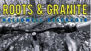
Popular Hallowell Mountain Biking Trails
• 70 ★ 3.5 • 1,558 ft • 20 ft • 188 •
Popular blue difficulty singletrack. This mountain bike primary trail can be used both directions and has a moderate overall physical rating with a 20 ft blue climb. It features rock garden. On average it takes 2 minutes to complete this trail.
• 80 ★ 3.0 • 4,016 ft • 27 ft • 179 •
Popular blue difficulty singletrack. This mountain bike primary trail can be used both directions. On average it takes 5 minutes to complete this trail.
• 75 ★ 4.5 • 712 ft • 8 ft • 164 •
Popular blue difficulty singletrack. This mountain bike primary trail can be used both directions and has a moderate overall physical rating with a 8 ft blue climb. It features jump, pump track and roller coaster. On average it takes 1 minutes to complete this trail.
• 60 ★ 0.0 • 3,901 ft • 66 ft • 100 •
Moderately popular blue difficulty singletrack. This multi-use trail can be used both directions and has a easy overall physical rating with a 66 ft green climb. It features berm, bridge and rock garden. Trail visibility is always easy to follow. On average it takes 7 minutes to complete this trail.
• 100 ★ 0.0 • 1,745 ft • 23 ft • 92 •
Popular blue difficulty singletrack. This multi-use trail can be used both directions. It features berm, bridge and rock garden. On average it takes 6 minutes to complete this trail.
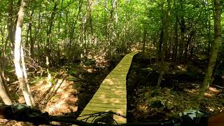
Photos of Hallowell Mountain Bike
Videos of Hallowell Mountain Bike

trail: Piney Loop
5:29 |
8 |
Jun 19, 2026 , Hallowell
trail: Figure Eight
5:29 |
13 |
Jun 19, 2026 , Hallowell

trail: Bucket
5:29 |
10 |
Jun 19, 2026 , Hallowell

trail: Animal House
15:56 |
20 |
Oct 24, 2025 , Hallowell

trail: Rocks and Crafts
6:17 |
114 |
Sep 2, 2024 , Hallowell

trail: Rocks and Crafts
9:32 |
103 |
Sep 2, 2024 , Hallowell

trail: Kerns Hill Loop
8:37 |
135 |
May 3, 2024 , Hallowell
6:17 |
101 |
Oct 1, 2023
Recent Trail Reports
| status | trail | date | condition | info | user |
|---|---|---|---|---|---|
| SnoMo | Jun 25, 2025 @ 7:51am Jun 25, 2025 | Dry | Tcarr21 | ||
| Egypt | Jun 24, 2025 @ 8:15am Jun 24, 2025 | Dry | Antjh2 | ||
| Bucket | Jun 8, 2025 @ 7:41pm Jun 8, 2025 | Wet | Tcarr21 | ||
| Piney Loop | May 14, 2025 @ 3:48pm May 14, 2025 | Ideal | Jffdejongh | ||
| Figure Eight | May 14, 2025 @ 3:48pm May 14, 2025 | Ideal | Jffdejongh | ||
| Kerns Hill Loop | May 14, 2025 @ 3:48pm May 14, 2025 | Wet | Jffdejongh | ||
| Kerns Hill Connector | May 14, 2025 @ 3:48pm May 14, 2025 | Wet | Jffdejongh | ||
| Kerns Hill Connector 2 | May 14, 2025 @ 3:48pm May 14, 2025 | Wet | Jffdejongh | ||
| Access | Nov 13, 2021 @ 8:31am Nov 13, 2021 | Dry | mblachet | ||
| Junkyard Loop | Nov 13, 2021 @ 8:31am Nov 13, 2021 | Dry | mblachet |
Activity Feed
| username | action | type | title | date |
|---|---|---|---|---|
| sstatman17 | wishlist | region | activity #97500460 | Jun 21, 2026 @ 10:42am Jun 21, 2026 |
| MarcPlaysOutdoors | add | video | activity #97352315 and 2 more | Jun 19, 2026 @ 4:26pm Jun 19, 2026 |
| wkdsDTeE | ridden | trail | activity #96829014 | Jun 12, 2026 @ 2:44pm Jun 12, 2026 |
| BenjaminxkJYji | wishlist | region | activity #92659101 | Apr 15, 2026 @ 7:36am Apr 15, 2026 |
| whmIV | wishlist | region | activity #92425004 | Apr 11, 2026 @ 1:54pm Apr 11, 2026 |
Recent Comments
| username | type | title | comment | date |
|---|---|---|---|---|
| report | * tree is at intersection with Egypt to Bucket... | Jun 24, 2025 @ 8:21am Jun 24, 2025 | ||
| trail | Just a follow up to the previous comment: If... | May 4, 2022 @ 12:02pm May 4, 2022 | ||
| trail | To all who would like to go ride these trails... | Jun 27, 2019 @ 6:08pm Jun 27, 2019 | ||
| report | Thanks for update. | May 11, 2019 @ 7:07pm May 11, 2019 |
Local Badges
-

Epic Mountain Bike Climb 2k1 awarded -

Climbing 10k Badge4 awarded -

Mountain Biking 100k Badge0 awarded -

Epic Ride Descent 2k1 awarded -

Descent 10k Badge4 awarded -

Descent 100k Badge0 awarded
Local Trail Supporters
![]()
- Brian Alexander
Activity Type Stats
| activitytype | trails | distance | descent | descent distance | total vertical | rating | global rank | state rank | photos | reports | routes | ridelogs |
|---|---|---|---|---|---|---|---|---|---|---|---|---|
| Mountain Bike | 15 | 7 miles | 518 ft | 3 miles | 148 ft | #6,284 | #2,127 | 46 | 86 | 3,309 | ||
| E-Bike | 1 | 3,301 ft | 49 ft | 978 ft | 52 ft | 76 | 13 | |||||
| Hike | 15 | 7 miles | 518 ft | 3 miles | 148 ft | #12,017 | #4,313 | 82 | 148 | |||
| Trail Running | 15 | 7 miles | 518 ft | 3 miles | 148 ft | #11,372 | #3,941 | 82 | 138 | |||
| Snowshoe | 4 | 1 mile | 72 ft | 2,457 ft | 92 ft | #1,894 | #1,110 | 22 | ||||
| Nordic Ski | 1 | 3,301 ft | 49 ft | 978 ft | 52 ft | 4 |
Frequently Asked Questions About Hallowell
▼
What are the best places to ride in Hallowell?
Hallowell has 1 areas to explore for mountain biking. The top rated areas are:
▼
What are the highest rated mountain biking trails in Hallowell?
The highest rated mountain biking trails in Hallowell are:
- Junkyard Loop (4.1/5)
- Bucket (4/5)
- Egypt (4/5)
- Figure Eight (3.9/5)
- Piney Loop (3.8/5)
▼
What is the best time of the year to ride in Hallowell?
Based on ride log data, the most popular months to ride in Hallowell are:
- July (64 activities)
- May (60 activities)
- August (56 activities)
▼
Where can I park to ride in Hallowell?
There are 1 parking locations listed in Hallowell. The most popular parking spots are:
- By MoveMaine & contributors
- Admins: NEMBAEXEC, MH&T
- #15503 - 1,789 views
- hallowell activity log | embed map of Hallowell mountain bike trails | hallowell mountain biking points of interest
Downloading of trail gps tracks in kml & gpx formats is enabled for Hallowell.
You must login to download files.