
close
3D
Trail Conditions
- Unknown
- Snow Groomed
- Snow Packed
- Snow Covered
- Snow Cover Partial
- Freeze/thaw Cycle
- Icy
- Prevalent Mud
- Wet
- Variable
- Ideal
- Dry
- Very Dry
Trail Flow (Ridden Direction)
Trailforks scans users activity logs to determine the most popular direction each trail is ridden. A good flowing trail network will have most trails flowing in a single direction according to their intension.
The colour categories are based on what percentage of users are riding a trail in its intended direction.
The colour categories are based on what percentage of users are riding a trail in its intended direction.
- > 96%
- > 90%
- > 80%
- > 70%
- > 50%
- < 50%
- bi-directional trail
- no data
Trail Last Used
Trailforks scans activity logs to determine the last time a trail was ridden.
- < 2 days
- < 1 week
- < 2 weeks
- < 1 month
- < 6 months
- > 6 months
Trail Ridden Direction
The intended direction a trail should be ridden.
- Downhill Only
- Downhill Primary
- Both Directions
- Uphill Primary
- Uphill Only
- One Direction
Contribute Details
Colors indicate trail is missing specified detail.
- Description
- Photos
- Description & Photos
- Videos
Trail Popularity ?
Trailforks scans activity logs to determine which trails are ridden the most in the last 9 months.
Trails are compared with nearby trails in the same city region with a possible 25 colour shades.
Think of this as a heatmap, more activities = more kinetic energy = warmer colors.
- most popular
- popular
- less popular
- not popular
ATV/ORV/OHV Filter
Max Vehicle Width
inches
US Cell Coverage
Legend

Radar Time
Activity Recordings
Trailforks uses anonymized public activity data.
?
Activity Recordings
Trailforks uses anonymized public activity data.
?
Winter Trails
Warning
A routing network for winter maps does not exist. Selecting trails using the winter trails layer has been disabled.
Missing Trails
Most Popular
Least Popular
Trails are colored based on popularity. The more popular a trail is, the more red. Less popular trails trend towards green.
Jump Magnitude Heatmap
Heatmap of where users jump on trails. Zoom in to see individual jumps, click circles to view jump details.
BC Backroad Status
![map legend]()
Service Road Atlas is a free to use, community-driven service for viewing and creating reports on the numerous back-country service roads around B.C. and Alberta.

Slope Aspect
Direction the slope faces
Trails Deemphasized
Trails are shown in grey.
Only show trails with no bike usage.
Suggested Layers
Based on selected activity type
Save the current map location and zoom level as your default home location whenever this page is loaded.
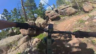
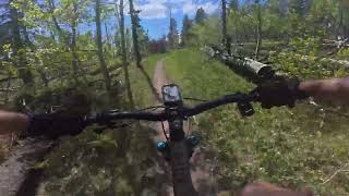
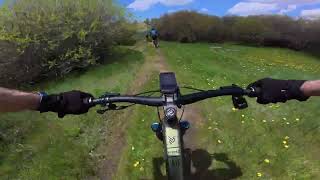
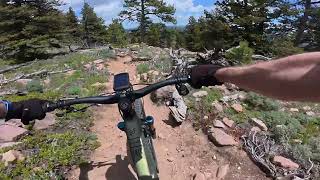
SaveFound off of exit 323 on I-80 east of Laramie, Happy Jack is a wonderful area for hiking, camping, mountain biking, cross-county skiing, snow shoeing and even home to trails for horseback riding.
Trails ranging from .4 miles to 3 miles, there is enough space here to spend a whole day enjoying nature.
This is a part of the Medicine Bow National Forest and a small fee is required per vehicle per day.
Trails ranging from .4 miles to 3 miles, there is enough space here to spend a whole day enjoying nature.
This is a part of the Medicine Bow National Forest and a small fee is required per vehicle per day.
source: Visit Laramie
Primary Trail Type: Cross-Country
eBikes Allowed:
No
Land Status: National Forest
 google parking directions plan a road trip here
Trail info last updated
Activities Click to view
- Mountain Bike
50 trails
- E-Bike
2 trails
- Horse
43 trails
- Hike
50 trails
- Trail Running
50 trails
- Snowshoe
17 trails
- Nordic Ski
26 trails
Region Details
- 3
- 2
- 13
- 26
- 3
- 3
Region Status
Open as of Oct 10, 2026Local Trail Association

Stats
- Avg Trail Rating
- Trails (view details)
- 74
- Trails Mountain Bike
- 50
- Trails E-Bike
- 2
- Trails Gravel Bike
- 7
- Trails Winter Fat Bike
- 13
- Trails Horse
- 43
- Trails Hike
- 50
- Trails Trail Running
- 50
- Trails Snowshoe
- 17
- Trails Backcountry Ski
- 2
- Trails Nordic Ski
- 26
- Total Distance
- 60 miles
- Total Descent
- 8,689 ft
- Total Vertical
- 799 ft
- Highest Trailhead
- 8,951 ft
- Reports
- 809
- Photos
- 46
- Completed Counter
- 13,703
Popular Happy Jack Recreational Area Trails
• 100 ★ 3.9 • 2,557 ft • 13 ft • 623 •
This is a fast and fun trail that zooms you around and in between lots of trees. The trail departs [L=https://www.trailforks.com/trails/upper-uw-loop/]Upper UW Loop[\L] at the top and connects to the Campground By-Pass or Alder Trail.
• 100 ★ 4.7 • 1 mile • 347 ft • 598 •
The top part of this trail is like most of Happy Jack: a little rutted, pretty straight, and fast. The bottom section was redone in 2018 to replace some unsustainable, fall-line trail with flowy, sustainable trail with some berms,...
• 95 ★ 3.0 • 400 ft • 0 ft • 533 •
Popular green difficulty singletrack. This multi-use trail can be used both directions and has a easy overall physical rating with a 0 ft green climb. On average it takes minutes to complete this trail.
• 95 ★ 4.3 • 2 miles • 472 ft • 498 •
This trail departs Lower UW Trail and descends quickly through the Happy Jack area. Be prepared for moderate tech, this trail has lots of rocks, roots, and turns. It connects to Haunted Forest Trail and Middle Aspen Trail. Significantly...
• 85 ★ 3.4 • 2,178 ft • 35 ft • 433 •
Popular blue difficulty singletrack. This multi-use trail can be used both directions with a 35 ft blue climb. On average it takes 3 minutes to complete this trail.
• 75 ★ 4.5 • 2 miles • 173 ft • 430 •
Death Crotch is a fantastic downhill descent (or tough climb) that connects Old Happy Jack Road and Summit Loop.
• 95 ★ 3.0 • 670 ft • 0 ft • 380 •
Popular blue difficulty singletrack. This multi-use trail can be used both directions and has a moderate overall physical rating with a 0 ft blue climb. On average it takes 1 minutes to complete this trail.
Mountain Bike Routes
11 miles • 1,540 ft • 17 • Loop •
This routes takes riders through what I would consider to be the best trails that Happy Jack Area has to...
★ 3.0 • 33 miles • 3,246 ft • 18 • Loop • Race •
“Sometimes you just gotta ride it and you’ll know!” The Course - The course will have two Race...
★ 5.0 • 31 miles • 3,191 ft • 13 • Loop • Race •
Race course for the 2018 Laramie Enduro
68 miles • 6,744 ft • 26 • Loop • Race •
Laramie Enduro Course. Starting at the Hidden Valley picnic ground, this route tours much of the Pole...
★ 3.0 • 28 miles • 2,852 ft • 28 • Loop • Race •
2017 Laramie Enduro race course
19 miles • 2,457 ft • 16 • Loop • Race •
You have between x and x to do the course. Do it as many times as you would like, we will use your fastest...
Photos of Happy Jack Recreational Area Mountain Bike
Videos of Happy Jack Recreational Area Mountain Bike

Recent Trail Reports
| status | trail | date | condition | info | user |
|---|---|---|---|---|---|
| Double Black Diamond | Sep 18, 2026 @ 11:25pm (America/Denver) Sep 18, 2026 | Variable | Spackattack | ||
| Upper UW Loop | Jul 29, 2026 @ 7:59am (America/Denver) Jul 29, 2026 | Ideal | milesmiles68 | ||
| Summit | Jul 29, 2026 @ 7:59am (America/Denver) Jul 29, 2026 | Ideal | milesmiles68 | ||
| Lower UW | Jul 29, 2026 @ 7:59am (America/Denver) Jul 29, 2026 | Ideal | milesmiles68 | ||
| Old Happy Jack Road | Jul 29, 2026 @ 7:59am (America/Denver) Jul 29, 2026 | Ideal | milesmiles68 | ||
| Headquarters NRT | Jul 29, 2026 @ 7:59am (America/Denver) Jul 29, 2026 | Ideal | milesmiles68 | ||
| Upper UW Connector | Jul 29, 2026 @ 7:59am (America/Denver) Jul 29, 2026 | Ideal | milesmiles68 | ||
| Ridge | Jul 29, 2026 @ 7:59am (America/Denver) Jul 29, 2026 | Ideal | milesmiles68 | ||
| Blackjack Loop 1 | Jul 29, 2026 @ 7:59am (America/Denver) Jul 29, 2026 | Ideal | milesmiles68 | ||
| Pole Creek | Jul 29, 2026 @ 7:59am (America/Denver) Jul 29, 2026 | Ideal | milesmiles68 |
Activity Feed
| username | action | type | title | date |
|---|---|---|---|---|
| berelson | add | report | activity #105625450 | Oct 10, 2026 @ 12:45pm Oct 10, 2026 |
| Spackattack | add | report | activity #104094643 | Sep 18, 2026 @ 10:25pm Sep 18, 2026 |
| RichardjtK4qq | difficultyvote | trail | activity #101254516 | Aug 11, 2026 @ 11:31am Aug 11, 2026 |
| kesheetz | wishlist | trail | activity #101047900 | Aug 8, 2026 @ 3:41pm Aug 8, 2026 |
| czkenne | add | photo | activity #100999523 and 1 more | Aug 8, 2026 @ 6:29am Aug 8, 2026 |
Recent Comments
| username | type | title | comment | date |
|---|---|---|---|---|
| trail | Could not agree more... This trail is spot on... | Aug 6, 2026 @ 2:13pm Aug 6, 2026 | ||
| trail | Hard to get to but what a blast! This is an... | Nov 18, 2025 @ 3:20pm Nov 18, 2025 | ||
| trail | This is an amazing trail! Excellent planing,... | Jul 4, 2025 @ 7:36pm Jul 4, 2025 | ||
| report | Tvg ere got me runner interesting em several g | May 3, 2025 @ 10:40am May 3, 2025 | ||
| report | It is in the big set of trees just before the... | Jul 7, 2024 @ 5:32pm Jul 7, 2024 |
Nearby Areas
| name | distance | ||||
|---|---|---|---|---|---|
| Vedauwoo / Blair | 8 | 13 | 5 | 4.9 km | |
| Pilot Hill/The Schoolyard | 13 | 25 | 3 | 1 | 8.1 km |
| Curt Gowdy State Park | 7 | 25 | 12 | 14 | 10.3 km |
| Red Mountain - Soapstone Prairie | 13 | 5 | 23.9 km | ||
| Beaver Meadows Resort Ranch | 2 | 10 | 4 | 1 | 31.2 km |
Local Badges
-

Completionist0 awarded



Local Products



Activity Type Stats
| activitytype | trails | distance | descent | descent distance | total vertical | rating | global rank | state rank | photos | reports | routes | activity logs |
|---|---|---|---|---|---|---|---|---|---|---|---|---|
| Mountain Bike | 50 | 50 miles | 7,487 ft | 23 miles | 797 ft | #1,973 | #5 | 34 | 781 | 7 | 7,362 | |
| E-Bike | 2 | 2,864 ft | 36 ft | 1,424 ft | 56 ft | #9,909 | #30 | 582 | 71 | |||
| Gravel Bike | 7 | 2 miles | 164 ft | 4,337 ft | 499 ft | #830 | #426 | 95 | 4 | |||
| Winter Fat Bike | 13 | 12 miles | 1,555 ft | 6 miles | 607 ft | #830 | #426 | 2 | 24 | |||
| Horse | 43 | 44 miles | 6,430 ft | 20 miles | 797 ft | #642 | #12 | 353 | 22 | |||
| Hike | 50 | 50 miles | 7,487 ft | 23 miles | 797 ft | #4,685 | #37 | 3 | 781 | 404 | ||
| Trail Running | 50 | 50 miles | 7,487 ft | 23 miles | 797 ft | #3,778 | #29 | 781 | 214 | |||
| Snowshoe | 17 | 14 miles | 1,558 ft | 6 miles | 650 ft | #678 | #9 | 131 | 31 | |||
| Backcountry Ski | 2 | 2 miles | 417 ft | 1 mile | 397 ft | 20 | 4 | |||||
| Nordic Ski | 26 | 11 miles | 1,240 ft | 4 miles | 354 ft | #502 | #1 | 31 | 1 | 923 |
Frequently Asked Questions
▼
What are the highest rated mountain biking trails in Happy Jack Recreational Area?
The highest rated mountain biking trails in Happy Jack Recreational Area are:
- Middle Aspen (4.3/5)
- Death Crotch (4.3/5)
- Pilot Hill Connector (4.1/5)
- Headquarters Trail (4.1/5)
- Haunted Forest (4.1/5)
▼
Where can I park to ride in Happy Jack Recreational Area?
There are 8 parking locations listed in Happy Jack Recreational Area. The most popular parking spots are: View all parking and trailhead locations on the map to plan your visit.
▼
What is the longest trail in Happy Jack Recreational Area?
The longest trail in Happy Jack Recreational Area is Pilot Hill Connector at 6.9 miles. View all trails sorted by distance.
▼
What are the best & highest rated hiking trails in Happy Jack Recreational Area?
The best hiking trails in Happy Jack Recreational Area are: View all hiking trails sorted by popularity score.
▼
What are the best & highest rated trail running trails in Happy Jack Recreational Area?
The best trail running trails in Happy Jack Recreational Area are: View all trail running trails sorted by popularity score.
▼
How many trails are in Happy Jack Recreational Area?
Happy Jack Recreational Area has a total of 74 trails. Of those, 50 are designated for mountain biking. Browse top mountain biking trails in Happy Jack Recreational Area to find detailed information including difficulty ratings, distances, and trail conditions.
▼
Which trail has the most elevation gain in Happy Jack Recreational Area?
The trail with the most elevation gain in Happy Jack Recreational Area is Pilot Hill Connector with 909 ft of elevation gain. View all trails sorted by elevation gain.
▼
Which trail has the most elevation descent in Happy Jack Recreational Area?
The trail with the most elevation descent in Happy Jack Recreational Area is Double Black Diamond with 879 ft of elevation descent. View all trails sorted by elevation descent.
▼
What activities are most popular in Happy Jack Recreational Area?
Happy Jack Recreational Area supports the following activities: Mountain Biking, E-Biking, Horseback, Hiking, Trail Running, Snowshoeing, Nordic Skiing.
▼
What are the steepest mountain biking trails in Happy Jack Recreational Area?
The steepest mountain biking trail in Happy Jack Recreational Area is Escape with an average grade of 9.3%. View all trails sorted by grade.
▼
Are the trails open in Happy Jack Recreational Area?
The overall region status for Happy Jack Recreational Area is Clear / Green. Out of 49 trails:
- Clear / Green: 44
- Minor Issue / Yellow: 3
- Significant Issue / Amber: 2
▼
Can I ride an ebike in Happy Jack Recreational Area?
Yes, Happy Jack Recreational Area supports e-bike riding. There are 2 trails in Happy Jack Recreational Area that allow e-bikes. Check the e-bike trails listing for specific trail access details and any local regulations.
▼
What are the most popular mountain biking routes in Happy Jack Recreational Area?
The most popular mountain biking routes in Happy Jack Recreational Area are: View all mountain biking routes in Happy Jack Recreational Area.
▼
What are the most popular Strava Segments in Happy Jack Recreational Area?
The most popular Strava segments in Happy Jack Recreational Area are:
- Let the Roadies Shine (2,604 athletes)
- Full Crotch Grab (2,145 athletes)
- New Aspen (2,100 athletes)
▼
What are some popular technical trail features in Happy Jack Recreational Area?
There are 1 technical trail features (TTFs) in Happy Jack Recreational Area. Some popular features include: View all technical trail features in Happy Jack Recreational Area.
▼
What are the most popular mountain biking trails in Happy Jack Recreational Area?
The most popular mountain biking trails in Happy Jack Recreational Area are: View all mountain biking trails sorted by popularity.
▼
What are the best beginner ride trails in Happy Jack Recreational Area?
The best beginner mountain biking trails in Happy Jack Recreational Area are:
- Upper UW Connector (3/5)
- Browns Landing (3/5)
- Blackjack Loop 1 (3/5)
Activities
Trails
- Hard trails in Happy Jack Recreational Area
- Easy trails in Happy Jack Recreational Area
- Favorite trails in Happy Jack Recreational Area
- Most ridden trails in Happy Jack Recreational Area
- Singletrack in Happy Jack Recreational Area
- Viewpoint trails in Happy Jack Recreational Area
- Trails with technical features in Happy Jack Recreational Area
- Race routes in Happy Jack Recreational Area
Points of Interest
- By chuktA
 TRAILFORKS NFTA NBBC & contributors
- Admins: BIKENET, laradice, BIKENET, 30percentirish
- #6279 - 26,654 views
- happy jack recreational area activity log | embed map of Happy Jack Recreational Area mountain bike trails | happy jack recreational area mountain biking points of interest
Downloading of trail gps tracks in kml & gpx formats is enabled for Happy Jack Recreational Area.
You must login to download files.
