close
-
Layers w
- Weather Layers
- Pro
- Pro
- Pro
- Pro
- Pro
- Pro
- More Layers
- Pro
- Pro
- Pro
- Pro
-
Upgrade to

3D
Trail Conditions
- Unknown
- Snow Groomed
- Snow Packed
- Snow Covered
- Snow Cover Partial
- Freeze/thaw Cycle
- Icy
- Prevalent Mud
- Wet
- Variable
- Ideal
- Dry
- Very Dry
Trail Flow (Ridden Direction)
Trailforks scans users ridelogs to determine the most popular direction each trail is ridden. A good flowing trail network will have most trails flowing in a single direction according to their intension.
The colour categories are based on what percentage of riders are riding a trail in its intended direction.
The colour categories are based on what percentage of riders are riding a trail in its intended direction.
- > 96%
- > 90%
- > 80%
- > 70%
- > 50%
- < 50%
- bi-directional trail
- no data
Trail Last Ridden
Trailforks scans ridelogs to determine the last time a trail was ridden.
- < 2 days
- < 1 week
- < 2 weeks
- < 1 month
- < 6 months
- > 6 months
Trail Ridden Direction
The intended direction a trail should be ridden.
- Downhill Only
- Downhill Primary
- Both Directions
- Uphill Primary
- Uphill Only
- One Direction
Contribute Details
Colors indicate trail is missing specified detail.
- Description
- Photos
- Description & Photos
- Videos
Trail Popularity ?
Trailforks scans ridelogs to determine which trails are ridden the most in the last 9 months.
Trails are compared with nearby trails in the same city region with a possible 25 colour shades.
Think of this as a heatmap, more rides = more kinetic energy = warmer colors.
- most popular
- popular
- less popular
- not popular
ATV/ORV/OHV Filter
Max Vehicle Width
inches
US Cell Coverage
Legend

Radar Time
Activity Recordings
Trailforks uses anonymized public activity data.
?
Activity Recordings
Trailforks uses anonymized public activity data.
?
Personal Heatmap
▶
Activity Types
all
/
none
▶
Options
2
Date range
month
–
Winter Trails
Warning
A routing network for winter maps does not exist. Selecting trails using the winter trails layer has been disabled.
Missing Trails
Most Popular
Least Popular
Trails are colored based on popularity. The more popular a trail is, the more red. Less popular trails trend towards green.
Jump Magnitude Heatmap
Heatmap of where riders jump on trails. Zoom in to see individual jumps, click circles to view jump details.
BC Backroad Status
![map legend]()
Service Road Atlas is a free to use, community-driven service for viewing and creating reports on the numerous back-country service roads around B.C. and Alberta.

Slope Aspect
Direction the slope faces
Trails Deemphasized
Trails are shown in grey.
Only show trails with no bike usage.
Suggested Layers
Based on selected activity type
Save the current map location and zoom level as your default home location whenever this page is loaded.
SaveThe Hardwick Trails are a system of 6 miles of hiking trails and 5 miles of single track biking trails, winding through mixed woodland habitats.
Hazen Union School, the Town of Hardwick, the Hardwick Electric Department and Nancy Shepard and Al Cockrell have all generously given permission for us to create this network on their lands.
Community volunteers and donors provide the muscle and means to care for this recreation jewel that is groomed for winter skiing and mowed for summer use.
source: Hardwick Trails
Links
Activities Click to view
- Mountain Bike
18 trails
- Adaptive Bike
0 trails
- Hike
17 trails
- Trail Running
17 trails
Region Details
- 1
- 5
- 5
- 6
- 1
Region Status
Open as of Jun 19, 2026Local Trail Association
Stats
- Avg Trail Rating
- Trails (view details)
- 18
- Trails Mountain Bike
- 18
- Trails E-Bike
- 1
- Trails Hike
- 17
- Trails Trail Running
- 17
- Total Distance
- 7 miles
- Total Descent
- 1,065 ft
- Total Vertical
- 376 ft
- Highest Trailhead
- 1,280 ft
- Reports
- 59
- Ridden Counter
- 1,062
Sub Regions
-
Hardwick Village Forest
- 5
- 5
- 6
- 1
Popular Hardwick Mountain Biking Trails
• 90 ★ 0.0 • 2,894 ft • 99 ft • 96 •
a rolling trails that generally goes downhill north to south.
• 100 ★ 0.0 • 1,040 ft • 72 ft • 88 •
Popular green difficulty doubletrack. This multi-use trail can be used both directions. On average it takes 2 minutes to complete this trail.
• 95 ★ 0.0 • 1,168 ft • 55 ft • 86 •
a very buff piece of single track with some Berms.
• 55 ★ 0.0 • 4,970 ft • 147 ft • 78 •
Moderately popular green difficulty family friendly singletrack. This multi-use trail can be used both directions and has a easy overall physical rating with a 147 ft green climb. Trail visibility is always easy to follow. On average it takes 8 minutes to complete this trail.
• 80 ★ 0.0 • 2,996 ft • 140 ft • 75 •
Popular blue difficulty singletrack. This mountain bike primary trail. On average it takes 7 minutes to complete this trail.
• 85 ★ 0.0 • 1,328 ft • 50 ft • 71 •
Popular black diamond difficulty singletrack. This mountain bike primary trail. On average it takes 3 minutes to complete this trail.
• 50 ★ 0.0 • 1,480 ft • 0 ft • 66 •
a fun chunky downhill with natural and man made features
• 45 ★ 4.0 • 2,057 ft • 186 ft • 66 •
a moderate climb up to the top of Hardwick or sweet flowing downhill on the way back down..
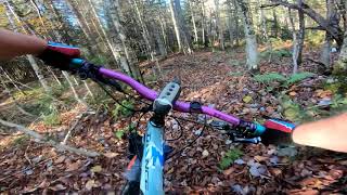
Videos of Hardwick Mountain Bike
trail: Drop in a Bucket
255 |
Aug 31, 2020 , Hardwick
6:48 |
351 |
Oct 29, 2019
Recent Trail Reports
| status | trail | date | condition | info | user |
|---|---|---|---|---|---|
| Two Bridges | Jun 19, 2026 @ 1:27pm (America/New_York) Jun 19, 2026 | Variable | Daveinator | ||
| Wild West | Jun 12, 2025 @ 10:54am Jun 12, 2025 | Dry | KurttKLS9I | ||
| Shepard's Trace | Jul 21, 2024 @ 7:05am Jul 21, 2024 | Ideal | snowecho | ||
| Shepard's Trail | Jul 21, 2024 @ 7:05am Jul 21, 2024 | Ideal | snowecho | ||
| Access | Jul 21, 2024 @ 7:05am Jul 21, 2024 | Ideal | snowecho | ||
| Eaton Brook loop | Jul 21, 2024 @ 7:05am Jul 21, 2024 | Ideal | snowecho | ||
| Sugar Road | Jul 21, 2024 @ 7:05am Jul 21, 2024 | Ideal | snowecho | ||
| School Perimeter Road | Jul 21, 2024 @ 7:05am Jul 21, 2024 | Ideal | snowecho | ||
| Squiggle | Jul 21, 2024 @ 7:05am Jul 21, 2024 | Ideal | snowecho | ||
| Hazel Union High School Parking | Jul 21, 2024 @ 7:05am Jul 21, 2024 | Ideal | snowecho |
Activity Feed
| username | action | type | title | date |
|---|---|---|---|---|
| Daveinator | add | report | activity #97381604 | Jun 20, 2026 @ 4:40am Jun 20, 2026 |
| murphycaroline15 | ridden | trail | activity #95481848 | May 25, 2026 @ 6:04am May 25, 2026 |
| hartmd25 | ridden | trail | activity #86019274 | Dec 24, 2025 @ 4:54pm Dec 24, 2025 |
| shreddymcshredderson | wishlist | region | activity #78950474 | Aug 25, 2025 @ 6:24pm Aug 25, 2025 |
| ColMcD3 | update | region | activity #75675463 | Jul 11, 2025 @ 12:13pm Jul 11, 2025 |
Recent Comments
| username | type | title | comment | date |
|---|---|---|---|---|
| report | Still logged, although there’s a lot of... | Aug 28, 2020 @ 3:33pm Aug 28, 2020 |
Local Badges
-

Epic Ride Climb 2k3 awarded -

Climbing 10k Badge1 awarded -

Climbing 100k Badge0 awarded -

Epic Ride Descent 2k3 awarded -

Descent 10k Badge1 awarded -

Descent 100k Badge0 awarded
Activity Type Stats
| activitytype | trails | distance | descent | descent distance | total vertical | rating | global rank | state rank | photos | reports | routes | ridelogs |
|---|---|---|---|---|---|---|---|---|---|---|---|---|
| Mountain Bike | 18 | 7 miles | 1,063 ft | 3 miles | 377 ft | #9,207 | #2,903 | 59 | 523 | |||
| E-Bike | 1 | 3,907 ft | 46 ft | 617 ft | 161 ft | 48 | 6 | |||||
| Hike | 17 | 7 miles | 958 ft | 3 miles | 377 ft | #11,580 | #4,138 | 59 | 34 | |||
| Trail Running | 17 | 7 miles | 958 ft | 3 miles | 377 ft | #11,106 | #3,842 | 59 | 14 |
Frequently Asked Questions About Hardwick
▼
What are the best places to ride in Hardwick?
Hardwick has 1 areas to explore for mountain biking. The top rated areas are:
▼
What are the highest rated mountain biking trails in Hardwick?
The highest rated mountain biking trails in Hardwick are:
- Dave's Drop (4/5)
- Sugar Road (0/5)
- Over and out (0/5)
- Shepard's Trace (0/5)
- Rocky Top (0/5)
▼
What is the best time of the year to ride in Hardwick?
Based on ride log data, the most popular months to ride in Hardwick are:
- June (19 activities)
- August (16 activities)
- July (9 activities)
▼
Where can I park to ride in Hardwick?
There are 1 parking locations listed in Hardwick. The most popular parking spots are:
Trails
Points of Interest
- By StephaneMarceau
 TRAILFORKS & contributors
 - Admins: apply
- #21705 - 4,140 views
- hardwick activity log | embed map of Hardwick mountain bike trails | hardwick mountain biking points of interest
Downloading of trail gps tracks in kml & gpx formats is enabled for Hardwick.
You must login to download files.