
close
3D
Trail Conditions
- Unknown
- Snow Groomed
- Snow Packed
- Snow Covered
- Snow Cover Partial
- Freeze/thaw Cycle
- Icy
- Prevalent Mud
- Wet
- Variable
- Ideal
- Dry
- Very Dry
Trail Flow (Ridden Direction)
Trailforks scans users activity logs to determine the most popular direction each trail is ridden. A good flowing trail network will have most trails flowing in a single direction according to their intension.
The colour categories are based on what percentage of users are riding a trail in its intended direction.
The colour categories are based on what percentage of users are riding a trail in its intended direction.
- > 96%
- > 90%
- > 80%
- > 70%
- > 50%
- < 50%
- bi-directional trail
- no data
Trail Last Used
Trailforks scans activity logs to determine the last time a trail was ridden.
- < 2 days
- < 1 week
- < 2 weeks
- < 1 month
- < 6 months
- > 6 months
Trail Ridden Direction
The intended direction a trail should be ridden.
- Downhill Only
- Downhill Primary
- Both Directions
- Uphill Primary
- Uphill Only
- One Direction
Contribute Details
Colors indicate trail is missing specified detail.
- Description
- Photos
- Description & Photos
- Videos
Trail Popularity ?
Trailforks scans activity logs to determine which trails are ridden the most in the last 9 months.
Trails are compared with nearby trails in the same city region with a possible 25 colour shades.
Think of this as a heatmap, more activities = more kinetic energy = warmer colors.
- most popular
- popular
- less popular
- not popular
ATV/ORV/OHV Filter
Max Vehicle Width
inches
US Cell Coverage
Legend

Radar Time
Activity Recordings
Trailforks uses anonymized public activity data.
?
Activity Recordings
Trailforks uses anonymized public activity data.
?
Winter Trails
Warning
A routing network for winter maps does not exist. Selecting trails using the winter trails layer has been disabled.
Missing Trails
Most Popular
Least Popular
Trails are colored based on popularity. The more popular a trail is, the more red. Less popular trails trend towards green.
Jump Magnitude Heatmap
Heatmap of where users jump on trails. Zoom in to see individual jumps, click circles to view jump details.
BC Backroad Status
![map legend]()
Service Road Atlas is a free to use, community-driven service for viewing and creating reports on the numerous back-country service roads around B.C. and Alberta.

Slope Aspect
Direction the slope faces
Trails Deemphasized
Trails are shown in grey.
Only show trails with no bike usage.
Suggested Layers
Based on selected activity type
Save the current map location and zoom level as your default home location whenever this page is loaded.
SavePopular Trail Networks
view all areas »
Snow & Rain 3D forecast Pro
See where it will snow, sleet or rain on Vermont hour by hour, on 3D terrain.
View 3D snow forecast
Vermont trails and routes are listed on Trailforks with interactive trail maps, difficulty ratings, photos, and user-reported trail conditions. The Trailforks community has mapped thousands of trails and shared thousands of photos in this region. Supported activity types include Hiking, Trail Running, Mountain Biking, Snowshoeing, E-Biking, Skiing, Nordic Skiing, Gravel Biking, Winter Fat Biking, Backcountry Skiing, Adaptive Biking, Snowmobiling, Horseback, ATVing/Offroading, Dirtbiking and Observed Trials. Trails here are often faint trail, flowy and rooty. Scenery includes views, summits and lakes. Common trail features include berms, bridges and jumps. Many trails are family friendly. Amenities include huts and picnic spots. Popular destinations include Stowe, East Burke and Killington.
This is an auto-generated description of Vermont.
Login or register to submit a custom description.
Trail info last updated

Stats
- Avg Trail Rating
- Trails (view details)
- 6,200
- Trails Mountain Bike
- 3,206
- Trails E-Bike
- 1,433
- Trails Gravel Bike
- 965
- Trails Adaptive Bike
- 460
- Trails Winter Fat Bike
- 666
- Trails Horse
- 105
- Trails Hike
- 3,459
- Trails Trail Running
- 3,438
- Trails Dirtbike/Moto
- 29
- Trails Observed Trials
- 3
- Trails ATV/ORV/OHV
- 37
- Trails Snowmobile
- 368
- Trails Snowshoe
- 1,541
- Trails Downhill Ski
- 1,428
- Trails Backcountry Ski
- 479
- Trails Nordic Ski
- 1,227
- Total Distance
- 6,552 miles
- Total Descent
- 1,124,836 ft
- Total Vertical
- 4,287 ft
- Highest Trailhead
- 4,382 ft
- Reports
- 171,620
- Photos
- 8,937
- Completed Counter
- 1,801,115
Articles

Video: Annijke Wade Explores Vermont’s World-Class Adaptive Trail Network
May 28, 2026 from pinkbike.com
Traveling solo to the Green Mountain State, Wade shreds jump lines and bike parks to discover why Vermont is setting the global standard for...
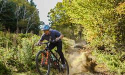
Video: Brice Shirbach Explores The MTB Trails of East Burke, VT in 'Underexposed'
Nov 20, 2025 from pinkbike.com
For many outsiders, it has become top of mind whenever mountain biking comes up, and that's not by accident.
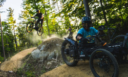
Video: How to Build Adaptive Trails For Everyone
Sep 5, 2025 from pinkbike.com
The Vermont Mountain Bike Association breaks down all the details to get more butts on bikes in their new 3-part YouTube series.
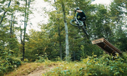
Video: Riding Bolton, Vermont in 'The Range'
Aug 29, 2025 from pinkbike.com
An afternoon well spent chasing Evan through the Driving Range trail network.
Sub Regions
- Addison County (186)
- Bennington County (107)
- Chittenden County (536)
- Franklin County (85)
- Lamoille County (317)
- Brewster River Valley (112)
- Northeast Kingdom (548)
- Caledonia County (313)
- Essex County (27)
- Orleans County (197)
- Orange County (127)
- Rutland County (277)
- Killington Valley (118)
- Slate Valley (65)
- Washington County (308)
- Mad River Valley (129)
- Montpelier Area (75)
- Windham County (292)
- Windsor County (420)
- Upper Valley (70)
- Woodstock Area (128)
Popular Vermont Mountain Biking Trails
• 100 ★ 4.9 • 3,035 ft • 0 ft • 4,825 •
Entirely machine built, Flo is a fast trail with many high berms, and tabletops of small to moderate sizes. It's easy to ride slowly, but hard to ride fast unless you have pump and jump skills. This is a great trail to take someone who...
• 100 ★ 4.9 • 1,430 ft • 3 ft • 4,796 •
Entirely machine built, Flo is a fast trail with many high berms, and tabletops of small to moderate sizes. It's easy to ride slowly, but hard to ride fast unless you have pump and jump skills. This is a great trail to take someone who...
• 100 ★ 4.7 • 584 ft • 0 ft • 4,634 •
Highly rated popular blue difficulty singletrack. This mountain bike primary trail. It features berm and bridge. Adaptive MTB rating: amtb blue. On average it takes 1 minutes to complete this trail.
• 100 ★ 4.4 • 545 ft • 0 ft • 4,489 •
Popular green difficulty singletrack. This multi-use trail can be used uphill only. Adaptive MTB rating: amtb green. On average it takes 1 minutes to complete this trail.
• 100 ★ 4.5 • 3,934 ft • 25 ft • 4,513 •
Classic descent back to main parking lot at Cady Hill. Mostly machined, but with a few roots and stump jumps and other natural features. The trail is divide into distinct sections with the top half riding very much like a downhill pump...
• 100 ★ 4.3 • 3,248 ft • 172 ft • 4,442 •
Flowly mostly hand built uphill to get you from the bottom of Florence back to the Cady Hill Connector
• 100 ★ 4.3 • 3,406 ft • 246 ft • 4,332 •
A machine built trail that rides like magic carpet from the Cady Hill Forest Trailhead up to the top of Bear's Trail. The Trail is Multi-use and sometimes will have hikers and trail runners among the mountain bikers, so be wary. Uphill...
• 95 ★ 3.7 • 2,405 ft • 102 ft • 3,726 •
This Trail is generally ridden from north to south starting in Ranch Camp/Backyard Bar's Parking lot finishing at start of the Cady Hill Road climb. This trail also connects into Bridgey Trail as well as Zog's Trail. This trail starts...
Vermont Mountain Bike Routes
Sugar High #3 Featured
★ 5.0 • 11 miles • 911 ft • 12 • Shuttled •
One of several top to bottom enduro rides that combine some of the best Sugarbush lift-served/...
★ 4.0 • 7 miles • 1,029 ft • 16 • Loop •
Kingdom Trails Intermediate Suggested Route: 8 mile intermediate rider friendly route on green circle,...
★ 5.0 • 7 miles • 744 ft • 8 • Loop •
Fall From Heaven: Moderately Challenging; 7 miles; 900 feet total elevation gain; allow approx. 60-75...
Cady Hill Classic Loop Featured
4 miles • 575 ft • 10 • Loop •
This is a route for a classic Cady Hill Ride. From the main parking lot up the Green Chair Climb, Cady...
Mad River Riders UNduro 2020 Featured
10 miles • 1,015 ft • 9 • Shuttled •
The UN Epic is back in 2020 as the UNduro! With COVID concerns, we making it even more UNeventful in 2020....
★ 3.4 • 13 miles • 1,739 ft • 8 • Loop •
Kingdom Trails Intermediate Suggested Route: 12 mile loop with 1800ft of climbing designed for...
Photos of Vermont Mountain Bike
Videos of Vermont Mountain Bike

National Scenic Trails & Official Routes
-
Velomont Trail
- Mountain Bike
- E-Bike
- Hike
- Trail Running
Activity Feed
| username | action | type | title | date |
|---|---|---|---|---|
| LMCxGo4n | wishlist | region | activity #107964177 | Nov 17, 2026 @ 4:41pm 2 hours |
| LMCxGo4n | wishlist | region | activity #107964169 | Nov 17, 2026 @ 4:41pm 2 hours |
| ridedigrepeat | add | report | activity #107963794 and 7 more | Nov 17, 2026 @ 4:34pm 2 hours |
| ridedigrepeat | add | report | activity #107963769 and 9 more | Nov 17, 2026 @ 4:33pm 2 hours |
| ridedigrepeat | add | report | activity #107963713 and 4 more | Nov 17, 2026 @ 4:33pm 2 hours |
Recent Comments
| username | type | title | comment | date |
|---|---|---|---|---|
| trail | Love this new climbing trail. This definitely... | Nov 10, 2026 @ 3:38pm Nov 10, 2026 | ||
| trail | This and the new climb trail are legendary... | Nov 10, 2026 @ 3:34pm Nov 10, 2026 | ||
| trail | This will get your heart rate up. | Nov 10, 2026 @ 3:23pm Nov 10, 2026 | ||
| trail | wild ride | Nov 4, 2026 @ 3:41pm Nov 4, 2026 | ||
| trail | There are 3 small trees down on homestead if... | Oct 22, 2026 @ 5:34am Oct 22, 2026 |
Local Badges
-

WAMBA Triple Crown1 awarded -

You Rode Flo!3,258 awarded -

Big Ride 30k9,976 awarded -
Big Ride 30k519 awarded -

Top 10 Trails0 awarded -
Big Ride 30k872 awarded
Bike & Skill Parks
| name | type | city | rating |
|---|---|---|---|
| Killington Bike Park | bike park | Killington | |
| von Trapp Family Lodge & Resort | bike park | Stowe | |
| Jay Peak Resort | bike park | Jay | |
| Bolton Valley Resort | bike park | Bolton | |
| Mount Snow | bike park | Dover |
Upcoming Local Events
Activity Type Stats
| activitytype | trails | distance | descent | descent distance | total vertical | rating | global rank | state rank | photos | reports | routes | activity logs |
|---|---|---|---|---|---|---|---|---|---|---|---|---|
| Mountain Bike | 3,206 | 2,124 miles | 324,078 ft | 902 miles | 4,078 ft | #19 | 8,460 | 166,419 | 571 | 567,060 | ||
| E-Bike | 1,433 | 865 miles | 119,406 ft | 350 miles | 3,957 ft | #30 | 40 | 71,129 | 134 | 17,649 | ||
| Gravel Bike | 965 | 976 miles | 97,277 ft | 386 miles | 4,078 ft | #33 | 4 | 13,037 | 35 | 7,055 | ||
| Adaptive Bike | 460 | 317 miles | 38,051 ft | 122 miles | 4,078 ft | #25 | 33,728 | 25 | 92 | |||
| Winter Fat Bike | 666 | 526 miles | 56,411 ft | 219 miles | 3,750 ft | #21 | 36 | 24,270 | 16 | 433 | ||
| Horse | 105 | 141 miles | 16,430 ft | 61 miles | 3,110 ft | #39 | 2 | 31,509 | 4 | 163 | ||
| Hike | 3,459 | 2,785 miles | 435,564 ft | 1,126 miles | 4,288 ft | #36 | 239 | 165,081 | 83 | 53,799 | ||
| Trail Running | 3,438 | 2,780 miles | 432,989 ft | 1,123 miles | 4,288 ft | #35 | 48 | 159,278 | 102 | 19,222 | ||
| Dirtbike/Moto | 29 | 35 miles | 3,737 ft | 16 miles | 1,601 ft | #29 | 1 | 11,236 | 234 | |||
| Observed Trials | 3 | 1 mile | 262 ft | 3,671 ft | 279 ft | #23 | 2 | 868 | 133 | |||
| ATV/ORV/OHV | 37 | 48 miles | 4,938 ft | 19 miles | 3,537 ft | #32 | 1 | 11,371 | 86 | |||
| Snowmobile | 368 | 2,537 miles | 89,665 ft | 331 miles | 2,749 ft | #3 | 3 | 12,635 | 1 | 100 | ||
| Snowshoe | 1,541 | 1,203 miles | 176,066 ft | 469 miles | 4,281 ft | #11 | 18 | 78,385 | 24 | 3,344 | ||
| Downhill Ski | 1,428 | 498 miles | 446,125 ft | 463 miles | 3,865 ft | #5 | 13 | 5,033 | 66,172 | |||
| Backcountry Ski | 479 | 689 miles | 139,006 ft | 299 miles | 4,035 ft | #6 | 13 | 28,941 | 17 | 31,177 | ||
| Nordic Ski | 1,227 | 952 miles | 122,740 ft | 394 miles | 4,252 ft | #11 | 39 | 81,792 | 21 | 22,601 |
Activities
- Vermont Mountain Biking Trails
- Vermont E-Biking Trails
- Vermont Gravel Biking Trails
- Vermont Adaptive Biking Trails
- Vermont Winter Fat Biking Trails
- Vermont Horseback Trails
- Vermont Hiking Trails
- Vermont Trail Running Trails
- Vermont Dirtbiking Trails
- Vermont ATVing/Offroading Trails
- Vermont Snowmobiling Trails
- Vermont Snowshoeing Trails
- Vermont Skiing Trails
- Vermont Backcountry Skiing Trails
- Vermont Nordic Skiing Trails
Trails
Points of Interest
- Sugarhouse Sight
- Drop In Zone Summit
- The Bike Shop Information
- Ramshead Camping (FREE!!)
- Gifford Woods State Park Camping
- Woodstock Inn Nordic Center (winter) Information
- Vista Viewpoint
- Cabin Sight
- Little River State Park Camping 2
- Little River State Park Camping 1
- Mount Mansfield (4,386 ft)
- Killington Peak (4,229 ft)
- Lower Lip (4,127 ft)
- By canadaka
 Trailforks & contributors
- Admins: Map Team, TransRockies, chuktA, msmcfate, WillieJacobsz, PlumbBobM, ReckitRolley, colinreuter, VMBA, Velomont
- #3155 - 123,684 views
- vermont activity log | embed map of Vermont mountain bike trails | vermont mountain biking points of interest polygons
Downloading of trail gps tracks in kml & gpx formats is enabled for Vermont.
You must login to download files.
