close
-
Layers w
- Weather Layers
- Pro
- Pro
- Pro
- Pro
- Pro
- Pro
- More Layers
- Pro
- Pro
- Pro
- Pro
-
Upgrade to

3D
Trail Conditions
- Unknown
- Snow Groomed
- Snow Packed
- Snow Covered
- Snow Cover Partial
- Freeze/thaw Cycle
- Icy
- Prevalent Mud
- Wet
- Variable
- Ideal
- Dry
- Very Dry
Trail Flow (Ridden Direction)
Trailforks scans users ridelogs to determine the most popular direction each trail is ridden. A good flowing trail network will have most trails flowing in a single direction according to their intension.
The colour categories are based on what percentage of riders are riding a trail in its intended direction.
The colour categories are based on what percentage of riders are riding a trail in its intended direction.
- > 96%
- > 90%
- > 80%
- > 70%
- > 50%
- < 50%
- bi-directional trail
- no data
Trail Last Ridden
Trailforks scans ridelogs to determine the last time a trail was ridden.
- < 2 days
- < 1 week
- < 2 weeks
- < 1 month
- < 6 months
- > 6 months
Trail Ridden Direction
The intended direction a trail should be ridden.
- Downhill Only
- Downhill Primary
- Both Directions
- Uphill Primary
- Uphill Only
- One Direction
Contribute Details
Colors indicate trail is missing specified detail.
- Description
- Photos
- Description & Photos
- Videos
Trail Popularity ?
Trailforks scans ridelogs to determine which trails are ridden the most in the last 9 months.
Trails are compared with nearby trails in the same city region with a possible 25 colour shades.
Think of this as a heatmap, more rides = more kinetic energy = warmer colors.
- most popular
- popular
- less popular
- not popular
ATV/ORV/OHV Filter
Max Vehicle Width
inches
US Cell Coverage
Legend

Radar Time
Activity Recordings
Trailforks uses anonymized public activity data.
?
Activity Recordings
Trailforks uses anonymized public activity data.
?
Personal Heatmap
▶
Activity Types
all
/
none
▶
Options
2
Date range
month
–
Winter Trails
Warning
A routing network for winter maps does not exist. Selecting trails using the winter trails layer has been disabled.
Missing Trails
Most Popular
Least Popular
Trails are colored based on popularity. The more popular a trail is, the more red. Less popular trails trend towards green.
Jump Magnitude Heatmap
Heatmap of where riders jump on trails. Zoom in to see individual jumps, click circles to view jump details.
BC Backroad Status
![map legend]()
Service Road Atlas is a free to use, community-driven service for viewing and creating reports on the numerous back-country service roads around B.C. and Alberta.

Slope Aspect
Direction the slope faces
Trails Deemphasized
Trails are shown in grey.
Only show trails with no bike usage.
Suggested Layers
Based on selected activity type
Save the current map location and zoom level as your default home location whenever this page is loaded.
Save
No description for Hedemora has been added yet!
Login or register to submit one.
This region uses the Uk/Euro style trail grading system.
Activities Click to view
- Mountain Bike
229 trails
- E-Bike
5 trails
- Adaptive Bike
0 trails
- Hike
223 trails
- Trail Running
223 trails
- Nordic Ski
7 trails
Region Details
- 95
- 65
- 55
- 13
- 1
Region Status
Open as of Jul 19, 2025Stats
- Trails (view details)
- 229
- Trails Mountain Bike
- 229
- Trails E-Bike
- 5
- Trails Hike
- 223
- Trails Trail Running
- 223
- Trails Nordic Ski
- 7
- Total Distance
- 155 miles
- Total Descent
- 13,024 ft
- Total Vertical
- 613 ft
- Highest Trailhead
- 908 ft
- Reports
- 7
- Photos
- 13
- Ridden Counter
- 662
Sub Regions
-
Garpenberg
- 2
- 2
-
Grådö
- 5
-
Hedemora / Vikmanshyttan
- 33
- 30
- 5
- 1
-
Nibbleberget
- 1
- 14
- 2
-
Nordansjö
- 25
- 5
- 1
Popular Hedemora Mountain Biking Trails
• 100 ★ 0.0 • 1 mile • 66 ft • 14 •
Popular green difficulty singletrack. This mountain bike primary trail can be used both directions. On average it takes 8 minutes to complete this trail.
• 85 ★ 0.0 • 1,020 ft • 3 ft • 11 •
Popular green difficulty singletrack. This mountain bike primary trail can be used both directions. On average it takes minutes to complete this trail.
• 100 ★ 0.0 • 4,098 ft • 29 ft • 11 •
Popular green difficulty singletrack. This mountain bike primary trail can be used both directions. On average it takes 3 minutes to complete this trail.
• 85 ★ 0.0 • 3,005 ft • 30 ft • 10 •
Popular green difficulty singletrack. This mountain bike primary trail can be used both directions. On average it takes 2 minutes to complete this trail.
• 100 ★ 0.0 • 1,243 ft • 3 ft • 10 •
Popular green difficulty singletrack. This mountain bike primary trail can be used both directions. On average it takes minutes to complete this trail.
• 95 ★ 0.0 • 5,013 ft • 93 ft • 8 •
Popular green difficulty mixed. This multi-use trail can be used both directions. On average it takes 6 minutes to complete this trail.
• 80 ★ 0.0 • 1,017 ft • 0 ft • 8 •
Popular green difficulty singletrack. This mountain bike primary trail can be used both directions. On average it takes 2 minutes to complete this trail.
• 85 ★ 0.0 • 994 ft • 0 ft • 8 •
Popular green difficulty singletrack. This mountain bike primary trail can be used both directions. On average it takes minutes to complete this trail.
Hedemora Mountain Bike Routes
★ 4.0 • 47 miles • 2,902 ft • 0 • Loop •
Kupering: Medel Höjdmeter: c:a 950 Lägsta punkt: 125 möh Högsta punkt: 254 möh Längd: ca 75 km...
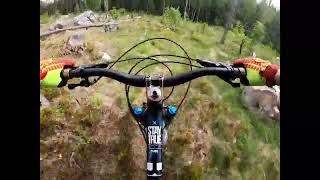
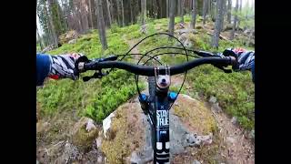
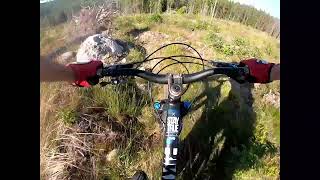
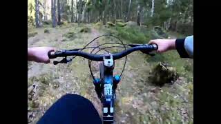
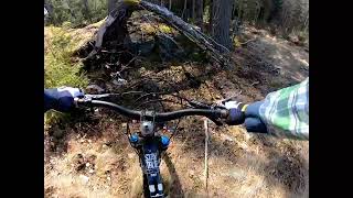
Photos of Hedemora Mountain Bike
Videos of Hedemora Mountain Bike
trail: Trollhällarna
2:08 |
73 |
Jun 13, 2023 , Hedemora
trail: Brunbacken Flow
0:42 |
71 |
Jun 13, 2023 , Hedemora
trail: Larven
2:40 |
96 |
Jun 13, 2023 , Hedemora
trail: Stressfritt
3:27 |
68 |
May 7, 2023 , Hedemora
trail: Älgtätt
2:28 |
93 |
Apr 15, 2023 , Hedemora
Recent Trail Reports
| status | trail | date | condition | info | user |
|---|---|---|---|---|---|
| Kerstin | Jul 19, 2025 @ 10:02am Jul 19, 2025 | Ideal | Martins0bh6pO | ||
| Matsbo | Jul 19, 2025 @ 10:02am Jul 19, 2025 | Ideal | Martins0bh6pO | ||
| Stadsberget Norr | Jul 19, 2025 @ 10:02am Jul 19, 2025 | Ideal | Martins0bh6pO | ||
| Workshop Fire Trail | Apr 10, 2021 @ 9:43pm Apr 10, 2021 | Wet | JordC | ||
| Skolvägen | Aug 22, 2020 @ 4:02am Aug 22, 2020 | Dry | nordis |
Activity Feed
| username | action | type | title | date |
|---|---|---|---|---|
| DanielWUJ1Lm | add | trail | activity #91974071 | Apr 5, 2026 @ 6:46am Apr 5, 2026 |
| MartinTia7XY | ridden | route | activity #85358616 | Dec 11, 2025 @ 8:05am Dec 11, 2025 |
| mattmalabanan | add | poi | activity #77954607 | Aug 12, 2025 @ 2:12am Aug 12, 2025 |
| Martins0bh6pO | add | report | activity #76213291 and 2 more | Jul 19, 2025 @ 3:05am Jul 19, 2025 |
| OrjanX | update | trail | activity #72933625 | Jun 2, 2025 @ 7:44am Jun 2, 2025 |
Local Badges
-

Epic Ride Climb 2k2 awarded -

Climbing 10k Badge3 awarded -

Climbing 100k Badge0 awarded -

Epic Ride Descent 2k2 awarded -

Descent 10k Badge3 awarded -

Descent 100k Badge0 awarded
Activity Type Stats
| activitytype | trails | distance | descent | descent distance | total vertical | rating | global rank | state rank | photos | reports | routes | ridelogs |
|---|---|---|---|---|---|---|---|---|---|---|---|---|
| Mountain Bike | 229 | 155 miles | 13,025 ft | 72 miles | 614 ft | #2,771 | #106 | 7 | 7 | 2 | 595 | |
| E-Bike | 5 | 2 miles | 154 ft | 5,272 ft | 85 ft | #6,052 | #124 | 6 | 3 | |||
| Hike | 223 | 143 miles | 12,736 ft | 68 miles | 614 ft | #1,336 | #68 | 6 | 7 | 23 | ||
| Trail Running | 223 | 143 miles | 12,736 ft | 68 miles | 614 ft | #973 | #71 | 7 | 95 | |||
| Nordic Ski | 7 | 5 miles | 361 ft | 2 miles | 190 ft | #582 | #62 | 52 |
Frequently Asked Questions About Hedemora
▼
What are the best places to ride in Hedemora?
Hedemora has 5 areas to explore for mountain biking. The top rated areas are:
▼
What are the highest rated mountain biking trails in Hedemora?
The highest rated mountain biking trails in Hedemora are:
- Tjärnan (0/5)
- Nyvalla 2 (0/5)
- Grådöslingan Kort (0/5)
- Tjärnan Alternativ (0/5)
- Grådöslingan Kort Mål (0/5)
▼
What is the best time of the year to ride in Hedemora?
Based on ride log data, the most popular months to ride in Hedemora are:
- October (3 activities)
- September (2 activities)
- August (2 activities)
▼
Where can I park to ride in Hedemora?
There are 1 parking locations listed in Hedemora. The most popular parking spots are:
Activities
Trails
Points of Interest
- By LeVieux & contributors
- Admins: ollesvenskonthetrail, JALLE, OrjanX, martinlindstr, OrjanX, svenakela, Cykelsadel
- #28968 - 2,750 views
- hedemora activity log | embed map of Hedemora mountain bike trails | hedemora mountain biking points of interest
Downloading of trail gps tracks in kml & gpx formats is enabled for Hedemora.
You must login to download files.