close
-
Layers w
- Weather Layers
- Pro
- Pro
- Pro
- Pro
- Pro
- Pro
- More Layers
- Pro
- Pro
- Pro
- Pro
-
Upgrade to

3D
Trail Conditions
- Unknown
- Snow Groomed
- Snow Packed
- Snow Covered
- Snow Cover Partial
- Freeze/thaw Cycle
- Icy
- Prevalent Mud
- Wet
- Variable
- Ideal
- Dry
- Very Dry
Trail Flow (Ridden Direction)
Trailforks scans users ridelogs to determine the most popular direction each trail is ridden. A good flowing trail network will have most trails flowing in a single direction according to their intension.
The colour categories are based on what percentage of riders are riding a trail in its intended direction.
The colour categories are based on what percentage of riders are riding a trail in its intended direction.
- > 96%
- > 90%
- > 80%
- > 70%
- > 50%
- < 50%
- bi-directional trail
- no data
Trail Last Ridden
Trailforks scans ridelogs to determine the last time a trail was ridden.
- < 2 days
- < 1 week
- < 2 weeks
- < 1 month
- < 6 months
- > 6 months
Trail Ridden Direction
The intended direction a trail should be ridden.
- Downhill Only
- Downhill Primary
- Both Directions
- Uphill Primary
- Uphill Only
- One Direction
Contribute Details
Colors indicate trail is missing specified detail.
- Description
- Photos
- Description & Photos
- Videos
Trail Popularity ?
Trailforks scans ridelogs to determine which trails are ridden the most in the last 9 months.
Trails are compared with nearby trails in the same city region with a possible 25 colour shades.
Think of this as a heatmap, more rides = more kinetic energy = warmer colors.
- most popular
- popular
- less popular
- not popular
ATV/ORV/OHV Filter
Max Vehicle Width
inches
US Cell Coverage
Legend

Radar Time
Activity Recordings
Trailforks uses anonymized public activity data.
?
Activity Recordings
Trailforks uses anonymized public activity data.
?
Personal Heatmap
▶
Activity Types
all
/
none
▶
Options
2
Date range
month
–
Winter Trails
Warning
A routing network for winter maps does not exist. Selecting trails using the winter trails layer has been disabled.
Missing Trails
Most Popular
Least Popular
Trails are colored based on popularity. The more popular a trail is, the more red. Less popular trails trend towards green.
Jump Magnitude Heatmap
Heatmap of where riders jump on trails. Zoom in to see individual jumps, click circles to view jump details.
BC Backroad Status
![map legend]()
Service Road Atlas is a free to use, community-driven service for viewing and creating reports on the numerous back-country service roads around B.C. and Alberta.

Slope Aspect
Direction the slope faces
Trails Deemphasized
Trails are shown in grey.
Only show trails with no bike usage.
Suggested Layers
Based on selected activity type
Save the current map location and zoom level as your default home location whenever this page is loaded.
SaveThe Bezirk Imst is an administrative district (Bezirk) in Tyrol, Austria. It borders the district Reutte in the north, as well as sharing a small border with Bavaria (Germany). It borders the district Innsbruck-Land in the east, South Tyrol (Italy) in the south, and the district Landeck in the west.
This region uses the Uk/Euro style trail grading system.
Activities Click to view
- Mountain Bike
62 trails
- E-Bike
61 trails
- Horse
4 trails
- Hike
28 trails
- Trail Running
26 trails
- Dirtbike/Moto
4 trails
- Observed Trials
4 trails
- ATV/ORV/OHV
4 trails
- Snowmobile
4 trails
- Snowshoe
5 trails
- Downhill Ski
100 trails
- Backcountry Ski
27 trails
- Nordic Ski
4 trails
Region Details
- 11
- 6
- 14
- 12
- 10
Stats
- Avg Trail Rating
- Trails (view details)
- 175
- Trails Mountain Bike
- 62
- Trails E-Bike
- 61
- Trails Gravel Bike
- 3
- Trails Horse
- 4
- Trails Hike
- 28
- Trails Trail Running
- 26
- Trails Dirtbike/Moto
- 4
- Trails Observed Trials
- 4
- Trails ATV/ORV/OHV
- 4
- Trails Snowmobile
- 4
- Trails Snowshoe
- 5
- Trails Downhill Ski
- 100
- Trails Backcountry Ski
- 27
- Trails Nordic Ski
- 4
- Total Distance
- 181 miles
- Total Descent
- 105,199 ft
- Total Vertical
- 8,898 ft
- Highest Trailhead
- 11,279 ft
- Reports
- 1,017
- Photos
- 383
- Ridden Counter
- 32,706
Articles
Bike Republic Sölden Expands for 2026 with New Lines & Smart Connections
May 12, 2026 from pinkbike.com
Get the first look at the redesigned Traien and Ohn Lines ahead of the BRS Festival and season kickoff on June 4.
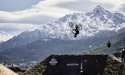
Rasoulution Shares Details on BRS Festival, Including Swatch Nines, World Records, & Parties
Aug 8, 2025 from pinkbike.com
The world’s best slopestyle and freeride athletes return to the flowy alpine nation to once again push the limits of MTB.
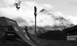
Video: 'Riders of the Storm' - Official 26-Minute Swatch Nines Documentary
Sep 19, 2024 from pinkbike.com
Rain, mud, sun, snow and a whole lot of send.
Details Announced for Bike Republic Sölden 2024 Opening
May 14, 2024 from pinkbike.com
Bikes can roll in Sölden from June 7.
Sub Regions
- Längenfeld (1)
- Nassereith (3)
- Oetz (7)
- Sölden (44)
- Bike Republic Sölden (42)
- Pitztal (6)
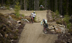
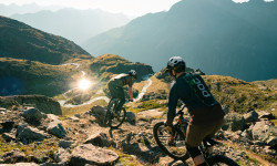
Popular Imst Mountain Biking Trails
• 95 ★ 4.1 • 1 mile • 2 ft • 1,686 •
Probably the most flowy trail: " " - open from 18.06.2016 - is one of this season's new attractions of the Bike Republic! Starting close to the Gaislachkogl Middle Station, it makes a perfect training area right amidst the huge network...
• 95 ★ 4.4 • 3 miles • 449 ft • 1,662 •
The "Teäre Line" opened only in 2015, has become a legendary trail within a few months - and only by word-of-mouth recommendation. What is so special about it? This unrivaled Flow Trail starts right at the Gaislachkogl Middle Station...
• 100 ★ 4.0 • 571 ft • 0 ft • 1,658 •
A short trail just off the side of Broate Line.
• 90 ★ 3.2 • 1 mile • 0 ft • 1,653 •
is an about 2.2 km long blue line starting right at the top station of Giggijoch Mountain Gondola. The short track down to Hochsölden features some 180 meters of altitude difference. is open from the 2017 summer, connecting the top...
• 80 ★ 4.4 • 4 miles • 56 ft • 1,479 •
Starting at Rettenbachalm mountain hut you take the (675) first. Follow it for about 2 km until you reach a fork-off into (6010). At its start the trail is quite level and broad, after a short track you bypass a huge boulder. Although...
• 80 ★ 4.2 • 5 miles • 168 ft • 1,417 •
[ɡaːhə] Fast, quick is the meaning of “Gahe“ – and yes, you can pick up speed indeed on this brand-new line. But you may require a solid endurance level for this epic flow ride as it goes on for incredible 7.6 km.
• 75 ★ 4.5 • 2,143 ft • 50 ft • 913 •
Reserved to tough girls and boys on two wheels! The "Zaahe Line" is a very challenging and stubborn trail, not easy to conquer - a quite tough trail indeed. If you are in an excellent physical shape and if your biking skills are...
Imst Mountain Bike Routes
1,378 ft • 3 ft • 0 • Point to Point •
Short, but hugely relevant to the riding experience in the Bike Republic, the new Drimmle Line (Ötztal...
Photos of Imst Mountain Bike
Videos of Imst Mountain Bike
trail: Gahe Line
0:09 |
105 |
Dec 30, 2021
trail: Teäre Line
0:24 |
28 |
Jul 7, 2021
trail: Ollweite Line
0:00 |
49 |
Apr 13, 2020
trail: Ohn Line
0:00 |
65 |
Apr 13, 2020
trail: Nene Trail
0:00 |
58 |
Apr 13, 2020
trail: Leiterberg Trail
0:00 |
49 |
Apr 13, 2020
trail: Fernar Trail
6:13 |
410 |
Feb 10, 2020
trail: Kühtrainschlucht Trail
6:28 |
117 |
Feb 9, 2020
Recent Trail Reports
Activity Feed
| username | action | type | title | date |
|---|---|---|---|---|
| HwarangOS | wishlist | badge | activity #97391596 | Jun 20, 2026 @ 7:13am 17 hours |
| captain-jeeves | vote | trail | activity #97344348 | Jun 19, 2026 @ 2:18pm 1 day |
| mh74germany | ridden | trail | activity #97314593 | Jun 19, 2026 @ 7:06am 2 days |
| mcharza | add | report | activity #97252847 and 7 more | Jun 18, 2026 @ 8:07am 3 days |
| mcharza | add | report | activity #97183114 and 3 more | Jun 17, 2026 @ 7:45am Jun 17, 2026 |
Recent Comments
| username | type | title | comment | date |
|---|---|---|---|---|
| trail | just dangerous if it wasnt so slow. after... | Sep 18, 2025 @ 5:40am Sep 18, 2025 | ||
| trail | very slow, bad turns. | Sep 18, 2025 @ 5:39am Sep 18, 2025 | ||
| trail | eher schlecht gebaut. anleger zu flach,... | Sep 18, 2025 @ 1:45am Sep 18, 2025 | ||
| trail | Sadly, it’s boring. Great landscape, huge... | Jul 21, 2025 @ 11:11am Jul 21, 2025 | ||
| trail | Definitely not black but pros only. No chicken... | Jul 14, 2025 @ 1:49pm Jul 14, 2025 |
Local Badges
-

Epic Ride Climb 2k2,560 awarded -

Climbing 10k Badge374 awarded -

Climbing 100k Badge5 awarded -

Epic Ride Descent 2k3,659 awarded -

Descent 10k Badge585 awarded -

Descent 100k Badge7 awarded
Bike & Skill Parks
| name | type | city | rating |
|---|---|---|---|
| Bike Republic Sölden | bike park | Sölden | |
| Pumptrack Rolling Sölden | skill park | Sölden | |
| Pumptrack Hotel Sunny Sölden | skill park | Sölden | |
| AREA 47 Indoor Bikepark | skill park | Oetz |
Upcoming Local Events
Activity Type Stats
| activitytype | trails | distance | descent | descent distance | total vertical | rating | global rank | state rank | photos | reports | routes | ridelogs |
|---|---|---|---|---|---|---|---|---|---|---|---|---|
| Mountain Bike | 62 | 60 miles | 34,898 ft | 40 miles | 6,752 ft | 378 | 1,017 | 1 | 11,616 | |||
| E-Bike | 61 | 61 miles | 36,798 ft | 42 miles | 6,752 ft | 4 | 972 | 1,289 | ||||
| Gravel Bike | 3 | 23 | 21 | |||||||||
| Horse | 4 | 86 | ||||||||||
| Hike | 28 | 19 miles | 9,544 ft | 10 miles | 6,535 ft | 2 | 922 | 1,284 | ||||
| Trail Running | 26 | 17 miles | 7,648 ft | 8 miles | 6,535 ft | 922 | 68 | |||||
| Dirtbike/Moto | 4 | 86 | ||||||||||
| Observed Trials | 4 | 1 | ||||||||||
| ATV/ORV/OHV | 4 | 86 | 2 | |||||||||
| Snowmobile | 4 | |||||||||||
| Snowshoe | 5 | 4 miles | 338 ft | 4,465 ft | 1,732 ft | 10 | ||||||
| Downhill Ski | 100 | 56 miles | 56,047 ft | 53 miles | 6,184 ft | 5,387 | ||||||
| Backcountry Ski | 27 | 61 miles | 9,131 ft | 12 miles | 7,231 ft | 706 | ||||||
| Nordic Ski | 4 | 141 |
Frequently Asked Questions About Imst
▼
What are the best places to ride in Imst?
Imst has 5 areas to explore for mountain biking. The top rated areas are:
▼
What are the highest rated mountain biking trails in Imst?
The highest rated mountain biking trails in Imst are:
- Leiterberg Trail (4.5/5)
- Ohn Line (4.4/5)
- Schtirggar Line (4.4/5)
- Ollweite Line (4.4/5)
- Nene Trail (4.4/5)
▼
What is the best time of the year to ride in Imst?
Based on ride log data, the most popular months to ride in Imst are:
- July (171 activities)
- August (164 activities)
- September (129 activities)
▼
What is the longest trail in Imst?
The longest trail in Imst is Hochzeiger Family Trail at 4.5 miles. View all trails sorted by distance.
Activities
Trails
Points of Interest
- Cableway Pick-Up (Giggijochbahn) Other
- Cableway Drop-Off (Giggijochbahn) Other
- Cableway Pick-Up (Gaislachkoglbahn) Other
- Middle station Gaislachkoglbahn Other
- Chairlift Pick-Up (Langeggbahn) Other
- Chairlift Drop-Off (Langeggbahn) Other
- Cableway Pick-Up (Hochsölden-Rotkoglbahn) Other
- Cableway Drop-Off (Hochsölden-Rotkoglbahn) Other
- Middle station Hochsölden-Rotkoglbahn Other
- Cablecar Pick-Up (Zentrum Shuttle) Other
- Schrankogel (11,358 ft)
- Ruderhofspitze (11,260 ft)
- Sonklarspitze - Cima di Malavalle (11,247 ft)
- By elyari
 TRAILFORKS TFSPAIN & contributors
 - Admins: ktm-boy-69, mpecsi, lines, larry81541, PatrickMeraner
- #57241 - 2,217 views
- imst activity log | embed map of Imst mountain bike trails | imst mountain biking points of interest
Downloading of trail gps tracks in kml & gpx formats is enabled for Imst.
You must login to download files.