close
-
Layers w
- Weather Layers
- Pro
- Pro
- Pro
- Pro
- Pro
- Pro
- More Layers
- Pro
- Pro
- Pro
- Pro
-
Upgrade to

3D
Trail Conditions
- Unknown
- Snow Groomed
- Snow Packed
- Snow Covered
- Snow Cover Partial
- Freeze/thaw Cycle
- Icy
- Prevalent Mud
- Wet
- Variable
- Ideal
- Dry
- Very Dry
Trail Flow (Ridden Direction)
Trailforks scans users ridelogs to determine the most popular direction each trail is ridden. A good flowing trail network will have most trails flowing in a single direction according to their intension.
The colour categories are based on what percentage of riders are riding a trail in its intended direction.
The colour categories are based on what percentage of riders are riding a trail in its intended direction.
- > 96%
- > 90%
- > 80%
- > 70%
- > 50%
- < 50%
- bi-directional trail
- no data
Trail Last Ridden
Trailforks scans ridelogs to determine the last time a trail was ridden.
- < 2 days
- < 1 week
- < 2 weeks
- < 1 month
- < 6 months
- > 6 months
Trail Ridden Direction
The intended direction a trail should be ridden.
- Downhill Only
- Downhill Primary
- Both Directions
- Uphill Primary
- Uphill Only
- One Direction
Contribute Details
Colors indicate trail is missing specified detail.
- Description
- Photos
- Description & Photos
- Videos
Trail Popularity ?
Trailforks scans ridelogs to determine which trails are ridden the most in the last 9 months.
Trails are compared with nearby trails in the same city region with a possible 25 colour shades.
Think of this as a heatmap, more rides = more kinetic energy = warmer colors.
- most popular
- popular
- less popular
- not popular
ATV/ORV/OHV Filter
Max Vehicle Width
inches
US Cell Coverage
Legend

Radar Time
Activity Recordings
Trailforks uses anonymized public activity data.
?
Activity Recordings
Trailforks uses anonymized public activity data.
?
Personal Heatmap
▶
Activity Types
all
/
none
▶
Options
2
Date range
month
–
Winter Trails
Warning
A routing network for winter maps does not exist. Selecting trails using the winter trails layer has been disabled.
Missing Trails
Most Popular
Least Popular
Trails are colored based on popularity. The more popular a trail is, the more red. Less popular trails trend towards green.
Jump Magnitude Heatmap
Heatmap of where riders jump on trails. Zoom in to see individual jumps, click circles to view jump details.
BC Backroad Status
![map legend]()
Service Road Atlas is a free to use, community-driven service for viewing and creating reports on the numerous back-country service roads around B.C. and Alberta.

Slope Aspect
Direction the slope faces
Trails Deemphasized
Trails are shown in grey.
Only show trails with no bike usage.
Suggested Layers
Based on selected activity type
Save the current map location and zoom level as your default home location whenever this page is loaded.
Save
No description for Kingman has been added yet!
Login or register to submit one.
Activities Click to view
- Mountain Bike
136 trails
- E-Bike
132 trails
- Gravel Bike
2 trails
- Adaptive Bike
0 trails
- Winter Fat Bike
0 trails
- Horse
31 trails
- Hike
132 trails
- Trail Running
132 trails
Region Details
- 43
- 1
- 28
- 30
- 20
- 4
Region Status
Open as of May 30, 2026Stats
- Avg Trail Rating
- Trails (view details)
- 133
- Trails Mountain Bike
- 136
- Trails E-Bike
- 132
- Trails Gravel Bike
- 2
- Trails Horse
- 31
- Trails Hike
- 132
- Trails Trail Running
- 132
- Trails Dirtbike/Moto
- 4
- Trails Observed Trials
- 2
- Trails ATV/ORV/OHV
- 4
- Total Distance
- 204 miles
- Total Descent
- 32,235 ft
- Total Vertical
- 6,970 ft
- Highest Trailhead
- 8,344 ft
- Reports
- 308
- Photos
- 487
- Ridden Counter
- 6,981
Sub Regions
-
Hualapai Mountain Park
- 1
- 3
- 1
-
Monolith Gardens
- 18
- 17
- 8
- 2
-
White Cliffs Trail System
- 7
- 10
- 10
- 2
Popular Kingman Mountain Biking Trails
• 75 ★ 4.1 • 7 miles • 600 ft • 720 •
trail is an easy to intermediate loop system with some technical climbs and downhills. June 2011 (a technical intermediate) was connected at 3 location to the Monolith trail adding an additional 10.35 miles to the trail system. The most...
• 100 ★ 4.4 • 3,258 ft • 22 ft • 245 •
Highly rated popular blue difficulty singletrack. This multi-use trail can be used downhill primary and has a hard overall physical rating with a 22 ft black diamond climb. Trail visibility is always easy to follow. On average it takes 7 minutes to complete this trail.
• 95 ★ 4.0 • 1 mile • 39 ft • 196 •
Popular green difficulty singletrack. This mountain bike primary trail can be used both directions and has a moderate overall physical rating with a 39 ft blue climb. Trail visibility is always easy to follow. On average it takes 5 minutes to complete this trail.
• 80 ★ 3.5 • 6 miles • 670 ft • 163 •
From Coyote Pass trailhead (counter clockwise), the start of this trial is climb, but worth it. Once you make it across a service road, it flattens out. A short sprint through some flowing grassland terrain leads you to ride along the...
• 90 ★ 4.0 • 1,778 ft • 38 ft • 128 •
Popular green difficulty singletrack. This multi-use trail can be used both directions. On average it takes 2 minutes to complete this trail.
• 100 ★ 4.0 • 404 ft • 0 ft • 118 •
connector for bypassing Coyote Pass TH
Kingman Mountain Bike Routes
★ 5.0 • 9 miles • 1,009 ft • 26 •
This is a good course to follow showing all the trails ridden in the best direction. There are only a...
★ 5.0 • 8 miles • 661 ft • 3 •
Monolith Gardens is stunning! This is a quick 8-mile loop through the best of the area. You can ride it in...
★ 4.0 • 22 miles • 2,782 ft • 10 • Loop •
First, start by Climbing the north side of and get ready to hate life because this is a rocky mess of a...
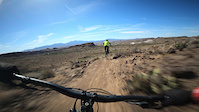
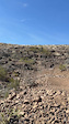
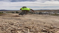
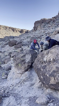
Photos of Kingman Mountain Bike
Videos of Kingman Mountain Bike
trail: Lower Geocache
0:17 |
20 |
May 5, 2026

trail: Upper Geocache
0:11 |
46 |
Apr 30, 2026

trail: Lower Geotech
3:30 |
27 |
Apr 29, 2026
trail: All Hat, No Cattle
0:09 |
57 |
Apr 5, 2026

trail: Lower Cactus Derby
0:32 |
33 |
Mar 9, 2025
trail: Downtown Connector
0:22 |
48 |
Nov 5, 2024
trail: Ghost Pepper
0:12 |
51 |
Apr 13, 2024

trail: Ledges Loop
2:32 |
88 |
Apr 13, 2024
Recent Trail Reports
| status | trail | date | condition | info | user |
|---|---|---|---|---|---|
| Lower Geocache | May 22, 2026 @ 3:25pm (America/Phoenix) May 22, 2026 | Dry | DanielHkj8VX | ||
| Upper Geocache | May 22, 2026 @ 3:25pm (America/Phoenix) May 22, 2026 | Dry | DanielHkj8VX | ||
| Lower Geotech | May 22, 2026 @ 3:24pm (America/Phoenix) May 22, 2026 | Dry | DanielHkj8VX | ||
| Badger | Apr 24, 2026 @ 9:56pm (America/Phoenix) Apr 24, 2026 | Ideal | DanielHkj8VX | ||
| Metwell Spur | Jan 25, 2026 @ 12:09pm (America/Phoenix) Jan 25, 2026 | Ideal | southpaw4411 | ||
| Baby Bottle Connector | Jan 21, 2026 @ 10:45am (America/Phoenix) Jan 21, 2026 | Ideal | Bergie4449 | ||
| Slick Rock Bypass | Jan 21, 2026 @ 10:45am (America/Phoenix) Jan 21, 2026 | Ideal | Bergie4449 | ||
| Foothills Rim | Jan 21, 2026 @ 10:45am (America/Phoenix) Jan 21, 2026 | Ideal | Bergie4449 | ||
| Cerbat Foothill Recreation Area Service Road | Jan 21, 2026 @ 10:45am (America/Phoenix) Jan 21, 2026 | Ideal | Bergie4449 | ||
| Camp Beale Loop | Dec 4, 2025 @ 1:24pm (America/Phoenix) Dec 4, 2025 | Dry | AmandaHSuHrf |
Activity Feed
| username | action | type | title | date |
|---|---|---|---|---|
| raisingarizona | comment | trail | activity #96785463 | Jun 11, 2026 @ 10:34pm Jun 11, 2026 |
| solo805er | ridden | trail | activity #96533864 | Jun 8, 2026 @ 5:57am Jun 8, 2026 |
| ctx760 | add | photo | activity #96188099 and 1 more | Jun 3, 2026 @ 4:23pm Jun 3, 2026 |
| KatzT | add | report | activity #95897296 | May 30, 2026 @ 4:48pm May 30, 2026 |
| BlakeXXKQHB | wishlist | trail | activity #95866447 | May 30, 2026 @ 10:23am May 30, 2026 |
Recent Comments
| username | type | title | comment | date |
|---|---|---|---|---|
| trail | Rowdiest dh track in Kingman. It's short but... | Jun 11, 2026 @ 10:34pm Jun 11, 2026 | ||
| trail | I really enjoyed this trail. It's short but a... | Nov 3, 2025 @ 1:15pm Nov 3, 2025 | ||
| trail | Nice trail. Pay attention. Easy to get off... | Sep 22, 2025 @ 12:31pm Sep 22, 2025 | ||
| trail | Katz is the coolest | Aug 29, 2025 @ 7:29pm Aug 29, 2025 | ||
| trail | Riding it uphill was extremely challenging,... | May 17, 2025 @ 3:43pm May 17, 2025 |
Local Badges
-

10 Blue Trails48 awarded -

Epic Ride Climb 2k4 awarded -

Climbing 10k Badge19 awarded -

Climbing 100k Badge1 awarded -

Epic Ride Descent 2k5 awarded -

Descent 10k Badge19 awarded
Bike & Skill Parks
| name | type | city | rating |
|---|---|---|---|
| High Desert 66 BMX | skill park | Kingman |
Activity Type Stats
| activitytype | trails | distance | descent | descent distance | total vertical | rating | global rank | state rank | photos | reports | routes | ridelogs |
|---|---|---|---|---|---|---|---|---|---|---|---|---|
| Mountain Bike | 136 | 179 miles | 26,827 ft | 76 miles | 5,069 ft | #991 | #390 | 465 | 308 | 5 | 7,464 | |
| E-Bike | 132 | 179 miles | 26,827 ft | 76 miles | 5,069 ft | #643 | #741 | 231 | 2 | 1,155 | ||
| Gravel Bike | 2 | #538 | #1,097 | 5 | ||||||||
| Horse | 31 | 70 miles | 7,674 ft | 25 miles | 3,694 ft | #847 | #604 | 47 | 1 | |||
| Hike | 132 | 184 miles | 28,629 ft | 79 miles | 5,069 ft | #790 | #361 | 21 | 232 | 832 | ||
| Trail Running | 132 | 184 miles | 28,629 ft | 79 miles | 5,069 ft | #807 | #300 | 1 | 232 | 465 | ||
| Dirtbike/Moto | 4 | 46 miles | 6,286 ft | 26 miles | 4,833 ft | 30 | 3 | |||||
| Observed Trials | 2 | 17 miles | 2,638 ft | 7 miles | 2,631 ft | 4 | ||||||
| ATV/ORV/OHV | 4 | 46 miles | 6,286 ft | 26 miles | 4,833 ft | 30 | 21 |
Frequently Asked Questions About Kingman
▼
What are the best places to ride in Kingman?
Kingman has 3 areas to explore for mountain biking. The top rated areas are:
▼
What are the highest rated mountain biking trails in Kingman?
The highest rated mountain biking trails in Kingman are:
- Badger (4.5/5)
- Tuff Break (4.4/5)
- Golf Course North Loop (4.4/5)
- Ghost Pepper (4.4/5)
- Golf Course South Loop (4.3/5)
▼
What is the best time of the year to ride in Kingman?
Based on ride log data, the most popular months to ride in Kingman are:
- November (129 activities)
- October (113 activities)
- December (99 activities)
▼
Where can I park to ride in Kingman?
There are 9 parking locations listed in Kingman. The most popular parking spots are: View all parking and trailhead locations on the map to plan your visit.
Activities
Trails
Points of Interest
- Girl Scouts Waterfall Sight
- Wall Ride on Rock Face TTF
- Rock Gap TTF
- Bonus Slickrock Freeride TTF
- Info Board with Map Information
- Info Board Information
- Info Board with Trail Map Information
- Happy Place step-up TTF
- Jump TTF
- Jump TTF
- Hayden Peak (8,340 ft)
- Dean Peak (7,940 ft)
- Hualapai Peak (7,779 ft)
- By schillingsworth
 TRAILFORKS HTA & contributors
 - Admins: AZT, chainslapAZ, schillingsworth, jeffgicklhorn, jpmcghee, msmcfate, cemoorelife, Schwinnshralper26, CRATA-AZ
- #5720 - 14,152 views
- kingman activity log | embed map of Kingman mountain bike trails | kingman mountain biking points of interest
Downloading of trail gps tracks in kml & gpx formats is enabled for Kingman.
You must login to download files.