close
-
Layers w
- Weather Layers
- Pro
- Pro
- Pro
- Pro
- Pro
- Pro
- More Layers
- Pro
- Pro
- Pro
- Pro
-
Upgrade to

3D
Trail Conditions
- Unknown
- Snow Groomed
- Snow Packed
- Snow Covered
- Snow Cover Partial
- Freeze/thaw Cycle
- Icy
- Prevalent Mud
- Wet
- Variable
- Ideal
- Dry
- Very Dry
Trail Flow (Ridden Direction)
Trailforks scans users ridelogs to determine the most popular direction each trail is ridden. A good flowing trail network will have most trails flowing in a single direction according to their intension.
The colour categories are based on what percentage of riders are riding a trail in its intended direction.
The colour categories are based on what percentage of riders are riding a trail in its intended direction.
- > 96%
- > 90%
- > 80%
- > 70%
- > 50%
- < 50%
- bi-directional trail
- no data
Trail Last Ridden
Trailforks scans ridelogs to determine the last time a trail was ridden.
- < 2 days
- < 1 week
- < 2 weeks
- < 1 month
- < 6 months
- > 6 months
Trail Ridden Direction
The intended direction a trail should be ridden.
- Downhill Only
- Downhill Primary
- Both Directions
- Uphill Primary
- Uphill Only
- One Direction
Contribute Details
Colors indicate trail is missing specified detail.
- Description
- Photos
- Description & Photos
- Videos
Trail Popularity ?
Trailforks scans ridelogs to determine which trails are ridden the most in the last 9 months.
Trails are compared with nearby trails in the same city region with a possible 25 colour shades.
Think of this as a heatmap, more rides = more kinetic energy = warmer colors.
- most popular
- popular
- less popular
- not popular
ATV/ORV/OHV Filter
Max Vehicle Width
inches
US Cell Coverage
Legend

Radar Time
Activity Recordings
Trailforks uses anonymized public activity data.
?
Activity Recordings
Trailforks uses anonymized public activity data.
?
Personal Heatmap
▶
Activity Types
all
/
none
▶
Options
2
Date range
month
–
Winter Trails
Warning
A routing network for winter maps does not exist. Selecting trails using the winter trails layer has been disabled.
Missing Trails
Most Popular
Least Popular
Trails are colored based on popularity. The more popular a trail is, the more red. Less popular trails trend towards green.
Jump Magnitude Heatmap
Heatmap of where riders jump on trails. Zoom in to see individual jumps, click circles to view jump details.
BC Backroad Status
![map legend]()
Service Road Atlas is a free to use, community-driven service for viewing and creating reports on the numerous back-country service roads around B.C. and Alberta.

Slope Aspect
Direction the slope faces
Trails Deemphasized
Trails are shown in grey.
Only show trails with no bike usage.
Suggested Layers
Based on selected activity type
Save the current map location and zoom level as your default home location whenever this page is loaded.
Save
No description for Kranj has been added yet!
Login or register to submit one.
This region uses the Uk/Euro style trail grading system.
Activities Click to view
- Mountain Bike
14 trails
- E-Bike
5 trails
- Adaptive Bike
0 trails
- Winter Fat Bike
0 trails
- Hike
5 trails
- Trail Running
5 trails
- Downhill Ski
9 trails
Region Details
- 6
- 3
- 2
- 1
- 1
Region Status
Open as of Aug 15, 2025Stats
- Avg Trail Rating
- Trails (view details)
- 20
- Trails Mountain Bike
- 14
- Trails E-Bike
- 5
- Trails Horse
- 3
- Trails Hike
- 5
- Trails Trail Running
- 5
- Trails Snowmobile
- 3
- Trails Snowshoe
- 3
- Trails Downhill Ski
- 9
- Trails Backcountry Ski
- 3
- Trails Nordic Ski
- 3
- Total Distance
- 25 miles
- Total Descent
- 12,825 ft
- Total Vertical
- 5,064 ft
- Highest Trailhead
- 6,386 ft
- Reports
- 174
- Photos
- 126
- Ridden Counter
- 3,341
Sub Regions
-
Bike park plana
-
Jošt
-
Krvavec
- 3
- 1
- 1
- 1
Popular Kranj Mountain Biking Trails
• 50 ★ 5.0 • 1 mile • 576 ft • 65 •
Moderately popular blue difficulty singletrack. This mountain bike primary trail can be used both directions and has a moderate overall physical rating with a 576 ft blue climb. It features jump and roller coaster. On average it takes 54 minutes to complete this trail.
• 5 ★ 5.0 • 0 ft • 0 ft • 3 •
Less popular double black diamond difficulty singletrack. This mountain bike primary trail can be used downhill primary.
Kranj Mountain Bike Routes
★ 5.0 • 7 miles • 2,000 ft • 0 •
22 miles • 4,744 ft • 0 • Point to Point •
Stage 36 of Slovenian mountain bike route (Slovenska turnokolesarska pot – STKP).
• 8 miles • 1,919 ft • 0 •
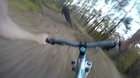
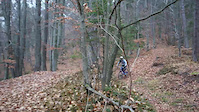
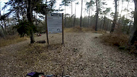
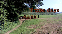
Photos of Kranj Mountain Bike
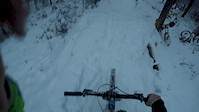
Videos of Kranj Mountain Bike
trail: Blueberry Hill
0:22 |
179 |
Apr 11, 2022
trail: Blueberry Hill
0:15 |
327 |
Jun 27, 2019
trail: Blueberry Hill
0:47 |
153 |
Feb 6, 2016
trail: Blueberry Hill
0:05 |
1206 |
Feb 6, 2016
trail: Blueberry Hill
0:51 |
372 |
Feb 6, 2016
trail: Blueberry Hill
0:13 |
241 |
Dec 10, 2015
trail: Blueberry Hill
0:09 |
251 |
Nov 17, 2015
trail: Blueberry Hill
2:29 |
374 |
Sep 2, 2014
Recent Trail Reports
| status | trail | date | condition | info | user |
|---|---|---|---|---|---|
| Krvavec road | Sep 8, 2024 @ 11:30am Sep 8, 2024 | Dry | Carbon24 | ||
| Gospinca - Kriška Planina | Jul 28, 2024 @ 6:09am Jul 28, 2024 | Dry | VjekoslavKrsanac TRAILFORKS | ||
| Plaža road | Jul 28, 2024 @ 6:09am Jul 28, 2024 | Dry | VjekoslavKrsanac TRAILFORKS | ||
| Kabinska žičnica Krvavec | Aug 27, 2023 @ 2:23am Aug 27, 2023 | Very Dry | ElMomos | ||
| Blueberry access road | Oct 1, 2020 @ 7:40am Oct 1, 2020 | Dry | Primoz |
Activity Feed
| username | action | type | title | date |
|---|---|---|---|---|
| MarijasaLk8v | wishlist | route | activity #98598241 | Jul 6, 2026 @ 2:13pm Jul 6, 2026 |
| uliholger | wishlist | route | activity #98584372 | Jul 6, 2026 @ 10:28am Jul 6, 2026 |
| WildDuck2025 | wishlist | route | activity #92110628 | Apr 7, 2026 @ 5:16am Apr 7, 2026 |
| andrejdekleva | add | photo | activity #87080425 and 7 more | Jan 12, 2026 @ 9:17am Jan 12, 2026 |
| JanSkomina | wishlist | trail | activity #82865290 | Oct 23, 2025 @ 5:20am Oct 23, 2025 |
Recent Comments
| username | type | title | comment | date |
|---|---|---|---|---|
| trail | It is not wet weather friendly. Don’t ride... | Mar 27, 2022 @ 4:36am Mar 27, 2022 |
Local Badges
-

Epic Ride Climb 2k414 awarded -

Climbing 10k Badge84 awarded -

Climbing 100k Badge10 awarded -

Epic Ride Descent 2k573 awarded -

Descent 10k Badge116 awarded -

Descent 100k Badge10 awarded
Bike & Skill Parks
| name | type | city | rating |
|---|---|---|---|
| Krvavec | bike park | Kranj | |
| Blueberry hill | skill park | Kranj |
Activity Type Stats
| activitytype | trails | distance | descent | descent distance | total vertical | rating | global rank | state rank | photos | reports | routes | ridelogs |
|---|---|---|---|---|---|---|---|---|---|---|---|---|
| Mountain Bike | 14 | 22 miles | 9,373 ft | 11 miles | 3,927 ft | #1,439 | #9 | 126 | 174 | 2 | 11,101 | |
| E-Bike | 5 | 8 miles | 850 ft | 2 miles | 3,766 ft | #1,307 | #9 | 118 | 444 | |||
| Horse | 3 | 29 | ||||||||||
| Hike | 5 | 2 miles | 121 ft | 932 ft | 738 ft | #2,291 | #17 | 135 | 1 | 3,400 | ||
| Trail Running | 5 | 2 miles | 121 ft | 932 ft | 738 ft | #1,939 | #19 | 135 | 29 | |||
| Snowmobile | 3 | |||||||||||
| Snowshoe | 3 | 2 | ||||||||||
| Downhill Ski | 9 | 3 miles | 3,451 ft | 3 miles | 1,542 ft | #229 | #2 | 354 | ||||
| Backcountry Ski | 3 | 572 | ||||||||||
| Nordic Ski | 3 | 179 |
Frequently Asked Questions About Kranj
▼
What are the best places to ride in Kranj?
Kranj has 3 areas to explore for mountain biking. The top rated areas are:
▼
What are the highest rated mountain biking trails in Kranj?
The highest rated mountain biking trails in Kranj are:
- Blueberry Hill (4.4/5)
- Trilchy line (4.2/5)
▼
What is the best time of the year to ride in Kranj?
Based on ride log data, the most popular months to ride in Kranj are:
- July (39 activities)
- August (26 activities)
- June (23 activities)
▼
Where can I park to ride in Kranj?
There are 3 parking locations listed in Kranj. The most popular parking spots are: View all parking and trailhead locations on the map to plan your visit.
Activities
Trails
- By krsh & contributors
- Admins: VjekoslavKrsanac, zocknroll, Primoz
- #4248 - 10,090 views
- kranj activity log | embed map of Kranj mountain bike trails | kranj mountain biking points of interest
Downloading of trail gps tracks in kml & gpx formats is enabled for Kranj.
You must login to download files.