close
-
Layers w
- Weather Layers
- Pro
- Pro
- Pro
- Pro
- Pro
- Pro
- More Layers
- Pro
- Pro
- Pro
- Pro
-
Upgrade to

3D
Trail Conditions
- Unknown
- Snow Groomed
- Snow Packed
- Snow Covered
- Snow Cover Partial
- Freeze/thaw Cycle
- Icy
- Prevalent Mud
- Wet
- Variable
- Ideal
- Dry
- Very Dry
Trail Flow (Ridden Direction)
Trailforks scans users activity logs to determine the most popular direction each trail is ridden. A good flowing trail network will have most trails flowing in a single direction according to their intension.
The colour categories are based on what percentage of users are riding a trail in its intended direction.
The colour categories are based on what percentage of users are riding a trail in its intended direction.
- > 96%
- > 90%
- > 80%
- > 70%
- > 50%
- < 50%
- bi-directional trail
- no data
Trail Last Ridden
Trailforks scans activity logs to determine the last time a trail was ridden.
- < 2 days
- < 1 week
- < 2 weeks
- < 1 month
- < 6 months
- > 6 months
Trail Ridden Direction
The intended direction a trail should be ridden.
- Downhill Only
- Downhill Primary
- Both Directions
- Uphill Primary
- Uphill Only
- One Direction
Contribute Details
Colors indicate trail is missing specified detail.
- Description
- Photos
- Description & Photos
- Videos
Trail Popularity ?
Trailforks scans activity logs to determine which trails are ridden the most in the last 9 months.
Trails are compared with nearby trails in the same city region with a possible 25 colour shades.
Think of this as a heatmap, more activities = more kinetic energy = warmer colors.
- most popular
- popular
- less popular
- not popular
ATV/ORV/OHV Filter
Max Vehicle Width
inches
US Cell Coverage
Legend

Radar Time
Activity Recordings
Trailforks uses anonymized public activity data.
?
Activity Recordings
Trailforks uses anonymized public activity data.
?
Personal Heatmap
▶
Activity Types
all
/
none
▶
Options
2
Date range
month
–
Winter Trails
Warning
A routing network for winter maps does not exist. Selecting trails using the winter trails layer has been disabled.
Missing Trails
Most Popular
Least Popular
Trails are colored based on popularity. The more popular a trail is, the more red. Less popular trails trend towards green.
Jump Magnitude Heatmap
Heatmap of where users jump on trails. Zoom in to see individual jumps, click circles to view jump details.
BC Backroad Status
![map legend]()
Service Road Atlas is a free to use, community-driven service for viewing and creating reports on the numerous back-country service roads around B.C. and Alberta.

Slope Aspect
Direction the slope faces
Trails Deemphasized
Trails are shown in grey.
Only show trails with no bike usage.
Suggested Layers
Based on selected activity type
Save the current map location and zoom level as your default home location whenever this page is loaded.
SaveNorsk
En liten bakke med en god del sykkelstier. Flere forskjellige muligheter for sammenkobling av stiene.
English
A little hill with quite a bit of rideable trails. Several different possibilities for link-ups of the trails.
En liten bakke med en god del sykkelstier. Flere forskjellige muligheter for sammenkobling av stiene.
English
A little hill with quite a bit of rideable trails. Several different possibilities for link-ups of the trails.
Primary Trail Type: All-Mountain & Downhill
 google parking directions
 Access Info:
Norsk
Kjør 6-7 km forbi Kroken. Ta til høyre inn på "Linkvegen", kjør oppover og du kommer til en port og en parkeringsplass.
English
Drive 6-7km past Kroken. Take a right on "Linkvegen", drive up and you will reach a gate and a parking spot.
Kjør 6-7 km forbi Kroken. Ta til høyre inn på "Linkvegen", kjør oppover og du kommer til en port og en parkeringsplass.
English
Drive 6-7km past Kroken. Take a right on "Linkvegen", drive up and you will reach a gate and a parking spot.
This region uses the Uk/Euro style trail grading system.
Activities Click to view
- Mountain Bike
18 trails
- E-Bike
1 trails
- Hike
18 trails
- Trail Running
17 trails
Region Details
- 2
- 10
- 6
Region Status
Caution as of Jun 18, 2026Local Trail Association
Stats
- Avg Trail Rating
- Trails (view details)
- 18
- Trails Mountain Bike
- 18
- Trails E-Bike
- 1
- Trails Hike
- 18
- Trails Trail Running
- 17
- Trails Nordic Ski
- 2
- Total Distance
- 26 miles
- Total Descent
- 6,155 ft
- Total Vertical
- 1,139 ft
- Highest Trailhead
- 1,148 ft
- Reports
- 31
- Photos
- 27
- Completed Counter
- 424
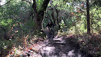
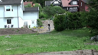
Popular Linken Mountain Biking Trails
• 95 ★ 0.0 • 1,266 ft • 23 ft • 51 •
Popular green difficulty doubletrack. This mountain bike primary trail can be used both directions and has a easy overall physical rating with a 23 ft green climb. On average it takes 1 minutes to complete this trail.
• 80 ★ 4.0 • 2,766 ft • 0 ft • 46 •
Popular green difficulty singletrack. This mountain bike primary trail can be used both directions and has a moderate overall physical rating with a 0 ft blue climb. On average it takes 3 minutes to complete this trail.
• 80 ★ 4.4 • 2 miles • 51 ft • 38 •
Nice trails close to town. A bit of everything, XC type flat/uphill riding and more enduro type parts as well.
• 85 ★ 3.0 • 4,318 ft • 0 ft • 33 •
A little more rocky and off camber than the more flowy " ". Take a left on the last knoll instead of a right as to the other trails. Go and cross the gravel road twice. Two options at the bottom, the left one is recommended.
• 75 ★ 3.0 • 2,402 ft • 0 ft • 31 •
Start directly behind the tower. Recently cleaned and rides really well and fast!
• 75 ★ 4.0 • 4,124 ft • 0 ft • 29 •
This is the best singletrack down from in my opinion, but sadly enough, this singletrack has been one of the best kept secrets in the area, so it hasn't been ridden enough. Gras and heather has partly taken over the trail, so it can be...
• 75 ★ 3.0 • 2 miles • 173 ft • 23 •
Flat trail that leads you either of the parking spots at . Several of the other trails end up at this one.
Photos of Linken Mountain Bike
Recent Trail Reports
| status | trail | date | condition | info | user |
|---|---|---|---|---|---|
| Trek Ex 9.9 AXS trail | Jun 18, 2026 @ 10:17pm (Europe/Oslo) Jun 18, 2026 | Unknown | granaas | ||
| Linken | May 31, 2026 @ 6:43pm (Arctic/Longyearbyen) May 31, 2026 | Ideal | espencapable | ||
| Link Right | May 31, 2026 @ 6:43pm (Arctic/Longyearbyen) May 31, 2026 | Ideal | espencapable | ||
| My gift to you | May 24, 2026 @ 2:54pm (Europe/Oslo) May 24, 2026 | Ideal | kga | ||
| Access Road | May 22, 2025 @ 2:20pm May 22, 2025 | Snow Covered | kga | ||
| Around Linken | Sep 7, 2024 @ 4:33pm Sep 7, 2024 | Dry | sergsmal | ||
| Skavåsen Til Skytebanen | Sep 7, 2024 @ 4:33pm Sep 7, 2024 | Ideal | sergsmal | ||
| Åsfjellet | Aug 5, 2021 @ 6:33am Aug 5, 2021 | Variable | granaas | ||
| Reinvannet og Bakvannet | Jul 28, 2020 @ 11:19am Jul 28, 2020 | Ideal | FredOisund | ||
| Straight Ahead | Jul 20, 2017 @ 10:21am Jul 20, 2017 | Dry | Ezbikez |
Activity Feed
| username | action | type | title | date |
|---|---|---|---|---|
| Annmikaela | comment | trail | activity #98260724 | Jul 2, 2026 @ 5:40am Jul 2, 2026 |
| r4nWZq | ridden | trail | activity #97982114 and 2 more | Jun 28, 2026 @ 6:06am Jun 28, 2026 |
| granaas | add | report | activity #97272606 | Jun 18, 2026 @ 1:17pm Jun 18, 2026 |
| espencapable | add | report | activity #95978882 and 1 more | May 31, 2026 @ 2:35pm May 31, 2026 |
| kga | add | report | activity #95482723 | May 25, 2026 @ 6:21am May 25, 2026 |
Recent Comments
| username | type | title | comment | date |
|---|---|---|---|---|
| trail | Men | Jul 2, 2026 @ 5:40am Jul 2, 2026 | ||
| report | NB! Skulle være varierende, en del våte... | Jul 3, 2018 @ 3:41am Jul 3, 2018 |
Nearby Areas
| name | distance | ||||
|---|---|---|---|---|---|
| Tromsø island | 27 | 14 | 5.3 km | ||
| Mainland Tromsø | 13 | 30 | 2 | 7.8 km | |
| Breivikeidet | 1 | 10.6 km | |||
| Straumsbukta | 26 | 6 | 1 | 14.1 km | |
| Malangen | 4 | 4 | 2 | 19.2 km |
Activity Type Stats
| activitytype | trails | distance | descent | descent distance | total vertical | rating | global rank | state rank | photos | reports | routes | activity logs |
|---|---|---|---|---|---|---|---|---|---|---|---|---|
| Mountain Bike | 18 | 26 miles | 6,155 ft | 13 miles | 1,138 ft | #4,271 | #43 | 27 | 31 | 568 | ||
| E-Bike | 1 | 4,124 ft | 689 ft | 4,094 ft | 689 ft | #3,038 | #53 | 25 | 84 | |||
| Hike | 18 | 26 miles | 6,155 ft | 13 miles | 1,138 ft | #3,598 | #31 | 31 | 83 | |||
| Trail Running | 17 | 26 miles | 5,958 ft | 12 miles | 1,138 ft | #2,777 | #30 | 31 | 13 | |||
| Nordic Ski | 2 | 7 miles | 935 ft | 3 miles | 551 ft | 32 |
Frequently Asked Questions About Linken
▼
What are the highest rated mountain biking trails in Linken?
The highest rated mountain biking trails in Linken are:
- Åsfjellet (4.2/5)
- Linken (4.1/5)
- Skavåsen Til Skytebanen (4/5)
- Barheia (4/5)
- My gift to you (4/5)
▼
What is the best time of the year to ride in Linken?
Based on ride log data, the most popular months to ride in Linken are:
- July (7 activities)
- September (6 activities)
- August (6 activities)
▼
Where can I park to ride in Linken?
There are 1 parking locations listed in Linken. The most popular parking spots are:
▼
What is the longest trail in Linken?
The longest trail in Linken is Movikvatnet at 5.5 miles. View all trails sorted by distance.
- By kjetims & contributors
- Admins: maristam
- #10314 - 3,962 views
- linken activity log | embed map of Linken mountain bike trails | linken mountain biking points of interest
Downloading of trail gps tracks in kml & gpx formats is enabled for Linken.
You must login to download files.