close
-
Layers w
- Weather Layers
- Pro
- Pro
- Pro
- Pro
- Pro
- Pro
- More Layers
- Pro
- Pro
- Pro
- Pro
-
Upgrade to

3D
Trail Conditions
- Unknown
- Snow Groomed
- Snow Packed
- Snow Covered
- Snow Cover Partial
- Freeze/thaw Cycle
- Icy
- Prevalent Mud
- Wet
- Variable
- Ideal
- Dry
- Very Dry
Trail Flow (Ridden Direction)
Trailforks scans users ridelogs to determine the most popular direction each trail is ridden. A good flowing trail network will have most trails flowing in a single direction according to their intension.
The colour categories are based on what percentage of riders are riding a trail in its intended direction.
The colour categories are based on what percentage of riders are riding a trail in its intended direction.
- > 96%
- > 90%
- > 80%
- > 70%
- > 50%
- < 50%
- bi-directional trail
- no data
Trail Last Ridden
Trailforks scans ridelogs to determine the last time a trail was ridden.
- < 2 days
- < 1 week
- < 2 weeks
- < 1 month
- < 6 months
- > 6 months
Trail Ridden Direction
The intended direction a trail should be ridden.
- Downhill Only
- Downhill Primary
- Both Directions
- Uphill Primary
- Uphill Only
- One Direction
Contribute Details
Colors indicate trail is missing specified detail.
- Description
- Photos
- Description & Photos
- Videos
Trail Popularity ?
Trailforks scans ridelogs to determine which trails are ridden the most in the last 9 months.
Trails are compared with nearby trails in the same city region with a possible 25 colour shades.
Think of this as a heatmap, more rides = more kinetic energy = warmer colors.
- most popular
- popular
- less popular
- not popular
ATV/ORV/OHV Filter
Max Vehicle Width
inches
US Cell Coverage
Legend

Radar Time
Activity Recordings
Trailforks uses anonymized public activity data.
?
Activity Recordings
Trailforks uses anonymized public activity data.
?
Personal Heatmap
▶
Activity Types
all
/
none
▶
Options
2
Date range
month
–
Winter Trails
Warning
A routing network for winter maps does not exist. Selecting trails using the winter trails layer has been disabled.
Missing Trails
Most Popular
Least Popular
Trails are colored based on popularity. The more popular a trail is, the more red. Less popular trails trend towards green.
Jump Magnitude Heatmap
Heatmap of where riders jump on trails. Zoom in to see individual jumps, click circles to view jump details.
BC Backroad Status
![map legend]()
Service Road Atlas is a free to use, community-driven service for viewing and creating reports on the numerous back-country service roads around B.C. and Alberta.

Slope Aspect
Direction the slope faces
Trails Deemphasized
Trails are shown in grey.
Only show trails with no bike usage.
Suggested Layers
Based on selected activity type
Save the current map location and zoom level as your default home location whenever this page is loaded.
Save
No description for Methven has been added yet!
Login or register to submit one.
Activities Click to view
- Mountain Bike
61 trails
- E-Bike
33 trails
- Gravel Bike
0 trails
- Adaptive Bike
0 trails
- Winter Fat Bike
0 trails
- Hike
19 trails
- Trail Running
20 trails
Region Details
- 3
- 3
- 6
- 15
- 10
- 3
- 1
Region Status
Caution as of Apr 5, 2026Local Trail Association
Stats
- Avg Trail Rating
- Trails (view details)
- 47
- Trails Mountain Bike
- 61
- Trails E-Bike
- 33
- Trails Hike
- 20
- Trails Trail Running
- 20
- Total Distance
- 27 miles
- Total Descent
- 11,176 ft
- Total Vertical
- 2,619 ft
- Highest Trailhead
- 3,678 ft
- Reports
- 172
- Photos
- 71
- Ridden Counter
- 12,724
Sub Regions
-
Alford Scenic Reserve
-
Mount Hutt Area
-
Mt Hutt Bike Park
- 1
- 7
- 14
- 10
- 10
- 1
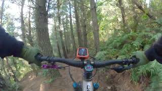
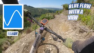
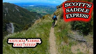
Popular Methven Mountain Biking Trails
• 90 ★ 4.4 • 1,509 ft • 0 ft • 397 •
Single track with new timber features including bridge, drops and wall ride.
• 100 ★ 5.0 • 2 miles • 578 ft • 364 •
is a graveled climbing track that is most commonly used to climb the park.
• 100 ★ 4.9 • 2,451 ft • 0 ft • 363 •
cuts out some of the 4WD track and provides a more exciting start to your downhill run!
• 90 ★ 4.4 • 4,506 ft • 18 ft • 350 •
The is where most downhill races will start on. It links most of the tracks together so chances are you will ride this track at some point.
• 45 ★ 3.9 • 1 mile • 122 ft • 336 •
is a favorite with cross country rider taking you from Slicker Feta to the bottom carpark. The track is intermediate, majorly downhill but does have a small climb.
• 100 ★ 5.0 • 399 ft • 0 ft • 334 •
Flaxes is a short alternative to a steep section on the . Don't be fooled though, its not necessarily easy for all. It is steep, rooty and rocky - a challenge in the wet.
• 90 ★ 4.4 • 1,933 ft • 82 ft • 311 •
is an uphill track linking the skid site to and Meadowmaker
• 95 ★ 5.0 • 2,516 ft • 168 ft • 306 •
Treeverse was destroyed in the 2015 logging and was then rebuilt as a much longer version taking you much higher. This is the middle section of the whole climb which can be joined on and off at several points along the climb.
Methven Mountain Bike Routes
7 miles • 1,440 ft • 7 • Loop •
This is a cross country loop on some of the more tame Mt Hutt Tracks. You'll experience various landscapes...
★ 4.0 • 3 miles • 315 ft • 3 • Loop •
Quick loop round the bottom XC Loop, good to take the kids on.
7 miles • 1,525 ft • 7 • Loop •
This is the Long Course for the annual 679 xc race year 2023...
8 miles • 2,329 ft • 34 • Loop •
This enduro type route takes you along various trails from easy to advanced. It has huge amount of variety...
3 miles • 501 ft • 3 • Loop •
this is the short course for our annual 679 xc race year 2023...
6 miles • 1,030 ft • 37 • Loop •
A longer route for families or entry level riders. There is a moderate climb followed by green downhill...
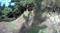
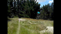
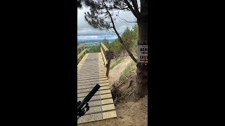
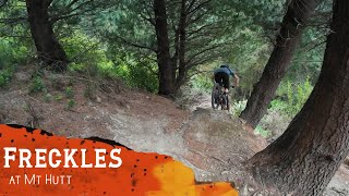
Photos of Methven Mountain Bike

Recent Trail Reports
| status | trail | date | condition | info | user |
|---|---|---|---|---|---|
| Swamp Donkey XC Loop | Apr 6, 2026 @ 9:50am (Pacific/Auckland) Apr 5, 2026 | Variable | PAStevens26 | ||
| Meadow Maker | Mar 8, 2026 @ 9:21pm (Pacific/Auckland) Mar 8, 2026 | Ideal | AlexeyDubovskoy | ||
| Wrightys | Mar 8, 2026 @ 9:21pm (Pacific/Auckland) Mar 8, 2026 | Ideal | AlexeyDubovskoy | ||
| Front Door | Mar 8, 2026 @ 9:20pm (Pacific/Auckland) Mar 8, 2026 | Ideal | AlexeyDubovskoy | ||
| Fuzz | Jan 31, 2026 @ 1:06pm (Pacific/Auckland) Jan 30, 2026 | Prevalent Mud | Lyttelbear | ||
| Ajar | Dec 29, 2025 @ 8:19pm (Pacific/Auckland) Dec 28, 2025 | Dry | camerasam | ||
| Up The Guts | Oct 13, 2025 @ 12:04pm (Pacific/Auckland) Oct 12, 2025 | Ideal | AlexeyDubovskoy | ||
| Sensible Hank Lower | Aug 23, 2025 @ 2:55am Aug 23, 2025 | Wet | AlexeyDubovskoy | ||
| Methven Walkway, RDR | Jul 4, 2025 @ 12:58pm Jul 4, 2025 | Ideal | SFZhKC | ||
| Weeverse | Apr 26, 2025 @ 7:51pm Apr 26, 2025 | Ideal | AlexeyDubovskoy |
Activity Feed
| username | action | type | title | date |
|---|---|---|---|---|
| BeauF7jn4Z | ridden | trail | activity #97462880 and 1 more | Jun 21, 2026 @ 1:58am Jun 21, 2026 |
| mjaldridge7 | ridden | trail | activity #96791006 and 11 more | Jun 12, 2026 @ 2:35am Jun 12, 2026 |
| BeauF7jn4Z | difficultyvote | trail | activity #96523976 | Jun 7, 2026 @ 11:57pm Jun 7, 2026 |
| BeauF7jn4Z | ridden | trail | activity #96523651 and 7 more | Jun 7, 2026 @ 11:45pm Jun 7, 2026 |
| BeauF7jn4Z | ridden | trail | activity #96510949 and 3 more | Jun 7, 2026 @ 5:37pm Jun 7, 2026 |
Recent Comments
| username | type | title | comment | date |
|---|---|---|---|---|
| trail | Trailforks says this is two way but its... | Feb 27, 2026 @ 6:06pm Feb 27, 2026 | ||
| trail | As a fellow trail-builder, I was impressed... | Dec 14, 2025 @ 4:47pm Dec 14, 2025 | ||
| trail | Lots of traversing to stay within the trees. ... | Dec 14, 2025 @ 4:35pm Dec 14, 2025 | ||
| trail | Missing bridge at start and another at around... | Jan 1, 2025 @ 11:21pm Jan 1, 2025 | ||
| trail | Pretty teck for a 3 | Jan 9, 2024 @ 12:26am Jan 9, 2024 |
Local Badges
-

10 Blue Trails100 awarded -

Epic Ride Climb 2k105 awarded -

Climbing 10k Badge29 awarded -

Climbing 100k Badge5 awarded -

Epic Ride Descent 2k181 awarded -

Descent 10k Badge31 awarded
Bike & Skill Parks
| name | type | city | rating |
|---|---|---|---|
| Methven BMX Track and Skillpark | skill park | Methven |
Activity Type Stats
| activitytype | trails | distance | descent | descent distance | total vertical | rating | global rank | state rank | photos | reports | routes | ridelogs |
|---|---|---|---|---|---|---|---|---|---|---|---|---|
| Mountain Bike | 61 | 27 miles | 11,175 ft | 16 miles | 2,618 ft | #1,174 | #27 | 67 | 171 | 6 | 6,376 | |
| E-Bike | 33 | 12 miles | 4,718 ft | 7 miles | 1,178 ft | #2,832 | #46 | 140 | 5 | 857 | ||
| Hike | 19 | 5 miles | 801 ft | 2 miles | 1,158 ft | #1,365 | #28 | 4 | 114 | 343 | ||
| Trail Running | 20 | 5 miles | 801 ft | 2 miles | 1,158 ft | #4,891 | #64 | 113 | 500 |
Frequently Asked Questions About Methven
▼
What are the best places to ride in Methven?
Methven has 1 areas to explore for mountain biking. The top rated areas are:
▼
What are the highest rated mountain biking trails in Methven?
The highest rated mountain biking trails in Methven are:
- Front Door (4.6/5)
- Wrightys (4.5/5)
- Reservoir (4.4/5)
- Scott's Saddle Express (4.3/5)
- Meadow Maker (4.3/5)
▼
What is the best time of the year to ride in Methven?
Based on ride log data, the most popular months to ride in Methven are:
- February (23 activities)
- January (21 activities)
- November (20 activities)
▼
Where can I park to ride in Methven?
There are 4 parking locations listed in Methven. The most popular parking spots are: View all parking and trailhead locations on the map to plan your visit.
Activities
Trails
Points of Interest
- Map Information
- Canterbury View Viewpoint
- Land Bridge DOC Sign Information
- Scott Saddle DOC Sign Information
- Map Information
- Over Bridge
- Mount Alford Summit
- Awa Awa Rata Reserve Shelter Cabin
- Mount Hutt Forest Information Board
- Mount Winterslow (5,571 ft)
- Mount Somers (5,512 ft)
- Mount Alford (3,829 ft)
- By YogiNZ & contributors
- Admins: Alps2Ocean-Cycle-Trail, MBA, rhino333
- #8937 - 11,560 views
- methven activity log | embed map of Methven mountain bike trails | methven mountain biking points of interest
Downloading of trail gps tracks in kml & gpx formats is enabled for Methven.
You must login to download files.