close
-
Layers w
- Weather Layers
- Pro
- Pro
- Pro
- Pro
- Pro
- Pro
- More Layers
- Pro
- Pro
- Pro
- Pro
-
Upgrade to

3D
Trail Conditions
- Unknown
- Snow Groomed
- Snow Packed
- Snow Covered
- Snow Cover Partial
- Freeze/thaw Cycle
- Icy
- Prevalent Mud
- Wet
- Variable
- Ideal
- Dry
- Very Dry
Trail Flow (Ridden Direction)
Trailforks scans users ridelogs to determine the most popular direction each trail is ridden. A good flowing trail network will have most trails flowing in a single direction according to their intension.
The colour categories are based on what percentage of riders are riding a trail in its intended direction.
The colour categories are based on what percentage of riders are riding a trail in its intended direction.
- > 96%
- > 90%
- > 80%
- > 70%
- > 50%
- < 50%
- bi-directional trail
- no data
Trail Last Ridden
Trailforks scans ridelogs to determine the last time a trail was ridden.
- < 2 days
- < 1 week
- < 2 weeks
- < 1 month
- < 6 months
- > 6 months
Trail Ridden Direction
The intended direction a trail should be ridden.
- Downhill Only
- Downhill Primary
- Both Directions
- Uphill Primary
- Uphill Only
- One Direction
Contribute Details
Colors indicate trail is missing specified detail.
- Description
- Photos
- Description & Photos
- Videos
Trail Popularity ?
Trailforks scans ridelogs to determine which trails are ridden the most in the last 9 months.
Trails are compared with nearby trails in the same city region with a possible 25 colour shades.
Think of this as a heatmap, more rides = more kinetic energy = warmer colors.
- most popular
- popular
- less popular
- not popular
ATV/ORV/OHV Filter
Max Vehicle Width
inches
US Cell Coverage
Legend

Radar Time
Activity Recordings
Trailforks uses anonymized public activity data.
?
Activity Recordings
Trailforks uses anonymized public activity data.
?
Personal Heatmap
▶
Activity Types
all
/
none
▶
Options
2
Date range
month
–
Winter Trails
Warning
A routing network for winter maps does not exist. Selecting trails using the winter trails layer has been disabled.
Missing Trails
Most Popular
Least Popular
Trails are colored based on popularity. The more popular a trail is, the more red. Less popular trails trend towards green.
Jump Magnitude Heatmap
Heatmap of where riders jump on trails. Zoom in to see individual jumps, click circles to view jump details.
BC Backroad Status
![map legend]()
Service Road Atlas is a free to use, community-driven service for viewing and creating reports on the numerous back-country service roads around B.C. and Alberta.

Slope Aspect
Direction the slope faces
Trails Deemphasized
Trails are shown in grey.
Only show trails with no bike usage.
Suggested Layers
Based on selected activity type
Save the current map location and zoom level as your default home location whenever this page is loaded.
Save
No description for Mödling has been added yet!
Login or register to submit one.
This region uses the Uk/Euro style trail grading system.
Activities Click to view
- Mountain Bike
33 trails
- E-Bike
26 trails
- Adaptive Bike
0 trails
- Winter Fat Bike
0 trails
- Hike
28 trails
- Trail Running
30 trails
Region Details
- 18
- 1
- 2
- 5
- 2
Region Status
Closed as of Jun 23, 2026Stats
- Avg Trail Rating
- Trails (view details)
- 34
- Trails Mountain Bike
- 34
- Trails E-Bike
- 26
- Trails Gravel Bike
- 1
- Trails Horse
- 1
- Trails Hike
- 28
- Trails Trail Running
- 30
- Total Distance
- 24 miles
- Total Descent
- 7,885 ft
- Total Vertical
- 1,291 ft
- Highest Trailhead
- 2,135 ft
- Reports
- 501
- Photos
- 130
- Ridden Counter
- 2,834
Sub Regions
-
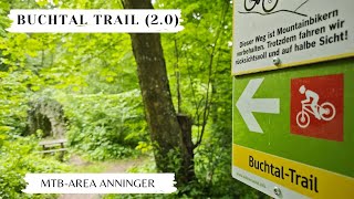
MTB-Area Anninger
- 1
- 3
- 5
- 2
Popular Mödling Mountain Biking Trails
• 75 ★ 4.6 • 1 mile • 31 ft • 189 •
Einfacher, großteils mäßig steiler und flowiger Natur-Trail. Einige Wurzeln und Steine sind zu erwarten, aber nichts allzu schwieriges, nur am Ende wird der Trail etwas steiler. Der Trail verläuft parallel zur wichtigsten...
• 90 ★ 4.0 • 2,523 ft • 21 ft • 175 •
Easy, mellow trail that connects " " and " ". Runs alongside the fireroad.
• 65 ★ 4.9 • 1 mile • 0 ft • 138 •
Fairly steep and straitght forward trail with fast sections and some tight corners. Some jumps in between. Rock face with different line choices near the end.
• 50 ★ 3.8 • 1 mile • 13 ft • 113 •
Einfacher Trail, der der Route der ehemaligen -Rodelbahn bergab folgt. Einige Steinwände ehemaliger Eiskurven sind noch vorhanden und können als Wallrides genutzt werden. Ein Stück Wintersportgeschichte, wiederbelebt als Mtb-Trail...
• 65 ★ 4.7 • 2,628 ft • 0 ft • 91 •
Technisch anspruchsvoller Singletrail mit steilen und hohen Wurzel- und Steinstufen, der Erfahrung in der Linienwahl und sehr gute Fahrtechnik voraussetzt. Der Trail startet wenige Meter nördlich des Husarentempels (Aussichtspunkt) und...
• 60 ★ 5.0 • 413 ft • 0 ft • 74 •
Kurze rote (mittelschwere) Variante am obersten Teil des Husarentempel-Trails. Wanderweg und Mtb-Strecke, bitte um Rücksicht auf andere Nutzer/-innen! Zunächst kurvenreicher Trail mit vielen Stein- und Wurzelstufen, dann geht es nach...
• 70 ★ 5.0 • 1,378 ft • 4 ft • 55 •
Schwarze (schwierige) Variante des Kiental-Trails aka Canadian mit einem kurzen steilen Uphill zu Beginn, anschließend steile und enge Kurven sowie ein paar Jumps (Sprünge können umfahren werden). Klassische und meistbenutzte...
• 50 ★ 4.7 • 735 ft • 0 ft • 53 •
Kurze rote (mittelschwere) Variante des -Trails mit einigen Wurzeln, Steinen und kurvenreichem Verlauf. Eine interessante Alternative zur blauen Hauptvariante für alle, die es ruppiger wollen. Beginnt kurz vor dem Aussichtplatzl bei...
Mödling Mountain Bike Routes
★ 3.0 • 20 miles • 2,348 ft • 1 • Loop •
Der Naturpark und die Perchtoldsdorfer Heide sind die bestimmenden und beeindruckenden Ingredienzien...
13 miles • 1,326 ft • 0 • Loop •
Die Genießertour zwischen Wiener Hütte, Kalksburg und Breitenfurt besticht durch ihre Leichtigkeit und...
23 miles • 1,895 ft • 0 • Loop •
Eine nette Rundtour um den und durch die bekannten Weinorte Gumpoldskirchen, Thallern und Pfaffstätten....
Photos of Mödling Mountain Bike
Videos of Mödling Mountain Bike

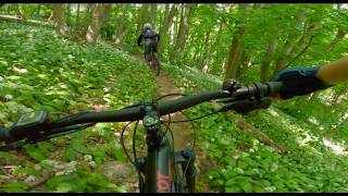
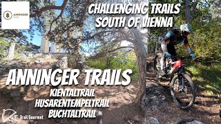
trail: Anninger-Trail
3:32 |
60 |
Apr 13, 2021
20:22 |
17 |
May 16, 2026
youtuber
![Kiental-Trail 2026 - Full Run (RAW) - MTB Area...]()
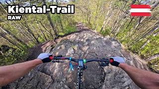
trail: Kiental-Trail
6:20 |
60 |
Apr 19, 2026 , Mödling

trail: Anninger-Trail
6:26 |
31 |
Mar 21, 2026 , Mödling
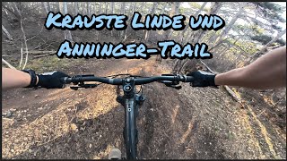
trail: Krauste Linde-Trail
6:26 |
21 |
Mar 21, 2026 , Mödling
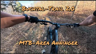
trail: Buchtal-Trail 2.0
4:06 |
79 |
Mar 14, 2026 , Mödling
trail: Buchtal-Trail 2.0
4:29 |
49 |
Nov 20, 2025 , Mödling
trail: Buchtal-Trail 2.0
18:59 |
48 |
Nov 20, 2025 , Mödling
Recent Trail Reports
Activity Feed
| username | action | type | title | date |
|---|---|---|---|---|
| mrtmau | update | trail | activity #97638858 | Jun 23, 2026 @ 10:58am Jun 23, 2026 |
| mrtmau | add | report | activity #97628606 | Jun 23, 2026 @ 8:20am Jun 23, 2026 |
| mrtmau | add | report | activity #97242744 | Jun 18, 2026 @ 4:25am Jun 18, 2026 |
| mrtmau | add | report | activity #97178690 and 5 more | Jun 17, 2026 @ 6:27am Jun 17, 2026 |
| mrtmau | add | report | activity #96856945 and 2 more | Jun 13, 2026 @ 2:47am Jun 13, 2026 |
Recent Comments
| username | type | title | comment | date |
|---|---|---|---|---|
| skillpark | Absolut furchtbar. Teils seltsame Kurven mit... | May 31, 2026 @ 9:54am May 31, 2026 | ||
| skillpark | Skatebowl ist spannend. Die Pumptrack... | May 31, 2026 @ 9:41am May 31, 2026 | ||
| trail | The route is very pleasant, easy, and... | Aug 11, 2025 @ 3:38am Aug 11, 2025 | ||
| trail | Super zu fahren. | Sep 10, 2023 @ 6:02am Sep 10, 2023 | ||
| trail | Easy but fun flow line that ends in a lot of... | May 28, 2023 @ 10:39am May 28, 2023 |
Local Badges
-

Epic Mountain Bike Climb 2k4 awarded -

Climbing 10k Badge13 awarded -

Mountain Biking 100k Badge0 awarded -

Epic Ride Descent 2k4 awarded -

Descent 10k Badge13 awarded -

Descent 100k Badge0 awarded
Bike & Skill Parks
| name | type | city | rating |
|---|---|---|---|
| Pumptrack Wiener Neudorf | skill park | Mödling | |
| Pumptrack Brunn am Gebirge | skill park | Mödling |
Activity Type Stats
| activitytype | trails | distance | descent | descent distance | total vertical | rating | global rank | state rank | photos | reports | routes | ridelogs |
|---|---|---|---|---|---|---|---|---|---|---|---|---|
| Mountain Bike | 33 | 19 miles | 5,128 ft | 9 miles | 1,289 ft | #2,433 | #16 | 100 | 502 | 4 | 3,066 | |
| E-Bike | 26 | 13 miles | 3,648 ft | 6 miles | 1,289 ft | #2,452 | #33 | 479 | 610 | |||
| Gravel Bike | 1 | #2,320 | #27 | 11 | 5 | |||||||
| Horse | 1 | 2 miles | 108 ft | 1 mile | 108 ft | 70 | ||||||
| Hike | 28 | 18 miles | 4,544 ft | 8 miles | 1,289 ft | #3,909 | #49 | 431 | 233 | |||
| Trail Running | 30 | 20 miles | 4,583 ft | 8 miles | 1,289 ft | #3,401 | #43 | 432 | 36 |
Frequently Asked Questions About Mödling
▼
What are the best places to ride in Mödling?
Mödling has 1 areas to explore for mountain biking. The top rated areas are:
▼
What are the highest rated mountain biking trails in Mödling?
The highest rated mountain biking trails in Mödling are:
- Kiental-Trail (4.5/5)
- Husarentempel-Trail / Rote Variante oberer Teil (4.4/5)
- Anninger-Trail (4.4/5)
- Husarentempel-Trail (4.4/5)
- Kiental-Trail / Schwarze Variante (4.3/5)
▼
What is the best time of the year to ride in Mödling?
Based on ride log data, the most popular months to ride in Mödling are:
- May (26 activities)
- August (12 activities)
- October (9 activities)
▼
Where can I park to ride in Mödling?
There are 7 parking locations listed in Mödling. The most popular parking spots are:
- Parking Richardhof (with fee)
- Main Parking
- Free Parking Mödling Prießnitztal - Anninger
- Free parking Gumpoldskirchen
- Parking Föhrenhof
Activities
Trails
- By lines
 TRAILFORKS & contributors
 - Admins: ANNI
- #23160 - 4,156 views
- mödling activity log | embed map of Mödling mountain bike trails | mödling mountain biking points of interest
Downloading of trail gps tracks in kml & gpx formats is enabled for Mödling.
You must login to download files.