close
-
Layers w
- Weather Layers
- Pro
- Pro
- Pro
- Pro
- Pro
- Pro
- More Layers
- Pro
- Pro
- Pro
- Pro
-
Upgrade to

3D
Trail Conditions
- Unknown
- Snow Groomed
- Snow Packed
- Snow Covered
- Snow Cover Partial
- Freeze/thaw Cycle
- Icy
- Prevalent Mud
- Wet
- Variable
- Ideal
- Dry
- Very Dry
Trail Flow (Ridden Direction)
Trailforks scans users ridelogs to determine the most popular direction each trail is ridden. A good flowing trail network will have most trails flowing in a single direction according to their intension.
The colour categories are based on what percentage of riders are riding a trail in its intended direction.
The colour categories are based on what percentage of riders are riding a trail in its intended direction.
- > 96%
- > 90%
- > 80%
- > 70%
- > 50%
- < 50%
- bi-directional trail
- no data
Trail Last Ridden
Trailforks scans ridelogs to determine the last time a trail was ridden.
- < 2 days
- < 1 week
- < 2 weeks
- < 1 month
- < 6 months
- > 6 months
Trail Ridden Direction
The intended direction a trail should be ridden.
- Downhill Only
- Downhill Primary
- Both Directions
- Uphill Primary
- Uphill Only
- One Direction
Contribute Details
Colors indicate trail is missing specified detail.
- Description
- Photos
- Description & Photos
- Videos
Trail Popularity ?
Trailforks scans ridelogs to determine which trails are ridden the most in the last 9 months.
Trails are compared with nearby trails in the same city region with a possible 25 colour shades.
Think of this as a heatmap, more rides = more kinetic energy = warmer colors.
- most popular
- popular
- less popular
- not popular
ATV/ORV/OHV Filter
Max Vehicle Width
inches
US Cell Coverage
Legend

Radar Time
Activity Recordings
Trailforks uses anonymized public activity data.
?
Activity Recordings
Trailforks uses anonymized public activity data.
?
Personal Heatmap
▶
Activity Types
all
/
none
▶
Options
2
Date range
month
–
Winter Trails
Warning
A routing network for winter maps does not exist. Selecting trails using the winter trails layer has been disabled.
Missing Trails
Most Popular
Least Popular
Trails are colored based on popularity. The more popular a trail is, the more red. Less popular trails trend towards green.
Jump Magnitude Heatmap
Heatmap of where riders jump on trails. Zoom in to see individual jumps, click circles to view jump details.
BC Backroad Status
![map legend]()
Service Road Atlas is a free to use, community-driven service for viewing and creating reports on the numerous back-country service roads around B.C. and Alberta.

Slope Aspect
Direction the slope faces
Trails Deemphasized
Trails are shown in grey.
Only show trails with no bike usage.
Suggested Layers
Based on selected activity type
Save the current map location and zoom level as your default home location whenever this page is loaded.
Save
No description for Nacka has been added yet!
Login or register to submit one.
This region uses the Uk/Euro style trail grading system.
Activities Click to view
- Mountain Bike
655 trails
- E-Bike
6 trails
- Gravel Bike
17 trails
- Adaptive Bike
17 trails
- Winter Fat Bike
66 trails
- Horse
20 trails
- Hike
666 trails
- Trail Running
666 trails
- Nordic Ski
26 trails
Region Details
- 58
- 77
- 317
- 181
- 21
- 1
Region Status
Open as of May 31, 2026Stats
- Avg Trail Rating
- Trails (view details)
- 672
- Trails Mountain Bike
- 655
- Trails E-Bike
- 6
- Trails Gravel Bike
- 17
- Trails Adaptive Bike
- 17
- Trails Winter Fat Bike
- 66
- Trails Horse
- 20
- Trails Hike
- 666
- Trails Trail Running
- 666
- Trails Backcountry Ski
- 1
- Trails Nordic Ski
- 26
- Total Distance
- 232 miles
- Total Descent
- 24,797 ft
- Total Vertical
- 256 ft
- Highest Trailhead
- 277 ft
- Reports
- 5,537
- Photos
- 333
- Ridden Counter
- 102,645
Sub Regions
-
Hellas och Nackaskogarna
- 62
- 187
- 113
- 14
- 1
-
Nyckelviken
- 2
- 1
-
Ryssbergen
- 2
- 5
-
Saltisbacken - Tattbyskogen
- 2
- 1
-
Saltsjö-Boo
- 10
- 114
- 64
- 2
-
Skuruparken
- 2
- 1
- 2
-
Trolldalen
- 8
Popular Nacka Mountain Biking Trails
• 100 ★ 5.0 • 1,017 ft • 5 ft • 1,023 • • hike
En stigsnutt som binder samman och .
• 95 ★ 3.2 • 1,470 ft • 18 ft • 953 •
Tidigare en alternativväg för Gröna, men numera ordinare del av Gröna spåret.
• 100 ★ 3.5 • 1,211 ft • 48 ft • 866 •
Popular green difficulty singletrack. This multi-use trail can be used both directions and has a easy overall physical rating with a 48 ft blue climb. It features bridge. Winter use: Classic snow grooming. On average it takes 2 minutes to complete this trail.
• 100 ★ 3.0 • 899 ft • 10 ft • 705 •
Popular trail for accessing or when coming from Hellasgården.
• 95 ★ 4.2 • 3,911 ft • 29 ft • 692 •
Highly rated popular red difficulty singletrack. This multi-use trail can be used both directions and has a moderate overall physical rating with a 29 ft blue climb. It features bridge and rock garden. On average it takes 9 minutes to complete this trail.
• 95 ★ 4.0 • 1,102 ft • 12 ft • 681 •
Popular blue difficulty singletrack. This multi-use trail can be used both directions. On average it takes 3 minutes to complete this trail.
Nacka Mountain Bike Routes
★ 3.7 • 11 miles • 727 ft • 9 • Loop •
Blåa spåret från Hellasgården och Gröna tillbaks.
★ 5.0 • 8 miles • 501 ft • 7 • Loop •
This route is created in an effort to not go out of bounds but still have plenty of cherries along the way.
★ 2.0 • 13 miles • 693 ft • 17 • Loop •
Partly challenging and partly easy. Great challenges as , , , Jubileumsklippan Up, up up, , , .
★ 5.0 • 3 miles • 162 ft • 4 • Loop •
Slinga från Mountainbikeskolan och tillbaka.
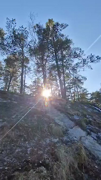
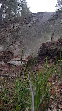
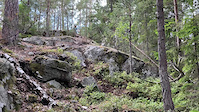
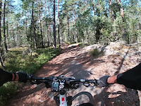
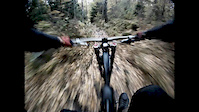
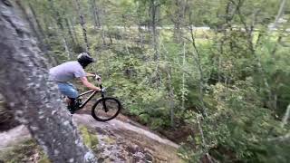
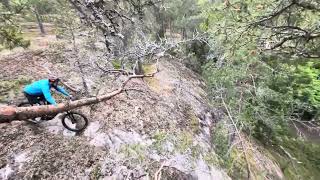
Photos of Nacka Mountain Bike
Videos of Nacka Mountain Bike
trail: Farbror Melker
0:22 |
43 |
Apr 10, 2026
trail: Das Röller
0:07 |
115 |
Sep 23, 2024
trail: Ödet
0:10 |
223 |
Jul 7, 2023
trail: Sandatrappan
0:16 |
53 |
Jun 30, 2023

trail: Crimson Dawn
0:18 |
95 |
Nov 25, 2020
trail: A-Trail
0:20 |
841 |
Oct 5, 2013
trail: Lekande Barn
0:10 |
136 |
Aug 14, 2025 , Nacka
trail: Skymningspatrullen
0:23 |
164 |
May 31, 2025 , Nacka
Current Trail Warnings
| status | trail | date | condition | user | info |
|---|---|---|---|---|---|
| Brant Backe | May 10, 2026 @ 3:06pm (Europe/Stockholm) May 10, 2026 | Unknown | cubist HSF | ‘Large trees blocking trail. |
Recent Trail Reports
| status | trail | date | condition | info | user |
|---|---|---|---|---|---|
| Säpo | May 31, 2026 @ 2:04am (Pacific/Midway) May 31, 2026 | Ideal | cubist HSF | ||
| De Två Tornen | May 31, 2026 @ 2:04am (Pacific/Midway) May 31, 2026 | Ideal | cubist HSF | ||
| Grönt Tak | May 31, 2026 @ 2:04am (Pacific/Midway) May 31, 2026 | Ideal | cubist HSF | ||
| Gröna Länken | May 31, 2026 @ 2:04am (Pacific/Midway) May 31, 2026 | Ideal | cubist HSF | ||
| Fem Svåra | May 31, 2026 @ 2:04am (Pacific/Midway) May 31, 2026 | Ideal | cubist HSF | ||
| Mer Skojs | May 31, 2026 @ 2:04am (Pacific/Midway) May 31, 2026 | Ideal | cubist HSF | ||
| Indianer Och Vita 1 | May 31, 2026 @ 2:04am (Pacific/Midway) May 31, 2026 | Ideal | cubist HSF | ||
| Gunslinger | May 31, 2026 @ 2:04am (Pacific/Midway) May 31, 2026 | Ideal | cubist HSF | ||
| Status Quo | May 31, 2026 @ 2:04am (Pacific/Midway) May 31, 2026 | Ideal | cubist HSF | ||
| Dow Jones | May 31, 2026 @ 2:04am (Pacific/Midway) May 31, 2026 | Ideal | cubist HSF |
Activity Feed
| username | action | type | title | date |
|---|---|---|---|---|
| cubist | add | report | activity #96102031 and 11 more | Jun 2, 2026 @ 12:15pm 3 days |
| Johan4Cu2o | ridden | trail | activity #96100566 | Jun 2, 2026 @ 11:55am 3 days |
| cRP0ZI | vote | trail | activity #95915425 | May 31, 2026 @ 1:30am May 31, 2026 |
| NiQn | wishlist | route | activity #95883790 | May 30, 2026 @ 1:39pm May 30, 2026 |
| NiQn | wishlist | trail | activity #95883062 and 2 more | May 30, 2026 @ 1:31pm May 30, 2026 |
Recent Comments
| username | type | title | comment | date |
|---|---|---|---|---|
| trail | Rating changed to red. | May 2, 2026 @ 11:19am May 2, 2026 | ||
| trail | Tack. En annan användare har röstat svart.... | May 2, 2026 @ 10:44am May 2, 2026 | ||
| trail | This is red. Not blue. | May 2, 2026 @ 10:26am May 2, 2026 | ||
| report | Oh, was about to make this my morning ride,... | Apr 27, 2026 @ 12:35am Apr 27, 2026 | ||
| trail | Vilken superrolig! Mycket action per meter. | Apr 19, 2026 @ 2:48am Apr 19, 2026 |
Local Badges
-

Epic Ride Climb 2k121 awarded -

Climbing 10k Badge396 awarded -

Climbing 100k Badge41 awarded -

Epic Ride Descent 2k123 awarded -

Descent 10k Badge397 awarded -

Descent 100k Badge43 awarded
Bike & Skill Parks
| name | type | city | rating |
|---|---|---|---|
| Orminge dirt track | skill park | Nacka | |
| Velamsund Skillpark | skill park | Nacka | |
| Fregattbacken Pump Track | skill park | Nacka |
Activity Type Stats
| activitytype | trails | distance | descent | descent distance | total vertical | rating | global rank | state rank | photos | reports | routes | ridelogs |
|---|---|---|---|---|---|---|---|---|---|---|---|---|
| Mountain Bike | 655 | 219 miles | 23,757 ft | 104 miles | 256 ft | #95 | #4 | 332 | 5,527 | 23 | 108,088 | |
| E-Bike | 6 | 2 miles | 85 ft | 3,504 ft | 131 ft | #1,389 | #40 | 5,138 | 2 | 2,748 | ||
| Gravel Bike | 17 | 18 miles | 1,001 ft | 7 miles | 210 ft | #61 | #70 | 331 | 1 | 571 | ||
| Adaptive Bike | 17 | 6 miles | 302 ft | 2 miles | 171 ft | #75 | #148 | 232 | ||||
| Winter Fat Bike | 66 | 25 miles | 1,893 ft | 11 miles | 213 ft | #32 | #82 | 15 | 3 | |||
| Horse | 20 | 8 miles | 732 ft | 3 miles | 164 ft | #359 | #30 | 735 | 9 | |||
| Hike | 666 | 232 miles | 24,590 ft | 109 miles | 256 ft | #246 | #18 | 1 | 5,514 | 9 | 2,046 | |
| Trail Running | 666 | 232 miles | 24,590 ft | 109 miles | 256 ft | #140 | #15 | 5,515 | 13 | 17,845 | ||
| Backcountry Ski | 1 | 4,885 ft | 52 ft | 2,717 ft | 46 ft | 3 | 71 | |||||
| Nordic Ski | 26 | 18 miles | 1,296 ft | 8 miles | 174 ft | #166 | #18 | 3 | 946 |
Frequently Asked Questions About Nacka
▼
What are the best places to ride in Nacka?
Nacka has 7 areas to explore for mountain biking. The top rated areas are:
▼
What are the highest rated mountain biking trails in Nacka?
The highest rated mountain biking trails in Nacka are:
- Vilse (4.5/5)
- Linje 17 (4.5/5)
- Traktormakt (4.4/5)
- Area 52 (4.4/5)
- Snoopy (4.4/5)
▼
What is the best time of the year to ride in Nacka?
Based on ride log data, the most popular months to ride in Nacka are:
- May (988 activities)
- August (959 activities)
- September (916 activities)
▼
Where can I park to ride in Nacka?
There are 12 parking locations listed in Nacka. The most popular parking spots are:
- P Nacka gamla kyrkogård
- Lilla asfaltsparkeringen Hellasgården V
- Lilla grusparkeringen Hellasgården V
- P Hellasgården
- Aborrträsk
Activities
Trails
- By ollesvenskonthetrail
 TRAILFORKS & contributors
 - Admins: ollesvenskonthetrail, JALLE, martinlindstr, ollesvenskonthetrail, OrjanX, Hulken, jnasslander, Fluffracka, MAARTEN76
- #7651 - 19,697 views
- nacka activity log | embed map of Nacka mountain bike trails | nacka mountain biking points of interest
Downloading of trail gps tracks in kml & gpx formats is enabled for Nacka.
You must login to download files.