

more stats
2,241 ft
Distance
12 ft
Climb
-10 ft
Descent
00:07:16
Avg time
2 ft
Altitude change
158 ft
Altitude min
168 ft
Altitude max
161 ft
Altitude start
164 ft
Altitude end
0.1%
Grade
-2.5%
Grade max
3.6%
Grade min
463 ft
Distance climb
564 ft
Distance down
1,214 ft
Distance flat
00:07:16
Avg time

Ödet Details

  • Activities
    • Mountain Bike
    • Hike
    • Trail Running
  • Riding Area
  • Difficulty Rating
  • Voted Difficulty
    Red (2 votes)
  • Local Popularity
    85 in Mountain Biking [+]
    • 5 in Trail Running
    • 5 in Hiking
  • Global Ranking
    #18613 in Mountain Biking [+]
    • #150291 in Trail Running
    • #353053 in Hiking
  • National Ranking
    #653 in Mountain Biking · Sweden [+]
    • #11,076 in Trail Running
    • #23,287 in Hiking
  • Trail Type
    Singletrack
  • Direction
    Both Directions
    Popular Direction Shown
  • Trail Visibility
    Sometimes hard to follow
  • Dogs Allowed
    Yes

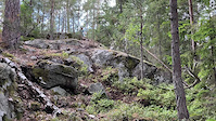
Entrén till stigen kan vara lite svår att hitta. När du väl kommit rätt belönas du med en riktigt seg teknisk klättring. Väl däruppe är också stigen lättare att se. Olika linjeval finns på flera ställen men det kommer förhoppningsvis bli tydligare med tiden. Efter lite fin single-track kommer så finalen - en riktigt brant roller nedför ett berg. Klart rullbar, men gå av första gången och titta först.

Access Info

Körs lämpligen i östlig riktning.

Tags
Faint trailRock slabs

Recent Activity on Trail

Past Week
  • 0 rides
  •  
6 Months
  • 28 rides
  • 11 miles avg distance
All
  • 147 rides
  • Last: Oct 18, 2026
Status:
on Apr 11, 2026
Prevalent Mud
Avg: 3.84 (7 votes)
Your vote: 0

view (561)
close
      Directions to odet trailhead (59.286570, 18.185010)

      Photos

      2 more »
      mtb
      104 |
      Jul 27, 2023 @ 4:44am
      Jul 27, 2023
      mtb
      142 |
      Jun 5, 2023 @ 1:56pm
      Jun 5, 2023

      Videos

      1 more »
      Krux-branten
      mtb
      0:10 | 236 | Jul 7, 2023 , Nacka
      3.7 ★★★★★
      7 Ratings
      5 ★ 14%
      4 ★ 57%
      3 ★ 14%
      2 ★ 14%
      1 ★

      2 Reviews & Comments

      OrjanX OrjanX
      Jag fick ihop en svart (branten klart svart) och tre röda passager. Då blir stigen snarast röd.
      nwestblad
      Kul spår! Skulle säga att det är ett blått spår med 2 röda features. Svart är nog att ta i, i jmf med vad som finns runtomkring. Så kanske en röd gradering istället Smile

      We hope you've been enjoying Trailforks!

      Create a FREE account to view all trail reviews and much more.

      • By AX3L-SwedenTF Pro & contributors
      • #650553 - 770 views

      Frequently Asked Questions

      ▼ Where is Ödet located?
      Ödet is located in Hellas och Nackaskogarna, Nacka, Sweden. It is part of the Hellas och Nackaskogarna trail network. The trailhead is located at coordinates 59.28657, 18.18501.
      ▼ How hard is Ödet?
      Ödet is rated as Red difficulty. The average grade is 0.1%.
      ▼ What is the elevation gain for Ödet?
      Ödet has 12 ft of elevation gain. The trail has 10 ft of elevation descent. The elevation ranges from 158 ft to 168 ft.
      ▼ Is Ödet a point to point trail?
      Ödet is not a point to point trail. The direction is Both Directions. The trail type is singletrack.
      ▼ How long is Ödet?
      Ödet is 2,241 ft long. The trail type is singletrack.
      ▼ Are dogs allowed on Ödet?
      Yes, dogs are allowed on Ödet. Please keep dogs on a leash where required and clean up after them.
      ▼ How do I access Ödet? Where is the closest parking trailhead?
      The closest parking and trailhead locations to Ödet are: View all parking locations in the area.
      ▼ How long does it take to ride Ödet?
      Based on recorded activities, it takes an average of 7 minutes to ride Ödet. The trail is 2,241 ft long. Actual times will vary based on fitness level, conditions, and pace. View recent activity logs for more details.
      ▼ How busy is Ödet?
      Ödet is a very popular trail. There have been 554 recorded activities on this trail. The trail has received 561 check-ins. View recent activity on this trail.

      Hit the Trail

      Open in App

      Get this trail on your phone instantly.

      open trail in app

      Download Trail

      Save to wishlist, Garmin & download.
      save the trail

      Find Related Routes

      Find routes and users activities that include this trail.
      find routes for this trail

      You must enter a description before submitting.

