close
-
Layers w
- Weather Layers
- Pro
- Pro
- Pro
- Pro
- Pro
- Pro
- More Layers
- Pro
- Pro
- Pro
- Pro
-
Upgrade to

3D
Trail Conditions
- Unknown
- Snow Groomed
- Snow Packed
- Snow Covered
- Snow Cover Partial
- Freeze/thaw Cycle
- Icy
- Prevalent Mud
- Wet
- Variable
- Ideal
- Dry
- Very Dry
Trail Flow (Ridden Direction)
Trailforks scans users ridelogs to determine the most popular direction each trail is ridden. A good flowing trail network will have most trails flowing in a single direction according to their intension.
The colour categories are based on what percentage of riders are riding a trail in its intended direction.
The colour categories are based on what percentage of riders are riding a trail in its intended direction.
- > 96%
- > 90%
- > 80%
- > 70%
- > 50%
- < 50%
- bi-directional trail
- no data
Trail Last Ridden
Trailforks scans ridelogs to determine the last time a trail was ridden.
- < 2 days
- < 1 week
- < 2 weeks
- < 1 month
- < 6 months
- > 6 months
Trail Ridden Direction
The intended direction a trail should be ridden.
- Downhill Only
- Downhill Primary
- Both Directions
- Uphill Primary
- Uphill Only
- One Direction
Contribute Details
Colors indicate trail is missing specified detail.
- Description
- Photos
- Description & Photos
- Videos
Trail Popularity ?
Trailforks scans ridelogs to determine which trails are ridden the most in the last 9 months.
Trails are compared with nearby trails in the same city region with a possible 25 colour shades.
Think of this as a heatmap, more rides = more kinetic energy = warmer colors.
- most popular
- popular
- less popular
- not popular
ATV/ORV/OHV Filter
Max Vehicle Width
inches
US Cell Coverage
Legend

Radar Time
Activity Recordings
Trailforks uses anonymized public activity data.
?
Activity Recordings
Trailforks uses anonymized public activity data.
?
Personal Heatmap
▶
Activity Types
all
/
none
▶
Options
2
Date range
month
–
Winter Trails
Warning
A routing network for winter maps does not exist. Selecting trails using the winter trails layer has been disabled.
Missing Trails
Most Popular
Least Popular
Trails are colored based on popularity. The more popular a trail is, the more red. Less popular trails trend towards green.
Jump Magnitude Heatmap
Heatmap of where riders jump on trails. Zoom in to see individual jumps, click circles to view jump details.
BC Backroad Status
![map legend]()
Service Road Atlas is a free to use, community-driven service for viewing and creating reports on the numerous back-country service roads around B.C. and Alberta.

Slope Aspect
Direction the slope faces
Trails Deemphasized
Trails are shown in grey.
Only show trails with no bike usage.
Suggested Layers
Based on selected activity type
Save the current map location and zoom level as your default home location whenever this page is loaded.
Save
No description for Nava has been added yet!
Login or register to submit one.
This region uses the Uk/Euro style trail grading system.
Activities Click to view
- Mountain Bike
64 trails
- E-Bike
59 trails
- Gravel Bike
0 trails
- Adaptive Bike
0 trails
- Winter Fat Bike
0 trails
- Hike
35 trails
- Trail Running
35 trails
Region Details
- 16
- 4
- 32
- 3
Region Status
Open as of Jun 24, 2026Stats
- Avg Trail Rating
- Trails (view details)
- 64
- Trails Mountain Bike
- 64
- Trails E-Bike
- 59
- Trails Horse
- 2
- Trails Hike
- 35
- Trails Trail Running
- 35
- Total Distance
- 68 miles
- Total Descent
- 35,868 ft
- Total Vertical
- 4,807 ft
- Highest Trailhead
- 6,028 ft
- Reports
- 528
- Photos
- 37
- Ridden Counter
- 6,280
Sub Regions
-
Nava freeride Park
- 4
- 31
- 3
Popular Nava Mountain Biking Trails
• 100 ★ 5.0 • 4,265 ft • 4 ft • 354 •
Highly rated popular blue difficulty singletrack. This mountain bike primary trail can be used downhill only and has a moderate overall physical rating. On average it takes 5 minutes to complete this trail.
• 95 ★ 4.9 • 1 mile • 0 ft • 291 •
Highly rated popular red difficulty singletrack. This mountain bike primary trail can be used downhill only and has a moderate overall physical rating. On average it takes 11 minutes to complete this trail.
• 95 ★ 4.3 • 4,111 ft • 11 ft • 260 •
Highly rated popular blue difficulty singletrack. This mountain bike primary trail can be used downhill only and has a moderate overall physical rating. On average it takes 3 minutes to complete this trail.
• 90 ★ 4.7 • 1,142 ft • 0 ft • 227 •
Highly rated popular blue difficulty singletrack. This mountain bike primary trail can be used downhill only and has a moderate overall physical rating. It features jump. On average it takes 5 minutes to complete this trail.
• 85 ★ 4.8 • 2 miles • 26 ft • 215 •
Highly rated popular red difficulty singletrack. This mountain bike primary trail can be used downhill only and has a moderate overall physical rating. On average it takes 20 minutes to complete this trail.
• 85 ★ 5.0 • 2,454 ft • 31 ft • 204 •
Popular red difficulty singletrack. This mountain bike primary trail can be used downhill only. On average it takes 7 minutes to complete this trail.
• 90 ★ 4.8 • 3 miles • 121 ft • 199 •
Popular red difficulty singletrack. This mountain bike primary trail can be used downhill primary. On average it takes 24 minutes to complete this trail.
• 95 ★ 4.0 • 3,799 ft • 371 ft • 181 •
Popular white difficulty dirt/gravel road. This mountain bike primary trail and has a moderate overall physical rating with a 371 ft blue climb. On average it takes 11 minutes to complete this trail.
Nava Mountain Bike Routes
22 miles • 5,936 ft • 10 • Loop •
A nice way to spend the day riding the Nava free-ride trails. Not too hard, though some sections can be...
11 miles • 2,737 ft • 8 • Loop •
Giro della Valle dei Forti Loop of Forts' Valley Description: Feasible from March to December, the route...
14 miles • 3,492 ft • 2 • Loop •
Tour dell'Alta Valle Arroscia Tour of Upper Arroscia Valley Description: The tour runs within the higher...
Photos of Nava Mountain Bike
Videos of Nava Mountain Bike
youtuber
![Nava 2026 #mtb #crash]()
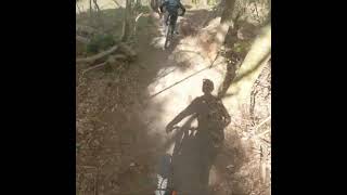
0:19 |
14 |
Apr 30, 2026
youtuber
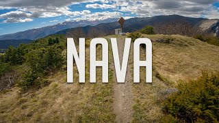
![Escursione S.B. Mendatica -Sentiero dei ciechi]()

8:32 |
111 |
Jul 23, 2024 , Nava

trail: La Fattoria linea Enduro
5:08 |
306 |
Apr 26, 2023 , Nava
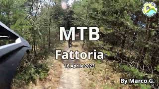
trail: La Fattoria
5:08 |
325 |
Apr 26, 2023 , Nava
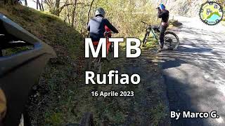
trail: Rufiao
2:58 |
202 |
Apr 21, 2023 , Nava

trail: Carabiniere P2
3:35 |
421 |
Apr 21, 2023 , Nava
7:57 |
210 |
Oct 6, 2022 , Nava
Recent Trail Reports
| status | trail | date | condition | info | user |
|---|---|---|---|---|---|
| Luigin Luigin | Jun 24, 2026 @ 6:01pm (Europe/Monaco) Jun 24, 2026 | Ideal | Roberto_DS | ||
| I Quarti | Jun 20, 2026 @ 8:55am (Europe/Monaco) Jun 19, 2026 | Dry | Roberto_DS | ||
| Rientro | Jun 20, 2026 @ 8:55am (Europe/Monaco) Jun 19, 2026 | Dry | Roberto_DS | ||
| Alligator | Jun 20, 2026 @ 8:55am (Europe/Monaco) Jun 19, 2026 | Very Dry | Roberto_DS | ||
| Monte Ariolo climb | Jun 20, 2026 @ 8:55am (Europe/Monaco) Jun 19, 2026 | Very Dry | Roberto_DS | ||
| Trnicea P2 | Jun 9, 2026 @ 6:06pm (Europe/Monaco) Jun 9, 2026 | Ideal | Roberto_DS | ||
| Trincea P1 | Jun 9, 2026 @ 6:06pm (Europe/Monaco) Jun 9, 2026 | Ideal | Roberto_DS | ||
| La fornace | Jun 3, 2026 @ 12:32pm (Europe/Rome) Jun 3, 2026 | Ideal | Marc1915 | ||
| Neonato | Jun 3, 2026 @ 12:31pm (Europe/Rome) Jun 3, 2026 | Ideal | Marc1915 | ||
| Ex PS | Jun 3, 2026 @ 12:31pm (Europe/Rome) Jun 3, 2026 | Ideal | Marc1915 |
Activity Feed
| username | action | type | title | date |
|---|---|---|---|---|
| Kuntac1962 | ridden | trail | activity #97820242 | Jun 26, 2026 @ 12:52am 3 days |
| Roberto_DS | add | report | activity #97707496 | Jun 24, 2026 @ 10:22am Jun 24, 2026 |
| Roberto_DS | wishlist | trail | activity #97707407 | Jun 24, 2026 @ 10:21am Jun 24, 2026 |
| Roberto_DS | vote | trail | activity #97564446 and 2 more | Jun 22, 2026 @ 8:41am Jun 22, 2026 |
| Roberto_DS | add | report | activity #97388366 and 2 more | Jun 20, 2026 @ 6:29am Jun 20, 2026 |
Recent Comments
| username | type | title | comment | date |
|---|---|---|---|---|
| trail | Steeper than most of the other tracks of the... | Oct 29, 2025 @ 7:36am Oct 29, 2025 | ||
| trail | A nice finish variation, includes a punchy... | Oct 29, 2025 @ 7:35am Oct 29, 2025 | ||
| trail | Such a beautiful track, nice routing. Some... | Oct 29, 2025 @ 7:31am Oct 29, 2025 | ||
| trail | So nice, ride it twice 🤌🏽 | Oct 29, 2025 @ 7:27am Oct 29, 2025 | ||
| trail | A highlight of trail riding | Oct 28, 2025 @ 4:49am Oct 28, 2025 |
Local Badges
-

10 Blue Trails59 awarded -

Epic Ride Climb 2k282 awarded -

Climbing 10k Badge35 awarded -

Climbing 100k Badge0 awarded -

Epic Ride Descent 2k391 awarded -

Descent 10k Badge43 awarded
Activity Type Stats
| activitytype | trails | distance | descent | descent distance | total vertical | rating | global rank | state rank | photos | reports | routes | ridelogs |
|---|---|---|---|---|---|---|---|---|---|---|---|---|
| Mountain Bike | 64 | 68 miles | 35,827 ft | 40 miles | 4,806 ft | #1,729 | #64 | 26 | 528 | 8 | 2,766 | |
| E-Bike | 59 | 58 miles | 33,990 ft | 37 miles | 4,806 ft | #1,171 | #153 | 11 | 472 | 2 | 521 | |
| Horse | 2 | 3 miles | 135 ft | 2,995 ft | 1,762 ft | 2 | ||||||
| Hike | 35 | 47 miles | 18,671 ft | 22 miles | 3,579 ft | #4,344 | #179 | 406 | 222 | |||
| Trail Running | 35 | 47 miles | 18,671 ft | 22 miles | 3,579 ft | #3,813 | #160 | 406 | 148 |
Frequently Asked Questions About Nava
▼
What are the best places to ride in Nava?
Nava has 1 areas to explore for mountain biking. The top rated areas are:
▼
What are the highest rated mountain biking trails in Nava?
The highest rated mountain biking trails in Nava are:
- La Fattoria linea Enduro (4.5/5)
- Neonato (4.5/5)
- Carabiniere P2 (4.5/5)
- Cucù (4.4/5)
- La Fattoria Jump (4.4/5)
▼
What is the best time of the year to ride in Nava?
Based on ride log data, the most popular months to ride in Nava are:
- September (19 activities)
- May (18 activities)
- October (12 activities)
▼
Where can I park to ride in Nava?
Check the Nava trail map for trailhead and parking information. Community members regularly update access and parking details for trails in the area.
Activities
Trails
- By denitopia
 TRAILFORKS VTA & contributors
 - Admins: denitopia
- #10685 - 8,304 views
- nava activity log | embed map of Nava mountain bike trails | nava mountain biking points of interest
Downloading of trail gps tracks in kml & gpx formats is enabled for Nava.
You must login to download files.