close
-
Layers w
- Weather Layers
- Pro
- Pro
- Pro
- Pro
- Pro
- Pro
- More Layers
- Pro
- Pro
- Pro
- Pro
-
Upgrade to

3D
Trail Conditions
- Unknown
- Snow Groomed
- Snow Packed
- Snow Covered
- Snow Cover Partial
- Freeze/thaw Cycle
- Icy
- Prevalent Mud
- Wet
- Variable
- Ideal
- Dry
- Very Dry
Trail Flow (Ridden Direction)
Trailforks scans users ridelogs to determine the most popular direction each trail is ridden. A good flowing trail network will have most trails flowing in a single direction according to their intension.
The colour categories are based on what percentage of riders are riding a trail in its intended direction.
The colour categories are based on what percentage of riders are riding a trail in its intended direction.
- > 96%
- > 90%
- > 80%
- > 70%
- > 50%
- < 50%
- bi-directional trail
- no data
Trail Last Ridden
Trailforks scans ridelogs to determine the last time a trail was ridden.
- < 2 days
- < 1 week
- < 2 weeks
- < 1 month
- < 6 months
- > 6 months
Trail Ridden Direction
The intended direction a trail should be ridden.
- Downhill Only
- Downhill Primary
- Both Directions
- Uphill Primary
- Uphill Only
- One Direction
Contribute Details
Colors indicate trail is missing specified detail.
- Description
- Photos
- Description & Photos
- Videos
Trail Popularity ?
Trailforks scans ridelogs to determine which trails are ridden the most in the last 9 months.
Trails are compared with nearby trails in the same city region with a possible 25 colour shades.
Think of this as a heatmap, more rides = more kinetic energy = warmer colors.
- most popular
- popular
- less popular
- not popular
ATV/ORV/OHV Filter
Max Vehicle Width
inches
US Cell Coverage
Legend

Radar Time
Activity Recordings
Trailforks uses anonymized public activity data.
?
Activity Recordings
Trailforks uses anonymized public activity data.
?
Personal Heatmap
▶
Activity Types
all
/
none
▶
Options
2
Date range
month
–
Winter Trails
Warning
A routing network for winter maps does not exist. Selecting trails using the winter trails layer has been disabled.
Missing Trails
Most Popular
Least Popular
Trails are colored based on popularity. The more popular a trail is, the more red. Less popular trails trend towards green.
Jump Magnitude Heatmap
Heatmap of where riders jump on trails. Zoom in to see individual jumps, click circles to view jump details.
BC Backroad Status
![map legend]()
Service Road Atlas is a free to use, community-driven service for viewing and creating reports on the numerous back-country service roads around B.C. and Alberta.

Slope Aspect
Direction the slope faces
Trails Deemphasized
Trails are shown in grey.
Only show trails with no bike usage.
Suggested Layers
Based on selected activity type
Save the current map location and zoom level as your default home location whenever this page is loaded.
Save
No description for Nice has been added yet!
Login or register to submit one.
This region uses the Uk/Euro style trail grading system.
Activities Click to view
- Mountain Bike
39 trails
- E-Bike
11 trails
- Gravel Bike
0 trails
- Adaptive Bike
0 trails
- Hike
48 trails
- Trail Running
48 trails
Region Details
- 6
- 3
- 17
- 12
- 1
Region Status
Open as of Jun 7, 2026Stats
- Avg Trail Rating
- Trails (view details)
- 39
- Trails Mountain Bike
- 39
- Trails E-Bike
- 11
- Trails Hike
- 48
- Trails Trail Running
- 48
- Total Distance
- 27 miles
- Total Descent
- 14,863 ft
- Total Vertical
- 2,545 ft
- Highest Trailhead
- 2,827 ft
- Reports
- 527
- Photos
- 11
- Ridden Counter
- 2,038
Sub Regions
-
Mont Baron
-
Mont Chauve
- 3
- 15
- 11
- 1
Popular Nice Mountain Biking Trails
• 100 ★ 4.0 • 2,310 ft • 15 ft • 69 •
Popular blue difficulty singletrack. This mountain bike primary trail. On average it takes 7 minutes to complete this trail.
• 100 ★ 4.0 • 1,021 ft • 31 ft • 63 •
Popular green difficulty singletrack. This mountain bike primary trail. On average it takes 1 minutes to complete this trail.
• 100 ★ 5.0 • 1,037 ft • 0 ft • 59 •
Popular blue difficulty singletrack. This mountain bike primary trail. On average it takes 1 minutes to complete this trail.
• 95 ★ 3.0 • 2,359 ft • 0 ft • 58 •
Popular blue difficulty singletrack. This mountain bike primary trail can be used downhill only. On average it takes 6 minutes to complete this trail.
• 55 ★ 4.0 • 3,130 ft • 12 ft • 53 •
Le début et la fin sont faciles, mais le milieu est raide et truffé de cailloux qui roulent, poussage obligatoire en montée
• 80 ★ 3.0 • 3,439 ft • 4 ft • 51 •
Popular red difficulty singletrack. This mountain bike primary trail can be used downhill primary and has a hard overall physical rating. It features skinny. On average it takes 5 minutes to complete this trail.
• 70 ★ 0.0 • 3,929 ft • 68 ft • 48 •
Popular red difficulty singletrack. This mountain bike primary trail. On average it takes 4 minutes to complete this trail.
• 75 ★ 0.0 • 2,792 ft • 2 ft • 39 •
Popular black difficulty singletrack. This mountain bike primary trail can be used downhill only. On average it takes 9 minutes to complete this trail.
Nice Mountain Bike Routes
82 miles • 14,417 ft • 0 • Loop •
Description à réaliser, merci pour l'ajout
Photos of Nice Mountain Bike
Videos of Nice Mountain Bike
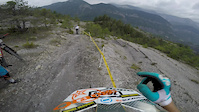
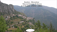
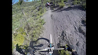
trail: Mercantour
0:56 |
217 |
Nov 5, 2016
trail: Mercantour
0:18 |
134 |
Sep 6, 2016
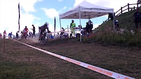
trail: Macaron
9:32 |
155 |
Feb 29, 2016
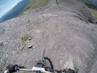
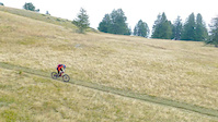
trail: Mercantour
3:37 |
506 |
Jan 25, 2016

trail: Mercantour
6:30 |
16 |
Sep 20, 2015
trail: Mercantour
0:12 |
69 |
Sep 8, 2015
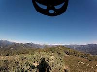
trail: Mercantour
4:46 |
127 |
Sep 7, 2015
trail: Mercantour
2:43 |
6429 |
Nov 6, 2014
Recent Trail Reports
| status | trail | date | condition | info | user |
|---|---|---|---|---|---|
| Flying Cinghiale 2 | Jun 7, 2026 @ 9:03am (Europe/Paris) Jun 7, 2026 | Ideal | Djedenice | ||
| Sing Sing | Jun 7, 2026 @ 9:03am (Europe/Paris) Jun 7, 2026 | Ideal | Djedenice | ||
| Liaison Condamine | Apr 18, 2026 @ 9:49am (Europe/Paris) Apr 18, 2026 | Dry | Djedenice | ||
| Planeurs 2 | Mar 27, 2026 @ 2:35pm (Europe/Paris) Mar 27, 2026 | Dry | Djedenice | ||
| Planeurs 1 | Mar 27, 2026 @ 2:35pm (Europe/Paris) Mar 27, 2026 | Dry | Djedenice | ||
| Cayenne | Mar 27, 2026 @ 2:35pm (Europe/Paris) Mar 27, 2026 | Dry | Djedenice | ||
| Piste SO Mont Chauve | Mar 27, 2026 @ 2:35pm (Europe/Paris) Mar 27, 2026 | Ideal | Djedenice | ||
| Ruche 1 | Feb 21, 2026 @ 8:23pm (Europe/Paris) Feb 21, 2026 | Unknown | MatBurger | ||
| flying cinghiale 1 | Jan 10, 2026 @ 8:53am (Europe/Paris) Jan 9, 2026 | Ideal | Alexair06 | ||
| Posi 2B | Jan 10, 2026 @ 8:53am (Europe/Paris) Jan 9, 2026 | Dry | Alexair06 |
Activity Feed
| username | action | type | title | date |
|---|---|---|---|---|
| Djedenice | add | report | activity #96447628 and 1 more | Jun 7, 2026 @ 4:51am Jun 7, 2026 |
| Djedenice | add | report | activity #92850027 | Apr 18, 2026 @ 5:25am Apr 18, 2026 |
| Arnooooo83 | ridden | trail | activity #92131817 and 2 more | Apr 7, 2026 @ 11:31am Apr 7, 2026 |
| Djedenice | add | report | activity #91388053 and 4 more | Mar 27, 2026 @ 11:51am Mar 27, 2026 |
| freerider48 | add | route | activity #91251383 | Mar 25, 2026 @ 1:24am Mar 25, 2026 |
Recent Comments
| username | type | title | comment | date |
|---|---|---|---|---|
| trail | Horrible | Jul 9, 2022 @ 1:25am Jul 9, 2022 | ||
| trail | Actually black for sure !! | Mar 28, 2021 @ 7:04am Mar 28, 2021 | ||
| trail | More of a blue trail !!! | Mar 28, 2021 @ 7:02am Mar 28, 2021 | ||
| trail | Le nom de cette variante c'est POSI 3 (... | Jan 23, 2021 @ 12:48am Jan 23, 2021 | ||
| trail | Hodně jednoduché, není třeba velkého umění | Sep 24, 2019 @ 9:25am Sep 24, 2019 |
Local Badges
-

10 Blue Trails18 awarded -

10 Black Trails7 awarded -

Epic Ride Climb 2k382 awarded -

Climbing 10k Badge43 awarded -

Climbing 100k Badge8 awarded -

Epic Ride Descent 2k380 awarded
Activity Type Stats
| activitytype | trails | distance | descent | descent distance | total vertical | rating | global rank | state rank | photos | reports | routes | ridelogs |
|---|---|---|---|---|---|---|---|---|---|---|---|---|
| Mountain Bike | 39 | 27 miles | 14,862 ft | 17 miles | 2,546 ft | #3,052 | #84 | 11 | 527 | 1 | 6,917 | |
| E-Bike | 11 | 10 miles | 4,649 ft | 5 miles | 2,467 ft | #2,789 | #155 | 499 | 4 | 1,597 | ||
| Hike | 48 | 27 miles | 14,862 ft | 17 miles | 2,546 ft | #3,486 | #91 | 519 | 212 | |||
| Trail Running | 48 | 27 miles | 14,862 ft | 17 miles | 2,546 ft | #3,085 | #85 | 519 | 155 |
Frequently Asked Questions About Nice
▼
What are the best places to ride in Nice?
Nice has 2 areas to explore for mountain biking. The top rated areas are:
▼
What are the highest rated mountain biking trails in Nice?
The highest rated mountain biking trails in Nice are:
- Planeurs 2 (4.2/5)
- Séré (4.1/5)
- Mercantour (4.1/5)
- Descente Du Plan De Revel (4.1/5)
- Planeurs 3 (4.1/5)
▼
What is the best time of the year to ride in Nice?
Based on ride log data, the most popular months to ride in Nice are:
- July (25 activities)
- April (17 activities)
- March (16 activities)
▼
Where can I park to ride in Nice?
There are 1 parking locations listed in Nice. The most popular parking spots are:
Activities
Trails
- By leopolo & contributors
- Admins: NER
- #7191 - 14,201 views
- nice activity log | embed map of Nice mountain bike trails | nice mountain biking points of interest
Downloading of trail gps tracks in kml & gpx formats is enabled for Nice.
You must login to download files.