
close
3D
Trail Conditions
- Unknown
- Snow Groomed
- Snow Packed
- Snow Covered
- Snow Cover Partial
- Freeze/thaw Cycle
- Icy
- Prevalent Mud
- Wet
- Variable
- Ideal
- Dry
- Very Dry
Trail Flow (Ridden Direction)
Trailforks scans users activity logs to determine the most popular direction each trail is ridden. A good flowing trail network will have most trails flowing in a single direction according to their intension.
The colour categories are based on what percentage of users are riding a trail in its intended direction.
The colour categories are based on what percentage of users are riding a trail in its intended direction.
- > 96%
- > 90%
- > 80%
- > 70%
- > 50%
- < 50%
- bi-directional trail
- no data
Trail Last Used
Trailforks scans activity logs to determine the last time a trail was ridden.
- < 2 days
- < 1 week
- < 2 weeks
- < 1 month
- < 6 months
- > 6 months
Trail Ridden Direction
The intended direction a trail should be ridden.
- Downhill Only
- Downhill Primary
- Both Directions
- Uphill Primary
- Uphill Only
- One Direction
Contribute Details
Colors indicate trail is missing specified detail.
- Description
- Photos
- Description & Photos
- Videos
Trail Popularity ?
Trailforks scans activity logs to determine which trails are ridden the most in the last 9 months.
Trails are compared with nearby trails in the same city region with a possible 25 colour shades.
Think of this as a heatmap, more activities = more kinetic energy = warmer colors.
- most popular
- popular
- less popular
- not popular
ATV/ORV/OHV Filter
Max Vehicle Width
inches
US Cell Coverage
Legend

Radar Time
Activity Recordings
Trailforks uses anonymized public activity data.
?
Activity Recordings
Trailforks uses anonymized public activity data.
?
Winter Trails
Warning
A routing network for winter maps does not exist. Selecting trails using the winter trails layer has been disabled.
Missing Trails
Most Popular
Least Popular
Trails are colored based on popularity. The more popular a trail is, the more red. Less popular trails trend towards green.
Jump Magnitude Heatmap
Heatmap of where users jump on trails. Zoom in to see individual jumps, click circles to view jump details.
BC Backroad Status
![map legend]()
Service Road Atlas is a free to use, community-driven service for viewing and creating reports on the numerous back-country service roads around B.C. and Alberta.

Slope Aspect
Direction the slope faces
Trails Deemphasized
Trails are shown in grey.
Only show trails with no bike usage.
Suggested Layers
Based on selected activity type
Save the current map location and zoom level as your default home location whenever this page is loaded.
SaveNice trails and routes are listed on Trailforks with interactive trail maps, difficulty ratings, photos, and user-reported trail conditions. Supported activity types include Hiking, Trail Running, Mountain Biking, E-Biking, Gravel Biking and Adaptive Biking. Trails here are often flowy. Common trail features include rock gardens and berms. Popular destinations include Mont Chauve and Mont Boron.
This is an auto-generated description of Nice.
Login or register to submit a custom description.
This region uses the Uk/Euro style trail grading system.
Trail info last updated
Activities Click to view
- Mountain Bike
39 trails
- E-Bike
11 trails
- Gravel Bike
6 trails
- Adaptive Bike
5 trails
- Hike
48 trails
- Trail Running
48 trails
Region Details
- 2
- 1
- 5
- 2
- 1
Region Status
Open as of Jun 7, 2026
E-Bike Stats
- Global Ranking
- #3,330
- State Ranking
- #206
- Trails (view details)
- 11
- Trails Mountain Bike
- 39
- Trails E-Bike
- 11
- Trails Gravel Bike
- 6
- Trails Adaptive Bike
- 5
- Trails Hike
- 48
- Trails Trail Running
- 48
- Total Distance
- 10 miles
- Total Descent Distance
- 5 miles
- Total Descent
- 4,649 ft
- Total Vertical
- 2,467 ft
- Reports
- 495
- Completed Counter
- 534
Sub Regions
-
Mont Chauve
- 3
- 15
- 11
- 1
Popular Nice E-Biking Trails
• 35 ★ 0.0 • 3,929 ft • 68 ft • 19 • • mtb
Moderately popular red difficulty singletrack. This mountain bike primary trail. On average it takes 4 minutes to complete this trail.
• 75 ★ 3.0 • 3,439 ft • 4 ft • 17 • • mtb
Popular red difficulty singletrack. This mountain bike primary trail can be used downhill primary and has a hard overall physical rating. It features skinny. On average it takes 7 minutes to complete this trail.
• 100 ★ 4.0 • 3,776 ft • 29 ft • 16 • • mtb
Popular blue difficulty singletrack. This mountain bike primary trail can be used both directions. Trail visibility is always easy to follow. On average it takes 5 minutes to complete this trail.
• 45 ★ 4.5 • 1 mile • 131 ft • 15 • • mtb
Fun trail with some rocky sections and tight switchbacks at the bottom.
• 85 ★ 4.0 • 1,631 ft • 32 ft • 14 • • mtb
Moderately popular blue difficulty singletrack. This mountain bike primary trail can be used downhill primary. Trail visibility is sometimes hard to follow. On average it takes 2 minutes to complete this trail.
• 50 ★ 0.0 • 2,792 ft • 2 ft • 10 • • mtb
Popular black difficulty singletrack. This mountain bike primary trail can be used downhill only. On average it takes 8 minutes to complete this trail.
• 70 ★ 1.0 • 3,222 ft • 226 ft • 10 • • mtb
Moderately popular blue difficulty singletrack. This mountain bike primary trail can be used both directions. On average it takes 10 minutes to complete this trail.
• 40 ★ 3.7 • 2,849 ft • 103 ft • 8 • • mtb
Nice short trail with lots of flow and one decent jump (although fairly flat landing) towards the top. Bit of pedalling but mostly downhill into the bottom of a gulley. Not technical at all, no rocks, just smooth earthy trail with a bit...
Nice Routes
45 miles • 6,003 ft • 1 • Loop •
Le Mont Macaron depuis Nice est un classique à ne pas manquer. Un classique facilement accessible depuis...
53 miles • 9,112 ft • 3 • Loop •
Avec le Mont Macaron, le Mont Férion reste un incontournable gravel du moyen pays. Un beau parcours...
24 miles • 3,480 ft • 0 • Loop •
Une fois l'ascension du Col d'Eze gravi, après une courte pause, la route continue de s'élever pour...
28 miles • 2,944 ft • 0 • Loop •
Découvrir le Gravel sur un itinéraire sans trop de difficultés. Longer les rives du var sur une piste...
82 miles • 14,417 ft • 0 • Loop •
Description à réaliser, merci pour l'ajout
Photos of Nice
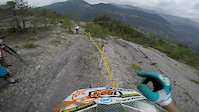
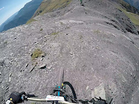
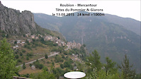
Videos of Nice

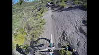

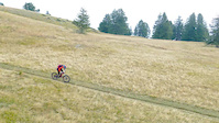
Recent Trail Reports
| status | trail | date | condition | info | user |
|---|---|---|---|---|---|
| Flying Cinghiale 2 | Jun 7, 2026 @ 9:03am (Europe/Paris) Jun 7, 2026 | Ideal | Djedenice | ||
| Cayenne | Mar 27, 2026 @ 2:35pm (Europe/Paris) Mar 27, 2026 | Dry | Djedenice | ||
| flying cinghiale 1 | Jan 10, 2026 @ 8:53am (Europe/Paris) Jan 9, 2026 | Ideal | Alexair06 | ||
| Posi 2B | Jan 10, 2026 @ 8:53am (Europe/Paris) Jan 9, 2026 | Dry | Alexair06 | ||
| Posi 2 | Jan 10, 2026 @ 8:53am (Europe/Paris) Jan 9, 2026 | Dry | Alexair06 | ||
| Sex in the City | Nov 29, 2025 @ 9:40am (Europe/Paris) Nov 29, 2025 | Ideal | Djedenice | ||
| Fying Cinghiale 3 | Oct 5, 2025 @ 9:56am (Europe/Paris) Oct 5, 2025 | Ideal | Djedenice | ||
| Caussimagne | Oct 5, 2025 @ 9:56am (Europe/Paris) Oct 5, 2025 | Dry | Djedenice | ||
| Climb Macaron | Aug 26, 2025 @ 9:30am Aug 26, 2025 | Ideal | Djedenice | ||
| Bordinas | Aug 26, 2025 @ 9:30am Aug 26, 2025 | Dry | Djedenice |
Activity Feed
| username | action | type | title | date |
|---|---|---|---|---|
| DavidKoller | wishlist | region | activity #102077661 | Aug 22, 2026 @ 10:39am Aug 22, 2026 |
| and90 | ridden | trail | activity #101081064 | Aug 9, 2026 @ 5:17am Aug 9, 2026 |
| Aaronct4piQ | wishlist | region | activity #99091660 | Jul 13, 2026 @ 5:40am Jul 13, 2026 |
| Kreebs | wishlist | region | activity #96825698 | Jun 12, 2026 @ 1:41pm Jun 12, 2026 |
| Djedenice | add | report | activity #96447628 and 1 more | Jun 7, 2026 @ 4:51am Jun 7, 2026 |
Recent Comments
| username | type | title | comment | date |
|---|---|---|---|---|
| trail | Horrible | Jul 9, 2022 @ 1:25am Jul 9, 2022 | ||
| trail | Actually black for sure !! | Mar 28, 2021 @ 7:04am Mar 28, 2021 | ||
| trail | Le nom de cette variante c'est POSI 3 (... | Jan 23, 2021 @ 12:48am Jan 23, 2021 | ||
| trail | Hodně jednoduché, není třeba velkého umění | Sep 24, 2019 @ 9:25am Sep 24, 2019 | ||
| trail | Zarostlý, nedoporučuji vůbec jezdit | Sep 24, 2019 @ 9:24am Sep 24, 2019 |
Activity Type Stats
| activitytype | trails | distance | descent | descent distance | total vertical | rating | global rank | state rank | photos | reports | routes | activity logs |
|---|---|---|---|---|---|---|---|---|---|---|---|---|
| Mountain Bike | 39 | 26 miles | 14,501 ft | 16 miles | 2,546 ft | #3,423 | #109 | 11 | 523 | 1 | 7,437 | |
| E-Bike | 11 | 10 miles | 4,649 ft | 5 miles | 2,467 ft | #3,330 | #206 | 495 | 5 | 1,662 | ||
| Gravel Bike | 6 | 6 miles | 1,385 ft | 2 miles | 2,293 ft | #874 | #27 | 35 | 5 | 48 | ||
| Adaptive Bike | 5 | 5 miles | 1,217 ft | 2 miles | 1,772 ft | #1,508 | #35 | 35 | ||||
| Hike | 48 | 29 miles | 15,285 ft | 18 miles | 2,546 ft | #3,893 | #109 | 517 | 251 | |||
| Trail Running | 48 | 29 miles | 15,285 ft | 18 miles | 2,546 ft | #3,442 | #107 | 517 | 197 |
Frequently Asked Questions
▼
What are the best places to ride in Nice?
Nice has 2 areas to explore for e-biking. The top rated areas are:
▼
What are the highest rated e-biking trails in Nice?
The highest rated e-biking trails in Nice are:
- Caussimagne (0/5)
- Fying Cinghiale 3 (0/5)
- Rumba (0/5)
- Cayenne (0/5)
- Sex in the City (0/5)
▼
Where can I park to ride in Nice?
There are 1 parking locations listed in Nice. The most popular parking spots are:
▼
What is the longest trail in Nice?
The longest trail in Nice is Bordinas at 1.4 miles. View all trails sorted by distance.
▼
What are the best & highest rated hiking trails in Nice?
The best hiking trails in Nice are:
- Sentier des Fauvettes
- Sentier de la Rade
- Circuit de Bellevue
- Chemin du Mont Boron
- Chemin Route Forestière
▼
How many trails are in Nice?
Nice has a total of 48 trails. Of those, 11 are designated for e-biking. Browse top e-biking trails in Nice to find detailed information including difficulty ratings, distances, and trail conditions.
▼
Which trail has the most elevation gain in Nice?
The trail with the most elevation gain in Nice is Rumba with 226 ft of elevation gain. View all trails sorted by elevation gain.
▼
Which trail has the most elevation descent in Nice?
The trail with the most elevation descent in Nice is Bordinas with 1,315 ft of elevation descent. View all trails sorted by elevation descent.
▼
What activities are most popular in Nice?
Nice supports the following activities: Mountain Biking, E-Biking, Gravel Biking, Adaptive Biking, Hiking, Trail Running.
▼
What are the steepest e-biking trails in Nice?
The steepest e-biking trail in Nice is Rumba with an average grade of 7%. View all trails sorted by grade.
▼
Are the trails open in Nice?
The overall region status for Nice is Clear / Green. Out of 38 trails:
- Clear / Green: 35
- Minor Issue / Yellow: 2
- Significant Issue / Amber: 1
▼
Can I ride an ebike in Nice?
Yes, Nice supports e-bike riding. There are 10 trails in Nice that allow e-bikes. Check the e-bike trails listing for specific trail access details and any local regulations.
▼
What are the most popular e-biking routes in Nice?
The most popular e-biking routes in Nice are:
- Circuit Gravel FFC n° 3 : Tour du Macaron
- Circuit Gravel FFC n° 4 : Le tour du Mont Férion
- Circuit Gravel FFC n° 2 : Col d'Eze - Fort de la Revère
▼
What is the highest summit in Nice?
The highest summit in Nice is Mont Chauve d'Aspremont at 2,769 ft elevation.
▼
What are the most popular Strava Segments in Nice?
The most popular Strava segments in Nice are:
- MaC Bordinas Cantaron (729 athletes)
- planeur 1 (584 athletes)
- Bordinas Cantaron Part 1 (583 athletes)
▼
Are there accessible or adaptive trails in Nice?
Yes, there are 5 accessible/adaptive trails in Nice. View all adaptive trails in Nice for specific accessibility information.
▼
Are there local clubs or events in Nice?
There are 2 local clubs or associations listed in the Nice directory. Browse the local directory for details.
▼
What are the most popular e-biking trails in Nice?
The most popular e-biking trails in Nice are: View all e-biking trails sorted by popularity.
▼
What are the best beginner ride trails in Nice?
The best beginner e-biking trails in Nice are:
- Sex in the City (0/5)
Activities
Trails
- By leopolo & contributors
- Admins: NER
- #7191 - 14,910 views
- nice activity log | embed map of Nice mountain bike trails | nice mountain biking points of interest
Downloading of trail gps tracks in kml & gpx formats is enabled for Nice.
You must login to download files.
