close
-
Layers w
- Weather Layers
- Pro
- Pro
- Pro
- Pro
- Pro
- Pro
- More Layers
- Pro
- Pro
- Pro
- Pro
-
Upgrade to

3D
Trail Conditions
- Unknown
- Snow Groomed
- Snow Packed
- Snow Covered
- Snow Cover Partial
- Freeze/thaw Cycle
- Icy
- Prevalent Mud
- Wet
- Variable
- Ideal
- Dry
- Very Dry
Trail Flow (Ridden Direction)
Trailforks scans users ridelogs to determine the most popular direction each trail is ridden. A good flowing trail network will have most trails flowing in a single direction according to their intension.
The colour categories are based on what percentage of riders are riding a trail in its intended direction.
The colour categories are based on what percentage of riders are riding a trail in its intended direction.
- > 96%
- > 90%
- > 80%
- > 70%
- > 50%
- < 50%
- bi-directional trail
- no data
Trail Last Ridden
Trailforks scans ridelogs to determine the last time a trail was ridden.
- < 2 days
- < 1 week
- < 2 weeks
- < 1 month
- < 6 months
- > 6 months
Trail Ridden Direction
The intended direction a trail should be ridden.
- Downhill Only
- Downhill Primary
- Both Directions
- Uphill Primary
- Uphill Only
- One Direction
Contribute Details
Colors indicate trail is missing specified detail.
- Description
- Photos
- Description & Photos
- Videos
Trail Popularity ?
Trailforks scans ridelogs to determine which trails are ridden the most in the last 9 months.
Trails are compared with nearby trails in the same city region with a possible 25 colour shades.
Think of this as a heatmap, more rides = more kinetic energy = warmer colors.
- most popular
- popular
- less popular
- not popular
ATV/ORV/OHV Filter
Max Vehicle Width
inches
US Cell Coverage
Legend

Radar Time
Activity Recordings
Trailforks uses anonymized public activity data.
?
Activity Recordings
Trailforks uses anonymized public activity data.
?
Personal Heatmap
▶
Activity Types
all
/
none
▶
Options
2
Date range
month
–
Winter Trails
Warning
A routing network for winter maps does not exist. Selecting trails using the winter trails layer has been disabled.
Missing Trails
Most Popular
Least Popular
Trails are colored based on popularity. The more popular a trail is, the more red. Less popular trails trend towards green.
Jump Magnitude Heatmap
Heatmap of where riders jump on trails. Zoom in to see individual jumps, click circles to view jump details.
BC Backroad Status
![map legend]()
Service Road Atlas is a free to use, community-driven service for viewing and creating reports on the numerous back-country service roads around B.C. and Alberta.

Slope Aspect
Direction the slope faces
Trails Deemphasized
Trails are shown in grey.
Only show trails with no bike usage.
Suggested Layers
Based on selected activity type
Save the current map location and zoom level as your default home location whenever this page is loaded.
SaveRegion Details
- 18
- 20
- 67
- 71
- 11
- 1
Stats
- Avg Trail Rating
- Trails (view details)
- 189
- Trails Mountain Bike
- 195
- Trails E-Bike
- 153
- Trails Hike
- 192
- Trails Trail Running
- 192
- Trails Snowshoe
- 14
- Trails Downhill Ski
- 14
- Trails Backcountry Ski
- 9
- Trails Nordic Ski
- 8
- Total Distance
- 68 miles
- Total Descent
- 45,404 ft
- Total Vertical
- 8,360 ft
- Highest Trailhead
- 9,839 ft
- Reports
- 889
- Photos
- 349
- Ridden Counter
- 7,102
Sub Regions
Popular Obwalden Mountain Biking Trails
• 100 ★ 4.1 • 3 miles • 199 ft • 269 •
The is a trail that is very inviting at the start. Towards the middle section, the ground becomes a little rocky and loose. The end is then a little more relaxed again. Advanced riding skills are recommended. nThe Lopper can also be...
• 35 ★ 3.5 • 2 miles • 10 ft • 211 •
The new is a flow trail from the Joch Pass to and is built so that beginners and experienced bikers can have fun. The various elements and curves can be negotiated at different speeds. The new with a lot of flow promises unlimited...
• 50 ★ 3.5 • 5,154 ft • 7 ft • 205 •
The -Engstlenalp route is comfortably laid out with one meter of width. Nevertheless, some bike-technical challenges are waiting for you. The trail head is accessible with the chairlift, part of the Engelberg-Titlis ski area and the...
• 70 ★ 4.5 • 3,566 ft • 10 ft • 139 •
Trail from the Gerschnialp, above Engelberg, through the forest down to the Bänklialp.
• 90 ★ 4.5 • 2,923 ft • 87 ft • 133 •
Highly rated popular blue difficulty singletrack. This multi-use trail can be used downhill primary with a 87 ft black diamond climb. It features berm, jump and rock garden. Trail visibility is always easy to follow. On average it takes 5 minutes to complete this trail.
• 100 ★ 5.0 • 2,297 ft • 0 ft • 113 •
Popular blue difficulty singletrack. This multi-use trail can be used downhill only. It features drop and rock garden. On average it takes 4 minutes to complete this trail.
• 95 ★ 5.0 • 702 ft • 0 ft • 112 •
Popular blue difficulty singletrack. This mountain bike primary trail can be used downhill only. On average it takes minutes to complete this trail.
Obwalden Mountain Bike Routes
15 miles • 2,223 ft • 5 • Point to Point •
Paved: 7km Forest Track: 11km SingleTrail: 6km
13 miles • 2,210 ft • 14 • Point to Point •
Nice route from Wirzweli, where you can start with the cablecar to save some pedaling.
31 miles • 6,047 ft • 5 • Loop •
Paved: 29km Forest Track: 14km SingleTrail: 6km
★ 5.0 • 3 miles • 13 ft • 0 • Point to Point •
Beautiful downhill through the woods with some nice rocky sections and a stunning view.
21 miles • 5,346 ft • 1 • Loop •
Diverse Abkürzungen möglich je nach Gruppe / Wetter / Umstände
Photos of Obwalden Mountain Bike
Videos of Obwalden Mountain Bike
trail: Häxewäldli
2:19 |
34 |
Jul 11, 2024
trail: Wäschplatte
2:14 |
39 |
Jul 11, 2024
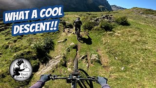
trail: Windegg
5:01 |
24 |
Jul 11, 2024
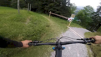
trail: Gerschni-Trail
3:56 |
265 |
Jul 11, 2024
trail: Gerschni-Trail
2:17 |
|
Oct 20, 2020
trail: Trudy Trail
3:43 |
6334 |
Dec 10, 2018
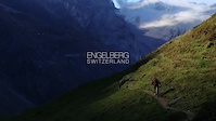
youtuber
![Biking in Engelberg]()
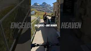
trail: Hells Bells Trail
0:34 |
54 |
Oct 29, 2025 , Engelberg
Recent Trail Reports
| status | trail | date | condition | info | user |
|---|---|---|---|---|---|
| Gerschni-Trail Engelberg-Titlis Biketrails | Jun 28, 2026 @ 2:58pm (Europe/Zurich) Jun 28, 2026 | Unknown | ACM1234 | ||
| Skill Parks Giswil Giswil | Jun 24, 2026 @ 7:07pm (Europe/Zurich) Jun 24, 2026 | Ideal | Hg2 | ||
| Erosion Giswil | Jun 24, 2026 @ 7:07pm (Europe/Zurich) Jun 24, 2026 | Very Dry | Hg2 | ||
| Best Section Giswil | Jun 24, 2026 @ 7:07pm (Europe/Zurich) Jun 24, 2026 | Very Dry | Hg2 | ||
| Sunnentag Horn Lungern | Jun 21, 2026 @ 8:55am (Europe/Zurich) Jun 20, 2026 | Ideal | Hg2 | ||
| Bergalp Lungern | Jun 21, 2026 @ 8:55am (Europe/Zurich) Jun 20, 2026 | Ideal | Hg2 | ||
| I am speed Kerns | Jun 6, 2026 @ 10:04am (Europe/Zurich) Jun 6, 2026 | Ideal | klauskoenig | ||
| Arvgigrat Kerns | Jun 6, 2026 @ 10:04am (Europe/Zurich) Jun 6, 2026 | Snow Cover Partial | klauskoenig | ||
| Schildboden Lungern | May 25, 2026 @ 11:38am (Europe/Zurich) May 25, 2026 | Ideal | romulXs | ||
| Herbrig I Lungern | May 25, 2026 @ 11:38am (Europe/Zurich) May 25, 2026 | Ideal | romulXs |
Activity Feed
| username | action | type | title | date |
|---|---|---|---|---|
| BeeeGeee | add | photo | activity #98528856 | Jul 5, 2026 @ 12:40pm Jul 5, 2026 |
| sgriffy | vote | trail | activity #98410300 and 4 more | Jul 4, 2026 @ 6:43am Jul 4, 2026 |
| Shotraps | ridden | trail | activity #98084852 | Jun 29, 2026 @ 1:38pm Jun 29, 2026 |
| seppli2017 | wishlist | trail | activity #98083756 | Jun 29, 2026 @ 1:17pm Jun 29, 2026 |
| seppli2017 | wishlist | trail | activity #98083743 and 1 more | Jun 29, 2026 @ 1:16pm Jun 29, 2026 |
Recent Comments
| username | type | title | comment | date |
|---|---|---|---|---|
| report | Was ? | Jun 12, 2026 @ 1:14pm Jun 12, 2026 | ||
| trail | Seit 2025 planiert. Neu grün. | Jun 6, 2026 @ 2:11am Jun 6, 2026 | ||
| trail | t | May 26, 2026 @ 11:26am May 26, 2026 | ||
| trail | leave your vote, would be awesome :-) | Nov 25, 2025 @ 9:20am Nov 25, 2025 | ||
| trail | leave your vote, would be awesome :) | Nov 25, 2025 @ 9:20am Nov 25, 2025 |
Local Badges
-

Epic Ride Descent 2k0 awarded -

Mountain Biking 100k Badge0 awarded -
Mountain Biking 100k Badge0 awarded -
Mountain Biking 100k Badge0 awarded -

Climbing 10k Badge0 awarded -
Epic Ride Descent 2k0 awarded
Bike & Skill Parks
| name | type | city | rating |
|---|---|---|---|
| Engelberg-Titlis Biketrails | bike park | Engelberg | |
| Trail Arena Bänklialp | skill park | Engelberg |
Activity Type Stats
| activitytype | trails | distance | descent | descent distance | total vertical | rating | global rank | state rank | photos | reports | routes | ridelogs |
|---|---|---|---|---|---|---|---|---|---|---|---|---|
| Mountain Bike | 195 | 68 miles | 44,964 ft | 50 miles | 5,755 ft | 345 | 889 | 7 | 6,705 | |||
| E-Bike | 153 | 63 miles | 42,113 ft | 47 miles | 5,755 ft | 4 | 829 | 5 | 881 | |||
| Hike | 192 | 63 miles | 41,132 ft | 45 miles | 5,509 ft | 853 | 1,886 | |||||
| Trail Running | 192 | 63 miles | 41,132 ft | 45 miles | 5,509 ft | 853 | 348 | |||||
| Snowshoe | 14 | 4 | 68 | |||||||||
| Downhill Ski | 14 | 4 | 2,880 | |||||||||
| Backcountry Ski | 9 | 856 ft | 440 ft | 719 ft | 440 ft | 733 | ||||||
| Nordic Ski | 8 | 1 | 1,182 |
Activities
Trails
Points of Interest
- By brenthillier
 NSMBA TRAILFORKS & contributors
 - Admins: swiss, trailpapst
- #8953 - 6,176 views
- obwalden activity log | embed map of Obwalden mountain bike trails | obwalden mountain biking points of interest
Downloading of trail gps tracks in kml & gpx formats is enabled for Obwalden.
You must login to download files.