1 mile
Distance
23 ft
Climb
-951 ft
Descent
00:16:22
Avg time
Hells Bells Trail Details
-
Activities
- Mountain Bike
-
Riding AreaHaslital
Meiringen -
Difficulty Rating
-
Voted DifficultyBlue (1 vote)
-
Trail TypeSingletrack
-
Bike TypeAM
-
Trail UsageBiking Only
-
DirectionDownhill OnlyPopular direction shown
-
Physical RatingModerate
-
SeasonJune - October
-
Dogs AllowedYes
-
Global Ranking#67722 in Mountain Biking
-
Local Popularity100 in Mountain Biking
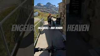
The Jochpass-Engstlenalp route is comfortably laid out with one meter of width. Nevertheless, some bike-technical challenges are waiting for you. The trail head is accessible with the Jochpass chairlift, part of the Engelberg-Titlis ski area and the Engstlen chairlift could be used to take the rider back to the Jochpass.
More Stats for Hells Bells Trail mountain bike trail trail
-
Altitude change-927 ft
-
Altitude min6,330 ft
-
Altitude max7,258 ft
-
Altitude start7,258 ft
-
Altitude end6,330 ft
-
Grade-16.734%
-
Grade max-40.722%
-
Grade min12.34%
-
Distance climb395 ft
-
Distance down5,053 ft
-
Distance flat94 ft
-
Avg time00:16:22
-
Avg reverse time00:23:13
- view trail stats
close
Trail Conditions
- Unknown
- Snow Groomed
- Snow Packed
- Snow Covered
- Freeze/thaw Cycle
- Icy
- Prevalent Mud
- Wet
- Variable
- Ideal
- Dry
- Very Dry
Trail Ridden Direction
Trailforks scans users ridelogs to determine the most popular direction each trail is ridden. A good flowing trail network will have most trails flowing in a single direction according to their intension.
The colour categories are based on what percentage of riders are riding a trail in its intended direction.
- > 96%
- > 90%
- > 80%
- > 70%
- > 50%
- < 50%
Trail Last Ridden
Trailforks scans ridelogs to determine the last time a trail was ridden.
- < 2 days
- < 1 week
- < 2 weeks
- < 1 month
- < 6 months
- > 6 months
Trail Ridden Direction
The intended direction a trail should be ridden.
- Downhill Only
- Downhill Primary
- Both Directions
- Uphill Primary
- Uphill Only
- One Direction
Contribute Details
Colors indicate trail is missing specified detail.
- Description
- Photos
- Description & Photos
- Videos
Trail Popularity ?
Trailforks scans ridelogs to determine which trails are ridden the most in the last 9 months.
Trails are compared with nearby trails in the same city region with a possible 25 colour shades.
Think of this as a heatmap, more rides = more kinetic energy = warmer colors.
- most popular
- popular
- less popular
- not popular
ATV/ORV/OHV Filter
Max Vehicle Width
inches
Radar Time
LEGEND
Trail Difficulties
Trail Report Status
- Access Road/Trail
- White
- Green
- Blue
- Black
- Double Black Diamond
Trail Report Status
- Clear / Green
- Minor Issue / Yellow
- Significant Issue / Amber
- Closed
- Land Owner Overlay
- Wilderness (typically no bikes in USA)
- BLM (public)
- USFS (Wildlife sanctuaries darker than usfs)
- State land
- Indigenous
- Military
Trail Conditions
- Unknown
- Snow Groomed
- Snow Packed
- Snow Covered
- Freeze/thaw Cycle
- Icy
- Prevalent Mud
- Wet
- Variable
- Ideal
- Dry
- Very Dry
- Map Markers
Trail Head
Photo
Directory Listing
Riding Area
TTF
Parking
Viewpoint
Information
Warning
Directions
Sight
Restrooms
eBike Charging Point
Water Fountain/Source
Gate
Trail Sign
Table or Bench
Ladder
Stairs
Bridge
Boardwalk
Camping
Cabin
Lodge
Bear Cache
Dock
Ranger Station
Summit
Other
Directions to hells-bells-trail trailhead
(46.778350, 8.386680)
update trails status or condition
Hells Bells Trail Trail Reports
view all reports »
Recent Ridelog Activity on Trail
Past Week
- 0 rides
6 Months
- 5 rides
- 22 miles avg distance
All
- 71 rides
Photos
no photos have been added for Hells Bells Trail yet, add a photo.
Reviews / Comments
No reviews yet, be the first to write a review or ask a question.
Use trail reports to comment on trail conditions.
Videos
no videos have been added for Hells Bells Trail yet, add a video.
Nearby Trails
- Jochpass Trail 220 ft
- Sessellift Jochpass-jochstock (jochstock-xpress) 751 ft
- Trudy Trail 906 ft
- Sessellift Engstlen-jochpass 1 mile
- Sessellift Trübsee-hopper 1 mile
- embed Hells Bells Trail trail on your website
- By engelbergtitlis & contributors
- #129368 - 609 views
- subscribe
- login to download gpx or kml files.
Open trail in mobile app