close
-
Layers w
- Weather Layers
- Pro
- Pro
- Pro
- Pro
- Pro
- Pro
- More Layers
- Pro
- Pro
- Pro
- Pro
-
Upgrade to

3D
Trail Conditions
- Unknown
- Snow Groomed
- Snow Packed
- Snow Covered
- Snow Cover Partial
- Freeze/thaw Cycle
- Icy
- Prevalent Mud
- Wet
- Variable
- Ideal
- Dry
- Very Dry
Trail Flow (Ridden Direction)
Trailforks scans users activity logs to determine the most popular direction each trail is ridden. A good flowing trail network will have most trails flowing in a single direction according to their intension.
The colour categories are based on what percentage of users are riding a trail in its intended direction.
The colour categories are based on what percentage of users are riding a trail in its intended direction.
- > 96%
- > 90%
- > 80%
- > 70%
- > 50%
- < 50%
- bi-directional trail
- no data
Trail Last Ridden
Trailforks scans activity logs to determine the last time a trail was ridden.
- < 2 days
- < 1 week
- < 2 weeks
- < 1 month
- < 6 months
- > 6 months
Trail Ridden Direction
The intended direction a trail should be ridden.
- Downhill Only
- Downhill Primary
- Both Directions
- Uphill Primary
- Uphill Only
- One Direction
Contribute Details
Colors indicate trail is missing specified detail.
- Description
- Photos
- Description & Photos
- Videos
Trail Popularity ?
Trailforks scans activity logs to determine which trails are ridden the most in the last 9 months.
Trails are compared with nearby trails in the same city region with a possible 25 colour shades.
Think of this as a heatmap, more activities = more kinetic energy = warmer colors.
- most popular
- popular
- less popular
- not popular
ATV/ORV/OHV Filter
Max Vehicle Width
inches
US Cell Coverage
Legend

Radar Time
Activity Recordings
Trailforks uses anonymized public activity data.
?
Activity Recordings
Trailforks uses anonymized public activity data.
?
Personal Heatmap
▶
Activity Types
all
/
none
▶
Options
2
Date range
month
–
Winter Trails
Warning
A routing network for winter maps does not exist. Selecting trails using the winter trails layer has been disabled.
Missing Trails
Most Popular
Least Popular
Trails are colored based on popularity. The more popular a trail is, the more red. Less popular trails trend towards green.
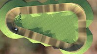
Jump Magnitude Heatmap
Heatmap of where users jump on trails. Zoom in to see individual jumps, click circles to view jump details.
BC Backroad Status
![map legend]()
Service Road Atlas is a free to use, community-driven service for viewing and creating reports on the numerous back-country service roads around B.C. and Alberta.

Slope Aspect
Direction the slope faces
Trails Deemphasized
Trails are shown in grey.
Only show trails with no bike usage.
Suggested Layers
Based on selected activity type
Save the current map location and zoom level as your default home location whenever this page is loaded.
Save
No description for Orange has been added yet!
Login or register to submit one.
Activities Click to view
- Mountain Bike
139 trails
- E-Bike
53 trails
- Gravel Bike
0 trails
- Adaptive Bike
0 trails
- Winter Fat Bike
0 trails
- Horse
4 trails
- Hike
117 trails
- Trail Running
116 trails
Region Details
- 29
- 29
- 45
- 18
- 6
Region Status
Open as of 1 dayStats
- Avg Trail Rating
- Trails (view details)
- 127
- Trails Mountain Bike
- 139
- Trails E-Bike
- 53
- Trails Horse
- 4
- Trails Hike
- 117
- Trails Trail Running
- 116
- Trails Dirtbike/Moto
- 3
- Total Distance
- 120 miles
- Total Descent
- 27,792 ft
- Total Vertical
- 3,174 ft
- Highest Trailhead
- 4,556 ft
- Reports
- 786
- Photos
- 858
- Completed Counter
- 10,715
Sub Regions
-
Glenwood Forest Trails
- 4
- 4
- 1
- 1
-
Kinross State Forest
- 17
- 17
- 2
-
Lake Canobolas Mountain Bike Park
- 4
- 7
- 3
-
Mount Canobolas
- 10
- 6
- 4
-
Mullion Creek
- 3
- 7
- 6
- 1
Popular Orange Mountain Biking Trails
• 95 ★ 3.5 • 4,195 ft • 66 ft • 405 •
Popular green difficulty singletrack. This mountain bike primary trail can be used one direction and has a easy overall physical rating with a 66 ft green climb. On average it takes 5 minutes to complete this trail.
• 95 ★ 3.5 • 1 mile • 103 ft • 401 •
Popular green difficulty singletrack. This mountain bike primary trail can be used one direction and has a easy overall physical rating with a 103 ft green climb. On average it takes 8 minutes to complete this trail.
• 100 ★ 4.8 • 4 miles • 2 ft • 396 •
Green descending flow trail with Blue line options. Part of a 18km loop with the Gallinbundinya and Onwards & Upwards climb. Top can also be accessed by vehicle along Alf Meyers Way. Designed for the 'Enthusiast' mountain bikers as...
• 95 ★ 2.5 • 1,572 ft • 64 ft • 376 •
Uphill climb from lookout to start of downhill section
• 95 ★ 4.0 • 3,313 ft • 70 ft • 376 •
Popular blue difficulty singletrack. This mountain bike primary trail can be used one direction and has a easy overall physical rating with a 70 ft green climb. On average it takes 3 minutes to complete this trail.
Hillyary Permanently Closed
• 100 ★ 3.0 • 1,010 ft • 36 ft • 339 •
Popular blue difficulty closed singletrack. This mountain bike primary trail and has a moderate overall physical rating with a 36 ft blue climb. On average it takes 2 minutes to complete this trail.
Orange Mountain Bike Routes
9 miles • 1,224 ft • 5 • Loop •
Nice loop from Lidster rural fire to top of Mitchell Way and down and back across. Follow the creek up,...
12 miles • 1,631 ft • 0 • Loop •
Fire road only loop from Pinnacle carpark. Head up Main Central Rd, turn right on North Boundary Rd;...
5 miles • 531 ft • 27 • Loop •
Updated Ninja Loop takes in a range of differing tracks than the previous version and makes for a fun ride.
5 miles • 478 ft • 15 • Loop •
This route takes in a good swag of trails in Kinross, nothing too technically difficult but some good...
3 miles • 410 ft • 3 •
New Southern loop for 2021!! Trees cleared in July Still open and approved by forestry 2021
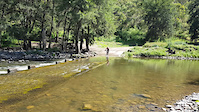
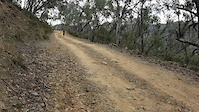
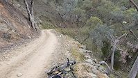
Photos of Orange Mountain Bike
Videos of Orange Mountain Bike
trail: Lake Canobolas Pump Track
0:59 |
5 |
Jul 4, 2026

trail: Bridle Track
0:19 |
37 |
Aug 5, 2023
trail: Bridle Track
0:26 |
58 |
Aug 5, 2023

trail: Bridle Track
0:25 |
18 |
Aug 5, 2023

trail: Bridle Track
0:15 |
12 |
Aug 5, 2023

trail: Bridle Track
0:15 |
3 |
Aug 5, 2023
trail: Bridle Track
0:46 |
3 |
Aug 5, 2023
trail: Bridle Track
0:33 |
8 |
Aug 5, 2023
Current Trail Warnings
| status | trail | date | condition | user | info |
|---|---|---|---|---|---|
| Tav's Trail | Jul 26, 2026 @ 1:49pm (Australia/Sydney) 2 days | Ideal | jack-advancedtraildesign OMC | tree over trail in first block. Can duck... |
Recent Trail Reports
| status | trail | date | condition | info | user |
|---|---|---|---|---|---|
| The Eye Of The Wombat | Jul 26, 2026 @ 2:26pm (Australia/Sydney) 1 day | Variable | jack-advancedtraildesign OMC | ||
| Onwards & Upwards | Jul 26, 2026 @ 1:16pm (Australia/Sydney) 2 days | Variable | jack-advancedtraildesign OMC | ||
| Don't Believe the Hype | Jul 25, 2026 @ 6:19pm (Australia/Sydney) 2 days | Ideal | Davelesliewilton | ||
| True Blue | Jul 19, 2026 @ 3:00pm (Australia/Sydney) Jul 18, 2026 | Ideal | jack-advancedtraildesign OMC | ||
| Magic Mushroom | Jul 19, 2026 @ 2:23pm (Australia/Sydney) Jul 18, 2026 | Ideal | jack-advancedtraildesign OMC | ||
| Galinbundinya Trail | Jul 18, 2026 @ 9:39pm (Australia/Sydney) Jul 18, 2026 | Variable | atad5768 | ||
| Freak On A Leash | Jul 17, 2026 @ 10:40pm (Australia/Sydney) Jul 17, 2026 | Variable | atad5768 | ||
| Woggle Valley | Feb 25, 2026 @ 9:06pm (Australia/Sydney) Feb 25, 2026 | Dry | jack-advancedtraildesign OMC | ||
| Blackberry Downs | Feb 24, 2026 @ 9:03pm (Australia/Sydney) Feb 24, 2026 | Ideal | jack-advancedtraildesign OMC | ||
| Old Biddy | Feb 23, 2026 @ 8:55pm (Australia/Sydney) Feb 23, 2026 | Dry | jack-advancedtraildesign OMC |
Activity Feed
| username | action | type | title | date |
|---|---|---|---|---|
| RocketRobC | wishlist | trail | activity #100111047 and 1 more | Jul 26, 2026 @ 9:57pm 11 hours |
| jack-advancedtraildesign | add | report | activity #100025702 and 1 more | Jul 25, 2026 @ 8:47pm 2 days |
| jack-advancedtraildesign | add | report | activity #100024743 and 1 more | Jul 25, 2026 @ 8:16pm 2 days |
| Davelesliewilton | add | report | activity #99943640 and 1 more | Jul 25, 2026 @ 1:19am 2 days |
| sketchylanding | wishlist | region | activity #99651308 | Jul 20, 2026 @ 7:44pm Jul 20, 2026 |
Recent Comments
| username | type | title | comment | date |
|---|---|---|---|---|
| trail | open for riding. its now dual way allowing... | Jun 20, 2026 @ 7:48pm Jun 20, 2026 | ||
| trail | Trail currently open. It ends about 1.5km... | Jun 20, 2026 @ 7:45pm Jun 20, 2026 | ||
| report | 9.5 machine hours 1.8 ton excavator | Feb 5, 2026 @ 2:19pm Feb 5, 2026 | ||
| trail | Awesome track, probably the least gnarly of... | Jan 27, 2026 @ 1:46am Jan 27, 2026 | ||
| trail | Great track with some fun whoops sections,... | Jan 27, 2026 @ 1:45am Jan 27, 2026 |
Local Badges
-

Top 10 Trails0 awarded -

Descent 100k Badge8 awarded -

Big Ride 30k2,965 awarded -

Epic Ride 50k1,474 awarded -

Completionist0 awarded -
Completionist0 awarded
Bike & Skill Parks
| name | type | city | rating |
|---|---|---|---|
| Lake Canobolas Skills Park | skill park | Orange |
Local Trail Supporters
- OMC
- DG Cycles
- Red City Gym
Activity Type Stats
| activitytype | trails | distance | descent | descent distance | total vertical | rating | global rank | state rank | photos | reports | routes | activity logs |
|---|---|---|---|---|---|---|---|---|---|---|---|---|
| Mountain Bike | 139 | 120 miles | 27,792 ft | 62 miles | 3,173 ft | #813 | #42 | 891 | 785 | 25 | 15,867 | |
| E-Bike | 53 | 55 miles | 14,180 ft | 30 miles | 2,536 ft | #1,990 | #101 | 692 | 3 | 1,157 | ||
| Horse | 4 | 22 miles | 3,773 ft | 11 miles | 1,854 ft | #787 | #37 | 160 | ||||
| Hike | 117 | 97 miles | 18,291 ft | 45 miles | 3,173 ft | #1,709 | #52 | 629 | 283 | |||
| Trail Running | 116 | 97 miles | 18,179 ft | 45 miles | 3,173 ft | #1,347 | #42 | 629 | 355 | |||
| Dirtbike/Moto | 3 | 20 miles | 3,507 ft | 10 miles | 1,788 ft | 160 | 12 |
Frequently Asked Questions About Orange
▼
What are the best places to ride in Orange?
Orange has 5 areas to explore for mountain biking. The top rated areas are:
▼
What are the highest rated mountain biking trails in Orange?
The highest rated mountain biking trails in Orange are:
- Trail of Awesomeness (4.6/5)
- Onwards & Upwards (4.3/5)
- Jack's (4.3/5)
- Rocky Road (4.2/5)
- Galinbundinya Trail (4.2/5)
▼
What is the best time of the year to ride in Orange?
Based on activity log data, the most popular months to ride in Orange are:
- January (81 activities)
- November (65 activities)
- October (63 activities)
▼
Where can I park to ride in Orange?
There are 9 parking locations listed in Orange. The most popular parking spots are:
- Parking
- Glenwood Galinbundinya Parking Area
- Lake Canobolas MTB Park parking
- Lower Car Park
- Kinross Parking area
Activities
Trails
- By armageddonactionsports & contributors
- Admins: stuartrichardson, OMC
- #4756 - 15,208 views
- orange activity log | embed map of Orange mountain bike trails | orange mountain biking points of interest polygons
Downloading of trail gps tracks in kml & gpx formats is enabled for Orange.
You must login to download files.