close
-
Layers w
- Weather Layers
- Pro
- Pro
- Pro
- Pro
- Pro
- Pro
- More Layers
- Pro
- Pro
- Pro
- Pro
-
Upgrade to

3D
Trail Conditions
- Unknown
- Snow Groomed
- Snow Packed
- Snow Covered
- Snow Cover Partial
- Freeze/thaw Cycle
- Icy
- Prevalent Mud
- Wet
- Variable
- Ideal
- Dry
- Very Dry
Trail Flow (Ridden Direction)
Trailforks scans users ridelogs to determine the most popular direction each trail is ridden. A good flowing trail network will have most trails flowing in a single direction according to their intension.
The colour categories are based on what percentage of riders are riding a trail in its intended direction.
The colour categories are based on what percentage of riders are riding a trail in its intended direction.
- > 96%
- > 90%
- > 80%
- > 70%
- > 50%
- < 50%
- bi-directional trail
- no data
Trail Last Ridden
Trailforks scans ridelogs to determine the last time a trail was ridden.
- < 2 days
- < 1 week
- < 2 weeks
- < 1 month
- < 6 months
- > 6 months
Trail Ridden Direction
The intended direction a trail should be ridden.
- Downhill Only
- Downhill Primary
- Both Directions
- Uphill Primary
- Uphill Only
- One Direction
Contribute Details
Colors indicate trail is missing specified detail.
- Description
- Photos
- Description & Photos
- Videos
Trail Popularity ?
Trailforks scans ridelogs to determine which trails are ridden the most in the last 9 months.
Trails are compared with nearby trails in the same city region with a possible 25 colour shades.
Think of this as a heatmap, more rides = more kinetic energy = warmer colors.
- most popular
- popular
- less popular
- not popular
ATV/ORV/OHV Filter
Max Vehicle Width
inches
US Cell Coverage
Legend

Radar Time
Activity Recordings
Trailforks uses anonymized public activity data.
?
Activity Recordings
Trailforks uses anonymized public activity data.
?
Personal Heatmap
▶
Activity Types
all
/
none
▶
Options
2
Date range
month
–
Winter Trails
Warning
A routing network for winter maps does not exist. Selecting trails using the winter trails layer has been disabled.
Missing Trails
Most Popular
Least Popular
Trails are colored based on popularity. The more popular a trail is, the more red. Less popular trails trend towards green.
Jump Magnitude Heatmap
Heatmap of where riders jump on trails. Zoom in to see individual jumps, click circles to view jump details.
BC Backroad Status
![map legend]()
Service Road Atlas is a free to use, community-driven service for viewing and creating reports on the numerous back-country service roads around B.C. and Alberta.

Slope Aspect
Direction the slope faces
Trails Deemphasized
Trails are shown in grey.
Only show trails with no bike usage.
Suggested Layers
Based on selected activity type
Save the current map location and zoom level as your default home location whenever this page is loaded.
Save
No description for Österåker has been added yet!
Login or register to submit one.
This region uses the Uk/Euro style trail grading system.
Activities Click to view
- Mountain Bike
313 trails
- Gravel Bike
0 trails
- Adaptive Bike
0 trails
- Winter Fat Bike
0 trails
- Horse
12 trails
- Hike
312 trails
- Trail Running
312 trails
- Nordic Ski
5 trails
Region Details
- 68
- 38
- 150
- 53
- 3
Region Status
Open as of May 23, 2026Stats
- Avg Trail Rating
- Trails (view details)
- 312
- Trails Mountain Bike
- 313
- Trails E-Bike
- 2
- Trails Horse
- 12
- Trails Hike
- 312
- Trails Trail Running
- 312
- Trails Nordic Ski
- 5
- Total Distance
- 139 miles
- Total Descent Distance
- 58 miles
- Total Descent
- 10,109 ft
- Total Vertical
- 259 ft
- Highest Trailhead
- 276 ft
- Reports
- 209
- Photos
- 81
- Ridden Counter
- 7,661
Sub Regions
-
Åkersberga
- 13
- 37
- 11
-
Ljusterö
- 1
- 1
- 2
-
Österåker Norra
- 2
- 13
- 2
-
Rydbo
- 1
- 15
-
Täljö
- 8
- 24
- 17
-
Trastsjöskogen
- 15
- 58
- 21
- 3
Popular Österåker Mountain Biking Trails
• 100 ★ 4.4 • 3 miles • 211 ft • 293 •
En MTB-bana finansierad av Österåkers kommun och byggd av Niklas Skogh. Vid svårare passager finns lättare alternativ. Felrapporter skickas till Niklas Skogh, info(a)byniklas.se, som vidarebefordrar till kommunen.
• 95 ★ 0.0 • 896 ft • 0 ft • 72 •
Popular blue difficulty singletrack. This multi-use trail can be used both directions and has a hard overall physical rating with a 0 ft blue climb. Trail visibility is always easy to follow. On average it takes 1 minutes to complete this trail.
• 95 ★ 0.0 • 696 ft • 0 ft • 71 •
Popular red difficulty singletrack. This multi-use trail can be used both directions and has a moderate overall physical rating with a 0 ft blue climb. Trail visibility is always easy to follow. On average it takes 2 minutes to complete this trail.
• 100 ★ 0.0 • 551 ft • 0 ft • 71 •
Popular blue difficulty singletrack. This multi-use trail can be used both directions and has a moderate overall physical rating with a 0 ft blue climb. On average it takes minutes to complete this trail.
• 85 ★ 5.0 • 3,638 ft • 52 ft • 69 •
Popular blue difficulty singletrack. This multi-use trail can be used both directions. On average it takes 5 minutes to complete this trail.
• 100 ★ 0.0 • 515 ft • 8 ft • 59 •
Popular blue difficulty singletrack. This multi-use trail can be used both directions. On average it takes minutes to complete this trail.
• 90 ★ 0.0 • 2,451 ft • 22 ft • 57 •
Popular blue difficulty singletrack. This multi-use trail can be used both directions and has a moderate overall physical rating with a 22 ft blue climb. Trail visibility is always easy to follow. On average it takes 4 minutes to complete this trail.
Österåker Mountain Bike Routes
12 miles • 657 ft • 8 • Point to Point •
Roslagsleden Wira Bruk - Domarudden (Etapp 5) består av ca 50% stig och 50% grusväg. Vissa sträckor är...
3 miles • 197 ft • 0 • Loop •
En MTB-bana finansierad av Österåkers kommun och byggd av Niklas Skogh. Vid svårare passager finns...
6 miles • 428 ft • 0 • Loop •
Relatively easy flowy xco trail with some technical stuff, excellent to ride in sun set and wintertime if...
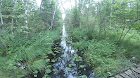
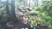
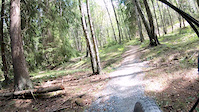
Photos of Österåker Mountain Bike
Videos of Österåker Mountain Bike
Recent Trail Reports
Activity Feed
| username | action | type | title | date |
|---|---|---|---|---|
| Diplidupli | comment | trail | activity #97171876 | Jun 17, 2026 @ 3:41am Jun 17, 2026 |
| DrGang | add | trail | activity #96537432 | Jun 8, 2026 @ 7:14am Jun 8, 2026 |
| DrGang | add | trail | activity #96489887 and 4 more | Jun 7, 2026 @ 12:50pm Jun 7, 2026 |
| Plonkan | add | report | activity #95321690 | May 23, 2026 @ 8:33am May 23, 2026 |
| Volker84TKaB | ridden | trail | activity #94874624 | May 16, 2026 @ 11:11pm May 16, 2026 |
Recent Comments
| username | type | title | comment | date |
|---|---|---|---|---|
| trail | awesome website! | Jun 17, 2026 @ 3:41am Jun 17, 2026 | ||
| trail | Blå grad. | Sep 14, 2025 @ 6:09am Sep 14, 2025 | ||
| trail | Blå grad. | Sep 14, 2025 @ 4:26am Sep 14, 2025 | ||
| trail | Gör en stigrapport (Trail report) istället. | Jul 15, 2025 @ 6:02am Jul 15, 2025 | ||
| trail | Nyligen röjt gräs och sly längs banan, och... | Jul 14, 2025 @ 2:38am Jul 14, 2025 |
Local Badges
-

Completionist0 awarded -

Epic Ride 50k248 awarded -

Top 10 Trails0 awarded -
Completionist0 awarded -

Big Ride 30k798 awarded -
Completionist0 awarded
Activity Type Stats
| activitytype | trails | distance | descent | descent distance | total vertical | rating | global rank | state rank | photos | reports | routes | ridelogs |
|---|---|---|---|---|---|---|---|---|---|---|---|---|
| Mountain Bike | 313 | 139 miles | 10,108 ft | 58 miles | 259 ft | #1,158 | #65 | 81 | 209 | 4 | 9,914 | |
| E-Bike | 2 | 2 miles | 82 ft | 3,963 ft | 89 ft | 168 | 317 | |||||
| Horse | 12 | 6 miles | 430 ft | 2 miles | 217 ft | #1,614 | #75 | 32 | ||||
| Hike | 312 | 139 miles | 10,079 ft | 57 miles | 259 ft | #1,044 | #60 | 207 | 3 | 456 | ||
| Trail Running | 312 | 139 miles | 10,079 ft | 57 miles | 259 ft | #768 | #63 | 207 | 3 | 943 | ||
| Nordic Ski | 5 | 7 miles | 417 ft | 3 miles | 85 ft | #963 | #99 | 59 |
Frequently Asked Questions About Österåker
▼
What are the best places to ride in Österåker?
Österåker has 6 areas to explore for mountain biking. The top rated areas are:
▼
What are the highest rated mountain biking trails in Österåker?
The highest rated mountain biking trails in Österåker are:
- Hacksta MTB (4.2/5)
- Täljö Trailduro 2 (4.1/5)
- Täljö Trailduro 1 (4.1/5)
- Roslagsleden Etapp 5 Mörtvättern (4.1/5)
- Södra Stigen (4.1/5)
▼
What is the best time of the year to ride in Österåker?
Based on ride log data, the most popular months to ride in Österåker are:
- August (68 activities)
- June (68 activities)
- May (58 activities)
▼
Where can I park to ride in Österåker?
Activities
Trails
Points of Interest
- By ollesvenskonthetrail
 TRAILFORKS & contributors
 - Admins: ollesvenskonthetrail, JALLE, OrjanX, martinlindstr, ollesvenskonthetrail, OrjanX, Hulken, jnasslander, Fluffracka, erikemil
- #14768 - 3,592 views
- Österåker activity log | embed map of Österåker mountain bike trails | Österåker mountain biking points of interest
Downloading of trail gps tracks in kml & gpx formats is enabled for Österåker.
You must login to download files.