
close
3D
Trail Conditions
- Unknown
- Snow Groomed
- Snow Packed
- Snow Covered
- Snow Cover Partial
- Freeze/thaw Cycle
- Icy
- Prevalent Mud
- Wet
- Variable
- Ideal
- Dry
- Very Dry
Trail Flow (Ridden Direction)
Trailforks scans users activity logs to determine the most popular direction each trail is ridden. A good flowing trail network will have most trails flowing in a single direction according to their intension.
The colour categories are based on what percentage of users are riding a trail in its intended direction.
The colour categories are based on what percentage of users are riding a trail in its intended direction.
- > 96%
- > 90%
- > 80%
- > 70%
- > 50%
- < 50%
- bi-directional trail
- no data
Trail Last Used
Trailforks scans activity logs to determine the last time a trail was ridden.
- < 2 days
- < 1 week
- < 2 weeks
- < 1 month
- < 6 months
- > 6 months
Trail Ridden Direction
The intended direction a trail should be ridden.
- Downhill Only
- Downhill Primary
- Both Directions
- Uphill Primary
- Uphill Only
- One Direction
Contribute Details
Colors indicate trail is missing specified detail.
- Description
- Photos
- Description & Photos
- Videos
Trail Popularity ?
Trailforks scans activity logs to determine which trails are ridden the most in the last 9 months.
Trails are compared with nearby trails in the same city region with a possible 25 colour shades.
Think of this as a heatmap, more activities = more kinetic energy = warmer colors.
- most popular
- popular
- less popular
- not popular
ATV/ORV/OHV Filter
Max Vehicle Width
inches
US Cell Coverage
Legend

Radar Time
Activity Recordings
Trailforks uses anonymized public activity data.
?
Activity Recordings
Trailforks uses anonymized public activity data.
?
Winter Trails
Warning
A routing network for winter maps does not exist. Selecting trails using the winter trails layer has been disabled.
Missing Trails
Most Popular
Least Popular
Trails are colored based on popularity. The more popular a trail is, the more red. Less popular trails trend towards green.
Jump Magnitude Heatmap
Heatmap of where users jump on trails. Zoom in to see individual jumps, click circles to view jump details.
BC Backroad Status
![map legend]()
Service Road Atlas is a free to use, community-driven service for viewing and creating reports on the numerous back-country service roads around B.C. and Alberta.

Slope Aspect
Direction the slope faces
Trails Deemphasized
Trails are shown in grey.
Only show trails with no bike usage.
Suggested Layers
Based on selected activity type
Save the current map location and zoom level as your default home location whenever this page is loaded.
SavePopular Trail Networks
view all areas »Perth and Kinross Region trails and routes are listed on Trailforks with interactive trail maps, difficulty ratings, photos, and user-reported trail conditions. The Trailforks community has mapped hundreds of trails and shared hundreds of photos in this region. Supported activity types include Mountain Biking, E-Biking, Hiking, Trail Running and Horseback. Trails here are often faint trail, flowy and rooty. Scenery includes views, summits and creeks. Common trail features include berms, jumps and drops. Many trails are family friendly. Amenities include huts. Popular destinations include Dunkeld, Perth and Crieff.
This is an auto-generated description of Perth and Kinross Region.
Login or register to submit a custom description.
This region uses the Uk/Euro style trail grading system.
Trail info last updated
Activities Click to view
- Mountain Bike
832 trails
- E-Bike
743 trails
- Horse
91 trails
- Hike
598 trails
- Trail Running
597 trails
- Dirtbike/Moto
0 trails
- Observed Trials
0 trails
- ATV/ORV/OHV
0 trails
- Nordic Ski
0 trails
Region Details
- 284
- 103
- 128
- 163
- 146
- 7
Stats
- Avg Trail Rating
- Trails (view details)
- 869
- Trails Mountain Bike
- 832
- Trails E-Bike
- 743
- Trails Gravel Bike
- 345
- Trails Adaptive Bike
- 68
- Trails Winter Fat Bike
- 154
- Trails Horse
- 91
- Trails Hike
- 598
- Trails Trail Running
- 597
- Total Distance
- 595 miles
- Total Descent
- 127,020 ft
- Total Vertical
- 3,392 ft
- Highest Trailhead
- 3,472 ft
- Reports
- 6,232
- Photos
- 870
- Completed Counter
- 171,737
Articles

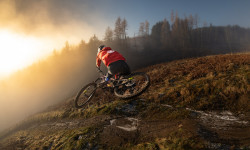
Video: Winter Shredding at Glassie BikePark With Corey Watson
Feb 6, 2025 from pinkbike.com
Corey Watson sure knows how to ride a bike.
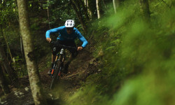
Video: Lachlan Blair's 61 Second Raw Edit on Glassie Bike Park's Shredo Trail
Jan 16, 2024 from pinkbike.com
Some perfect moody winter riding.
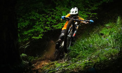
Video & Photo Story: The Best Hand Cut Trails in Scotland, Perthshire
Nov 18, 2021 from pinkbike.com
Scotty Laughland visits Perthshire and showcases the region's diversity through riding locations, Dunkeld, Comrie Croft and Aberfeldy.
Video: Joe Barnes & Hazzard Racing's Chippy Tour of Scotland Begins
Jun 29, 2021 from pinkbike.com
The loam of Inverness and the shale of Dunkeld is a match made in heaven for a trip on the road.
Sub Regions
- Aberargie (10)
- Aberfeldy (62)
- Glassie Bike Park (11)
- Strathtay & Grandtully Wood (19)
- Weem Wood (22)
- Alyth (33)
- Alyth Hill (30)
- Blair Atholl (7)
- Beinn Dearg (3)
- Glen Tilt (4)
- Braco (21)
- Bridge of Gaur (1)
- Comrie (41)
- Ben Chonzie (1)
- Comrie Croft (33)
- Coupar Angus (76)
- Ballo Wood (38)
- Hallyburton & Lundie Craigs (38)
- Crieff (68)
- Crieff Hydro Trails (27)
- Torlum Trails (26)
- Dunkeld (243)
- Atholl Hill (51)
- Birnam Hill (24)
- Craigvinean (53)
- Dalmarnock (65)
- Deuchary Hill (23)
- Newtyle Hill (10)
- Dunning (31)
- Littlerigg (11)
- Perth (138)
- Deuchny Woods (60)
- Kinnoull Hill (61)
- Moncreiffe Hill (17)
- Pitlochry (45)
- Auchnafree (5)
- Ben Vorlich (1)
- Dunsinane Hill (1)
- Glen Devon (46)
Popular Perth and Kinross Region Mountain Biking Trails
• 95 ★ 4.4 • 1,280 ft • 52 ft • 1,570 •
Highly rated popular blue difficulty singletrack. This mountain bike primary trail can be used one direction and has a moderate overall physical rating with a 52 ft blue climb. It features bridge. Trail visibility is always easy to follow. On average it takes 4 minutes to complete this trail.
• 85 ★ 4.7 • 3,179 ft • 42 ft • 1,519 •
The most obviously man made trail at Comrie. Starts at the cattle grid, or as a continuation of the blue upper. If your new, you can roll the whole thing, you might have to pedal a bit. Experienced riders will love the way the trail...
• 85 ★ 3.2 • 1,457 ft • 3 ft • 1,409 •
Outward link from fireroad that leads to blue, red and black routes
• 100 ★ 4.0 • 295 ft • 12 ft • 1,331 •
Highly rated popular red difficulty singletrack. This mountain bike primary trail can be used one direction and has a moderate overall physical rating with a 12 ft black diamond climb. Trail visibility is always easy to follow. On average it takes minutes to complete this trail.
• 75 ★ 4.1 • 1,529 ft • 24 ft • 1,330 •
Small climb about halfway through. Little bit more technical than a standard Forestry Commission blue route. There area couple of extra sections with black grade sections too, so it's worth riding even if you'd normally skip blue routes.
• 90 ★ 4.5 • 689 ft • 0 ft • 1,255 •
Highly rated popular blue difficulty machine groomed. This mountain bike primary trail can be used one direction and has a easy overall physical rating with a 0 ft blue climb. It features berm. Trail visibility is always easy to follow. On average it takes minutes to complete this trail.
• 80 ★ 4.2 • 1,975 ft • 0 ft • 1,253 •
Tight, rocky harsh trail with steep corners and tricky rocky obstacles. Little bit pedally at the top and bottom. This trail is nothing like any Forestry Commission red graded trail, or even the new red graded trail - it's far more...
• 65 ★ 4.3 • 2,392 ft • 23 ft • 1,187 •
Bridges, rocks, lots of extra optional sections as close to feeling natural as it gets at a trail centre.
Perth and Kinross Region Mountain Bike Routes
★ 1.0 • 183 miles • 10,595 ft • 1 • Loop •
The Cairngorms Loop is a 186 mile (300km) independent time trial (ITT) route through the Cairngorms...
5 miles • 448 ft • 1 •
The Classic Fiddlers Path Loop form Dunkeld. This crosses the A9 bridge on a footpath. Note the A9 works...
★ 3.0 • 28 miles • 5,192 ft • 22 • Loop •
Full route for the Dunkeld Enduro 2019
★ 3.0 • 17 miles • 3,147 ft • 16 • Loop •
This is the route used for the 2021 Dunkeld Enduro Race.
2 miles • 288 ft • 2 • Loop •
Gravel loop on Forest roads starting at the main car park
★ 3.0 • 22 miles • 1,874 ft • 1 • Loop •
Starting at Bankfoot, with a road section to warm up. Otherwise mostly off road, with a section through...
Photos of Perth and Kinross Region Mountain Bike
Videos of Perth and Kinross Region Mountain Bike
Current Trail Warnings
| status | trail | date | condition | user | info |
|---|---|---|---|---|---|
| Access Trail Glen Devon | Nov 9, 2026 @ 1:29pm (Europe/London) Nov 9, 2026 | Ideal | aag87 BCDC | Hike Trail marked as closed/not in use as it... | |
| Pheonix Link Craigvinean | Nov 8, 2026 @ 8:57pm (Europe/London) Nov 8, 2026 | Wet | trailco-ordinator BSTA | Trail is running well. Large fallen trees... | |
| Dalmarnock Descent Part 2 Dalmarnock | Nov 8, 2026 @ 9:23am (Europe/Isle_of_Man) Nov 8, 2026 | Wet | JohnKaneNelson | Loads of trees down, blocking the start |
Recent Trail Reports
National Scenic Trails & Official Routes
-
Rob Roy Way
- Mountain Bike
- E-Bike
- Hike
- Trail Running
Activity Feed
| username | action | type | title | date |
|---|---|---|---|---|
| StoneAgeMTB | wishlist | region | activity #107657428 | Nov 12, 2026 @ 8:05am 3 hours |
| StoneAgeMTB | wishlist | region | activity #107657423 | Nov 12, 2026 @ 8:05am 3 hours |
| craigfalconer626 | add | report | activity #107648336 | Nov 12, 2026 @ 3:48am 7 hours |
| craigfalconer626 | add | report | activity #107591734 and 1 more | Nov 11, 2026 @ 6:05am 1 day |
| bobfin3 | wishlist | trail | activity #107563772 | Nov 10, 2026 @ 3:06pm 2 days |
Recent Comments
| username | type | title | comment | date |
|---|---|---|---|---|
| trail | Great long trail | Nov 8, 2026 @ 5:47am Nov 8, 2026 | ||
| report | further update i have managed to clear the... | Nov 7, 2026 @ 4:55am Nov 7, 2026 | ||
| trail | overgrown, mostly riding over grass where it... | Oct 23, 2026 @ 4:40am Oct 23, 2026 | ||
| trail | Definitely not a blue 😂 I would classify... | Sep 26, 2026 @ 8:40am Sep 26, 2026 | ||
| trail | I’d say red with a lot of black sections.... | Sep 11, 2026 @ 11:39pm Sep 11, 2026 |
Local Badges
-

The 1hr Hally Sesh24 awarded -

Completionist0 awarded -
Completionist0 awarded -
Completionist0 awarded -
Completionist1 awarded -
Completionist10 awarded
Bike & Skill Parks
| name | type | city | rating |
|---|---|---|---|
| Pump & Skills Track | skill park | Crieff |






Activity Type Stats
| activitytype | trails | distance | descent | descent distance | total vertical | rating | global rank | state rank | photos | reports | routes | activity logs |
|---|---|---|---|---|---|---|---|---|---|---|---|---|
| Mountain Bike | 832 | 584 miles | 124,682 ft | 272 miles | 3,392 ft | 837 | 6,232 | 34 | 60,140 | |||
| E-Bike | 743 | 487 miles | 100,502 ft | 222 miles | 3,392 ft | 18 | 5,635 | 12 | 12,525 | |||
| Gravel Bike | 345 | 324 miles | 34,173 ft | 124 miles | 2,946 ft | 643 | 5 | 226 | ||||
| Adaptive Bike | 68 | 62 miles | 9,032 ft | 26 miles | 2,057 ft | 295 | 1 | 1 | ||||
| Winter Fat Bike | 154 | 138 miles | 25,492 ft | 62 miles | 2,933 ft | 1,085 | 1 | 2 | ||||
| Horse | 91 | 95 miles | 11,896 ft | 41 miles | 1,378 ft | 699 | 2 | |||||
| Hike | 598 | 528 miles | 78,553 ft | 220 miles | 3,392 ft | 15 | 4,993 | 5 | 4,288 | |||
| Trail Running | 597 | 524 miles | 76,788 ft | 217 miles | 3,392 ft | 4,990 | 5 | 2,760 |
Frequently Asked Questions
▼
What are the best places to ride in Perth and Kinross Region?
Perth and Kinross Region has 26 areas to explore for mountain biking. The top rated areas are:
▼
What are the highest rated mountain biking trails in Perth and Kinross Region?
The highest rated mountain biking trails in Perth and Kinross Region are:
- Riviera (4.6/5)
- Jalfrezi (4.5/5)
- Cookie Monster (4.5/5)
- Rake & Ruin (4.5/5)
- The Blue Route (4.5/5)
▼
What is the best time of the year to ride in Perth and Kinross Region?
Based on activity log data, the most popular months to ride in Perth and Kinross Region are:
- August (469 activities)
- September (453 activities)
- May (449 activities)
▼
What is the longest trail in Perth and Kinross Region?
The longest trail in Perth and Kinross Region is Beinn a Ghlo Loop Trail at 40.8 km. View all trails sorted by distance.
▼
What are the best & highest rated hiking trails in Perth and Kinross Region?
The best hiking trails in Perth and Kinross Region are: View all hiking trails sorted by popularity score.
▼
What are the best & highest rated trail running trails in Perth and Kinross Region?
The best trail running trails in Perth and Kinross Region are: View all trail running trails sorted by popularity score.
▼
How many trails are in Perth and Kinross Region?
Perth and Kinross Region has a total of 869 trails. Of those, 832 are designated for mountain biking. Browse top mountain biking trails in Perth and Kinross Region to find detailed information including difficulty ratings, distances, and trail conditions.
▼
Which trail has the most elevation gain in Perth and Kinross Region?
The trail with the most elevation gain in Perth and Kinross Region is Beinn a Ghlo Loop Trail with 1,002 m of elevation gain. View all trails sorted by elevation gain.
▼
Which trail has the most elevation descent in Perth and Kinross Region?
The trail with the most elevation descent in Perth and Kinross Region is Beinn a Ghlo Loop Trail with 846 m of elevation descent. View all trails sorted by elevation descent.
▼
What activities are most popular in Perth and Kinross Region?
Perth and Kinross Region supports the following activities: Mountain Biking, E-Biking, Horseback, Hiking, Trail Running, Dirtbiking, Observed Trials, ATVing/Offroading, Nordic Skiing.
▼
What bike services are there in Perth and Kinross Region?
The following bike services are available in Perth and Kinross Region:
- Bike Shop (5)
- Trail Association (4)
- Land Managers (2)
▼
What are the steepest mountain biking trails in Perth and Kinross Region?
The steepest mountain biking trail in Perth and Kinross Region is Ben Vrackie Path with an average grade of 26.8%. View all trails sorted by grade.
▼
Are there any trails with scenic viewpoints in Perth and Kinross Region?
Yes, there are 19 scenic viewpoints marked along trails in Perth and Kinross Region. Some popular viewpoints include: Explore more points of interest to find trails with the best views.
▼
What trails have the biggest jumps in Perth and Kinross Region?
The trails with the biggest jumps in Perth and Kinross Region are: Browse all mountain bike trails to find trails with jumps and technical features.
▼
Are the trails open in Perth and Kinross Region?
The overall region status for Perth and Kinross Region is Minor Issue / Yellow. Out of 592 trails:
- Clear / Green: 438
- Minor Issue / Yellow: 67
- Significant Issue / Amber: 54
- Closed: 33
▼
What are the trail conditions in Perth and Kinross Region?
Based on trail reports from the past week in Perth and Kinross Region:
- Wet: 6 trails
- Ideal: 2 trails
- Variable: 2 trails
▼
Can I ride an ebike in Perth and Kinross Region?
Yes, Perth and Kinross Region supports e-bike riding. There are 703 trails in Perth and Kinross Region that allow e-bikes. Check the e-bike trails listing for specific trail access details and any local regulations.
▼
What are the most popular mountain biking routes in Perth and Kinross Region?
The most popular mountain biking routes in Perth and Kinross Region are: View all mountain biking routes in Perth and Kinross Region.
▼
What type of bike is most common in Perth and Kinross Region?
Based on activity log data, the most common bike types used in Perth and Kinross Region are:
- AM (146 activities)
- XC (23 activities)
- Gravel (7 activities)
- DJ (1 activities)
▼
What is the highest summit in Perth and Kinross Region?
The highest summit in Perth and Kinross Region is Càrn nan Gabhar at 1,112 m elevation.
▼
What are the top sights to see in Perth and Kinross Region?
There are 6 notable sights in Perth and Kinross Region. Some of the top sights include: Explore all points of interest in Perth and Kinross Region.
▼
What are the most popular Strava Segments in Perth and Kinross Region?
The most popular Strava segments in Perth and Kinross Region are:
- Stan Salvador (6,199 athletes)
- COTC 2018 stage 2 (6,077 athletes)
- ThE jUmP (5,507 athletes)
▼
What are some popular technical trail features in Perth and Kinross Region?
There are 9 technical trail features (TTFs) in Perth and Kinross Region. Some popular features include: View all technical trail features in Perth and Kinross Region.
▼
What trails are closed in Perth and Kinross Region?
There are currently 33 closed trails in Perth and Kinross Region. The breakdown of all trail statuses is:
- Clear / Green: 438
- Minor Issue / Yellow: 67
- Significant Issue / Amber: 54
- Closed: 33
▼
Are there local clubs or events in Perth and Kinross Region?
There are 4 local clubs or associations listed in the Perth and Kinross Region directory. Browse the local directory for details.
▼
What are the most popular mountain biking trails in Perth and Kinross Region?
The most popular mountain biking trails in Perth and Kinross Region are: View all mountain biking trails sorted by popularity.
▼
What are the best beginner ride trails in Perth and Kinross Region?
The best beginner mountain biking trails in Perth and Kinross Region are:
- Winter Bypass (2/5)
- Path (1/5)
- Path (2/5)
Activities
Trails
- Hard trails in Perth and Kinross Region
- Easy trails in Perth and Kinross Region
- Favorite trails in Perth and Kinross Region
- Most ridden trails in Perth and Kinross Region
- Singletrack in Perth and Kinross Region
- Viewpoint trails in Perth and Kinross Region
- Trails with technical features in Perth and Kinross Region
- Race routes in Perth and Kinross Region
- By 20twenty-p
 TVTA & contributors
- Admins: UKTP, 20twenty-p, DMBinS, FLS, TTA
- #6240 - 27,938 views
- perth and kinross region activity log | embed map of Perth and Kinross Region mountain bike trails | perth and kinross region mountain biking points of interest polygons
Downloading of trail gps tracks in kml & gpx formats is enabled for Perth and Kinross Region.
You must login to download files.
