close
-
Layers w
- Weather Layers
- Pro
- Pro
- Pro
- Pro
- Pro
- Pro
- More Layers
- Pro
- Pro
- Pro
- Pro
-
Upgrade to

3D
Trail Conditions
- Unknown
- Snow Groomed
- Snow Packed
- Snow Covered
- Snow Cover Partial
- Freeze/thaw Cycle
- Icy
- Prevalent Mud
- Wet
- Variable
- Ideal
- Dry
- Very Dry
Trail Flow (Ridden Direction)
Trailforks scans users ridelogs to determine the most popular direction each trail is ridden. A good flowing trail network will have most trails flowing in a single direction according to their intension.
The colour categories are based on what percentage of riders are riding a trail in its intended direction.
The colour categories are based on what percentage of riders are riding a trail in its intended direction.
- > 96%
- > 90%
- > 80%
- > 70%
- > 50%
- < 50%
- bi-directional trail
- no data
Trail Last Ridden
Trailforks scans ridelogs to determine the last time a trail was ridden.
- < 2 days
- < 1 week
- < 2 weeks
- < 1 month
- < 6 months
- > 6 months
Trail Ridden Direction
The intended direction a trail should be ridden.
- Downhill Only
- Downhill Primary
- Both Directions
- Uphill Primary
- Uphill Only
- One Direction
Contribute Details
Colors indicate trail is missing specified detail.
- Description
- Photos
- Description & Photos
- Videos
Trail Popularity ?
Trailforks scans ridelogs to determine which trails are ridden the most in the last 9 months.
Trails are compared with nearby trails in the same city region with a possible 25 colour shades.
Think of this as a heatmap, more rides = more kinetic energy = warmer colors.
- most popular
- popular
- less popular
- not popular
ATV/ORV/OHV Filter
Max Vehicle Width
inches
US Cell Coverage
Legend

Radar Time
Activity Recordings
Trailforks uses anonymized public activity data.
?
Activity Recordings
Trailforks uses anonymized public activity data.
?
Personal Heatmap
▶
Activity Types
all
/
none
▶
Options
2
Date range
month
–
Winter Trails
Warning
A routing network for winter maps does not exist. Selecting trails using the winter trails layer has been disabled.
Missing Trails
Most Popular
Least Popular
Trails are colored based on popularity. The more popular a trail is, the more red. Less popular trails trend towards green.
Jump Magnitude Heatmap
Heatmap of where riders jump on trails. Zoom in to see individual jumps, click circles to view jump details.
BC Backroad Status
![map legend]()
Service Road Atlas is a free to use, community-driven service for viewing and creating reports on the numerous back-country service roads around B.C. and Alberta.

Slope Aspect
Direction the slope faces
Trails Deemphasized
Trails are shown in grey.
Only show trails with no bike usage.
Suggested Layers
Based on selected activity type
Save the current map location and zoom level as your default home location whenever this page is loaded.
Save
No description for Piteå has been added yet!
Login or register to submit one.
This region uses the Uk/Euro style trail grading system.
Activities Click to view
- Mountain Bike
715 trails
- E-Bike
523 trails
- Adaptive Bike
4 trails
- Winter Fat Bike
0 trails
- Horse
91 trails
- Hike
713 trails
- Trail Running
714 trails
- Dirtbike/Moto
42 trails
- Snowmobile
9 trails
- Snowshoe
64 trails
- Backcountry Ski
65 trails
- Nordic Ski
78 trails
Region Details
- 128
- 1
- 333
- 178
- 46
- 6
Region Status
Open as of Jul 14, 2025Stats
- Avg Trail Rating
- Trails (view details)
- 692
- Trails Mountain Bike
- 715
- Trails E-Bike
- 523
- Trails Adaptive Bike
- 4
- Trails Horse
- 91
- Trails Hike
- 713
- Trails Trail Running
- 714
- Trails Dirtbike/Moto
- 42
- Trails Snowmobile
- 9
- Trails Snowshoe
- 64
- Trails Backcountry Ski
- 65
- Trails Nordic Ski
- 78
- Total Distance
- 268 miles
- Total Descent Distance
- 91 miles
- Total Descent
- 13,534 ft
- Total Vertical
- 662 ft
- Highest Trailhead
- 663 ft
- Reports
- 20
- Photos
- 157
- Ridden Counter
- 1,915
Sub Regions
-
Bodsjön
- 2
- 3
- 3
-
Lustgården Sjulsmark
- 2
- 4
- 5
- 1
-
Sikfors
- 9
- 7
- 5
-
Strömlidaskogen
- 1
- 1
- 10
Popular Piteå Mountain Biking Trails
• 100 ★ 0.0 • 801 ft • 0 ft • 21 •
Grävd bana från toppen av Strömlida. Flowig grusad bana i sluttning ner mot foten av skidbacken.
• 90 ★ 0.0 • 2,661 ft • 45 ft • 19 •
Teknisk XC-bana med två utförslöpor med byggda kurvor/berms. En hel del stenig terräng och mycket rötter. Korta partier där du kan vila/dricka. Hög puls och fullt fokus krävs under i princip hela rundan:)!
• 100 ★ 5.0 • 3 miles • 141 ft • 18 •
15 km MTB stigcykling, tekniska partier (stenar och rötter). Stigning efter ca 1 km därefter flack bana. Mycket rolig stigcykling med få ställen där du kan dricka - ta chansen så fort det blir jämnt underlag - snart blir det...
• 95 ★ 0.0 • 3 miles • 39 ft • 18 •
Den är mycket rolig med lite småkullar som man kan hålla hög fart på. Har en kort sektion grusväg på mitten.
• 100 ★ 0.0 • 2,897 ft • 32 ft • 17 •
Popular red difficulty singletrack. This mountain bike primary trail can be used one direction and has a moderate overall physical rating with a 32 ft blue climb. Trail visibility is always easy to follow. On average it takes 4 minutes to complete this trail.
• 100 ★ 0.0 • 1,181 ft • 15 ft • 16 •
Popular red difficulty singletrack. This mountain bike primary trail can be used one direction and has a moderate overall physical rating with a 15 ft blue climb. Trail visibility is always easy to follow. On average it takes 2 minutes to complete this trail.
• 95 ★ 0.0 • 1,270 ft • 7 ft • 16 •
Popular red difficulty singletrack. This mountain bike primary trail can be used one direction and has a moderate overall physical rating with a 7 ft blue climb. Trail visibility is always easy to follow. On average it takes 2 minutes to complete this trail.
Piteå Mountain Bike Routes
★ 5.0 • 9 miles • 405 ft • 6 • Loop •
15 km MTB stigcykling, tekniska partier (stenar och rötter). Stigning efter ca 1 km därefter flack bana....
★ 5.0 • 11 miles • 484 ft • 17 • Loop •
En varierad bana med lätta partier och med mera rötter. Det finns lite sandområden men det går ofta...
★ 5.0 • 26 miles • 815 ft • 4 • Loop •
En rutt som går runt med halvsvåra stigar blandat med lutande backar.
★ 5.0 • 17 miles • 745 ft • 16 • Loop •
Detta är en mtb-slinga som det har tävlats på tidigare men som nu har röjts upp och gjorts farbar igen.
7 miles • 286 ft • 13 • Loop •
En rutt som innehåller det mesta allt från lätta stigar till mera krävande stigar.
13 miles • 220 ft • 5 • Loop •
PiteMTB rutt på måndagar som är i genomsnitt lätta stigar dock finns några mindre ställen med lite...
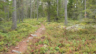
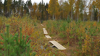
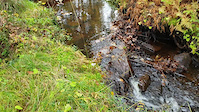
Photos of Piteå Mountain Bike
Videos of Piteå Mountain Bike
trail: Tubens Långa
0:23 |
33 |
Nov 20, 2022
trail: Tubens Långa
0:21 |
26 |
Nov 20, 2022
trail: Tubens Långa
0:21 |
20 |
Nov 20, 2022
Recent Trail Reports
| status | trail | date | condition | info | user |
|---|---|---|---|---|---|
| Berm Baby Berm | Jul 14, 2025 @ 9:20pm Jul 14, 2025 | Very Dry | ahallberg | ||
| Gläntan | Aug 28, 2024 @ 2:26am Aug 28, 2024 | Ideal | Krillnecks | ||
| Artiller Stigen | Aug 28, 2024 @ 2:26am Aug 28, 2024 | Ideal | Krillnecks | ||
| Klubben | Aug 28, 2024 @ 2:26am Aug 28, 2024 | Ideal | Krillnecks | ||
| The Magic Flow | Aug 28, 2024 @ 2:26am Aug 28, 2024 | Ideal | Krillnecks | ||
| Gläntan Flow | Aug 28, 2024 @ 2:26am Aug 28, 2024 | Ideal | Krillnecks | ||
| Sideways Of Tracks | Aug 28, 2024 @ 2:26am Aug 28, 2024 | Ideal | Krillnecks | ||
| Get The Flow | Aug 28, 2024 @ 2:26am Aug 28, 2024 | Ideal | Krillnecks | ||
| Dragon Stigen | Aug 28, 2024 @ 2:26am Aug 28, 2024 | Ideal | Krillnecks | ||
| Greyhound | Aug 28, 2024 @ 2:26am Aug 28, 2024 | Ideal | Krillnecks |
Activity Feed
| username | action | type | title | date |
|---|---|---|---|---|
| JoakimJohstrom | wishlist | route | activity #96063223 | Jun 1, 2026 @ 10:31pm Jun 1, 2026 |
| Krillnecks | add | poi | activity #96044391 | Jun 1, 2026 @ 3:30pm Jun 1, 2026 |
| Krillnecks | add | trail | activity #96043060 and 2 more | Jun 1, 2026 @ 3:05pm Jun 1, 2026 |
| Krillnecks | add | route | activity #95986821 | May 31, 2026 @ 4:35pm May 31, 2026 |
| Krillnecks | add | trail | activity #94844890 and 8 more | May 16, 2026 @ 12:55pm May 16, 2026 |
Recent Comments
| username | type | title | comment | date |
|---|---|---|---|---|
| trail | Verkar mer vara en rutt än en enda stig. Kan... | Apr 26, 2023 @ 1:33am Apr 26, 2023 |
Local Badges
-

Epic Mountain Bike Climb 2k0 awarded -

Climbing 10k Badge3 awarded -

Mountain Biking 100k Badge0 awarded -

Epic Ride Descent 2k0 awarded -

Descent 10k Badge3 awarded -

Descent 100k Badge0 awarded
Bike & Skill Parks
| name | type | city | rating |
|---|---|---|---|
| Hortlax Pumptrack | skill park | Piteå |
Activity Type Stats
| activitytype | trails | distance | descent | descent distance | total vertical | rating | global rank | state rank | photos | reports | routes | ridelogs |
|---|---|---|---|---|---|---|---|---|---|---|---|---|
| Mountain Bike | 715 | 268 miles | 13,533 ft | 91 miles | 663 ft | #301 | #25 | 123 | 20 | 12 | 3,765 | |
| E-Bike | 523 | 135 miles | 5,597 ft | 42 miles | 663 ft | #394 | #29 | 19 | 11 | 170 | ||
| Adaptive Bike | 4 | #132 | #159 | |||||||||
| Horse | 91 | 67 miles | 3,225 ft | 28 miles | 558 ft | #374 | #31 | |||||
| Hike | 713 | 268 miles | 13,497 ft | 91 miles | 663 ft | #322 | #27 | 20 | 133 | |||
| Trail Running | 714 | 268 miles | 13,524 ft | 91 miles | 663 ft | #245 | #25 | 20 | 719 | |||
| Dirtbike/Moto | 42 | 41 miles | 1,768 ft | 18 miles | 545 ft | #199 | #4 | |||||
| Snowmobile | 9 | 4 miles | 325 ft | 2 miles | 190 ft | #106 | #14 | 1 | ||||
| Snowshoe | 64 | 62 miles | 3,294 ft | 27 miles | 561 ft | #80 | #2 | 1 | ||||
| Backcountry Ski | 65 | 65 miles | 3,455 ft | 28 miles | 561 ft | #140 | #11 | 19 | ||||
| Nordic Ski | 78 | 42 miles | 2,526 ft | 13 miles | 322 ft | #296 | #36 | 1 | 270 |
Frequently Asked Questions About Piteå
▼
What are the best places to ride in Piteå?
Piteå has 4 areas to explore for mountain biking. The top rated areas are:
▼
What are the highest rated mountain biking trails in Piteå?
The highest rated mountain biking trails in Piteå are:
- Tubens Långa (4.4/5)
- SCA Gul (4.1/5)
- Guldkusten (4/5)
- Berm Baby Berm (0/5)
- PFM-stigen (0/5)
▼
What is the best time of the year to ride in Piteå?
Based on ride log data, the most popular months to ride in Piteå are:
- July (39 activities)
- August (17 activities)
- June (17 activities)
▼
Where can I park to ride in Piteå?
There are 15 parking locations listed in Piteå. The most popular parking spots are: View all parking and trailhead locations on the map to plan your visit.
Activities
Trails
- By OrjanX
 TRAILFORKS Stgvrkt & contributors
 - Admins: ollesvenskonthetrail, JALLE, martinlindstr, Advena, Krillnecks
- #29701 - 5,601 views
- piteå activity log | embed map of Piteå mountain bike trails | piteå mountain biking points of interest polygons
Downloading of trail gps tracks in kml & gpx formats is enabled for Piteå.
You must login to download files.