
close
3D
Trail Conditions
- Unknown
- Snow Groomed
- Snow Packed
- Snow Covered
- Snow Cover Partial
- Freeze/thaw Cycle
- Icy
- Prevalent Mud
- Wet
- Variable
- Ideal
- Dry
- Very Dry
Trail Flow (Ridden Direction)
Trailforks scans users activity logs to determine the most popular direction each trail is ridden. A good flowing trail network will have most trails flowing in a single direction according to their intension.
The colour categories are based on what percentage of users are riding a trail in its intended direction.
The colour categories are based on what percentage of users are riding a trail in its intended direction.
- > 96%
- > 90%
- > 80%
- > 70%
- > 50%
- < 50%
- bi-directional trail
- no data
Trail Last Used
Trailforks scans activity logs to determine the last time a trail was ridden.
- < 2 days
- < 1 week
- < 2 weeks
- < 1 month
- < 6 months
- > 6 months
Trail Ridden Direction
The intended direction a trail should be ridden.
- Downhill Only
- Downhill Primary
- Both Directions
- Uphill Primary
- Uphill Only
- One Direction
Contribute Details
Colors indicate trail is missing specified detail.
- Description
- Photos
- Description & Photos
- Videos
Trail Popularity ?
Trailforks scans activity logs to determine which trails are ridden the most in the last 9 months.
Trails are compared with nearby trails in the same city region with a possible 25 colour shades.
Think of this as a heatmap, more activities = more kinetic energy = warmer colors.
- most popular
- popular
- less popular
- not popular
ATV/ORV/OHV Filter
Max Vehicle Width
inches
US Cell Coverage
Legend

Radar Time
Activity Recordings
Trailforks uses anonymized public activity data.
?
Activity Recordings
Trailforks uses anonymized public activity data.
?
Winter Trails
Warning
A routing network for winter maps does not exist. Selecting trails using the winter trails layer has been disabled.
Missing Trails
Most Popular
Least Popular
Trails are colored based on popularity. The more popular a trail is, the more red. Less popular trails trend towards green.
Jump Magnitude Heatmap
Heatmap of where users jump on trails. Zoom in to see individual jumps, click circles to view jump details.
BC Backroad Status
![map legend]()
Service Road Atlas is a free to use, community-driven service for viewing and creating reports on the numerous back-country service roads around B.C. and Alberta.

Slope Aspect
Direction the slope faces
Trails Deemphasized
Trails are shown in grey.
Only show trails with no bike usage.
Suggested Layers
Based on selected activity type
Save the current map location and zoom level as your default home location whenever this page is loaded.
SaveFrom the village Rävlanda you will reach plenty of trails in all directions. Most registered trails are north of the village with a large forest area on both sides of the highway. There is also a XC-trail area with a green, blue and red trail and a pump track right behind the school, next to the church. The trails are managed by CK Rävlanda.
Från Rävlanda når man många bra stigar, i alla väderstreck. Flest registrerade stigar finns norr om byn med ett stort skogsområde på båda sidor om R40. Det finns även en anlagd XC-bana med grön, blå och röd bana, samt pup track precis bakom skolan, vid kyrkan. Banorna sköts av CK Rävlanda.
Från Rävlanda når man många bra stigar, i alla väderstreck. Flest registrerade stigar finns norr om byn med ett stort skogsområde på båda sidor om R40. Det finns även en anlagd XC-bana med grön, blå och röd bana, samt pup track precis bakom skolan, vid kyrkan. Banorna sköts av CK Rävlanda.
Primary Trail Type: Cross-Country
 google parking directions plan a road trip here
This region uses the Uk/Euro style trail grading system.
Trail info last updated
Activities Click to view
- Mountain Bike
165 trails
- E-Bike
9 trails
- Hike
143 trails
- Trail Running
143 trails
Region Details
- 31
- 62
- 63
- 8
- 1
Region Status
Open as of Oct 14, 2026Stats
- Avg Trail Rating
- Trails (view details)
- 165
- Trails Mountain Bike
- 165
- Trails E-Bike
- 9
- Trails Gravel Bike
- 47
- Trails Adaptive Bike
- 27
- Trails Winter Fat Bike
- 109
- Trails Hike
- 143
- Trails Trail Running
- 143
- Total Distance
- 48 miles
- Total Descent Distance
- 21 miles
- Total Descent
- 4,574 ft
- Total Vertical
- 441 ft
- Highest Trailhead
- 609 ft
- Reports
- 261
- Photos
- 26
- Completed Counter
- 2,905
Popular Rävlanda Mountain Biking Trails
• 100 ★ 5.0 • 1,890 ft • 50 ft • 66 •
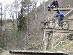
Första delen av CK Rävlandas Röda XC-bana. Dropp och hopp ute vid gräsfältet. Ny dragning 2025 där man undviker asfalten och iställer kör ner mot backen direkt. Börjar med tre olika gap-hop, men möjlighet att rulla förbi,...
• 100 ★ 0.0 • 673 ft • 0 ft • 65 •
Den gröna XC-banans andra del. Passerar springbacken och vänder vid pumptracken mot Phils Flow. The green XC-trails second part. Passing the "running hill" and turns just before the pump track back towards Phils Flow.
• 100 ★ 0.0 • 761 ft • 9 ft • 61 •
Avstickare ut på asfalten för den blåa och röda banan. Vanligtvis är det här langning sker vid tävling.
• 100 ★ 0.0 • 535 ft • 2 ft • 59 •
Efter att man får fart från Magnus Dropp kan man ev. lyckas med att cykla upp för springbacken, sen viker den av ner igen för att klättra upp mot en stenkista/dropp ner igen.
• 100 ★ 0.0 • 951 ft • 5 ft • 59 •
Andra avstickaren som är en del av den blåa XC-banan. Second detour that is part of the blue XC-line.
Rävlanda Mountain Bike Routes
2 miles • 61 ft • 26 • Loop •
CK Rävlandas blåa XC-bana. CK Rävlanda's blue XC-Cource.
Photos of Rävlanda Mountain Bike

Recent Trail Reports
| status | trail | date | condition | info | user |
|---|---|---|---|---|---|
| Ryggraden | Oct 14, 2026 @ 6:04pm (Europe/Copenhagen) Oct 14, 2026 | Ideal | maythefourthbewithu | ||
| Avvikaren | Oct 14, 2026 @ 6:04pm (Europe/Copenhagen) Oct 14, 2026 | Ideal | maythefourthbewithu | ||
| Sanatoriet | Oct 14, 2026 @ 6:04pm (Europe/Copenhagen) Oct 14, 2026 | Ideal | maythefourthbewithu | ||
| Living On The Edge | Oct 14, 2026 @ 6:04pm (Europe/Copenhagen) Oct 14, 2026 | Ideal | maythefourthbewithu | ||
| Mot Rammberget | Oct 14, 2026 @ 6:04pm (Europe/Copenhagen) Oct 14, 2026 | Wet | maythefourthbewithu | ||
| Path To 3 Ways | Oct 14, 2026 @ 6:04pm (Europe/Copenhagen) Oct 14, 2026 | Wet | maythefourthbewithu | ||
| Along R40 | Oct 14, 2026 @ 6:04pm (Europe/Copenhagen) Oct 14, 2026 | Ideal | maythefourthbewithu | ||
| Atlaskotan | Oct 14, 2026 @ 6:04pm (Europe/Copenhagen) Oct 14, 2026 | Ideal | maythefourthbewithu | ||
| Södra Stå | Oct 14, 2026 @ 6:04pm (Europe/Copenhagen) Oct 14, 2026 | Ideal | maythefourthbewithu | ||
| Phils Flow 2 | May 27, 2026 @ 6:10pm (Europe/Copenhagen) May 27, 2026 | Ideal | maythefourthbewithu |
Activity Feed
| username | action | type | title | date |
|---|---|---|---|---|
| maythefourthbewithu | add | report | activity #105884802 and 8 more | Oct 14, 2026 @ 12:24pm Oct 14, 2026 |
| mikaeljansson | vote | trail | activity #103273200 | Sep 7, 2026 @ 10:18am Sep 7, 2026 |
| TusiaT | wishlist | trail | activity #96825982 | Jun 12, 2026 @ 1:46pm Jun 12, 2026 |
| maythefourthbewithu | add | report | activity #95650080 and 4 more | May 27, 2026 @ 11:39am May 27, 2026 |
| maythefourthbewithu | add | report | activity #93669990 and 8 more | Apr 29, 2026 @ 1:46pm Apr 29, 2026 |
Recent Comments
| username | type | title | comment | date |
|---|---|---|---|---|
| trail | Första delen är numera en grusväg | Nov 27, 2023 @ 2:02am Nov 27, 2023 |
Nearby Areas
| name | distance | ||||
|---|---|---|---|---|---|
| Bollekollen | 2 | 2 | 2.2 km | ||
| Bollebygd | 77 | 118 | 3.2 km | ||
| Hindås | 72 | 66 | 3.4 km | ||
| Hyssna | 8 | 14 | 7.7 km | ||
| Härryda | 26 | 18 | 7.8 km |
Local Badges
-

Completionist0 awarded

Activity Type Stats
| activitytype | trails | distance | descent | descent distance | total vertical | rating | global rank | state rank | photos | reports | routes | activity logs |
|---|---|---|---|---|---|---|---|---|---|---|---|---|
| Mountain Bike | 165 | 48 miles | 4,573 ft | 21 miles | 440 ft | #1,007 | #31 | 26 | 261 | 1 | 2,350 | |
| E-Bike | 9 | 1 mile | 92 ft | 1,890 ft | 144 ft | #5,920 | #377 | 246 | 2 | |||
| Gravel Bike | 47 | 19 miles | 1,191 ft | 7 miles | 440 ft | #6,950 | #280 | 5 | ||||
| Adaptive Bike | 27 | 14 miles | 968 ft | 6 miles | 400 ft | #6,964 | #282 | 37 | ||||
| Winter Fat Bike | 109 | 33 miles | 3,114 ft | 15 miles | 436 ft | #6,950 | #280 | 151 | ||||
| Hike | 143 | 44 miles | 4,272 ft | 19 miles | 440 ft | #3,583 | #112 | 257 | 22 | |||
| Trail Running | 143 | 44 miles | 4,272 ft | 19 miles | 440 ft | #2,759 | #116 | 257 | 181 |
Frequently Asked Questions
▼
What are the highest rated mountain biking trails in Rävlanda?
The highest rated mountain biking trails in Rävlanda are:
- Kobacken (4.2/5)
- Milspåret - Klippan (4.1/5)
- Hällingsjö Goes To Skansen (4/5)
- Följer Åsen (4/5)
- Höpp 2 (4/5)
▼
Where can I park to ride in Rävlanda?
There are 4 parking locations listed in Rävlanda. The most popular parking spots are:
- Parkering Rävlandaskolan 1
- Orintostugan/Badplatsen Rammsjön
- Parkering - Rävlandaskolan 2
- Parkering - Föreningsgården
▼
What is the longest trail in Rävlanda?
The longest trail in Rävlanda is Milspåret - Klippan at 1.1 miles. View all trails sorted by distance.
▼
What are the best & highest rated hiking trails in Rävlanda?
The best hiking trails in Rävlanda are: View all hiking trails sorted by popularity score.
▼
What are the best & highest rated trail running trails in Rävlanda?
The best trail running trails in Rävlanda are: View all trail running trails sorted by popularity score.
▼
How many trails are in Rävlanda?
Rävlanda has a total of 165 trails. Browse top mountain biking trails in Rävlanda to find detailed information including difficulty ratings, distances, and trail conditions.
▼
Which trail has the most elevation gain in Rävlanda?
The trail with the most elevation gain in Rävlanda is Milspåret - Klippan with 170 ft of elevation gain. View all trails sorted by elevation gain.
▼
Which trail has the most elevation descent in Rävlanda?
The trail with the most elevation descent in Rävlanda is Barkkulla with 165 ft of elevation descent. View all trails sorted by elevation descent.
▼
What activities are most popular in Rävlanda?
Rävlanda supports the following activities: Mountain Biking, E-Biking, Hiking, Trail Running.
▼
What are the steepest mountain biking trails in Rävlanda?
The steepest mountain biking trail in Rävlanda is Vattentornssvängen with an average grade of 9.7%. View all trails sorted by grade.
▼
Are there any trails with scenic viewpoints in Rävlanda?
Yes, there are 1 scenic viewpoints marked along trails in Rävlanda. Some popular viewpoints include: Explore more points of interest to find trails with the best views.
▼
Are the trails open in Rävlanda?
The overall region status for Rävlanda is Clear / Green. Out of 109 trails:
- Clear / Green: 98
- Minor Issue / Yellow: 7
- Significant Issue / Amber: 4
▼
Can I ride an ebike in Rävlanda?
Yes, Rävlanda supports e-bike riding. However, individual trail e-bike permissions vary. Check the e-bike trails listing for specific trail access details and any local regulations.
▼
What are the most popular mountain biking routes in Rävlanda?
The most popular mountain biking routes in Rävlanda are: View all mountain biking routes in Rävlanda.
▼
What are the most popular Strava Segments in Rävlanda?
The most popular Strava segments in Rävlanda are:
- Hornsmossen från Hindås (185 athletes)
- Hornsmossen (179 athletes)
- Milspåret Fun Downill (126 athletes)
▼
What are some popular technical trail features in Rävlanda?
There are 12 technical trail features (TTFs) in Rävlanda. Some popular features include:
- Gaphopp Kobacken (Gap Jump)
- Laxtrappan (Other)
- Orintobranten (Rock Face)
- Stenkistan (Rock Garden)
- På-Vippen (Teeter Totter)
▼
What are the most popular mountain biking trails in Rävlanda?
The most popular mountain biking trails in Rävlanda are: View all mountain biking trails sorted by popularity.
▼
What are the best beginner ride trails in Rävlanda?
The best beginner mountain biking trails in Rävlanda are:
- Hällingsjö Goes To Skansen (4/5)
- Höpp 2 (4/5)
- XC Grön 2 (0/5)
Activities
Trails
- By Rdeyoswed
 & contributors
- Admins: nivis, Marleey, wikisara, JBohden, GSC, marcla99, maythefourthbewithu, Vallev
- #36834 - 3,551 views
- rävlanda activity log | embed map of Rävlanda mountain bike trails | rävlanda mountain biking points of interest
Downloading of trail gps tracks in kml & gpx formats is enabled for Rävlanda.
You must login to download files.
