close
-
Layers w
- Weather Layers
- Pro
- Pro
- Pro
- Pro
- Pro
- Pro
- More Layers
- Pro
- Pro
- Pro
- Pro
-
Upgrade to

3D
Trail Conditions
- Unknown
- Snow Groomed
- Snow Packed
- Snow Covered
- Snow Cover Partial
- Freeze/thaw Cycle
- Icy
- Prevalent Mud
- Wet
- Variable
- Ideal
- Dry
- Very Dry
Trail Flow (Ridden Direction)
Trailforks scans users ridelogs to determine the most popular direction each trail is ridden. A good flowing trail network will have most trails flowing in a single direction according to their intension.
The colour categories are based on what percentage of riders are riding a trail in its intended direction.
The colour categories are based on what percentage of riders are riding a trail in its intended direction.
- > 96%
- > 90%
- > 80%
- > 70%
- > 50%
- < 50%
- bi-directional trail
- no data
Trail Last Ridden
Trailforks scans ridelogs to determine the last time a trail was ridden.
- < 2 days
- < 1 week
- < 2 weeks
- < 1 month
- < 6 months
- > 6 months
Trail Ridden Direction
The intended direction a trail should be ridden.
- Downhill Only
- Downhill Primary
- Both Directions
- Uphill Primary
- Uphill Only
- One Direction
Contribute Details
Colors indicate trail is missing specified detail.
- Description
- Photos
- Description & Photos
- Videos
Trail Popularity ?
Trailforks scans ridelogs to determine which trails are ridden the most in the last 9 months.
Trails are compared with nearby trails in the same city region with a possible 25 colour shades.
Think of this as a heatmap, more rides = more kinetic energy = warmer colors.
- most popular
- popular
- less popular
- not popular
ATV/ORV/OHV Filter
Max Vehicle Width
inches
US Cell Coverage
Legend

Radar Time
Activity Recordings
Trailforks uses anonymized public activity data.
?
Activity Recordings
Trailforks uses anonymized public activity data.
?
Personal Heatmap
▶
Activity Types
all
/
none
▶
Options
2
Date range
month
–
Winter Trails
Warning
A routing network for winter maps does not exist. Selecting trails using the winter trails layer has been disabled.
Missing Trails
Most Popular
Least Popular
Trails are colored based on popularity. The more popular a trail is, the more red. Less popular trails trend towards green.
Jump Magnitude Heatmap
Heatmap of where riders jump on trails. Zoom in to see individual jumps, click circles to view jump details.
BC Backroad Status
![map legend]()
Service Road Atlas is a free to use, community-driven service for viewing and creating reports on the numerous back-country service roads around B.C. and Alberta.

Slope Aspect
Direction the slope faces
Trails Deemphasized
Trails are shown in grey.
Only show trails with no bike usage.
Suggested Layers
Based on selected activity type
Save the current map location and zoom level as your default home location whenever this page is loaded.
Save
No description for Rocallaura has been added yet!
Login or register to submit one.
This region uses the Uk/Euro style trail grading system.
Activities Click to view
- Mountain Bike
20 trails
- E-Bike
20 trails
- Adaptive Bike
0 trails
- Hike
10 trails
- Trail Running
10 trails
Region Details
- 8
- 3
- 2
- 7
Region Status
Open as of Jun 7, 2026Stats
- Avg Trail Rating
- Trails (view details)
- 20
- Trails Mountain Bike
- 20
- Trails E-Bike
- 20
- Trails Hike
- 10
- Trails Trail Running
- 10
- Total Distance
- 11 miles
- Total Descent Distance
- 5 miles
- Total Descent
- 3,545 ft
- Total Vertical
- 451 ft
- Highest Trailhead
- 2,325 ft
- Reports
- 433
- Photos
- 67
- Ridden Counter
- 4,145
Sub Regions
-
Rocallaura Bikepark
- 3
- 2
- 7
Popular Rocallaura Mountain Biking Trails
• 80 ★ 4.9 • 2,749 ft • 0 ft • 178 •
Sender ample, rapidíssim, amb nombrosos passos tècnics: esglaons, salts i drops de diferents tipus i algun peralt. Vigileu de no entrar als salts amb massa velocitat. Si es fan tots els salts la categoria puja a vermell.
• 60 ★ 4.7 • 2,999 ft • 0 ft • 169 •
Baixada que porta el nom de la prestigiosa marca d'amortiguadors EXT-Shox Racing. Feta amb col.laboració de WildCoast Bikes i amb participació del trailbuilder internacional Willard Bruce. En general és facileta amb flow i peraltes...
• 65 ★ 5.0 • 1,906 ft • 0 ft • 166 •
Sender paral.lel a Búnker, dins bosc d'obaga. Bon brip tot l'any. Combina nombrosos passos tècnics naturals, salts, drops, trams amb molt de flow i un final de pura adrenalina.
• 45 ★ 4.8 • 2,096 ft • 3 ft • 162 •
D'inici pla i enganyós, doncs és el màxim exponent de la dificultat a la Vall. Sender creat a partir de zero, incloent tots els passos complicats que et pots trobar. Punts estrets, corbes tancades en ple descens, salts, lloses molles...
• 55 ★ 5.0 • 3,045 ft • 0 ft • 156 •
El sender més antic del Bikepark junt amb Bunker. Sender amb el desnivell absolut més important de tota la vall del Maldanell. Pensat per poder pujar també amb bicicleta. Sense dificultats tècniques abanda d'algunes rampes de fort...
• 75 ★ 4.8 • 2,421 ft • 0 ft • 152 •
Té de tot: peralts, salts de diferents altures, un salt en corva, drops, esglaons de roques, rampots, i algun tram més obert amb flow. Costa trobar el terreny en perfecte estat ja que te tendencia a estar molt sec i polsós. Te 3...
• 95 ★ 3.9 • 4,170 ft • 331 ft • 144 •
Sender de nova creació per a pujar a , preferiblement fer-lo de pujada com a drecera. PRECAUCIÓ!! 3 encreuaments amb i . Pas preferent pels ciclistes que baixin i
• 50 ★ 4.2 • 2,835 ft • 2 ft • 126 •
El trail més exigent de Rocallaura Bikepark, que obliga a aplicar-se en tot el seu recorregut. Mateix inici que i igual que aquesta, té 3 encreuaments amb (PRECAUCIÓ). Hi trobarem un tram inicial de flow, seguint amb un tram força...
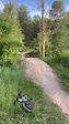
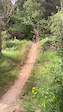
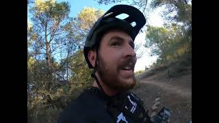
Photos of Rocallaura Mountain Bike
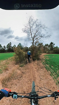
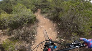
Videos of Rocallaura Mountain Bike
trail: Bunker
0:04 |
5 |
Jun 7, 2026
trail: Bunker
0:10 |
6 |
Jun 7, 2026
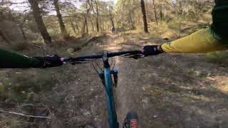
trail: Solana
2:17 |
60 |
Apr 2, 2022
trail: Enduline
2:22 |
227 |
Jan 22, 2024 , Rocallaura
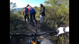
trail: Solana
3:15 |
228 |
Aug 4, 2023 , Rocallaura
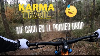
trail: Karma
2:07 |
281 |
Aug 3, 2023 , Rocallaura
trail: Enduline
7:15 |
145 |
Aug 3, 2023 , Rocallaura
trail: Karma
2:51 |
783 |
Apr 9, 2023 , Rocallaura
Recent Trail Reports
| status | trail | date | condition | info | user |
|---|---|---|---|---|---|
| Bunker | Jun 7, 2026 @ 12:52pm (Europe/Madrid) Jun 7, 2026 | Ideal | elcuquito | ||
| Sortida Senders Obaga | Jun 7, 2026 @ 12:52pm (Europe/Madrid) Jun 7, 2026 | Dry | elcuquito | ||
| Jack | May 29, 2026 @ 5:01pm (Europe/Madrid) May 29, 2026 | Dry | PLFamiliesOG91 | ||
| Anarchy | May 26, 2026 @ 9:34am (Europe/Madrid) May 26, 2026 | Dry | PLFamiliesOG91 | ||
| Màgic Llaura | May 25, 2026 @ 5:24pm (Europe/Madrid) May 25, 2026 | Dry | snaker4 TFSPAIN | ||
| 261010 | May 25, 2026 @ 5:23pm (Europe/Madrid) May 25, 2026 | Dry | snaker4 TFSPAIN | ||
| Orgàsmic | May 25, 2026 @ 5:23pm (Europe/Madrid) May 25, 2026 | Dry | snaker4 TFSPAIN | ||
| EXT Line | May 25, 2026 @ 5:23pm (Europe/Madrid) May 25, 2026 | Dry | snaker4 TFSPAIN | ||
| Enllaç Rocagrossa amb Búnker i Senders Obaga | May 25, 2026 @ 5:22pm (Europe/Madrid) May 25, 2026 | Unknown | snaker4 TFSPAIN | ||
| Accés a Rocagrossa | May 25, 2026 @ 5:22pm (Europe/Madrid) May 25, 2026 | Dry | snaker4 TFSPAIN |
Activity Feed
| username | action | type | title | date |
|---|---|---|---|---|
| GMNKF0K | wishlist | trail | activity #98561181 | Jul 6, 2026 @ 2:00am Jul 6, 2026 |
| elcuquito | add | photo | activity #97028890 | Jun 15, 2026 @ 2:15am Jun 15, 2026 |
| gonzalez64 | wishlist | trail | activity #96938248 and 1 more | Jun 13, 2026 @ 9:28pm Jun 13, 2026 |
| GMNKF0K | wishlist | trail | activity #96526095 | Jun 8, 2026 @ 1:21am Jun 8, 2026 |
| elcuquito | add | report | activity #96443703 and 2 more | Jun 7, 2026 @ 3:51am Jun 7, 2026 |
Recent Comments
| username | type | title | comment | date |
|---|---|---|---|---|
| trail | Brutal | Sep 11, 2025 @ 6:16am Sep 11, 2025 | ||
| trail | Jo crec que hi ha massa salts i coses en molt... | Apr 27, 2025 @ 8:34am Apr 27, 2025 | ||
| trail | Amb la part del esglaó on tocaven els baixos... | Dec 27, 2024 @ 9:10am Dec 27, 2024 | ||
| trail | Salt final ja no hi ha Gap, és una meseta. | Nov 10, 2024 @ 7:38am Nov 10, 2024 | ||
| trail | Cuidado quan veieu el senyal de caigudes a... | Jun 8, 2024 @ 12:05pm Jun 8, 2024 |
Local Badges
-

Epic Mountain Bike Climb 2k0 awarded -

Climbing 10k Badge0 awarded -

Mountain Biking 100k Badge0 awarded -

Epic Ride Descent 2k0 awarded -

Descent 10k Badge0 awarded -

Descent 100k Badge0 awarded
Local Trail Supporters
![]()
- Antic Balneari de Rocallaura
![]()
Activity Type Stats
| activitytype | trails | distance | descent | descent distance | total vertical | rating | global rank | state rank | photos | reports | routes | ridelogs |
|---|---|---|---|---|---|---|---|---|---|---|---|---|
| Mountain Bike | 20 | 11 miles | 3,547 ft | 5 miles | 453 ft | #5,042 | #301 | 40 | 433 | 106 | ||
| E-Bike | 20 | 11 miles | 3,547 ft | 5 miles | 453 ft | #540 | #157 | 27 | 433 | 50 | ||
| Hike | 10 | 7 miles | 577 ft | 2 miles | 453 ft | #10,616 | #491 | 318 | 16 | |||
| Trail Running | 10 | 7 miles | 577 ft | 2 miles | 453 ft | #10,099 | #490 | 317 |
Frequently Asked Questions About Rocallaura
▼
What are the best places to ride in Rocallaura?
Rocallaura has 1 areas to explore for mountain biking. The top rated areas are:
▼
What are the highest rated mountain biking trails in Rocallaura?
▼
Where can I park to ride in Rocallaura?
There are 2 parking locations listed in Rocallaura. The most popular parking spots are:
▼
What is the longest trail in Rocallaura?
The longest trail in Rocallaura is Remuntada at 1.3 km. View all trails sorted by distance.
Activities
Trails
Points of Interest
- By bandidos
 & contributors
 - Admins: snaker4, kai-bcn, EdgarSoler
- #56110 - 1,596 views
- rocallaura activity log | embed map of Rocallaura mountain bike trails | rocallaura mountain biking points of interest
Downloading of trail gps tracks in kml & gpx formats is enabled for Rocallaura.
You must login to download files.