close
-
Layers w
- Map Content
- More Layers
- Pro
- Pro
- Pro
- Pro
- Pro
- Pro
- Pro
- Pro
-
Upgrade to

3D
Trail Conditions
- Unknown
- Snow Groomed
- Snow Packed
- Snow Covered
- Snow Cover Partial
- Freeze/thaw Cycle
- Icy
- Prevalent Mud
- Wet
- Variable
- Ideal
- Dry
- Very Dry
Trail Flow (Ridden Direction)
Trailforks scans users ridelogs to determine the most popular direction each trail is ridden. A good flowing trail network will have most trails flowing in a single direction according to their intension.
The colour categories are based on what percentage of riders are riding a trail in its intended direction.
The colour categories are based on what percentage of riders are riding a trail in its intended direction.
- > 96%
- > 90%
- > 80%
- > 70%
- > 50%
- < 50%
- bi-directional trail
- no data
Trail Last Ridden
Trailforks scans ridelogs to determine the last time a trail was ridden.
- < 2 days
- < 1 week
- < 2 weeks
- < 1 month
- < 6 months
- > 6 months
Trail Ridden Direction
The intended direction a trail should be ridden.
- Downhill Only
- Downhill Primary
- Both Directions
- Uphill Primary
- Uphill Only
- One Direction
Contribute Details
Colors indicate trail is missing specified detail.
- Description
- Photos
- Description & Photos
- Videos
Trail Popularity ?
Trailforks scans ridelogs to determine which trails are ridden the most in the last 9 months.
Trails are compared with nearby trails in the same city region with a possible 25 colour shades.
Think of this as a heatmap, more rides = more kinetic energy = warmer colors.
- most popular
- popular
- less popular
- not popular
ATV/ORV/OHV Filter
Max Vehicle Width
inches
US Cell Coverage
Legend

Radar Time
x
Activity Recordings
Trailforks users anonymized public ridelogs from the past 6 months.
- mountain biking recent
- mountain biking (>6 month)
- hiking (1 year)
- moto (1 year)
Activity Recordings
Trailforks users anonymized public skilogs from the past 12 months.
- Downhill Ski
- Backcountry Ski
- Nordic Ski
- Snowmobile
Winter Trails
Warning
A routing network for winter maps does not exist. Selecting trails using the winter trails layer has been disabled.
x
Missing Trails
Most Popular
Least Popular
Trails are colored based on popularity. The more popular a trail is, the more red. Less popular trails trend towards green.
Jump Magnitude Heatmap
Heatmap of where riders jump on trails. Zoom in to see individual jumps, click circles to view jump details.
Trails Deemphasized
Trails are shown in grey.
Only show trails with NO bikes.
Save the current map location and zoom level as your default home location whenever this page is loaded.
SaveThe Rockhouse Hill Sanctuary (RHS) is 600, town-owned acres of preserved, forested watershed of Four Mile Brook and the Housatonic River. The Town and the Oxford Land Trust share land-management responsibilities. Over the last 10 years, 15 miles of trails have been developed and upgraded by the Oxford High School Youth Conservation Corps (OHS YCC), through Boy Scout Eagle projects, and by members of the Land Trust. Tens of thousands of volunteer hours have been invested and additional work has been ongoing.
Funds for trail development have been provided by the Town of Oxford, the State of Connecticut, the Valley Community Foundation, the Oxford Denzler Foundation and through private donations. Materials and work have been donated by Earthworks and the Town of Oxford.
Housatonic Valley NEMBA is currently working with the Oxford Conservation Commission and the Oxford Youth Conservation Corps to make the trails more sustainable, build more purpose built single track, and make the existing trails more mountain bike friendly.
source: Rockhouse Hill
Primary Trail Type: Cross-Country
AKA: Rockhouse Hill Sanctuary
Land Status: City Managed
Land Manager: Town of Oxford
 google parking directions
 Activities Click to view
- Mountain Bike
21 trails
- Hike
21 trails
- Trail Running
20 trails
Region Details
- 1
- 12
- 5
- 3
Region Status
Open as of Apr 28, 2024Stats
- Avg Trail Rating
- Trails (view details)
- 21
- Trails Mountain Bike
- 21
- Trails Hike
- 21
- Trails Trail Running
- 20
- Total Distance
- 7 miles
- Total Descent Distance
- 3 miles
- Total Descent
- 674 ft
- Total Vertical
- 225 ft
- Highest Trailhead
- 516 ft
- Reports
- 232
- Photos
- 136
- Ridden Counter
- 9,260
Popular Rockhouse Hill Sanctuary Mountain Biking Trails
Rockhouse Hill Sanctuary Mountain Bike Routes
| title | rating | distance |
|---|---|---|
| Exercise Route | 5 miles |
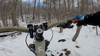
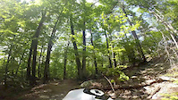
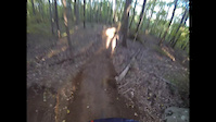
Photos of Rockhouse Hill Sanctuary Mountain Bike
trail: Hell's Way
12 |
Aug 27, 2023 @ 7:13am
Aug 27, 2023
trail: Hell's Way
15 |
Aug 27, 2023 @ 7:12am
Aug 27, 2023
trail: Red Line
55 |
Jun 14, 2023 @ 2:15am
Jun 14, 2023
trail: Lallement
45 |
Jun 14, 2023 @ 2:09am
Jun 14, 2023
trail: Lallement
41 |
Nov 13, 2022 @ 6:25am
Nov 13, 2022
trail: Wolverine
44 |
Oct 15, 2022 @ 7:07am
Oct 15, 2022
trail: Wolverine
32 |
Oct 15, 2022 @ 7:07am
Oct 15, 2022
trail: Wolverine
34 |
Apr 3, 2022 @ 4:06pm
Apr 3, 2022Videos of Rockhouse Hill Sanctuary Mountain Bike
trail: On the Rocks (Lower)
36 |
Dec 27, 2022

trail: Rolling Coal
3:01 |
213 |
Aug 9, 2015

trail: Rolling Coal
0:42 |
546 |
Oct 22, 2014
trail: Hell's Way
2:08 |
200 |
Aug 24, 2014
trail: Rolling Coal
0:44 |
258 |
Sep 23, 2013
trail: Rolling Coal
0:07 |
91 |
May 6, 2013

trail: Hell's Way
3:17 |
4129 |
Jun 5, 2012

trail: On the Rocks (Upper)
0:54 |
279 |
Oct 11, 2011
Recent Trail Reports
| status | trail | date | condition | info | user |
|---|---|---|---|---|---|
| Peach Cobbler | Apr 7, 2024 @ 7:01am Apr 7, 2024 | Ideal | taphephobia | ||
| Alley Way | Apr 7, 2024 @ 7:01am Apr 7, 2024 | Prevalent Mud | taphephobia | ||
| Lallement | Oct 15, 2023 @ 11:02am Oct 15, 2023 | Ideal | Doski | ||
| Rollerville | Aug 21, 2023 @ 4:36am Aug 21, 2023 | Ideal | Jpesci17 | ||
| Wolverine | Aug 21, 2023 @ 4:34am Aug 21, 2023 | Variable | Jpesci17 | ||
| On the Rocks (Upper) | Aug 5, 2023 @ 8:26am Aug 5, 2023 | Ideal | jnaidorf | ||
| Adeline Grey | Mar 19, 2023 @ 6:51am Mar 19, 2023 | Ideal | jnaidorf | ||
| Lemon Squeezer | Feb 10, 2023 @ 12:43pm Feb 10, 2023 | Ideal | Prayoub1 | ||
| On the Rocks (Lower) | Jan 2, 2023 @ 4:19am Jan 2, 2023 | Ideal | Prayoub1 | ||
| Mellow Yellow | Jan 2, 2023 @ 12:19pm Jan 2, 2023 | Ideal | Prayoub1 |
Activity Feed
| username | action | type | title | date |
|---|---|---|---|---|
| dhughes023 | wishlist | route | activity #52489706 | May 12, 2024 @ 11:31am May 12, 2024 |
| Detulio3 | wishlist | region | activity #52372598 | May 10, 2024 @ 9:34am May 10, 2024 |
| Grego818 | wishlist | trail | activity #52238593 | May 7, 2024 @ 4:15pm May 7, 2024 |
| Xj3K771y | wishlist | region | activity #52082446 | May 4, 2024 @ 8:33am May 4, 2024 |
| Detulio3 | wishlist | region | activity #51790397 | Apr 28, 2024 @ 4:34am Apr 28, 2024 |
Recent Comments
| username | type | title | comment | date |
|---|---|---|---|---|
| trail | Big tree down from heavy equipment work being... | Sep 6, 2022 @ 3:27pm Sep 6, 2022 | ||
| trail | Best rode in reverse | May 29, 2022 @ 5:12pm May 29, 2022 | ||
| trail | Also has a 1 1/2 foot drop heading straight at... | Nov 2, 2021 @ 2:45pm Nov 2, 2021 | ||
| trail | Jump line is on Adeline Grey trail. | Oct 26, 2021 @ 6:46am Oct 26, 2021 | ||
| trail | Cool trail with a few features that make it... | Oct 20, 2021 @ 11:15am Oct 20, 2021 |
Nearby Areas
| name | distance | ||||
|---|---|---|---|---|---|
| Naugatuck State Forest - Great Hill Block | 0.4 km | ||||
| Little Laurel Lime Ridge Park | 2 | 1.9 km | |||
| Naugatuck State Forest / Quillinan Reservoir | 5 | 6 | 1 | 4 km | |
| Paugussett State Forest - Zoar Lake Area | 6 | 4.3 km | |||
| Oxford Reservoir | 2 | 3 | 2 | 4.6 km |
Local Badges
-

Completionist14 awarded
Activity Type Stats
| activitytype | trails | distance | descent | descent distance | total vertical | rating | global rank | state rank | photos | reports | routes | ridelogs |
|---|---|---|---|---|---|---|---|---|---|---|---|---|
| Mountain Bike | 21 | 7 miles | 673 ft | 3 miles | 226 ft | #838 | #437 | 136 | 232 | 1 | 6,398 | |
| Hike | 21 | 7 miles | 673 ft | 3 miles | 226 ft | #593 | #371 | 231 | 176 | |||
| Trail Running | 20 | 7 miles | 659 ft | 3 miles | 226 ft | #605 | #375 | 231 | 31 |
- By MattTullo
 HV NEMBA & contributors
 - Admins: HV NEMBA, HV NEMBA, HV NEMBA
- #28533 - 15,726 views
- rockhouse hill sanctuary activity log | embed map of Rockhouse Hill Sanctuary mountain bike trails | rockhouse hill sanctuary mountain biking points of interest
Downloading of trail gps tracks in kml & gpx formats is enabled for Rockhouse Hill Sanctuary.
You must login to download files.