
close
-
Layers w
- Weather Layers
- Pro
- Pro
- Pro
- Pro
- Pro
- Pro
- More Layers
- Pro
- Pro
- Pro
- Pro
-
Upgrade to

3D
Trail Conditions
- Unknown
- Snow Groomed
- Snow Packed
- Snow Covered
- Snow Cover Partial
- Freeze/thaw Cycle
- Icy
- Prevalent Mud
- Wet
- Variable
- Ideal
- Dry
- Very Dry
Trail Flow (Ridden Direction)
Trailforks scans users activity logs to determine the most popular direction each trail is ridden. A good flowing trail network will have most trails flowing in a single direction according to their intension.
The colour categories are based on what percentage of users are riding a trail in its intended direction.
The colour categories are based on what percentage of users are riding a trail in its intended direction.
- > 96%
- > 90%
- > 80%
- > 70%
- > 50%
- < 50%
- bi-directional trail
- no data
Trail Last Used
Trailforks scans activity logs to determine the last time a trail was ridden.
- < 2 days
- < 1 week
- < 2 weeks
- < 1 month
- < 6 months
- > 6 months
Trail Ridden Direction
The intended direction a trail should be ridden.
- Downhill Only
- Downhill Primary
- Both Directions
- Uphill Primary
- Uphill Only
- One Direction
Contribute Details
Colors indicate trail is missing specified detail.
- Description
- Photos
- Description & Photos
- Videos
Trail Popularity ?
Trailforks scans activity logs to determine which trails are ridden the most in the last 9 months.
Trails are compared with nearby trails in the same city region with a possible 25 colour shades.
Think of this as a heatmap, more activities = more kinetic energy = warmer colors.
- most popular
- popular
- less popular
- not popular
ATV/ORV/OHV Filter
Max Vehicle Width
inches
US Cell Coverage
Legend

Radar Time
Activity Recordings
Trailforks uses anonymized public activity data.
?
Activity Recordings
Trailforks uses anonymized public activity data.
?
Winter Trails
Warning
A routing network for winter maps does not exist. Selecting trails using the winter trails layer has been disabled.
Missing Trails
Most Popular
Least Popular
Trails are colored based on popularity. The more popular a trail is, the more red. Less popular trails trend towards green.
Jump Magnitude Heatmap
Heatmap of where users jump on trails. Zoom in to see individual jumps, click circles to view jump details.
BC Backroad Status
![map legend]()
Service Road Atlas is a free to use, community-driven service for viewing and creating reports on the numerous back-country service roads around B.C. and Alberta.

Slope Aspect
Direction the slope faces
Trails Deemphasized
Trails are shown in grey.
Only show trails with no bike usage.
Suggested Layers
Based on selected activity type
Save the current map location and zoom level as your default home location whenever this page is loaded.
SaveOverview
Royalview is a popular mountain biking and hiking area within Mill Stream Run Reservation, part of the Cleveland Metroparks system in Strongsville, Ohio. The Royalview area occupies a wooded section of the East Branch Rocky River valley and combines mature hardwood forest, younger woodland, ravines, small streams, and scenic river views. The area is best known for its natural-surface singletrack, but also supports hiking, trail running, picnicking, and other outdoor recreation. The land is managed by Cleveland Metroparks, with the Royalview trail system developed and maintained in cooperation with the Cleveland Area Mountain Bike Association (CAMBA) and other trail volunteers. Mill Stream Run Reservation encompasses more than 3,500 acres across several southwestern Cleveland suburbs and provides a much larger network of recreational facilities and trails beyond Royalview itself.
Trails
Royalview features approximately 7.1 miles of primary singletrack divided between the Red and Yellow Loops, plus an approximately 1.1-mile advanced out-and-back spur. The trails are predominantly fast, flowing singletrack through forest, with relatively modest elevation change but frequent short climbs and descents, ravines, stream crossings, roots, bridges, and occasional more technical features. The Yellow Loop generally provides the gentler experience, passing through younger forest and along creek corridors, while the Red Loop incorporates steeper slopes and ravines with more dramatic views of the river and a quieter pine-forest setting. The two main loops are directional for mountain bikers, with the riding direction alternating between clockwise and counter-clockwise on different days; the posted direction should always be followed. The trails are shared-use facilities, so hikers also use the singletrack and should follow the posted hiking direction.
Royalview is a popular mountain biking and hiking area within Mill Stream Run Reservation, part of the Cleveland Metroparks system in Strongsville, Ohio. The Royalview area occupies a wooded section of the East Branch Rocky River valley and combines mature hardwood forest, younger woodland, ravines, small streams, and scenic river views. The area is best known for its natural-surface singletrack, but also supports hiking, trail running, picnicking, and other outdoor recreation. The land is managed by Cleveland Metroparks, with the Royalview trail system developed and maintained in cooperation with the Cleveland Area Mountain Bike Association (CAMBA) and other trail volunteers. Mill Stream Run Reservation encompasses more than 3,500 acres across several southwestern Cleveland suburbs and provides a much larger network of recreational facilities and trails beyond Royalview itself.
Trails
Royalview features approximately 7.1 miles of primary singletrack divided between the Red and Yellow Loops, plus an approximately 1.1-mile advanced out-and-back spur. The trails are predominantly fast, flowing singletrack through forest, with relatively modest elevation change but frequent short climbs and descents, ravines, stream crossings, roots, bridges, and occasional more technical features. The Yellow Loop generally provides the gentler experience, passing through younger forest and along creek corridors, while the Red Loop incorporates steeper slopes and ravines with more dramatic views of the river and a quieter pine-forest setting. The two main loops are directional for mountain bikers, with the riding direction alternating between clockwise and counter-clockwise on different days; the posted direction should always be followed. The trails are shared-use facilities, so hikers also use the singletrack and should follow the posted hiking direction.
Primary Trail Type: Cross-Country
eBikes Allowed:
Yes
AKA: Royalview
 google parking directions
 Access Info:
The principal access is from Royalview Lane, off Valley Parkway just south of Royalton Road (Route 82). The Royalview Trailhead provides access to the Red Loop, while the Yellow Loop has its own nearby trailhead; parking is available in both the lower and upper Royalview areas. The larger upper parking area is adjacent to the Royalview Picnic Area and reserved shelter, which provides picnic tables, grills, electricity, drinking water, restrooms, a play area, and parking. The shelter is available for reservation from May through October. The nearby Pawpaw Picnic Area provides another access point into the Royalview area and connects with the broader Mill Stream Run trail network.
Disclaimer:
Royalview is a public Cleveland Metroparks facility and no permit is required for ordinary hiking or mountain biking. Mountain biking, including Class 1 and Class 2 e-bikes, is permitted on designated natural-surface mountain bike trails when they are open, generally between 6:00 a.m. and 9:00 p.m. Riders must follow the posted daily direction of travel on the Red and Yellow Loops, remain on designated trails, yield appropriately, and control their speed around other users. Cleveland Metroparks closes natural-surface mountain bike trails when conditions are unsuitable, and riders should not use wet or closed trails because of the potential for rutting and trail damage. Bicycles are not permitted on hiking or bridle trails unless those trails are specifically designated as part of the mountain bike system. Dogs must be leashed in accordance with Cleveland Metroparks regulations. Visitors should check the Metroparks trail-status page before riding, particularly after rain or during seasonal maintenance. As of late July 2026, both the Royalview Red and Yellow Loops were listed as open.
Links
Trail info last updated
Activities Click to view
- Mountain Bike
2 trails
- E-Bike
0 trails
- Hike
4 trails
- Trail Running
4 trails
Region Details
- 2
Region Status
Caution as of Sep 5, 2026
Stats
- Avg Trail Rating
- Trails (view details)
- 4
- Trails Mountain Bike
- 2
- Trails Hike
- 4
- Trails Trail Running
- 4
- Total Distance
- 9 miles
- Total Descent Distance
- 3 miles
- Total Descent
- 688 ft
- Total Vertical
- 168 ft
- Highest Trailhead
- 990 ft
- Reports
- 91
- Photos
- 19
- Completed Counter
- 534
Popular Royalview Mountain Biking Trails
• 50 ★ 4.6 • 4 miles • 344 ft • 247 •
Nice forested path that winds through the trees. The gradients are easy and there are no obstacles, just fun singletrack trail through the woods. [note the trail is frequently closed in wet conditions; check...
• 75 ★ 4.9 • 4 miles • 275 ft • 227 •
Highly rated popular green difficulty singletrack. This mountain bike primary trail and has a easy overall physical rating with a 275 ft green climb. On average it takes 25 minutes to complete this trail.
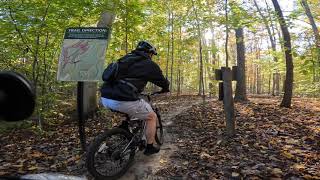
Photos of Royalview Mountain Bike
Videos of Royalview Mountain Bike
Recent Trail Reports
| status | trail | date | condition | info | user |
|---|---|---|---|---|---|
| Royalview Yellow | Sep 5, 2026 @ 3:15pm (America/Detroit) Sep 5, 2026 | Variable | clip78 | ||
| Royalview Red Trail | Sep 5, 2026 @ 3:15pm (America/Detroit) Sep 5, 2026 | Variable | clip78 |
Activity Feed
| username | action | type | title | date |
|---|---|---|---|---|
| clip78 | add | report | activity #103137468 and 1 more | Sep 5, 2026 @ 3:42pm Sep 5, 2026 |
| WillieJacobsz | update | region | activity #101695007 | Aug 17, 2026 @ 6:05am Aug 17, 2026 |
| Hickupville | ridden | trail | activity #96883217 | Jun 13, 2026 @ 8:51am Jun 13, 2026 |
| clip78 | add | report | activity #96497076 and 1 more | Jun 7, 2026 @ 2:18pm Jun 7, 2026 |
| aamcgee | wishlist | region | activity #93508972 | Apr 27, 2026 @ 4:34am Apr 27, 2026 |
Recent Comments
| username | type | title | comment | date |
|---|---|---|---|---|
| report | Update. Cleared | Nov 14, 2021 @ 6:27am Nov 14, 2021 | ||
| trail | 6/13/20 | Jun 21, 2020 @ 4:19pm Jun 21, 2020 | ||
| report | Because you'll trash the trail, and yes, you... | Apr 8, 2020 @ 12:29pm Apr 8, 2020 | ||
| report | Why is it closed? Seems dry. Tried to call... | Apr 4, 2020 @ 6:08am Apr 4, 2020 |
Nearby Areas
| name | distance | ||||
|---|---|---|---|---|---|
| West Creek Reservation | 11 | 2 | 1 | 7.7 km | |
| Rocky River Reserve | 8.5 km | ||||
| Huffman Park | 9 | 2 | 10.3 km | ||
| Reagan Park | 1 | 1 | 10.9 km | ||
| Ohio & Erie Canal Reservation | 2 | 2 | 11.6 km |
Activity Type Stats
| activitytype | trails | distance | descent | descent distance | total vertical | rating | global rank | state rank | photos | reports | routes | activity logs |
|---|---|---|---|---|---|---|---|---|---|---|---|---|
| Mountain Bike | 2 | 8 miles | 469 ft | 2 miles | 167 ft | #4,750 | #1,696 | 19 | 91 | 2,511 | ||
| Hike | 4 | 9 miles | 689 ft | 3 miles | 167 ft | #14,436 | #6,240 | 91 | 31 | |||
| Trail Running | 4 | 9 miles | 689 ft | 3 miles | 167 ft | #13,919 | #5,757 | 91 | 18 |
- By Damin216
 CAMBA:O&E CAMBA: WCR CAMBA: BR & contributors
 - Admins: CAMBA, CAMBA: RV, CAMBA
- #6000 - 6,589 views
- royalview activity log | embed map of Royalview mountain bike trails | royalview mountain biking points of interest
Downloading of trail gps tracks in kml & gpx formats is enabled for Royalview.
You must login to download files.