close
-
Layers w
- Weather Layers
- Pro
- Pro
- Pro
- Pro
- Pro
- Pro
- More Layers
- Pro
- Pro
- Pro
- Pro
-
Upgrade to

3D
Trail Conditions
- Unknown
- Snow Groomed
- Snow Packed
- Snow Covered
- Snow Cover Partial
- Freeze/thaw Cycle
- Icy
- Prevalent Mud
- Wet
- Variable
- Ideal
- Dry
- Very Dry
Trail Flow (Ridden Direction)
Trailforks scans users ridelogs to determine the most popular direction each trail is ridden. A good flowing trail network will have most trails flowing in a single direction according to their intension.
The colour categories are based on what percentage of riders are riding a trail in its intended direction.
The colour categories are based on what percentage of riders are riding a trail in its intended direction.
- > 96%
- > 90%
- > 80%
- > 70%
- > 50%
- < 50%
- bi-directional trail
- no data
Trail Last Ridden
Trailforks scans ridelogs to determine the last time a trail was ridden.
- < 2 days
- < 1 week
- < 2 weeks
- < 1 month
- < 6 months
- > 6 months
Trail Ridden Direction
The intended direction a trail should be ridden.
- Downhill Only
- Downhill Primary
- Both Directions
- Uphill Primary
- Uphill Only
- One Direction
Contribute Details
Colors indicate trail is missing specified detail.
- Description
- Photos
- Description & Photos
- Videos
Trail Popularity ?
Trailforks scans ridelogs to determine which trails are ridden the most in the last 9 months.
Trails are compared with nearby trails in the same city region with a possible 25 colour shades.
Think of this as a heatmap, more rides = more kinetic energy = warmer colors.
- most popular
- popular
- less popular
- not popular
ATV/ORV/OHV Filter
Max Vehicle Width
inches
US Cell Coverage
Legend

Radar Time
Activity Recordings
Trailforks uses anonymized public activity data.
?
Activity Recordings
Trailforks uses anonymized public activity data.
?
Personal Heatmap
▶
Activity Types
all
/
none
▶
Options
2
Date range
month
–
Winter Trails
Warning
A routing network for winter maps does not exist. Selecting trails using the winter trails layer has been disabled.
Missing Trails
Most Popular
Least Popular
Trails are colored based on popularity. The more popular a trail is, the more red. Less popular trails trend towards green.
Jump Magnitude Heatmap
Heatmap of where riders jump on trails. Zoom in to see individual jumps, click circles to view jump details.
BC Backroad Status
![map legend]()
Service Road Atlas is a free to use, community-driven service for viewing and creating reports on the numerous back-country service roads around B.C. and Alberta.

Slope Aspect
Direction the slope faces
Trails Deemphasized
Trails are shown in grey.
Only show trails with no bike usage.
Suggested Layers
Based on selected activity type
Save the current map location and zoom level as your default home location whenever this page is loaded.
Save
No description for Seaside has been added yet!
Login or register to submit one.
Activities Click to view
- Mountain Bike
39 trails
- E-Bike
28 trails
- Adaptive Bike
1 trails
- Hike
37 trails
- Trail Running
36 trails
- ATV/ORV/OHV
0 trails
Region Details
- 4
- 8
- 12
- 4
- 1
Region Status
Open as of 3 daysStats
- Avg Trail Rating
- Trails (view details)
- 46
- Trails Mountain Bike
- 42
- Trails E-Bike
- 28
- Trails Gravel Bike
- 1
- Trails Adaptive Bike
- 1
- Trails Hike
- 37
- Trails Trail Running
- 36
- Total Distance
- 32 miles
- Total Descent
- 6,312 ft
- Total Vertical
- 3,282 ft
- Highest Trailhead
- 3,286 ft
- Reports
- 737
- Photos
- 129
- Ridden Counter
- 14,588
Sub Regions
-
Klootchy Creek Trails
- 8
- 10
- 3
- 1
Popular Seaside Mountain Biking Trails
• 85 ★ 4.2 • 1 mile • 294 ft • 934 •
A brand new machine made climbing trail that was very well thought out. No long punchy climbs, easy switchbacks to navigate, a great introduction trail.
• 90 ★ 4.2 • 3,015 ft • 123 ft • 898 •
Popular green difficulty singletrack. This mountain bike primary trail. On average it takes 6 minutes to complete this trail.
• 95 ★ 4.1 • 1,916 ft • 8 ft • 886 •
Highly rated popular green difficulty singletrack. This mountain bike primary trail. On average it takes 4 minutes to complete this trail.
• 90 ★ 3.5 • 1,906 ft • 38 ft • 789 •
Popular blue difficulty singletrack. This mountain bike primary trail. On average it takes 1 minutes to complete this trail.
• 70 ★ 4.7 • 1,890 ft • 0 ft • 724 •
This is the newest trail in the system. is a bermed out delight. Multiple 'rollable' jumps, it was like riding a bobsled track at warp speed. Basically it was a big brown wave- always ready to shred.
• 100 ★ 3.5 • 1,099 ft • 0 ft • 651 •
One directional family-friendly downhill trail with rollers.
Seaside Mountain Bike Routes
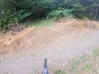
Photos of Seaside Mountain Bike
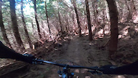
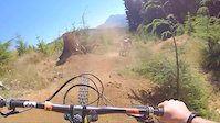
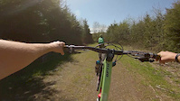
Videos of Seaside Mountain Bike
trail: Passive Aggressive
4:08 |
125 |
Aug 25, 2025
trail: Chris Cross
0:23 |
402 |
Jun 1, 2021
trail: Quarantine
0:29 |
803 |
Sep 9, 2020
trail: Defibrillator
2:33 |
1272 |
Apr 17, 2020

trail: Mo Flow
0:53 |
758 |
Jul 30, 2019
trail: Passive Aggressive
4:34 |
44 |
Apr 16, 2026 , Seaside
trail: Sticky Buns
5:35 |
37 |
Apr 16, 2026 , Seaside
trail: Evil Twin
6:43 |
76 |
Apr 5, 2026 , Seaside
Recent Trail Reports
| status | trail | date | condition | info | user |
|---|---|---|---|---|---|
| Pace Maker | Jul 2, 2026 @ 6:12pm (America/Vancouver) 3 days | Variable | schmobob | ||
| Upper Chris Cross | Jun 22, 2026 @ 8:21pm (America/Los_Angeles) Jun 22, 2026 | Ideal | CassJones1 | ||
| Mo Flow | Jun 22, 2026 @ 8:21pm (America/Los_Angeles) Jun 22, 2026 | Ideal | CassJones1 | ||
| Upper Greenwood | Jun 22, 2026 @ 8:21pm (America/Los_Angeles) Jun 22, 2026 | Ideal | CassJones1 | ||
| Low Tide | Jun 22, 2026 @ 8:21pm (America/Los_Angeles) Jun 22, 2026 | Ideal | CassJones1 | ||
| Chris Cross | Jun 22, 2026 @ 8:21pm (America/Los_Angeles) Jun 22, 2026 | Ideal | CassJones1 | ||
| Roller Coaster | Jun 6, 2026 @ 6:27pm (America/Vancouver) Jun 6, 2026 | Wet | schmobob | ||
| Ski Tracks | May 31, 2026 @ 11:13pm (America/Los_Angeles) May 31, 2026 | Variable | schmobob | ||
| Climb to Evil Twin | May 31, 2026 @ 11:13pm (America/Los_Angeles) May 31, 2026 | Variable | schmobob | ||
| Climb to Ski Tracks | May 31, 2026 @ 11:13pm (America/Los_Angeles) May 31, 2026 | Variable | schmobob |
Activity Feed
| username | action | type | title | date |
|---|---|---|---|---|
| alecentress | ridden | trail | activity #98517294 | Jul 5, 2026 @ 10:39am 33 mins |
| Bricycle82 | wishlist | region | activity #98439194 | Jul 4, 2026 @ 11:28am 24 hours |
| vSZyUB | wishlist | region | activity #98424680 | Jul 4, 2026 @ 9:04am 1 day |
| schmobob | add | report | activity #98387460 | Jul 3, 2026 @ 10:10pm 2 days |
| J50005 | wishlist | region | activity #98241834 | Jul 1, 2026 @ 7:09pm Jul 1, 2026 |
Recent Comments
| username | type | title | comment | date |
|---|---|---|---|---|
| trail | I think this trail had a rework since the last... | May 8, 2026 @ 7:58am May 8, 2026 | ||
| trail | Official trail overview: A hidden gem with a... | Dec 21, 2025 @ 2:04pm Dec 21, 2025 | ||
| trail | Bottom of trail has been logged and a large... | Sep 5, 2025 @ 12:35am Sep 5, 2025 | ||
| trail | Tree cover keeps this trail running really... | Aug 1, 2025 @ 9:00pm Aug 1, 2025 | ||
| trail | Fantastic trail that stay mostly in the trees... | Aug 1, 2025 @ 8:59pm Aug 1, 2025 |
Local Badges
-

Epic Mountain Bike Climb 2k5 awarded -

Climbing 10k Badge10 awarded -

Mountain Biking 100k Badge0 awarded -

Epic Ride Descent 2k5 awarded -

Descent 10k Badge10 awarded -

Descent 100k Badge0 awarded
Activity Type Stats
| activitytype | trails | distance | descent | descent distance | total vertical | rating | global rank | state rank | photos | reports | routes | ridelogs |
|---|---|---|---|---|---|---|---|---|---|---|---|---|
| Mountain Bike | 39 | 16 miles | 3,776 ft | 8 miles | 1,060 ft | #2,613 | #932 | 124 | 738 | 1 | 5,042 | |
| E-Bike | 28 | 5 miles | 1,224 ft | 2 miles | 869 ft | #5,341 | #1,656 | 543 | 574 | |||
| Gravel Bike | 1 | #1,072 | #586 | 27 | ||||||||
| Adaptive Bike | 1 | #720 | #1,912 | |||||||||
| Hike | 37 | 22 miles | 3,753 ft | 10 miles | 3,281 ft | #5,133 | #1,807 | 6 | 534 | 839 | ||
| Trail Running | 36 | 22 miles | 3,753 ft | 10 miles | 3,281 ft | #6,267 | #2,025 | 534 | 130 |
Frequently Asked Questions About Seaside
▼
What are the best places to ride in Seaside?
Seaside has 4 areas to explore for mountain biking. The top rated areas are:
▼
What are the highest rated mountain biking trails in Seaside?
The highest rated mountain biking trails in Seaside are:
- Mo Flow (4.5/5)
- Evil Twin (4.4/5)
- Low Tide Spur 4 (4.4/5)
- Defibrillator (4.3/5)
- Sticky Buns (4.3/5)
▼
What is the best time of the year to ride in Seaside?
Based on ride log data, the most popular months to ride in Seaside are:
- July (101 activities)
- August (81 activities)
- October (52 activities)
▼
Where can I park to ride in Seaside?
There are 8 parking locations listed in Seaside. The most popular parking spots are: View all parking and trailhead locations on the map to plan your visit.
Activities
Trails
- By northwestdhdad EMBA-SW & contributors
- Admins: NWTA
- #29027 - 9,707 views
- seaside activity log | embed map of Seaside mountain bike trails | seaside mountain biking points of interest
Downloading of trail gps tracks in kml & gpx formats is enabled for Seaside.
You must login to download files.